The best road cycling routes in Hildebrand Ranch Park
4.6
(34)
3,245
riders
81
rides
Road cycling routes in Hildebrand Ranch Park traverse a landscape characterized by a blend of prairie and mountain environments. The park features varied terrains, including open grasslands, elevated hogbacks, and rocky ridge-lines, offering dynamic riding experiences. Cyclists encounter unique geological formations and varied elevation changes, providing diverse challenges. Deer Creek runs through the park, contributing to the natural features.
Best road cycling routes in Hildebrand Ranch Park
- The most popular road cycling route is Big Soda Lake loop from Hildebrand…
Last updated: October 27, 2026
5
riders
Hard road ride. Very good fitness required. Mostly well-paved surfaces and easy to ride.
5
riders
51.9km
03:07
1,140m
1,140m
Hard road ride. Very good fitness required. Some segments of this route may be unpaved and difficult to ride.

5.0
(1)
134
riders
62.4km
03:22
1,200m
1,200m
Hard road ride. Very good fitness required. Mostly well-paved surfaces and easy to ride.
5.0
(1)
158
riders
Easy road ride. Mostly well-paved surfaces and easy to ride.
5.0
(1)
63
riders
Moderate road ride. Good fitness required. Mostly well-paved surfaces and easy to ride.
Get access to more routes and recommendations from other explorers.
Already have an account?
Our route recommendations are based on thousands of hikes, rides, and runs completed by other people on komoot.
Start today with a free account
Your next adventure awaits.


Tips from the Community

This is a nice overlook near Mt. Carbon, with expansive views of the Denver skyline, Bear Lake Park, and Mount Falcon Park in the background. Bear Creek Trail ends here, making it a great spot to pause, sit for a bit, and enjoy the views.
0
0

tight and steep switchbacks lead to the junction with Squaw Pass Rd
0
0

Bear Creek Lake Park spans 2,624 acres and is a great spot for hiking, biking, and horseback riding, as well as swimming, fishing, and boating year-round recreation. Open from April 1 to October 31, the campground is one of the closest full-service options near Denver. Visitors can also enjoy picnic shelters, paved and unpaved trails, an archery range, and scenic reservoirs.
1
0
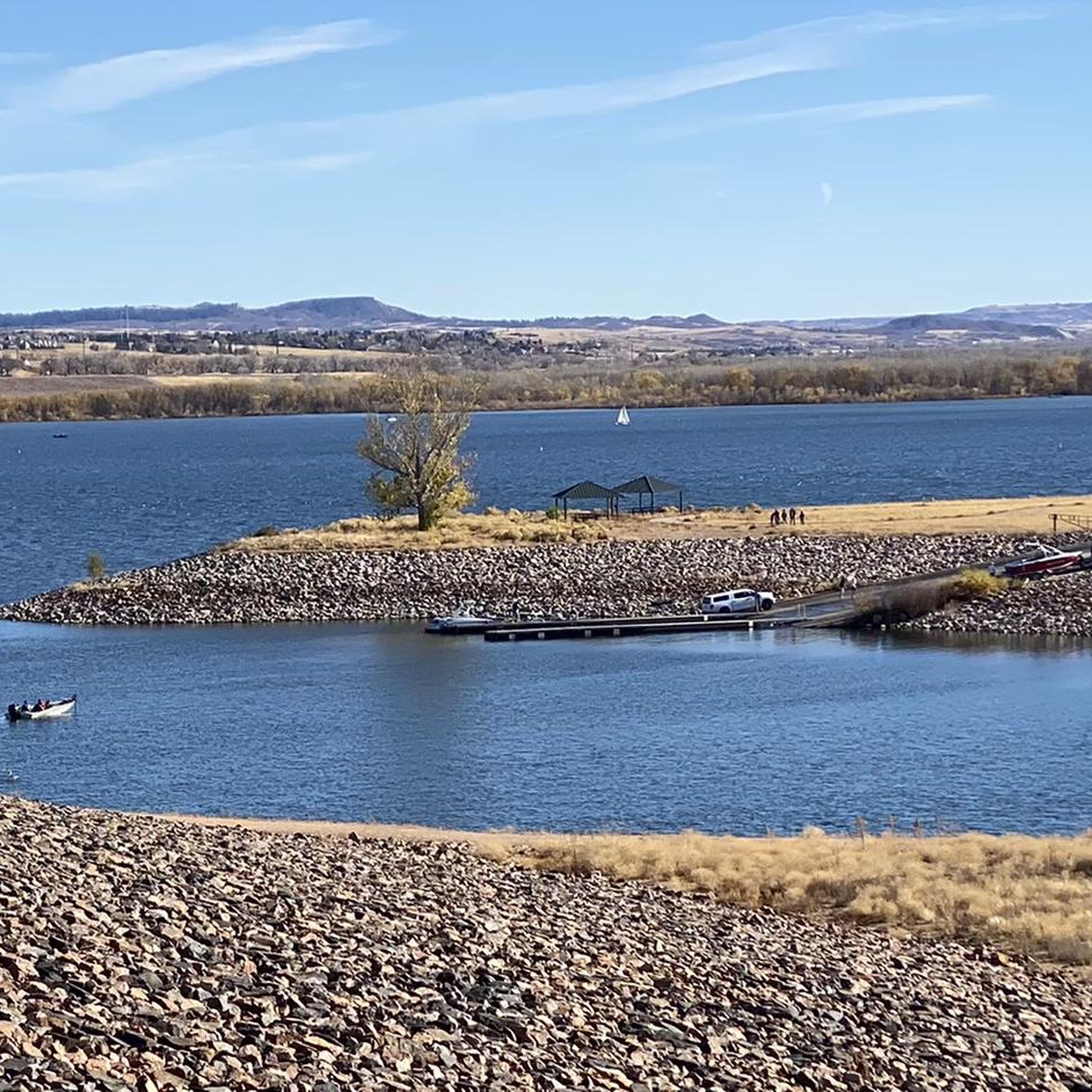
The Slocumb Cabin is about 200 feet away from the Chatfield State Park Office, heading north-west down a paved trail. The cabin is the oldest standing structure in the Denver area. This 10x12-foot cabin was acquired by pioneer Thomas Slocumb in 1859. The views from here over Chatfield State Park and Chatfield Reservoir are stunning.
0
0
Mann Reservoir has tall red rock features on the north-east side of the reservoir. The Swallow Trail will take visitors closest to the rock features. There is also parking on the north end of the reservoir.
0
0
The South Valley Park South Trailhead is one end of the Coyote Song Trail. This area has maps, parking, and restrooms. The trailhead is a quick turnoff from W. Deer Creek Canyon Road and is very accessible.
0
0

Chatfield State Park is a 5,300-acre park featuring a 1,400-acre reservoir. There are a bunch of different trails, ponds, and natural areas, and the majority of the main roads are paved and well-kept.
0
0
The climb up South Deer Creek Canyon Road can get rough near the top, but you actually get a short downhill break at the very northern end. The views back towards town are great and there are plenty of pull-offs along the side of the road, so if you need to take a break, you'll have plenty of chances.
0
0
Frequently Asked Questions
How many road cycling routes are available in Hildebrand Ranch Park?
Hildebrand Ranch Park offers a wide selection of road cycling routes, with over 70 different tours available. These routes cater to various skill levels, including easy, moderate, and difficult options.
What kind of terrain can I expect on road cycling routes in Hildebrand Ranch Park?
You can expect a diverse range of terrain, blending prairie and mountain environments. Routes feature open grasslands, elevated hogbacks, and rocky ridge-lines. While dedicated paved paths are limited, the park's well-maintained trails offer varied surfaces, including gravel sections, suitable for road and gravel bikes.
Are there any beginner-friendly road cycling routes in the park?
Yes, there are several easier options. For instance, the View from Chatfield Dam – Mary Carter Greenway Trail loop from Chatfield State Park is an easy route that offers a more relaxed ride with minimal elevation gain.
What are some challenging road cycling routes for experienced riders?
Experienced cyclists looking for a challenge can explore routes with significant elevation changes and longer distances. The Red Rocks Park Scenic Road – Big Soda Lake loop from Classification Natural Resource Protection is a difficult 71.2-mile path with substantial climbing, connecting to Red Rocks Park. Another demanding option is the Roadbike loop from Classification Natural Resource Protection, a 32.3-mile trail with over 1,100 meters of elevation gain.
What are the notable natural features or viewpoints along the road cycling routes?
Cyclists can enjoy breathtaking views of Denver, the plains, the foothills, and Chatfield Lake. The park is characterized by unique geological formations, including hogbacks and rocky ridge-lines. Deer Creek also runs through the park, acting as a wildlife corridor, and you might spot prairie dog habitats.
Are there any historical attractions or landmarks to see while cycling?
Yes, Hildebrand Ranch Park offers a glimpse into the region's past. The park was a working cattle ranch in the 19th century, and you can explore a historic working ranch featuring a stable, house, wagon shed, milking barn, and garden. Many original buildings are still standing, and the ranch is listed on the National Register of Historic Places.
Is Hildebrand Ranch Park suitable for family road cycling?
While the park offers varied terrain, some sections, like the Two Brands Trail, include gentle grades and can transition into neighborhood paths, making them manageable for families with appropriate bikes. For easier, paved options, consider routes that connect to the Mary Carter Greenway Trail.
What are the parking options for cyclists at Hildebrand Ranch Park?
The park provides parking facilities for visitors. Specific trailheads, such as the one for the Two Brands Trail, offer convenient access to the cycling routes. It's advisable to check the park's official website for the most current parking information and any potential fees.
When is the best time of year to go road cycling in Hildebrand Ranch Park?
The park is generally accessible year-round, but spring and fall offer pleasant temperatures for cycling. Summers can be warm, while winters may bring snow, impacting trail conditions. Always check local weather forecasts and park advisories before your ride.
Are there any loop trails for road cycling in the park?
Yes, many routes in and around Hildebrand Ranch Park are designed as loops. For example, the Big Soda Lake loop from Hildebrand Ranch Park is a popular moderate 20.6-mile circular route. The Two Brands Trail within the park is also a nearly five-mile loop.
What do other road cyclists enjoy the most about road cycling in Hildebrand Ranch Park?
The road cycling routes in Hildebrand Ranch Park are highly rated by the komoot community, with an average score of 4.2 stars from over 20 reviews. Cyclists often praise the diverse terrain, the unique blend of prairie and mountain environments, and the scenic views of the surrounding landscape.
Are there any specific trail closures I should be aware of?
Some trails in the area, such as sections of the Black Bear Trail which connects to the Plymouth Mountain trail system, may have seasonal closures for raptor protection. It's always best to check the official Hildebrand Ranch Park or Denver Botanic Gardens Chatfield Farms website for current trail conditions and closure notices before planning your ride.
Can I connect to other cycling systems from Hildebrand Ranch Park?
Yes, the park's trails offer connectivity to other systems. For instance, you can link to the Plymouth Mountain trail system via the Black Bear Trail (though check for seasonal closures). For longer rides, connections to the Chatfield Area Gravel ride offer a 40-mile route with varied surfaces.
Most popular routes in Hildebrand Ranch Park

Get inspired with the komoot mobile app


Explore more
Browse the best Road cycling routes in other regions.
