The best running trails in Ernest E. Debs Regional Park
4.4
(59)
5,136
runners
156
runs
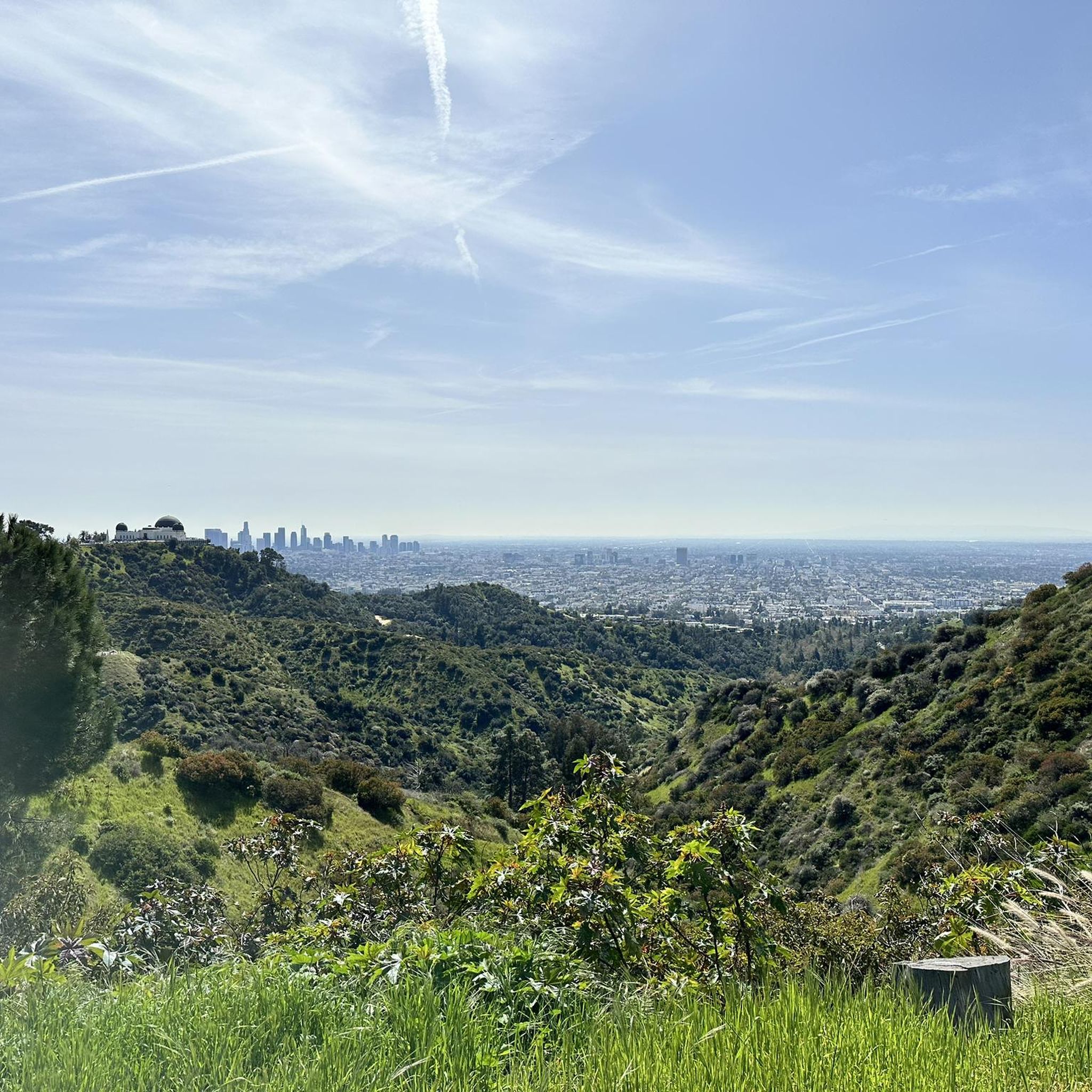
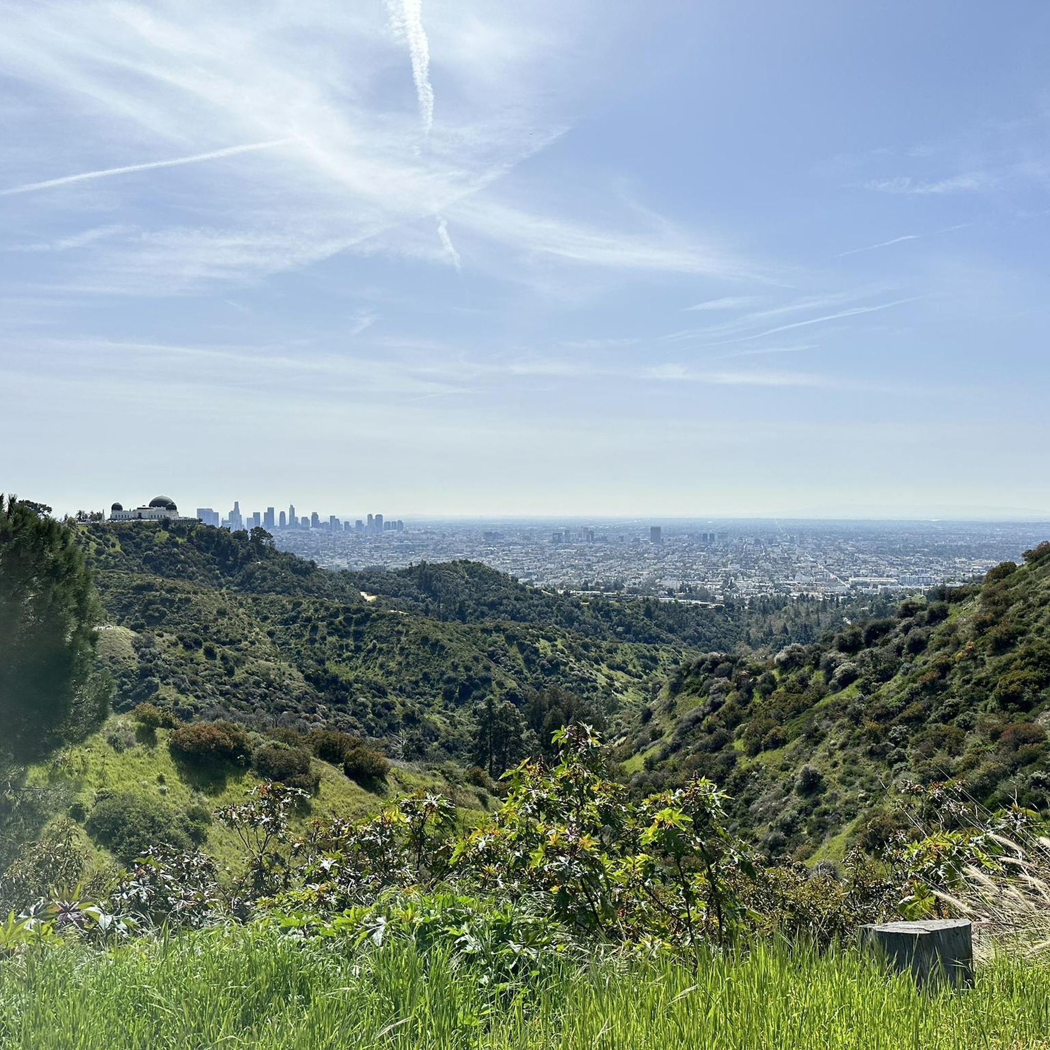
Jogging in Ernest E. Debs Regional Park offers a diverse landscape for runners, spanning 282 acres of natural wilderness. The park features rolling hills, some steep inclines, and winding paths through native California walnut and oak woodlands. Runners can experience varied terrain while enjoying views of the Los Angeles skyline and the San Gabriel Mountains. This urban oasis provides a range of routes suitable for different skill levels.
Best jogging routes in Ernest E. Debs Regional Park
- The most popular jogging route is Donut Friend loop from Southwest Museum, a 5.5 miles (8.9 km) trail that takes about 55 minutes to complete. This route features rolling hills and offers panoramic views of the city.
- Another top favourite among local runners is Arroyo Seco – Brookside Park loop from Highland Park, a difficult 10.4 miles (16.7 km) path. This longer route winds through varied terrain with significant elevation changes.
- Local runners also love the Donut Friend loop from Highland Park, a 3.9 miles (6.2 km) trail leading through native California woodlands, often completed in about 39 minutes.
- Jogging in Ernest E. Debs Regional Park is defined by rolling hills, native California walnut and oak woodlands, and scenic viewpoints of the Los Angeles skyline. The network offers options for easy, moderate, and difficult ability levels.
- The routes in Ernest E. Debs Regional Park are highly rated by the komoot community with an average score of 4.6 stars from more than 40 reviews. More than 3,700 runners have used komoot to explore Ernest E. Debs Regional Park's varied terrain.
Last updated: September 30, 2026
5.0
(1)
5
runners
8.87km
00:55
60m
60m
Moderate run. Good fitness required. Mostly paved surfaces. Suitable for all skill levels.
5
runners
7.00km
00:45
80m
80m
Moderate run. Good fitness required. Mostly paved surfaces. Suitable for all skill levels.

19
runners
13.1km
01:23
90m
90m
Moderate run. Good fitness required. Mostly paved surfaces. Suitable for all skill levels.
5.0
(1)
33
runners
20.8km
02:13
170m
170m
Hard run. Very good fitness required. Mostly paved surfaces. Suitable for all skill levels.
5.0
(1)
9
runners
6.26km
00:39
40m
40m
Moderate run. Good fitness required. Mostly paved surfaces. Suitable for all skill levels.
Get access to more routes and recommendations from other explorers.
Already have an account?
Our route recommendations are based on thousands of hikes, rides, and runs completed by other people on komoot.
Start today with a free account
Your next adventure awaits.

Tips from the Community

Tree lined street with Lots of other cyclists. Great warm up ride
0
0

The Arroyo Seco is a 25-mile seasonal stream, canyon, watershed, and cultural area. The watershed is one of the major streams that capture rainfall and stormwater in Pasadena. There are 22 miles of trails around "the Arroyo" that connect Angeles National Forest to South Pasadena.
0
0
Lower Arroyo Park is 70 acres along the Arroyo Seco, a 25-mile seasonal river. The park features The Arroyo Seco Bike Path, water fountains, restrooms, bike racks, and a snack stand.
1
0

Brookside Park is Pasadena's largest fully maintained park at 61.1 acres. It sits south of Rose Bowl Stadium with tons of parking off Arroyo Boulevard. The park features a lighted baseball diamond, two softball diamonds, and a large, lighted, multi-purpose field for soccer and flag football. There is also a speaker's platform with permanent seating, numerous picnic tables, barbecue pits, a play area, restrooms, and drinking fountains.
0
0
The Arroyo Seco is a 25-mile seasonal stream, canyon, watershed, and cultural area. The watershed is one of the major streams that capture rainfall and stormwater in Pasadena. There are 22 miles of trails around "the Arroyo" that connect Angeles National Forest to South Pasadena.
0
0
Brookside Park is Pasadena's largest fully maintained park at 61.1 acres. It sits south of Rose Bowl Stadium with tons of parking off Arroyo Boulevard. The park features a lighted baseball diamond, two softball diamonds, and a large, lighted, multi-purpose field for soccer and flag football. There is also a speaker's platform with permanent seating, numerous picnic tables, barbecue pits, a play area, restrooms, and drinking fountains.
0
0

This northern section of the Arroyo Seco runs parallel to Arroyo Boulevard, passing the Rose Bowl Stadium and running in to some more developed trails in Arroyo Park.
0
0

Frequently Asked Questions
How many running routes are available in Ernest E. Debs Regional Park?
Ernest E. Debs Regional Park offers a wide selection of jogging routes, with over 120 different trails to explore. These routes cater to various skill levels, from easy strolls to more challenging runs.
What kind of terrain will I encounter on the jogging trails in Ernest E. Debs Regional Park?
You can expect a diverse environment, including rolling hills, some steep inclines, and winding paths through native California walnut and oak woodlands. The park's varied terrain provides an engaging experience for runners of all levels.
What are some notable attractions or scenic views I can enjoy while running in the park?
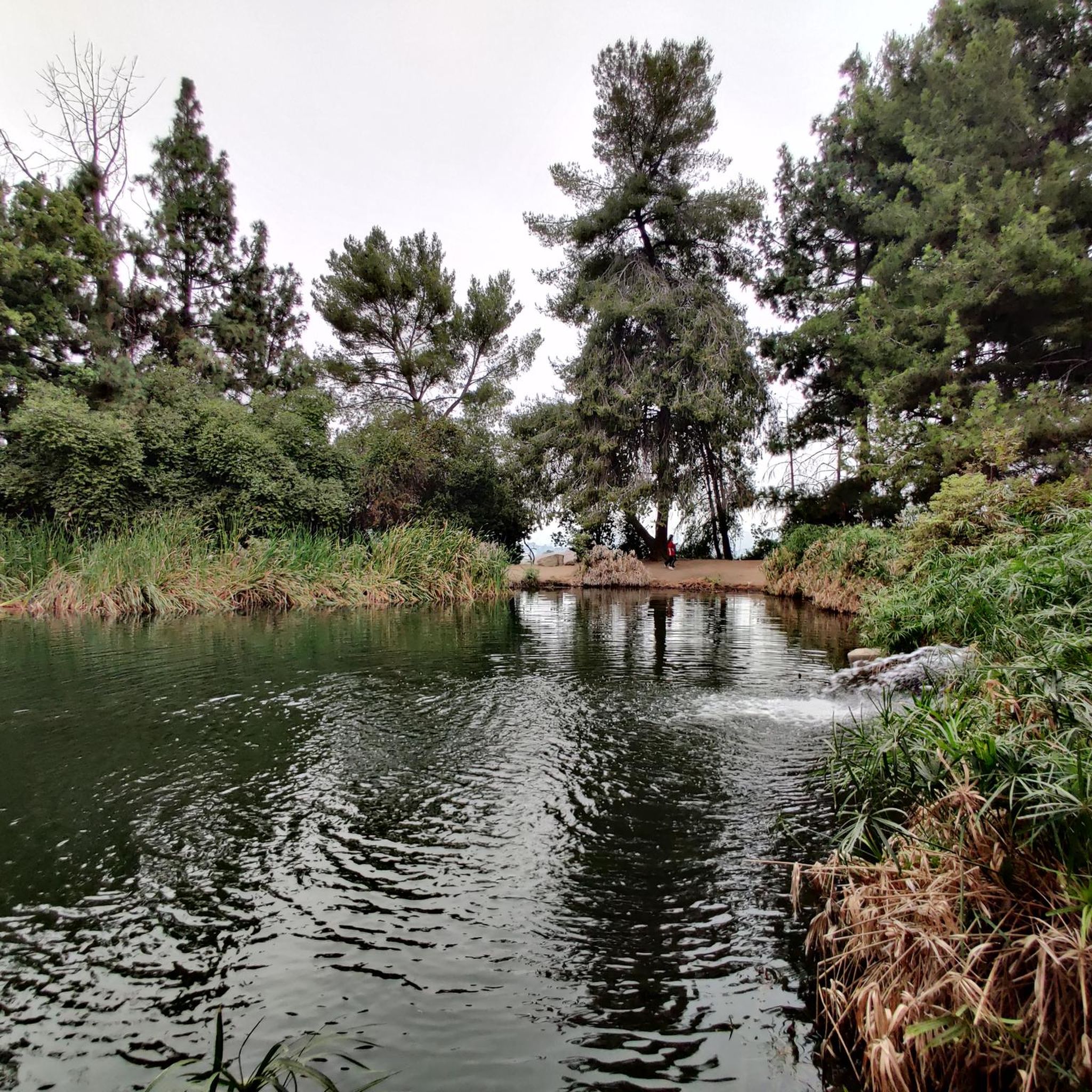
As you jog, you'll be treated to spectacular views of the Los Angeles skyline, the Arroyo Seco, and the San Gabriel Mountains. The park also features tranquil water features like Debs Pond (also known as Peanut Lake), and the Audubon Center at Debs Park, which is great for birdwatching. Some visitors even discover a 'secret' hiker swing.
Are there routes suitable for beginners or those looking for an easier run?
Yes, the park offers a range of routes for different abilities. While many trails feature rolling hills, there are easier options available. For example, the park has 11 routes classified as easy, providing a gentler experience.
What do other runners enjoy most about jogging in Ernest E. Debs Regional Park?
The running routes in Ernest E. Debs Regional Park are highly rated by the komoot community, with an average score of 4.6 stars from over 40 reviews. Runners frequently praise the diverse landscapes, the scenic views of the city and mountains, and the opportunity to escape urban life within a natural setting.
Is Ernest E. Debs Regional Park accessible by public transport?
Yes, Ernest E. Debs Regional Park is generally accessible. While specific public transport routes can vary, the park's location in Los Angeles makes it reachable via various transit options. It's advisable to check local transit schedules for the most current information on reaching the park's entry points.
Are there parking facilities available for joggers?
Yes, the park is easily accessible with parking areas located near its entry points, typically from Griffin Avenue or Monterey Road. This makes it convenient for visitors driving to the park for a run.
Are the running trails in Ernest E. Debs Regional Park dog-friendly?
Ernest E. Debs Regional Park is a popular spot for outdoor activities, and many trails are dog-friendly. However, it's always recommended to keep dogs on a leash and to check for any specific park regulations regarding pets before your visit.
Are there any family-friendly running options or amenities in the park?
Absolutely! Ernest E. Debs Regional Park is suitable for families. Beyond the varied trails, there are landscaped picnic areas, grassy fields, and even a children's area with a play-house and water/sand play areas, making it a great destination for a family outing that can include a run.
Can I find circular running routes in the park?
Many of the routes in Ernest E. Debs Regional Park are designed as loops, offering circular paths that bring you back to your starting point. An example is the Donut Friend loop from Southwest Museum, which is a popular 5.5-mile trail.
What is the typical length and elevation gain for runs in the park?
The trails vary significantly. You can find loops up to 2.8 miles with rolling hills for a moderate effort, or longer routes exceeding 10 miles with over 1000 feet of elevation gain for a more intense workout. For instance, the Arroyo Seco – Brookside Park loop from Highland Park is a difficult 10.4-mile path with significant elevation changes.
Are there any specific routes that offer a good balance of challenge and scenery?
For a moderate challenge with great views, consider the Donut Friend loop from Highland Park. This 3.9-mile trail leads through native California woodlands and offers scenic vistas, typically completed in about 39 minutes.
Most popular routes in Ernest E. Debs Regional Park

Get inspired with the komoot mobile app


Explore more
Browse the best Running Trails & Routes in other regions.
