The best road cycling routes in Año Nuevo State Park
5.0
(10)
361
riders
10
rides
Road cycling in Año Nuevo State Park offers routes along the Pacific coastline and through the rolling hills of San Mateo County. The terrain features coastal bluffs, rural roads, and views of the ocean. Cyclists can expect a mix of flat sections and moderate climbs, characteristic of the central California coast.
Best road cycling routes in Año Nuevo State Park
- The most popular road cycling route is Stage Road – Downtown Pescadero loop from Mayal's Beach, a 46.1 miles…
Last updated: May 11, 2026
5.0
(3)
112
riders
74.2km
03:28
870m
870m
Moderate road ride. Good fitness required. Mostly well-paved surfaces and easy to ride.
12
riders
Easy road ride. Great for any fitness level. Mostly well-paved surfaces and easy to ride.

Sign up for free
7
riders
Easy road ride. Great for any fitness level. Mostly well-paved surfaces and easy to ride.
5.0
(5)
74
riders
44.6km
02:01
490m
490m
Moderate road ride. Good fitness required. Mostly well-paved surfaces and easy to ride.
23
riders
74.3km
03:47
1,290m
1,290m
Hard road ride. Very good fitness required. Mostly well-paved surfaces and easy to ride.
Get access to more routes and recommendations from other explorers.
Sign up for free
Already have an account?
Our route recommendations are based on thousands of hikes, rides, and runs completed by other people on komoot.
Start today with a free account
Your next adventure awaits.
Login or Signup
Popular around Año Nuevo State Park
Tips from the Community

Old La Honda Road is considered one of the most challenging climbs in the Bay Area. The road winds through Redwood forests, offering stunning views of the surrounding mountains and valleys, as well as a peaceful and enjoyable ride.
1
0

Alpine Rd Downhill to La Honda: https://youtu.be/MdsNqhRt4so?si=j7I-PfTWqhQc1lxf
0
0

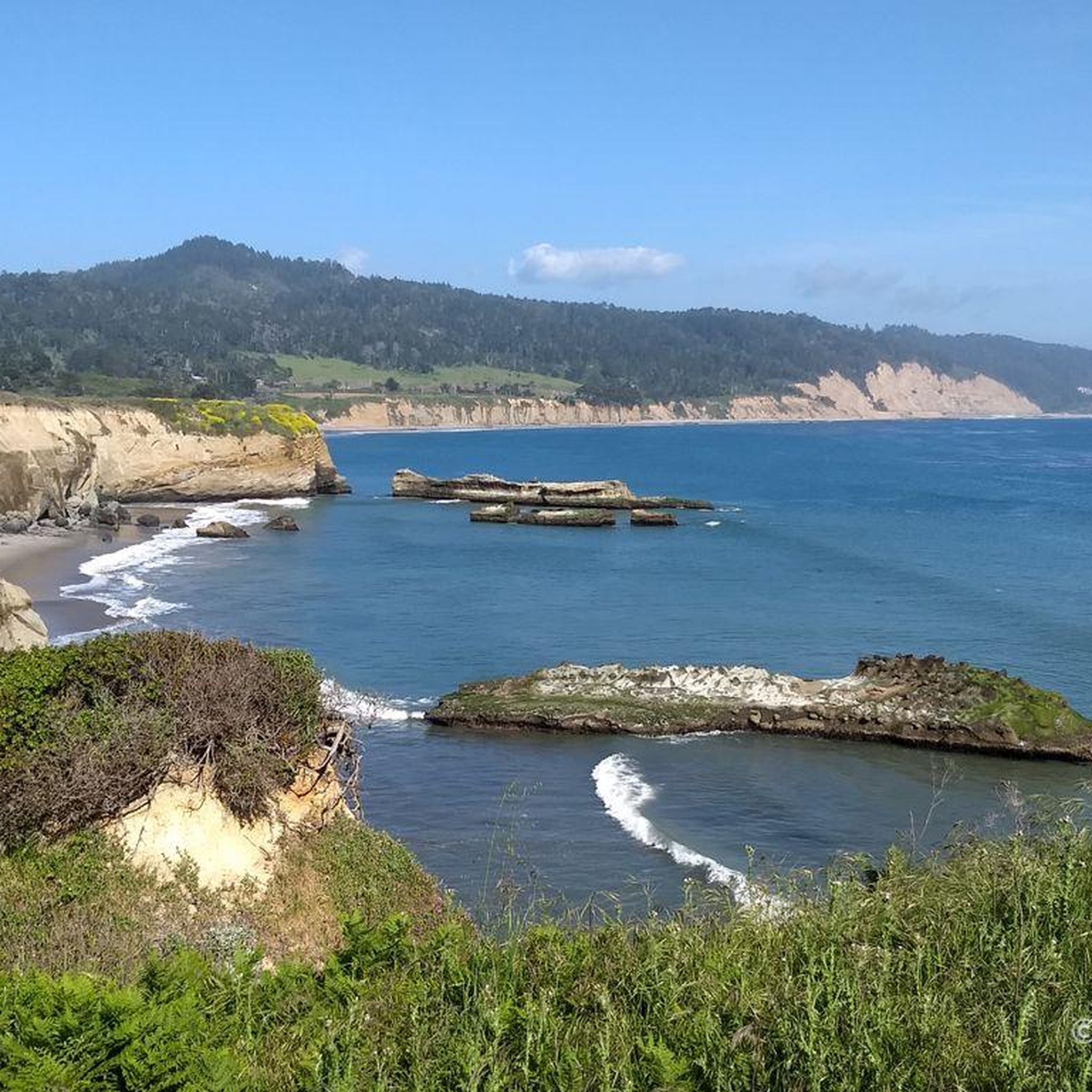
Walk across the short sandy beach to the rocky coast and enjoy the Pacific
0
0

San Gregorio State Beach is the perfect spot for starting and finishing long road rides. There is free parking along with public restrooms and water fountains here. It's worth locking up the bike and walking out onto the beach before you leave after your ride.
1
0


A nice place to pause and catch the view before zipping down the hill on either side. There's a wooden fence where you can lean your bike for a moment.
1
0

This is a perfect segment to recharge your batteries before reaching Pescadero and climbing the mountain
0
0

It's all downhill from here! It's a pretty awesome section all the way to San Gregorio Beach.
1
0
Frequently Asked Questions
How many road cycling routes are available in Año Nuevo State Park?
Año Nuevo State Park offers a selection of 11 road cycling routes, catering to various skill levels. These routes traverse coastal bluffs, rural roads, and rolling hills, providing diverse scenery for cyclists.
Are there road cycling routes suitable for beginners in Año Nuevo State Park?
Yes, Año Nuevo State Park has several easy road cycling options. For instance, the Downtown Pescadero – Pigeon Point Lighthouse loop from Mayal's Beach is an easy 19.5-mile path offering coastal views and passing the historic Pigeon Point Lighthouse. Another easy option is the Cloverdale Road – Downtown Pescadero loop from Quiroste Valley Cultural Preserve.
What are some of the longer road cycling routes in Año Nuevo State Park?
For those seeking longer rides, the Stage Road – Downtown Pescadero loop from Mayal's Beach is a substantial 46.1-mile route with significant elevation gain, typically taking around 3 hours and 27 minutes. Another challenging option is the Pescadero Creek Road – Stage Road loop from Pescadero, which is also over 46 miles and features considerable climbing.
What scenic viewpoints or attractions can I see while road cycling in Año Nuevo State Park?
Road cycling routes in Año Nuevo State Park offer access to stunning coastal views and unique natural attractions. You might pass by the Elephant Seals Observation Point, where you can often spot the park's famous marine mammals, or enjoy the vistas from Ano Nuevo Beach Overlook. The historic Pigeon Point Lighthouse is also a notable landmark along some coastal routes.
Are there many loop routes for road cycling in Año Nuevo State Park?
Yes, many of the road cycling routes in Año Nuevo State Park are designed as loops, providing a varied experience without retracing your path. Examples include the Pescadero Creek Road & La Honda Road Loop and the Stage Road – Downtown Pescadero loop from Mayal's Beach, which offer diverse scenery from rural roads to coastal stretches.
Is parking available for road cyclists in Año Nuevo State Park?
Yes, parking is available at various access points and trailheads within or near Año Nuevo State Park. Specific parking areas are often designated for visitors, including those arriving for cycling. It's advisable to check the park's official website for current parking information and any fees.
When is the best time of year to go road cycling in Año Nuevo State Park?
The central California coast, including Año Nuevo State Park, generally offers pleasant cycling conditions year-round. Spring and fall often provide mild temperatures and clear skies. Winter can bring rain, but also dramatic coastal views, while summer can be foggy, especially in the mornings, offering a cool respite from inland heat.
Are there cafes or places to refuel near the road cycling routes?
Yes, the routes often pass through or near small coastal towns like Pescadero, where you can find cafes, bakeries, and small shops to refuel. These towns provide convenient stops for coffee, snacks, or a meal during your ride.
What do other road cyclists appreciate most about the routes in Año Nuevo State Park?
The road cycling routes in Año Nuevo State Park are highly rated by the komoot community, with an average score of 5.0 stars. Cyclists often praise the stunning coastal bluffs, the quiet rural roads, and the diverse terrain that offers both flat sections and challenging climbs, all while enjoying ocean views.
Are there advanced road cycling routes for experienced riders in Año Nuevo State Park?
Experienced road cyclists will find challenging options in Año Nuevo State Park. Routes like the Pescadero Creek Road – Stage Road loop from Pescadero feature significant elevation gains, with over 1290 meters of climbing, providing a demanding workout through rolling hills and forested areas.
What kind of terrain can I expect on road cycling routes in Año Nuevo State Park?
Road cycling in Año Nuevo State Park is characterized by a mix of coastal bluffs, scenic rural roads, and rolling hills. You'll encounter both relatively flat sections along the coast and moderate to significant climbs as you venture inland, offering a varied and engaging cycling experience.
Most popular routes in Año Nuevo State Park
Most popular attractions in Año Nuevo State Park

Get inspired with the komoot mobile app


Explore more
Browse the best Road cycling routes in other regions.
