Long Ridge Open Space Preserve (Closed Areas)
Long Ridge Open Space Preserve (Closed Areas)
The best running trails in Long Ridge Open Space Preserve (Closed Areas)
4.8
(16)
463
runners
23
runs
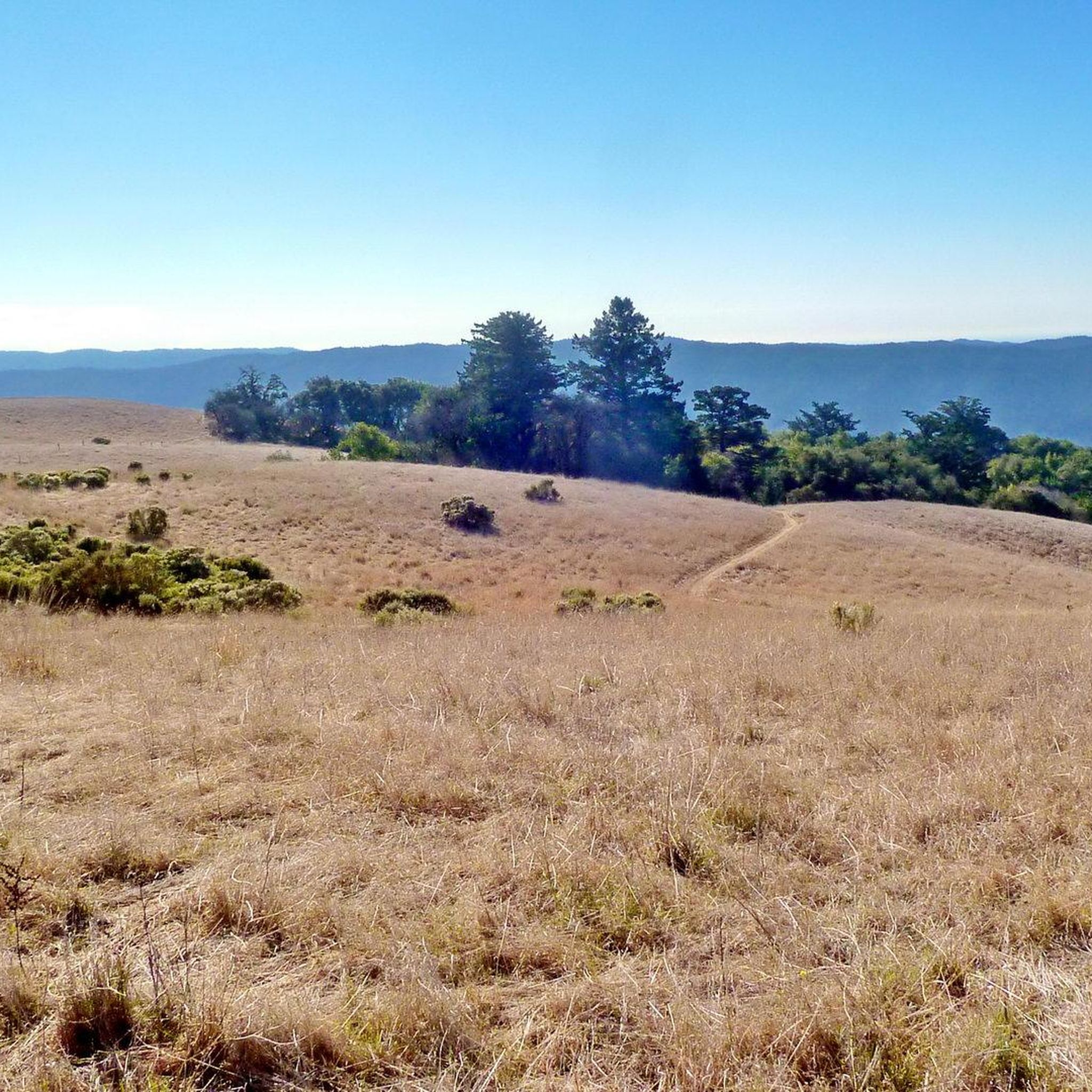
Jogging in Long Ridge Open Space Preserve (Closed Areas) offers a diverse landscape for runners, characterized by a mix of shady woodlands, cool creekside forests, and expansive grasslands. The preserve features varied topography, transitioning from lower elevations along creeks to higher ridges. From these elevated points, runners can experience panoramic views of the Santa Cruz Mountains, the Pescadero Valley, and the Pacific Ocean.
Best jogging routes in Long Ridge Open Space Preserve (Closed Areas)
- The most popular jogging route is Grizzly Flat Trail to Table Mountain Loop, a 7.2 miles (11.6 km) trail that takes 1 hour 26 minutes to complete. This difficult route offers significant elevation changes and diverse habitats.
- Another top favourite among local runners is White Oak and Stevens Creek Nature Trail Loop, a moderate 3.7 miles (5.9 km) path. This route provides a serene experience through lush woodlands alongside a creek.
- Local runners also love the Borel Hill – Skyline Boulevard Viewpoint loop from Skyline Ridge Open Space Preserve, a 12.7 miles (20.4 km) trail leading through varied terrain with expansive views, often completed in about 2 hours 36 minutes.
- Jogging in Long Ridge Open Space Preserve (Closed Areas) is defined by extensive trail networks, diverse ecosystems including woodlands and grasslands, and panoramic views. The network offers options for various ability levels, from moderate paths to more challenging routes.
- The routes in Long Ridge Open Space Preserve (Closed Areas) are highly rated by the komoot community with an average score of 4.9 stars from nearly 20 reviews. More than 600 runners have used komoot to explore Long Ridge Open Space Preserve (Closed Areas)'s varied terrain.
Last updated: May 13, 2026
11.6km
01:27
520m
520m
Challenge yourself on the difficult 7.2-mile Grizzly Flat Trail to Table Mountain Loop, featuring diverse terrain and significant elevation
5.92km
00:43
150m
150m
Jog this moderate 3.7-mile loop in Monte Bello Open Space Preserve, featuring oak woodlands, canyon views, and 495 feet of elevation gain.

Sign up for free
7
runners
Hard run. Very good fitness required. Mostly paved surfaces. Suitable for all skill levels.
5.0
(1)
5
runners
Hard run. Very good fitness required. Mostly paved surfaces. Suitable for all skill levels.
8
runners
7.35km
00:53
150m
150m
Jog the moderate 4.6-mile Achistaca Trail to Turtle Rock in Long Ridge Open Space Preserve, enjoying oak forests and distant ocean views.
Get access to more routes and recommendations from other explorers.
Sign up for free
Already have an account?
Our route recommendations are based on thousands of hikes, rides, and runs completed by other people on komoot.
Start today with a free account
Your next adventure awaits.
Login or Signup
Popular around Long Ridge Open Space Preserve (Closed Areas)

Tips from the Community

Turtle Rock is the highest and most prominent mountain in the area. From this viewpoint, you can enjoy a panoramic view of the surrounding mountains, especially stunning at sunset. Be cautious, as the trail is popular and often busy with hikers.
1
0

Russian Ridge is an incredible 3,137-acre preserve that boasts a rich diversity of plants and wildlife, steep forested canyons, and grasslands, with abundant wildflowers in the spring. The open ridge tops provide breathtaking panoramic views of the Santa Cruz Mountains, the Bay Area, and the Pacific Ocean, making it one of the most scenic preserves in the area to enjoy a picturesque ride.
0
0

Long Ridge Open Space Preserve is a 2,035-acre preserve that follows Long Ridge in the Santa Cruz Mountains. There are a variety of trails that can be used for hiking, biking, or horse riding. This is a dirt trail area, so it is more suited for gravel bikes or a stout touring bike; a hardtail would be ideal. In addition, this is a preserve and not a park, so there are no facilities that you would normally expect in a park, such as bathrooms, drinking water fountains, picnic tables, snack bars, or stores.
1
0
This beautiful trail passes through madrone and oak woods before emerging into grasslands peppered with very large old oak trees. The wooded areas on the route are a welcome relief on a hot day. The trail runs along Steven Creek and its tributaries, offering a lush forest floor ladened with wild rose, ferns and gooseberry under the California bay and big-leaf maple trees.
0
0

Table Mountain Trail winds through a valley with plenty of tree coverage, as well as a nice mix of exposed sections so you can see the rolling hills. There isn't any awe-inspiring overlook, so this isn't the best location if you want views, but great for if you just want a fast loop to train on.
0
0
Turtle Rock gets its name because it looks like a little turtle with its head sticking up. This is a stunning spot to take a break and enjoy the overlook of the rolling hills and clouds roaming through the valleys.
0
0
White Oak Trail is a nice flowy single track trail that meanders through a mixture of open grassland and shaded oak forests. You can enjoy both lowland views for plants/wildlife, and scenic overlooks.
0
0

This pond rests atop the San Andreas Fault, causing an indentation that later filled up from an underground spring. Unfortunately, the water isn't easily visible due to the overgrowth of cattails in the area. Nonetheless, it remains a beautiful natural spot worth the effort to explore.
0
0
Frequently Asked Questions
How many running routes are available in Long Ridge Open Space Preserve?
Long Ridge Open Space Preserve offers a comprehensive network of over 20 running routes. These routes cater to various fitness levels, including 2 easy, 14 moderate, and 7 difficult trails, ensuring a suitable option for every runner.
Are there any easy or beginner-friendly running trails in the preserve?
Yes, the preserve features a couple of easy running routes perfect for beginners or those seeking a relaxed jog. While specific easy routes are not detailed in the top recommendations, the extensive trail network ensures you can find less strenuous paths to enjoy the diverse landscapes.
What are some challenging routes for experienced runners in the preserve?
For experienced runners seeking a challenge, Long Ridge Open Space Preserve offers several difficult routes. A notable option is the Grizzly Flat Trail to Table Mountain Loop, which spans 7.2 miles (11.6 km) with significant elevation changes. Another demanding trail is the Borel Hill – Skyline Boulevard Viewpoint loop from Skyline Ridge Open Space Preserve, a 12.7-mile (20.4 km) route offering expansive views.
What kind of scenery can I expect while running in Long Ridge Open Space Preserve?
Runners in Long Ridge Open Space Preserve can enjoy a fascinating transition through diverse ecosystems. You'll experience shady woodlands, cool creekside forests, and expansive grasslands. From higher elevations, expect breathtaking panoramic views of the Santa Cruz Mountains, the Pescadero Valley, and the Pacific Ocean. The Long Ridge Road segment also provides sweeping views of protected redwoods in Big Basin, Butano, and Portola Redwoods State Parks.
Are there any circular running routes in Long Ridge Open Space Preserve?
Yes, many of the trails in Long Ridge Open Space Preserve are designed as loops, offering varied terrain and scenery without retracing your steps. For example, the White Oak and Stevens Creek Nature Trail Loop is a moderate 3.7-mile (5.9 km) circular path through lush woodlands. The Grizzly Flat Trail to Table Mountain Loop is another popular, more challenging loop option.
What are the best seasons for running in Long Ridge Open Space Preserve?
While the trails are generally open year-round, spring is particularly spectacular due to the vibrant displays of wildflowers, including lupines and California buttercups, that burst across the meadows. The diverse topography also means you can find shaded routes along creeks during warmer months, and enjoy crisp, clear views during cooler seasons.
Are there any notable landmarks or points of interest along the running trails?
Absolutely! A significant landmark is the Wallace Stegner Memorial Bench, a granite bench dedicated to the Pulitzer Prize-winning author. Located at the intersection of Long Ridge Road and Long Ridge Trail, it offers fantastic unobstructed views to the west and southwest, making it an inspiring spot for a mid-run break. You'll also pass through old apple orchards and alongside serene creeks, adding charm to your run.
What do other runners enjoy most about jogging in Long Ridge Open Space Preserve?
The area is highly rated by the komoot community, with an average score of 4.9 stars from nearly 20 reviews. Runners often praise the extensive trail network, the diverse ecosystems that keep runs interesting, and the breathtaking panoramic views of the Santa Cruz Mountains and the Pacific Ocean. The well-signed and maintained trails also contribute to a rewarding experience.
Is public transport available to Long Ridge Open Space Preserve for runners?
While the preserve is easily accessible by car, direct public transport options to the trailheads are limited. It's advisable to check local transit authority websites for the most current information on bus routes or shuttle services that might connect to the preserve's vicinity, though driving remains the most common method of access.
Are there designated parking areas for runners at Long Ridge Open Space Preserve?
Yes, Long Ridge Open Space Preserve provides designated parking areas at various trailheads, making it convenient for runners to access the extensive trail network. These parking lots are typically well-marked, but it's always a good idea to arrive early during peak times to secure a spot.
Can I spot any wildlife while running in the preserve?
The varied habitats of Long Ridge Open Space Preserve support diverse wildlife. Joggers might spot turkeys, feral pigs, and coyotes, especially on dusty trails during drier months. The transition from shady woodlands to open grasslands provides opportunities to observe different species in their natural environment.
Are there any restrictions or temporary closures I should be aware of?
While there aren't permanently 'closed areas' as distinct, inaccessible sections, some trails may experience temporary closures or restrictions. This can occur, for example, for bicycles and equestrians during wet conditions to prevent damage, or a general 'no off-trail use' policy during wildflower season. It's always a good idea to check the Midpeninsula Regional Open Space District's official website for the most current trail conditions and any specific alerts before your run.
Are there any routes that offer a serene experience through woodlands?
Yes, for a serene experience, consider the White Oak and Stevens Creek Nature Trail Loop. This moderate 3.7-mile (5.9 km) path provides a tranquil jog through lush woodlands alongside a creek, offering a shaded and peaceful environment.
Most popular routes in Long Ridge Open Space Preserve (Closed Areas)

Get inspired with the komoot mobile app


Explore more
Browse the best Running Trails & Routes in other regions.
