The best running trails in La Honda Creek Open Space Preserve
4.7
(3)
232
runners
10
runs
Jogging in La Honda Creek Open Space Preserve offers a diverse experience across its varied terrain. The preserve features a landscape characterized by rolling hills, dense woodlands, and open grasslands, providing a mix of shaded and exposed paths. Creeks and riparian areas are also present, contributing to the natural environment. The elevation changes throughout the preserve offer both gentle gradients and more challenging climbs for runners.
Best jogging routes in La Honda Creek Open Space Preserve
- The most popular jogging…
Last updated: May 13, 2026
4.0
(1)
66
runners
16.9km
02:15
490m
490m
Hard run. Very good fitness required. Mostly paved surfaces. Suitable for all skill levels.
5.0
(1)
11
runners
7.65km
01:00
200m
200m
Moderate run. Good fitness required. Mostly paved surfaces. Suitable for all skill levels.

Sign up for free
9
runners
11.8km
01:32
290m
290m
Moderate run. Good fitness required. Mostly paved surfaces. Suitable for all skill levels.
7
runners
7.74km
00:55
220m
220m
Moderate run. Good fitness required. Mostly paved surfaces. Suitable for all skill levels.
6
runners
29.0km
03:47
790m
790m
Hard run. Very good fitness required. Sure-footedness, sturdy shoes and alpine experience required.
Get access to more routes and recommendations from other explorers.
Sign up for free
Already have an account?
Our route recommendations are based on thousands of hikes, rides, and runs completed by other people on komoot.
Start today with a free account
Your next adventure awaits.
Login or Signup

Tips from the Community

The hike from Razorback Ridge trailhead to the Windyhill summit is mostly through shaded sections. Sections of it kept cool from the fog rolling in from the Santa Cruz Mountains. The final section, Anniversary Trail is out in the open but has nice views of the bay.
0
0

Along the Old Spanish Trail, there’s a small bench tucked under eucalyptus trees where you get a clear view of Mt. Diablo. It’s a good spot to pause, catch your breath, and take in the landscape.
0
0

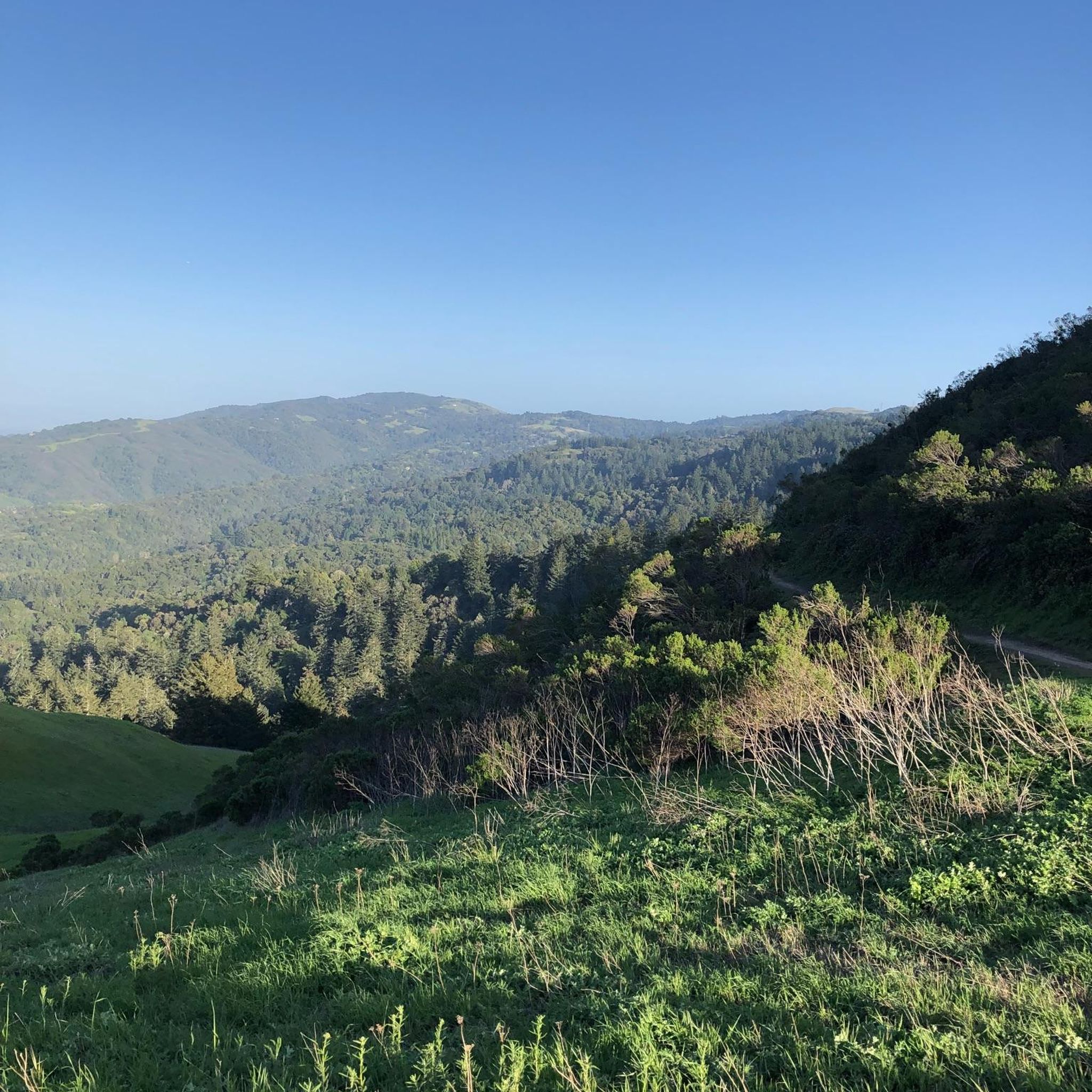
From up here on the ridge you get great sweeping views across the foothills. On a clear day you can see out west to the Pacific Ocean.
0
0
On a clear day, you can see up the bay to San Francisco and out across Silicon Valley. The trail follows a packed dirt track which winds above the treetops, granting sweeping views from this northern section.
0
0

Borel Hill is my favorite place to watch spring flowers. The western slope near ancient oaks (5-10min west of Borel Hill) are covered with orange California Poppies and purple flowers starting in April. Borel Hill itself peaks around mid May and has a wide variety of flowers. The show lasts only a few weeks until end of May. The peak time and flower intensity varies from year to year, so come several times between April and May. There is small summit NW of Borel Hill and a narrow dirt trail leads you to a rock within 2 min. The rock is big enough for 2-3 to sit on. On a sunny day, the rock is nice warm even if the air is cold. Good views on the ocean and the Bay.
1
0

Windy Hill Summit, located at an elevation of 1,905 feet within the Windy Hill Open Space Preserve, offers great views of Silicon Valley and the Peninsula. The preserve stretches 1,132 acres along the east side of the Santa Cruz Mountains, coming up from the valley road near Portola Valley to this scenic summit. It’s a great spot to watch the sunset and take in views.
0
1

The top of Borel Hill has an elevation of 2,572 feet and offers panoramic views of the city below as well as views of the ocean in the distance.
0
0

Windy Hill Open Space Preserve encompasses a little over 1,100 acres of barren land with a few spotty forest areas. The majority of the Peninsula Range (the mountain range in which the park is encompassed) is completely covered in trees, but the Windy Hill Open Space Preserve has a bunch of open meadows and bald hills with expansive views.
0
0
Frequently Asked Questions
What is the difficulty range of running trails in La Honda Creek Open Space Preserve?
La Honda Creek Open Space Preserve offers a variety of running routes catering to different fitness levels. You'll find everything from moderate paths through wooded areas to more difficult trails with significant elevation gain, such as the Windy Hill Summit loop.
Are there challenging running routes for experienced runners in the preserve?
Yes, experienced runners will find several challenging options. For instance, the Windy Hill Summit loop from Portola Valley is a difficult 14.5-mile (23.4 km) trail with substantial elevation gain, offering expansive views. Another demanding route is the Alpine Pond – Borel Hill loop from Portola Valley, which spans nearly 18 miles (29 km).
Are there easier running options for beginners in La Honda Creek Open Space Preserve?
While many routes involve rolling hills, there are moderate options suitable for beginners looking for a good workout. The Running loop from Los Trancos Woods is a moderate 4.8-mile (7.7 km) trail through mixed forest, often completed in about an hour, providing a balanced running experience without extreme difficulty.
Are there loop trails available for running in the preserve?
Yes, many of the running routes in La Honda Creek Open Space Preserve are designed as loops, allowing you to start and finish at the same point. Examples include the popular Running loop from Portola Valley and the Borel Hill loop from Skyline Ridge Open Space Preserve.
What are the typical distances for running routes in La Honda Creek Open Space Preserve?
Running routes in the preserve vary significantly in length. You can find shorter loops around 5 miles (8 km), such as the Running loop from Portola Valley, up to longer, more challenging trails like the Windy Hill Summit loop which is over 14 miles (23 km).
Is there parking available for trail runners at La Honda Creek Open Space Preserve?
Yes, parking is generally available at designated trailheads and access points around La Honda Creek Open Space Preserve. Specific parking details can often be found on the individual route pages or the preserve's official website.
Can I bring my dog on the running trails in La Honda Creek Open Space Preserve?
Policies regarding dogs in open space preserves can vary. It's best to check the specific regulations for La Honda Creek Open Space Preserve before heading out, as some areas may require dogs to be on a leash or may restrict access to certain trails.
Are the running trails suitable for families with children?
While the preserve offers diverse terrain, some moderate, shorter loop trails might be suitable for active families. However, many routes involve significant elevation changes and longer distances, so it's important to choose a route that matches the family's fitness level and experience. Always check the route details for distance and elevation before setting out.
What kind of terrain can I expect while running in La Honda Creek Open Space Preserve?
Runners in La Honda Creek Open Space Preserve will encounter a varied landscape of rolling hills, dense woodlands, and open grasslands. The trails feature a mix of shaded and exposed paths, with creeks and riparian areas adding to the natural environment. Expect elevation changes that range from gentle gradients to more challenging climbs.
What is the best time of year to go running in La Honda Creek Open Space Preserve?
The preserve is generally enjoyable year-round, but spring offers lush greenery and wildflowers, while fall provides cooler temperatures and clear skies. Summer mornings are ideal to beat the heat, and winter can be beautiful, though trails might be muddy after rain. Always check weather and trail conditions before your run.
What are the trail conditions typically like in La Honda Creek Open Space Preserve?
Trail conditions in La Honda Creek Open Space Preserve are generally well-maintained. However, as with any natural area, conditions can vary. Expect dirt paths, some rocky sections, and potential muddy areas after rainfall, especially during the wetter months. Always wear appropriate footwear.
What do other runners say about the trails in La Honda Creek Open Space Preserve?
The running routes in La Honda Creek Open Space Preserve are highly rated by the komoot community, with an average score of 5.0 stars from 3 reviews. Runners often praise the varied terrain, scenic views, and the balance of challenging climbs and enjoyable descents.
Most popular routes in La Honda Creek Open Space Preserve

Get inspired with the komoot mobile app


Explore more
Browse the best Running Trails & Routes in other regions.
