The best cycling routes in Garin Regional Park
4.4
(47)
849
riders
64
rides
Touring cycling in Garin Regional Park offers routes through rolling hills, open grasslands, and along creek trails in the East Bay region. The park features varied terrain, including elevated ridges that provide expansive views of the surrounding landscape. Cyclists can expect a mix of paved roads and well-maintained paths suitable for touring bicycles, traversing both developed areas and natural open spaces.
Best touring cycling routes in Garin Regional Park
- The most popular touring cycling route is Alameda Creek Trail to…
Last updated: May 13, 2026
5.0
(10)
94
riders
Moderate bike ride. Good fitness required. Mostly paved surfaces. Suitable for all skill levels.
5.0
(1)
12
riders
15.5km
01:50
650m
650m
Hard bike ride. Very good fitness required. Mostly paved surfaces. Suitable for all skill levels.

Sign up for free
5
riders
Hard bike ride. Very good fitness required. Mostly paved surfaces. Suitable for all skill levels.
5.0
(2)
12
riders
Moderate bike ride. Good fitness required. Mostly paved surfaces. Suitable for all skill levels.
32
riders
Easy bike ride. Great for any fitness level. Mostly paved surfaces. Suitable for all skill levels.
Get access to more routes and recommendations from other explorers.
Sign up for free
Already have an account?
Our route recommendations are based on thousands of hikes, rides, and runs completed by other people on komoot.
Start today with a free account
Your next adventure awaits.
Login or Signup

Other adventures in Garin Regional Park

Tips from the Community

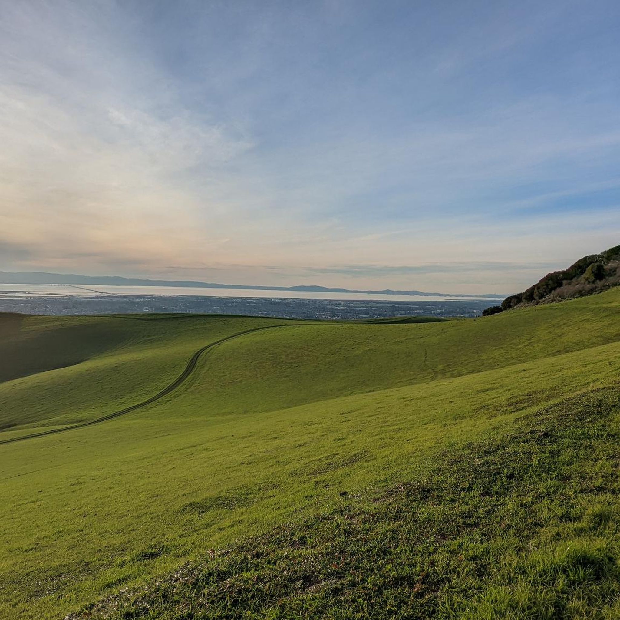
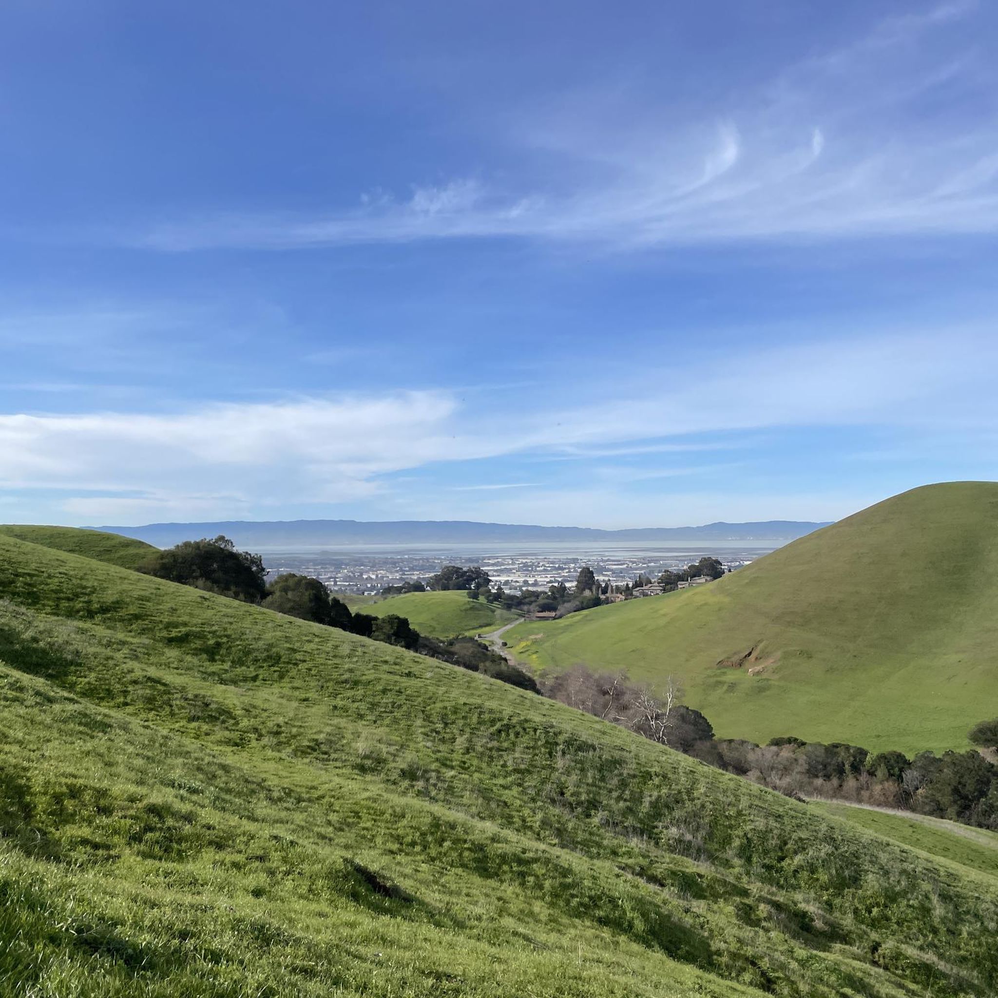
On a clear day you can see all the way across the bay, past the San Mateo-Hayward Bridge.
0
0
From here you can see out over Alvarado to San Francisco Bay. The hills of Dry Creek Park roll out away from you toward the water.
0
0

The Castlewood Country Club is a private 36-hole facility. The property dates back to the late 1800s and now offers tennis courts, Bocce courts, pool, fitness center, to go with the two golf courses.
0
0

Pleasant ride along the canal. Beautiful white birds are seen occasionally.
0
0

The Alameda Creek Trail runs from the mouth of Niles Canyon westward to San Francisco Bay. The trail is fully paved and is popular with hikers, runners and cyclists.
1
0

The perfect spot for a break! No shade here, but there is a bench, an informational panel, and a wooden observation deck. The views over the marshland here and the bay are pretty amazing.
0
0

The Bayview Trail is an excellent route to explore year round. As you ride along the trail you can enjoy the hills to the easy and the famous San Francisco Bay to the west.
0
0
The Alamo Canal Trail can be found adjacent to the man-made waterway, the Alamo Canal. It is a short but useful trail, connecting riders and runners to other trails, like the Iron Horse Regional Trail.
0
0
Frequently Asked Questions
How many touring cycling routes are available in Garin Regional Park?
Garin Regional Park offers a wide selection of touring cycling routes, with over 60 options to explore. These routes cater to various skill levels, including easy, moderate, and difficult trails.
Are there any family-friendly touring cycling routes in Garin Regional Park?
Yes, Garin Regional Park features several routes suitable for families looking for a more relaxed ride. There are 18 easy touring cycling routes, often characterized by gentler inclines and well-maintained paths, perfect for a family outing. Look for routes with lower elevation gain for the most comfortable experience.
What are some challenging touring cycling routes for experienced riders?
For experienced touring cyclists seeking a challenge, Garin Regional Park has 19 difficult routes. One such option is the High Ridge viewpoint loop from Garin Regional Park, which ascends to a high ridge, offering panoramic vistas but demanding significant effort. Another challenging ride is the Palomares Road – Palomares Road loop from Five Canyons Open Space, covering 19.6 miles with substantial elevation changes.
Are there circular touring cycling routes in Garin Regional Park?
Many touring cycling routes in Garin Regional Park are designed as loops, allowing you to start and end at the same point. An example is the Alameda Creek Trail to the Bay – Bayview Trail loop from James Logan High School, a moderate 29.4-mile route that follows the Alameda Creek Trail to the bay and back.
What is the best time of year to go touring cycling in Garin Regional Park?
The best time for touring cycling in Garin Regional Park is typically during the spring and fall months. The weather is generally mild, with comfortable temperatures and less chance of extreme heat or heavy rain. Winter can also be pleasant on clear days, while summer can be hot, especially on exposed trails.
Where can I park when visiting Garin Regional Park for cycling?
Garin Regional Park offers designated parking areas at its main entrances and trailheads. Specific parking availability can vary by trailhead, so it's advisable to check the park's official website or signage upon arrival for the most current information and any potential fees.
Is public transport available to access touring cycling routes in Garin Regional Park?
Public transport options to Garin Regional Park are limited, but some bus routes may serve areas near the park's perimeter. For direct access to trailheads, driving or cycling to the park is generally the most convenient method. Check local transit authority websites for routes that might connect to Hayward or other nearby communities.
What kind of wildlife might I see while cycling in Garin Regional Park?
Garin Regional Park is home to diverse wildlife. Cyclists might spot various bird species, including raptors soaring overhead, as well as ground squirrels, rabbits, and occasionally deer. Keep an eye out, especially during quieter times of day, to observe the park's natural inhabitants.
Are there any scenic viewpoints along the touring cycling routes?
Yes, Garin Regional Park is known for its elevated ridges that provide expansive views. Routes like the High Ridge viewpoint loop from Garin Regional Park are specifically designed to lead to panoramic vistas of the regional park and the surrounding East Bay landscape.
What should I bring for a touring cycling trip in Garin Regional Park?
When touring cycling in Garin Regional Park, it's essential to bring plenty of water, especially on longer routes or warmer days, as water sources can be limited. Sun protection (sunscreen, hat, sunglasses), snacks, a basic bike repair kit, and a map or GPS device are also highly recommended. Layered clothing is advisable due to changing temperatures.
What do other touring cyclists say about their experience in Garin Regional Park?
The touring cycling routes in Garin Regional Park are highly rated by the komoot community, with an average score of 4.5 stars from over 50 reviews. Cyclists often praise the varied terrain, from open grasslands to scenic ridge climbs, and the expansive views of the East Bay.
Are there any longer touring cycling routes that extend beyond Garin Regional Park?
Yes, some routes connect Garin Regional Park with neighboring areas, offering longer rides. For instance, the Arroyo de la Laguna – Pleasanton Ridge Regional Park loop from South Hayward is a challenging 51.9-mile route that extends into Pleasanton Ridge Regional Park, providing an extensive touring experience.
Can I find moderate touring cycling routes that offer good views without extreme difficulty?
Certainly. Garin Regional Park offers 23 moderate touring cycling routes that balance challenge with accessibility. The High Ridge viewpoint – High Ridge Loop Trail loop from Dry Creek Pioneer Regional Park is a moderate 6.1-mile option that still provides excellent views without the intense climbs of more difficult trails.
Most popular routes in Garin Regional Park

Get inspired with the komoot mobile app


Explore more
Browse the best Cycling routes in other regions.
