The best running trails in Thomas F. Riley Wilderness Park
5.0
(2)
273
runners
44
runs
Jogging in Thomas F. Riley Wilderness Park offers a diverse outdoor experience across its 544-acre wildlife sanctuary. The region is characterized by rolling hills and canyons covered in Coastal Sage Scrub and grasslands, providing varied terrain for running. Old groves of Coast Live Oaks and Western Sycamores border seasonal creeks, offering shaded sections along the routes. The park features a well-maintained trail system suitable for various fitness levels.
Best jogging routes in Thomas F. Riley Wilderness Park
- The most popular…
Last updated: May 27, 2026
2
runners
4.49km
00:33
70m
70m
Easy run. Great for any fitness level. Mostly paved surfaces. Suitable for all skill levels.
1
runners
7.86km
00:59
100m
100m
Moderate run. Good fitness required. Mostly accessible paths. Some sure footedness required.

Sign up for free
3
runners
9.00km
00:59
160m
160m
Moderate run. Good fitness required. Mostly paved surfaces. Suitable for all skill levels.
15.7km
01:43
210m
210m
Hard run. Very good fitness required. Mostly paved surfaces. Suitable for all skill levels.
19.4km
02:15
400m
390m
Hard run. Very good fitness required. Mostly paved surfaces. Suitable for all skill levels.
Get access to more routes and recommendations from other explorers.
Sign up for free
Already have an account?
Our route recommendations are based on thousands of hikes, rides, and runs completed by other people on komoot.
Start today with a free account
Your next adventure awaits.
Login or Signup

Tips from the Community

The trail here is a wide, secluded double track that takes you on a rolling adventure through the hills. To the east you get views of Crow Canyon and the mountains, and to the west there are two spur trails that take you down to Vista del Verde.
0
0
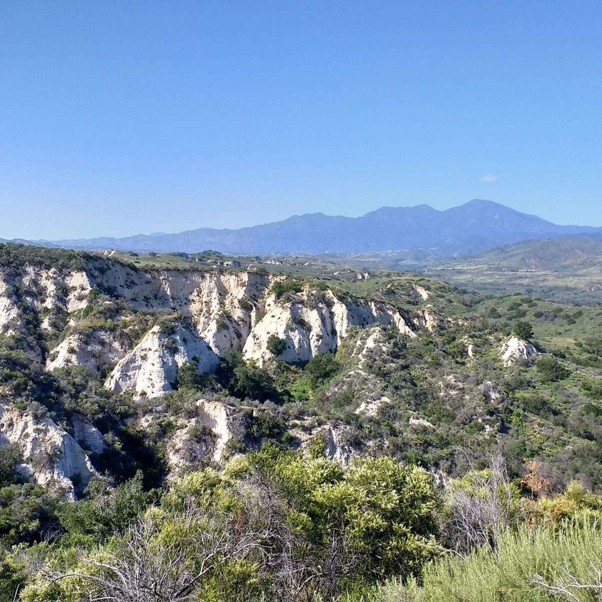
You get fantastic views of the Santa Ana Mountains as you follow a narrow dirt singletrack along the ridge between dense fields of flowers.
0
0

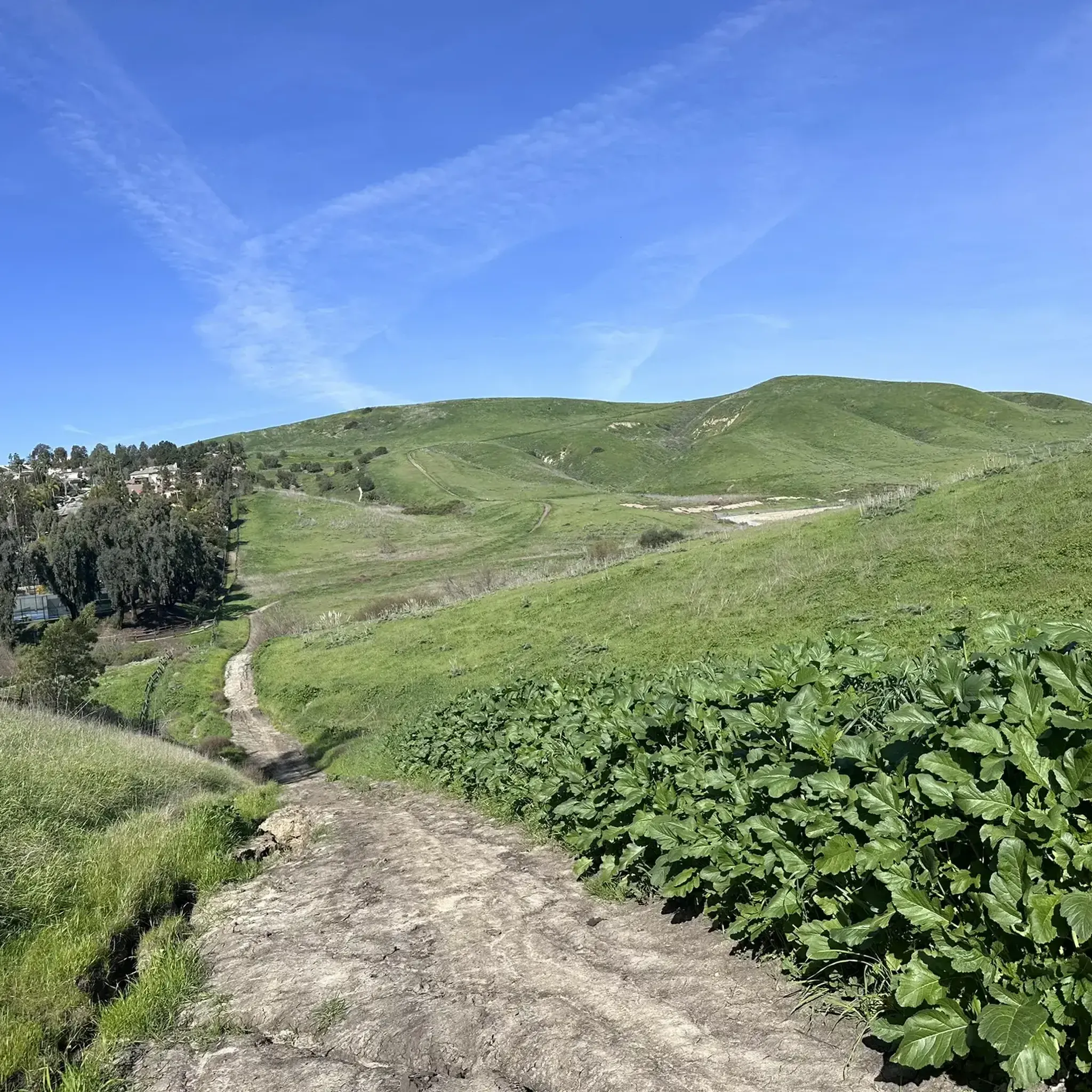
Thomas F. Riley Wilderness Park features multiple trails, a couple official overlooks, and a small pond within its 540 acres. A lot of the trails are in open grassy areas while a few wide dirt trails climb up some of the higher hills.
0
0
The trailhead has a large packed dirt lot, shaded picnic tables, and a historic wagon. From here you can explore a wonderful collection of trails. The best views are often found from the Vista Ridge Trail and Horned Toad Vista Point.
0
0
This is a wide easy doubletrack with views of foothills and white cliffs of the West Ridge. There are multiple overlooks, and there are spur trails leading down to Bell Creek every 3/4 of a mile or so, making it easy to customize the length of your adventure.
0
0
You cross the creek a few times along the trail, and have views of the San Juan nearly the entire time. The creek is 29 miles long and drains the area of the foothills from up beyond the hot springs to Oso Creek on its way to the Pacific.
0
0
There are restrooms and a small gravel parking lot here at the trailhead. There is also a kiosk with trail information. For more information on camping here, trail conditions, fees, and other information see ocparks.com/caspers.
0
0
The creek starts up in the foothills of the Santa Ana Mountains and carves its way through Fox Canyon, Dove Canyon, and Crow Canyon to get here before spilling into the San Juan. The trails cross the creek in a number of places.
0
0
Frequently Asked Questions
What kind of terrain can I expect on the running routes in Thomas F. Riley Wilderness Park?
The park features diverse terrain, including rolling hills and canyons covered in Coastal Sage Scrub and grasslands. You'll also find old groves of Coast Live Oaks and Western Sycamores bordering seasonal creeks, offering shaded sections and a sense of wilderness. The trails provide a good workout with varied elevation changes.
Are there any easy running trails suitable for beginners or a relaxed jog?
Yes, the park offers several easy trails. The Oak Canyon and Vista Ridge Trail Loop is an excellent choice, covering about 2.8 miles with varied terrain. Other easy options include the Wagon Wheel Canyon Trail and portions of the Oak Canyon Trail, as well as the Sycamore Loop trail for a gentle stroll.
What are some challenging running routes for experienced runners?
For a more challenging experience, consider routes like the West Ridge Trail, which spans over 9.7 miles with significant elevation changes. Another demanding option is the Oso and Juaneño Trail Loop, extending nearly 12 miles with considerable climbs.
Are there any scenic viewpoints or landmarks along the running trails?
Absolutely! The park boasts two prominent scenic overlooks: Skink Vista Point and Horned Toad Vista Point. These offer breathtaking views of Orange County and the Santa Ana Mountains, perfect for a brief pause during your run. You can reach Skink Vista Point via the moderate Vista Ridge Trail, and Horned Toad Vista Point by taking the easy Oak Canyon Trail to the moderate Horned Toad Trail. Additionally, a vibrant one-acre native plant butterfly garden near the Ranger Station is a highlight, especially in April and May.
Can I bring my dog on the running trails in Thomas F. Riley Wilderness Park?
No, dogs are unfortunately not permitted on the trails in Thomas F. Riley Wilderness Park. The park operates as a wildlife sanctuary, and this policy helps protect the native plant and animal life.
Are there any loop running routes available?
Yes, many of the park's trails are designed as loops, offering varied scenery without retracing your steps. Popular loop options include the Oak Canyon and Vista Ridge Trail Loop and the East Ridge and Bell Canyon Trail Loop.
What is the best time of year to go running in the park?
The park is open year-round from 7 AM to sunset. Spring (April and May) is particularly vibrant, with the butterfly garden in full bloom. However, trails may close for up to three days following significant rain, so it's always a good idea to check conditions before heading out. The shaded sections along the creeks can offer some relief during warmer months.
Is there parking available at Thomas F. Riley Wilderness Park?
Yes, parking is available at the park. There is a dedicated parking area that can accommodate up to 50 vehicles, making it convenient for visitors to access the trail system.
Are there any facilities like restrooms or drinking fountains?
Yes, the park provides amenities for visitors. You'll find portable restrooms and drinking fountains available, ensuring a more comfortable experience during your run.
What do other runners say about the trails in Thomas F. Riley Wilderness Park?
The park is highly regarded by the komoot community, with over 200 runners having explored its varied terrain. Users often praise the peaceful and quiet atmosphere, the well-maintained multi-use and single-track trails, and the beautiful natural features like rolling hills, canyons, and old-growth trees. The variety of trail difficulties also allows runners of all levels to find suitable routes.
Are there any routes suitable for families or those with children?
Yes, the park offers trails suitable for families. Easy routes like the Wagon Wheel Canyon Trail and portions of the Oak Canyon Trail provide gentle paths that are not overly strenuous, making them ideal for a family jog or walk. The Sycamore Loop trail is also an easy stroll beneath sycamore trees.
How many running routes are there in Thomas F. Riley Wilderness Park?
There are over 45 running routes documented in Thomas F. Riley Wilderness Park on komoot, ranging from easy to difficult, ensuring options for every fitness level and preference.
Where can I find more information about the park's regulations or current status?
For official information regarding park regulations, seasonal closures, or any other updates, you can visit the Orange County Parks website: oc.gov/district-resource/riley-wilderness-park.
Most popular routes in Thomas F. Riley Wilderness Park

Get inspired with the komoot mobile app


Explore more
Browse the best Running Trails & Routes in other regions.
