Routes

Planner

Features

Updates

App

Login or Signup

Get the App

Login or Signup

Routes
Hikes
United States
California
Marin County

White Hill Open Space Preserve

The best walks and hikes in White Hill Open Space Preserve

4.9

(131)

2,082

hikers

146

hikes

If you've ever tried to plan hiking in White Hill Open Space Preserve, you know how quickly the options can feel overwhelming. With so many trails crisscrossing the preserve and connecting to adjacent areas, it's tough to know which routes are genuinely worth your time and effort, and which are just filler. That's where we come in. Our komoot community has explored, mapped, and reviewed countless routes here, so we've curated a shortlist of the absolute best to save you the guesswork.

Hiking in White Hill Open Space Preserve means immersing yourself in a landscape of rolling hills, diverse woodlands of oak and bay trees, and open chaparral. What truly sets it apart are the expansive views of Mount Tamalpais, San Francisco Bay, and Tomales Bay that reward your climbs, alongside the unique spring wildflowers found in areas of serpentine soil. The preserve offers everything from easy strolls to more demanding ascents, and the trail network seamlessly connects to neighboring preserves like Loma Alta for longer adventures. Expect the multi-tiered Carson Falls to be especially impressive after seasonal rains.

If you're looking for a solid moderate challenge with great views, we'd start with the White Hill, Blue Ridge and Split Rock Loop, a 5.6 miles (9.0 km) route that offers a fantastic taste of the preserve's varied terrain. For those ready for a longer day out, the White Hill, Hobo Camp, and Broken Dam Loop at 7.6 miles (12.2 km) is a local favorite, combining fire roads and trails for a rewarding experience. Dive in and discover why more than 1,800 hikers have already explored these trails with komoot!

Last updated: May 11, 2026

6

hikers

#1.

Loma Alta Peak Trail

11.2km

03:36

480m

480m

Explore the Loma Alta Open Space Preserve on the Loma Alta Peak Trail, a moderate 6.9-mile (11.2 km) hike that delivers stunning 360-degree views from one of Marin County's highest points. You'll traverse diverse terrain, from shaded California bay woods and oak woodlands to wide-open grasslands, culminating in the Loma Alta Summit. Expect a steady climb with 1561 feet (476 metres) of elevation gain, taking around 3 hours and 36 minutes, making it a rewarding challenge for hikers with good fitness.

Planning your visit to the Loma Alta Peak Trail is straightforward, with the White Hill Trailhead serving as a popular access point. Due to extensive sun exposure on the upper sections, an early morning start or a cooler day is recommended. If you hike in winter or early spring, prepare for potentially muddy conditions, but you might also be rewarded with seasonal wildflowers and a delicate waterfall. Always carry ample water, especially during warmer months.

This trail is a highlight for its panoramic vistas, which can include the San Francisco skyline, Mt. Tamalpais, and the Pacific Coast. It's also part of the larger Bay Area Ridge Trail system, connecting you to other open spaces. The preserve's varied ecosystems, from grasslands to woodlands, showcase Marin County's natural beauty, and you might even spot grazing cattle, a practice that dates back over 150 years.

Navigate with device

Send to Phone

Save

Moderate

The Oak Manor, Smith Ridge, Sunrise and Old Railroad Grade Loop is a challenging 14.4-mile (23.1 km) hike that winds through a remarkable variety of landscapes in Marin County. Expect to climb 2528 feet (771 metres) over approximately 7 hours and 4 minutes, traversing everything from cool redwood canyons to sun-drenched chaparral and open grasslands. From the top of Smith Ridge, you'll earn breathtaking panoramic views of San Francisco, the Pacific Ocean, and the entire Bay Area, a truly spectacular reward for your effort.

This difficult route requires good fitness and sturdy footwear, especially given the extremely steep sections on Sunrise Fire Road. While much of the trail consists of unpaved fire roads and natural paths, the historic Old Railroad Grade offers a more consistent ascent. Be sure to bring plenty of water and sun protection, as many parts of the trail are exposed. Starting early in the morning or late afternoon can offer the best light for photography and more comfortable temperatures.

A significant portion of the trail follows the Old Railroad Grade, tracing the path of the former Mt. Tamalpais Scenic Railway. Along this historic route, you can spot remnants of the railway's past, including cut-through hills and the famous "Double Bowknot" series of hairpin curves. The trail is a multi-use path, popular with mountain bikers and runners, and is also an important link in the larger Bay Area Ridge Trail system.

Hard
guide_signup
Let us show you the way with the komoot mobile app
With a free komoot account, you can easily find, customize, and navigate endless outdoor adventures.

Sign up for free

The White Hill, Hobo Camp, and Broken Dam Loop offers a dynamic hiking experience through Marin County's varied landscapes. You'll traverse rolling hills, open grasslands, and dense woodlands, with sections of wide fire roads giving way to narrower, rockier paths. Keep an eye out for impressive stands of redwoods and hazelnut, and on clear days, enjoy panoramic views of Mount Tamalpais, Loma Alta, and even Mount Diablo.

This moderate 7.6-mile (12.2 km) loop involves 1035 feet (315 metres) of elevation gain and typically takes about 3 hours and 32 minutes. While not overly strenuous, the consistent climbs provide a good workout, making it suitable for hikers with a good level of fitness. Spring is particularly rewarding for the vibrant wildflower displays, but the trail is enjoyable year-round.

The area is known for its diverse ecosystems, including unique serpentine rocks and soil at higher elevations. While the names "Hobo Camp" and "Broken Dam" are part of the trail's designation, the broader White Hill Preserve also holds historical significance, including a 1946 B-17 bomber crash site. Dogs are welcome on the trails, though leash rules can vary.

Moderate

The White Hill, Blue Ridge and Split Rock Loop offers a dynamic hiking experience through varied landscapes, from shaded woodlands to open grasslands and chaparral. You'll traverse a moderate 5.6-mile (9.0 km) route with 1448 feet (441 metres) of elevation gain, typically completed in just under 3 hours, culminating in breathtaking 360-degree views from the White Hill summit that stretch to Mount Diablo and Mount Tamalpais. In spring, the trail comes alive with a colorful display of wildflowers like lupines and California poppies, making it a truly scenic journey.

To plan your visit, head to the White Hill Open Space Preserve in Fairfax, California. While specific parking details aren't always highlighted, arriving earlier in the day is a good strategy, especially on weekends. The trail is popular not just for hiking but also for mountain biking and horseback riding, so you'll be sharing the paths. Spring is arguably the best time to visit, not only for the wildflowers but also for generally pleasant hiking weather.

This trail is part of a larger network within the White Hill Open Space Preserve, an area known for its diverse plant life, including rare species found at higher elevations. The preserve's varied terrain, from wide fire roads to steep, wooded inclines, provides a comprehensive taste of Marin County's natural beauty. While not directly on this loop, the broader area even has a historical B-17 bomber crash site nearby, adding a layer of intrigue to the region's history.

Moderate

The Old Railroad Grade, Glen Fire, Smith Ridge & Sunrise loop offers a dynamic hiking experience, combining historical paths with challenging climbs and panoramic vistas. This moderate 4.9-mile (7.9 km) route, featuring 875 feet (267 metres) of elevation gain, typically takes about 2 hours and 25 minutes to complete. You'll traverse wide fire roads, dirt, and gravel paths, with sections like the Sunrise Fire Road presenting notably steep ascents, while others, like the Old Railroad Grade, offer a more gradual, though sustained, climb. Expect diverse scenery, from redwood canyons and chaparral to open grasslands and sweeping Bay Area views.

Planning your visit to this Marin County gem is straightforward, though awareness is key. Street parking is available, particularly near the Glen Drive starting point for the Glen Fire Road, but it's always wise to arrive early, especially on weekends, to secure a spot. The trails are multi-use, so you'll share the path with mountain bikers and horseback riders; courtesy and awareness of other users are essential. While the loop can be enjoyed year-round, spring brings vibrant wildflowers, and clear days offer the best visibility for the expansive views.

This loop is rich in history and natural beauty, following parts of the

Moderate
Sign up for free to see 142 more hikes in White Hill Open Space Preserve.

Get access to more routes and recommendations from other explorers.

Sign up for free

Already have an account?

Our route recommendations are based on thousands of hikes, rides, and runs completed by other people on komoot.

Start today with a free account

Your next adventure awaits.
Login or Signup

Popular around White Hill Open Space Preserve

Running Trails in White Hill Open Space Preserve

MTB Trails in White Hill Open Space Preserve

Cycling in White Hill Open Space Preserve

Road Cycling Routes in White Hill Open Space Preserve

Gravel biking in White Hill Open Space Preserve

Tips from the Community

Matthew
February 14, 2024, Loma Alta Summit

Loma Alta literally translates to "high hill" and is the highest point in the Loma Alta Open Space Preserve. A few different dirt roads and trails lead to the bald summit that looks over the surrounding hillsides.

0

0

Sue
October 28, 2023, White Hill

With its peak at 1,404-foot (428 m), White Hill is a grassy horseshoe-shaped hill boasting fantastic views of the Marin County Ridge, Mt. Diablo, Loma Alta, and the north side of Mt. Tamalpais. In the spring, you can enjoy blooming lupines, California poppies, blue larkspur, and, if you're lucky, see a swallowtail butterfly or two.

0

0

Best appreciated after winter rainfall, this waterfall is right along Old White Hill Grade trail. If surprised by a shower the massive pipe channeling the usually small trickle of water under the trail can serve as an emergency roof, but be careful if water levels increase suddenly ...

0

0

At 1592 feet, Loma Alta is one of the highest points in Marin. For a less strenuous excursion, from the lower Loma Alta Open Space Preserve entrance on the Fairfax side to the White Hill entrance, Old Railroad Grade Fire Road runs along the lower perimeter of the 509-acre preserve. In rainy season, see Fairfax Falls cascading 25 feet. https://www.marincountyparks.org/parkspreserves/preserves/loma-alta

0

0

Enjoy heavenly Bay Area views, especially at sunrise and sunset: Here you can leave the gradual former railroad grade and take the extremely steep Sunrise Fire Road trail to the summit. At 1592 feet, Loma Alta is one of the highest points in Marin. https://www.marincountyparks.org/parkspreserves/preserves/loma-alta

0

0

Traveler
December 23, 2019, White Hill Trailhead

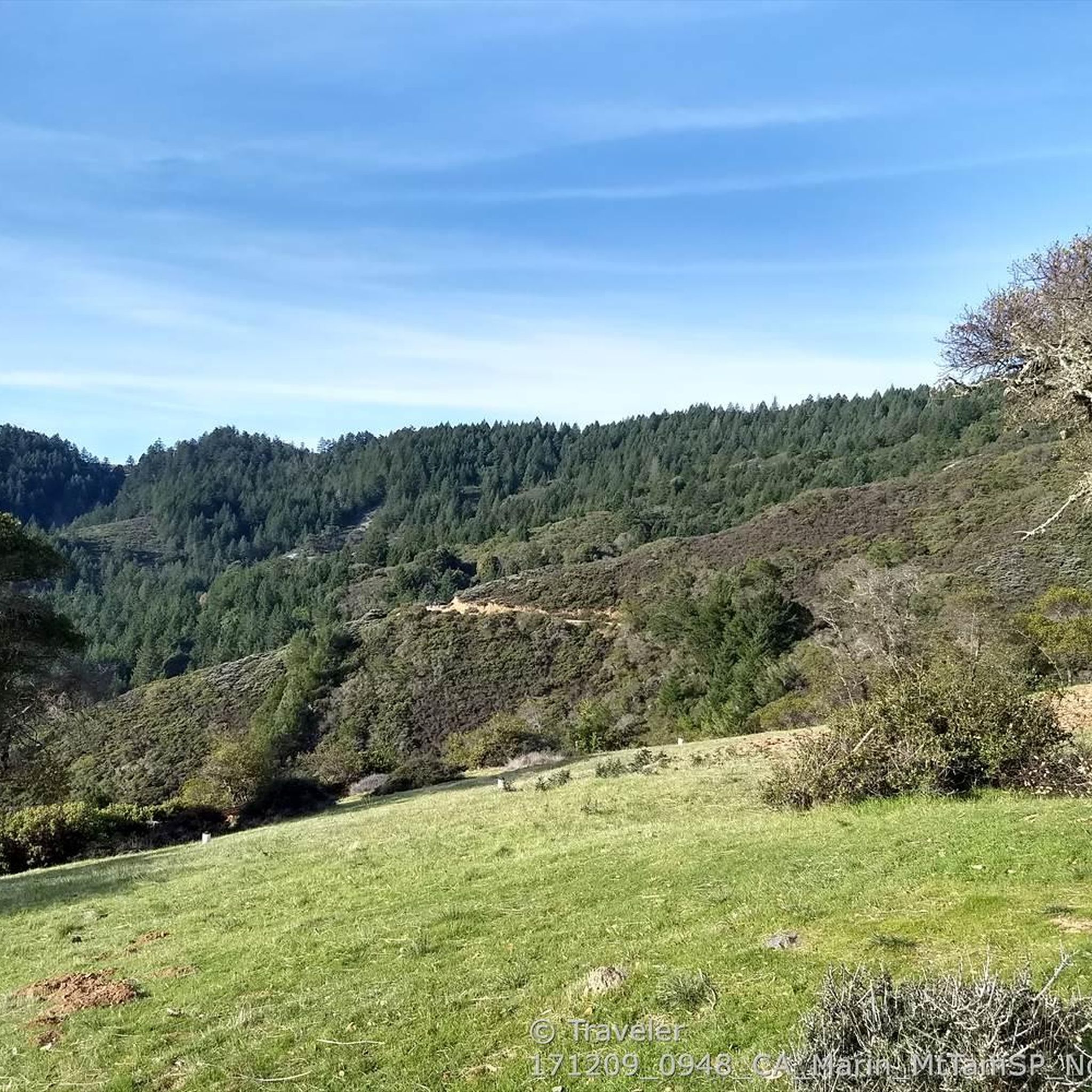
White Hill Trail crosses under Brown Bridge and then climbs steeply to link Loma Alta Preserve ( https://www.marincountyparks.org/parkspreserves/preserves/loma-alta ) with White Hill Preserve ( https://www.marincountyparks.org/parkspreserves/preserves/white-hill ), which further links up with Cascade Canyon Preserve, and Gary Giacomini Preserve.

0

0

Steep switchbacks single track to hike down into the canyon

0

2

To avoid the traffic when riding up (or down) White Hill, the highest elevation along Sir Francis Drake Boulevard from Fairfax, the old railroad grade is a more gradual, mostly smooth gravel trail alternative.

1

2

Frequently Asked Questions

Are dogs allowed in White Hill Open Space Preserve?

Yes, dogs are generally welcome in White Hill Open Space Preserve. They must be on a leash on all trails and fire roads. Please be mindful of other trail users, including hikers, cyclists, and equestrians, and always clean up after your pet to help protect the local wildlife and plants.

How do I get to the B-17 bomber crash site?

The historical B-17 bomber crash site is a compelling destination within the preserve. A popular way to reach it is via the White Hill and B-17 crash loop. This moderate route combines fire roads and singletrack trails, leading you through the area where the plane went down in 1946.

Are there any good loop hikes in the preserve?

Yes, the preserve is excellent for loop hikes. While many trails connect to adjacent parks, you can complete a great circuit entirely within the area. For a challenging day out, consider the San Geronimo Ridge Road via B-17 Trail loop, which covers significant ground and elevation for rewarding views.

What is the best time of year to hike in White Hill?

Spring is a particularly beautiful time to hike in White Hill Open Space Preserve. The hills are green, and the unique serpentine soils support a vibrant display of native wildflowers, including California poppies, lupines, and monkeyflowers. Autumn and winter also offer clear days and pleasant hiking conditions, while summer can be quite hot and dry on the exposed ridges.

How difficult are the trails in White Hill Open Space Preserve?

The preserve offers a range of difficulties. There are over 100 routes, with the majority being moderate. These trails, like the White Hill Trailhead loop from Fairfax, typically involve steady climbs on fire roads and singletrack. There are also about a dozen difficult hikes for those seeking a serious challenge, and over 30 easier options for more casual walks.

Can I connect to other parks from White Hill?

Yes, the trail network in White Hill is well-connected to adjacent open space preserves, allowing for extended hikes. You can easily create routes that venture into the neighboring Loma Alta and Giacomini preserves. A great example is the Old Railroad Grade, Glen Fire, Smith Ridge & Sunrise loop, which explores the varied terrain of Loma Alta.

What kind of wildlife might I see?

The diverse habitats of woodlands and chaparral support a variety of wildlife. Keep an eye out for black-tailed deer, coyotes, and bobcats. The preserve is also a great spot for birdwatching, with many species inhabiting the oak and bay tree groves. As always, observe wildlife from a respectful distance and do not feed the animals.

Are there any family-friendly hikes in the preserve?

While many trails feature steep climbs, the wider fire roads can be suitable for families with older children who are up for a bit of a challenge. The key is to choose a shorter route and go at your own pace. The lower sections of the White Hill Trail offer pleasant walks through woodlands before the main ascent begins.

What are the views like from the top of White Hill?

The summit of White Hill, at an elevation of 1,430 feet (436 m), offers spectacular 360-degree panoramic views. On a clear day, you can see many of Marin County's major peaks, including Mount Tamalpais, Mount Diablo, and Loma Alta. The ascent up the Blue Ridge Fire Road is well worth the effort for these sweeping vistas.

What do other hikers think of White Hill Open Space Preserve?

The preserve is highly regarded by the komoot community, with an average rating of 4.9 stars. Hikers often praise the stunning panoramic views from the ridges, the unique mix of woodland and chaparral landscapes, and the well-maintained network of fire roads and trails.

Where can I park to access the trails?

The primary access and parking area for White Hill Open Space Preserve is located in a pullout off Sir Francis Drake Boulevard in Fairfax. This trailhead provides direct access to the White Hill Trail. Parking is limited, so it's a good idea to arrive early, especially on weekends.

Most popular routes in White Hill Open Space Preserve

Easy hikes in White Hill Open Space Preserve

Store rating

Get inspired with the komoot mobile app

With a free komoot account, you can easily find, customize, and navigate endless outdoor adventures.

or

Join komoot Now

Store rating

Explore more

Browse the best Hikes in other regions.

Mount Tamalpais State ParkTamalpais-Homestead ValleyPoint Reyes National SeashoreMill ValleyCascade Canyon Open Space PreserveKentfieldSan AnselmoPhillip Burton WildernessInvernessBaltimore Canyon Open Space PreservePoint Reyes StationBelvedereSan RafaelNovatoRing Mountain Open Space PreserveFairfaxBolinas Lagoon Open Space PreserveKing Mountain Open Space PreserveBolinasNicasioMuir BeachRoy'S Redwoods Open Space PreserveWoodacreMuir Woods National MonumentBlithedale Summit Open Space PreserveLarkspurFrench Ranch Open Space PreserveSamuel P. Taylor State ParkHorse Hill Open Space PreserveAlto Bowl Open Space PreserveRossSan Pedro Mountain Open Space PreserveCamino Alto Open Space PreserveMount Burdell Open Space PreserveAltoStrawberryLucas Valley-MarinwoodTomales Bay State ParkDillon BeachTiburonLoma Alta Open Space PreserveLagunitas-Forest KnollsRush Creek Open Space PreserveStinson BeachSan Venetia Marsh Open Space PreserveSleepy HollowOld Saint Hilary'S Open Space PreserveSan GeronimoBald Hill Open Space PreserveSanta VenetiaMarin Islands National Wildlife RefugeSausalitoChina Camp State ParkCorte MaderaDeer Island Open Space PreserveBlack Point-Green PointAngel Island State ParkMarin City

Nearby adventure guides

Things to Do in Cascade Canyon Open Space Preserve

background

Get ready to conquer new peaks

Sign up for Free

Explore
RoutesRoute plannerFeaturesRedeem a voucherHikesMTB TrailsRoad cycling routesBikepackingSitemap
Download the app
Follow Us on Socials

© komoot GmbH

Privacy Policy