The best running trails in Baxter State Park
14
runners
18
runs
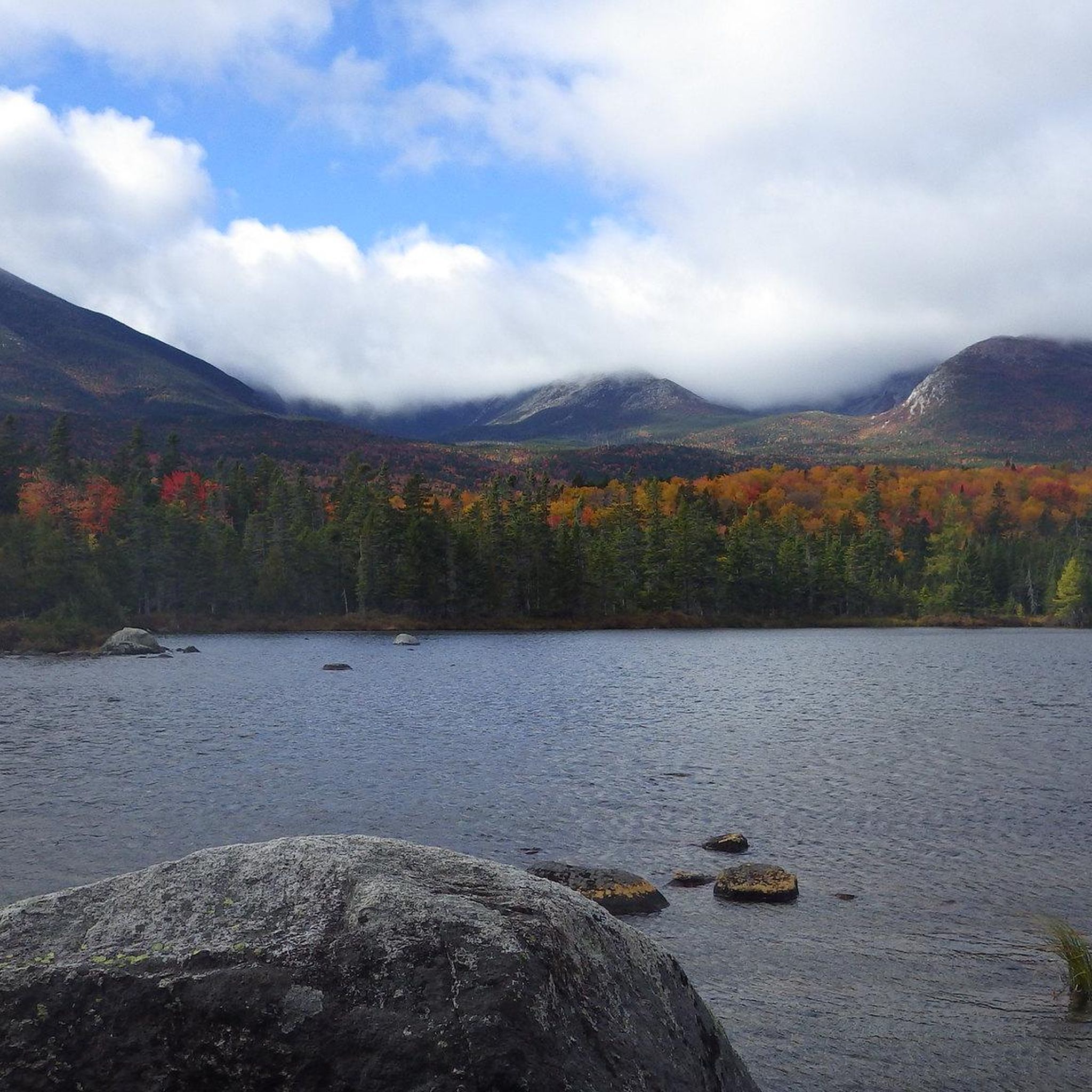
Jogging in Baxter State Park offers an opportunity to experience a rugged wilderness environment characterized by diverse mountainous terrain, numerous water bodies, and vast forests. The park features over 40 peaks and ridges, including Mount Katahdin, Maine's tallest mountain, and the Traveler Range. While many trails are challenging, the park's extensive network includes options with varying elevation gains and surfaces suitable for running. This region provides a genuine wilderness experience with evidence of glacial activity and abundant wildlife.
Best jogging…
Last updated: October 10, 2026
4
runners
13.8km
02:39
1,150m
1,150m
The Katahdin & Knife Edge loop presents a truly rugged jogging experience, covering 8.6 miles (13.8 km) with an intense 3767 feet (1148 metres) of elevation gain. This difficult route…
4
runners
15.8km
02:41
1,020m
1,020m
The Traveler Mountain Loop offers a difficult jogging experience across 9.8 miles (15.8 km) with a significant 3355 feet (1023 metres) of elevation gain. You'll encounter diverse terrain, from sections…

4
runners
12.6km
03:25
1,170m
1,170m
Prepare for a truly demanding jogging experience on the Abol Slide Trail, a difficult route that takes you towards Mount Katahdin's Baxter Peak. This 7.8-mile (12.6 km) journey involves a…
1
runners
22.0km
02:45
310m
310m
Embark on a difficult jogging adventure along the Russell Pond Trail, a challenging 13.6 miles (22.0 km) route that winds through a long valley in Baxter State Park. You will…
1
runners
15.7km
02:50
1,140m
1,140m
Prepare for a demanding journey on the Mount Katahdin via Cathedral and Saddle Trails Loop. This difficult route, though listed for jogging, involves a significant 3733 feet (1138 metres) of…
Get access to more routes and recommendations from other explorers.
Already have an account?
Our route recommendations are based on thousands of hikes, rides, and runs completed by other people on komoot.
Start today with a free account
Your next adventure awaits.
Popular around Baxter State Park
Tips from the Community

Russell Pond is deep in the heart of Baxter State Park and at the center of a wide network of trails. There is camping by the pond which can be a nice jumping off point to explore these trails from a convenient, and scenic location.
0
0

Russell Pond is at the center of a wide network of trails that radiate all throughout the park. You can camp here by the pond — if you are looking for a place to set up for a couple days to do long trails runs and explore as much of the park as possible, this is the crossroads.
0
0
This is an epic run that starts with a difficult climb up North Traveler (or Peak of the Ridges, if you come from the south) and then opens into a magnificent ridgeline singletrack which is fairly open all the way around the Traveler Ridge. You get stunning views down toward South Branch Ponds and all the way south to the Katahdin Massif.
0
0
This is an epic trail that leads up from Abol Campground to the Hunt Trail and Katahdin. It is technically the shortest route up Katahdin at 3.4 miles, but the terrain is very steep and involves a lot of scrambling. There are steps cut in at the bottom of the trail. This is a highly rewarding trail, but extremely difficult to run. Great place to practice your power hiking skills!
0
0
You get a fantastic view across Sandy Stream Pond to South Turner Mountain from here. There is another overlook a little ways further up the pond which grants epic views of Katahdin and its surrounding peaks. You can do a short loop around the pond, run up South Turner for some vert, or venture north along the flat, scenic Russell Ponds Trail which takes you all the way to the north end of the park.
1
0
Here the Pogy Notch Trail runs along the east shore of Lower and Upper South Branch Pond, but the trail runs all the way down Baxter State Park to Katahdin. There are a myraid of branching trails to explore from Pogy Notch, both around South Branch Ponds and beyond.
0
0
This is a great campground with tent sites, lean-tos, and cabins available. You can rent canoes and swim out in South Branch Pond. There are a ton of different trails to explore, so this is a great hub from which to enjoy the northern portion of Baxter. You get great views of North Traveler across the pond.
0
0

This is the northern end of the famed 2,135 mile Appalachian Trail. It ends at the highest of three peaks on Mount Katahdin: Baxter Peak at 5,268 feet. It is also the tallest mountain in the state of Maine. Katahdin literally means Greatest Mountain. Around the mountain, you can find black bear, deer, moose, a unique butterfly called Katahdin Arctic and lots of birds. A famous route is the so-called Knife´s Edge between Baxter Peak and Pamola Peak. Don´t underestimate the weather on Katahdin, it can be dangerous with slippery passages when snowed on or if sight is limited. Trails may be closed for periods due to weather and winter conditions.
0
0
Frequently Asked Questions
How many running routes are available in Baxter State Park?
Baxter State Park offers nearly 20 dedicated running routes, catering to various fitness levels. These include 2 easy routes, 8 moderate routes, and 8 challenging routes, ensuring there's a path for every runner.
What kind of terrain can I expect on the jogging trails in Baxter State Park?
The terrain in Baxter State Park is predominantly rugged and wild, reflecting its 'forever wild' philosophy. You'll encounter diverse mountainous landscapes, from the granite of Mount Katahdin to the rhyolite of the Traveler Range. Trails can range from relatively flat paths around ponds to steep, rocky ascents with significant elevation gains, requiring good fitness and sure-footedness.
Are there any easy or beginner-friendly jogging routes in the park?
Yes, while many trails are challenging, Baxter State Park does offer some easier options. There are 2 routes classified as easy, typically up to 3 miles long with an elevation gain of around 330 feet. These provide a good introduction to the park's natural beauty without extreme difficulty. For example, areas around Russell Pond offer flatter, scenic routes.
Can I bring my dog on the running trails in Baxter State Park?
No, dogs are generally not permitted on trails or in the backcountry of Baxter State Park. This rule is in place to protect the park's wilderness character and abundant wildlife. Service animals are an exception, but it's always best to check the park's official regulations before your visit.
Are there any family-friendly jogging routes in Baxter State Park?
For families looking for less strenuous options, the park has 2 easy routes that are suitable. These trails are typically shorter and have less elevation gain, making them more accessible for those jogging with children. Always consider the rugged nature of the park and choose routes that match your family's fitness level.
What natural features or landmarks can I see while running in Baxter State Park?
Baxter State Park is rich in natural beauty. You can encounter stunning mountain peaks like Mount Katahdin and Hamlin Peak, as well as unique glacial features such as kettle ponds and the dramatic Knife Edge arête. The park also boasts numerous water bodies, including Sandy Stream Pond and Rum Pond, and picturesque waterfalls like Big and Little Niagara Falls. Keep an eye out for wildlife such as moose and black bears, especially in marshy areas.
Are there any circular running routes in Baxter State Park?
Yes, the park offers several loop options for runners. For instance, the challenging Traveler Mountain Loop provides a circular path through the Traveler Range with substantial elevation gain. Other routes, like the Mount Katahdin via Cathedral and Saddle Trails Loop, also offer a circular experience around the park's highest peak.
What is the best time of year to go jogging in Baxter State Park?
The best time for jogging in Baxter State Park is typically from late spring through early autumn (May to October), when trails are free of snow and ice. Summer offers warmer temperatures, but can also bring more insects. Fall provides cooler weather and stunning foliage, making it a popular time for outdoor activities. Always check current trail conditions before heading out, as weather can change rapidly in the mountains.
What kind of wildlife might I encounter on the running trails?
Baxter State Park is a true wilderness area, home to diverse wildlife. Runners might spot moose, black bears, white-tailed deer, and even lynx. Smaller mammals like beaver, muskrats, river otters, and raccoons are also common, particularly near the park's numerous ponds and streams. Maintaining a respectful distance and being aware of your surroundings is always recommended.
Are there any specific permits or access rules for jogging in Baxter State Park?
Baxter State Park operates under a 'wilderness first, recreation second' principle. While specific jogging permits aren't typically required beyond park entry, there are strict rules regarding access, camping, and trail use. It's crucial to check the park's official website for current regulations, especially concerning day-use limits, parking reservations, and any seasonal restrictions, as facilities are rustic with no electricity or showers.
How long are the running routes in Baxter State Park?
The running routes in Baxter State Park vary significantly in length. You can find shorter, easier routes around 3 miles, while more challenging trails like the Russell Pond Trail extend over 13 miles. The longest routes, such as the Mount Katahdin via Cathedral and Saddle Trails Loop, can be nearly 10 miles and involve significant elevation, taking several hours to complete.
What makes the Russell Pond Trail a good option for running?
The Russell Pond Trail is a notable option for runners due to its length and relatively moderate elevation changes compared to the park's summit trails. It offers a wilderness experience with opportunities for wildlife spotting and scenic views around Russell Pond, making it suitable for a longer, more immersive run without the extreme vertical challenge of the major peaks.
What are the most challenging running routes in Baxter State Park?
The most challenging running routes in Baxter State Park often involve significant elevation gains and rugged, rocky terrain. Routes like the Katahdin & Knife Edge loop, Abol Slide Trail, and the Traveler Mountain Loop are classified as difficult. These routes can be over 9 miles long with more than 1000 feet of elevation gain, requiring very good fitness and sure-footedness, especially on sections like the Knife Edge.
Most popular attractions in Baxter State Park

Get inspired with the komoot mobile app


Explore more
Browse the best Running Trails & Routes in other regions.
