The best walks and hikes in Ngula Bulgarabang Regional Park
4.6
(1346)
11,237
hikers
110
hikes
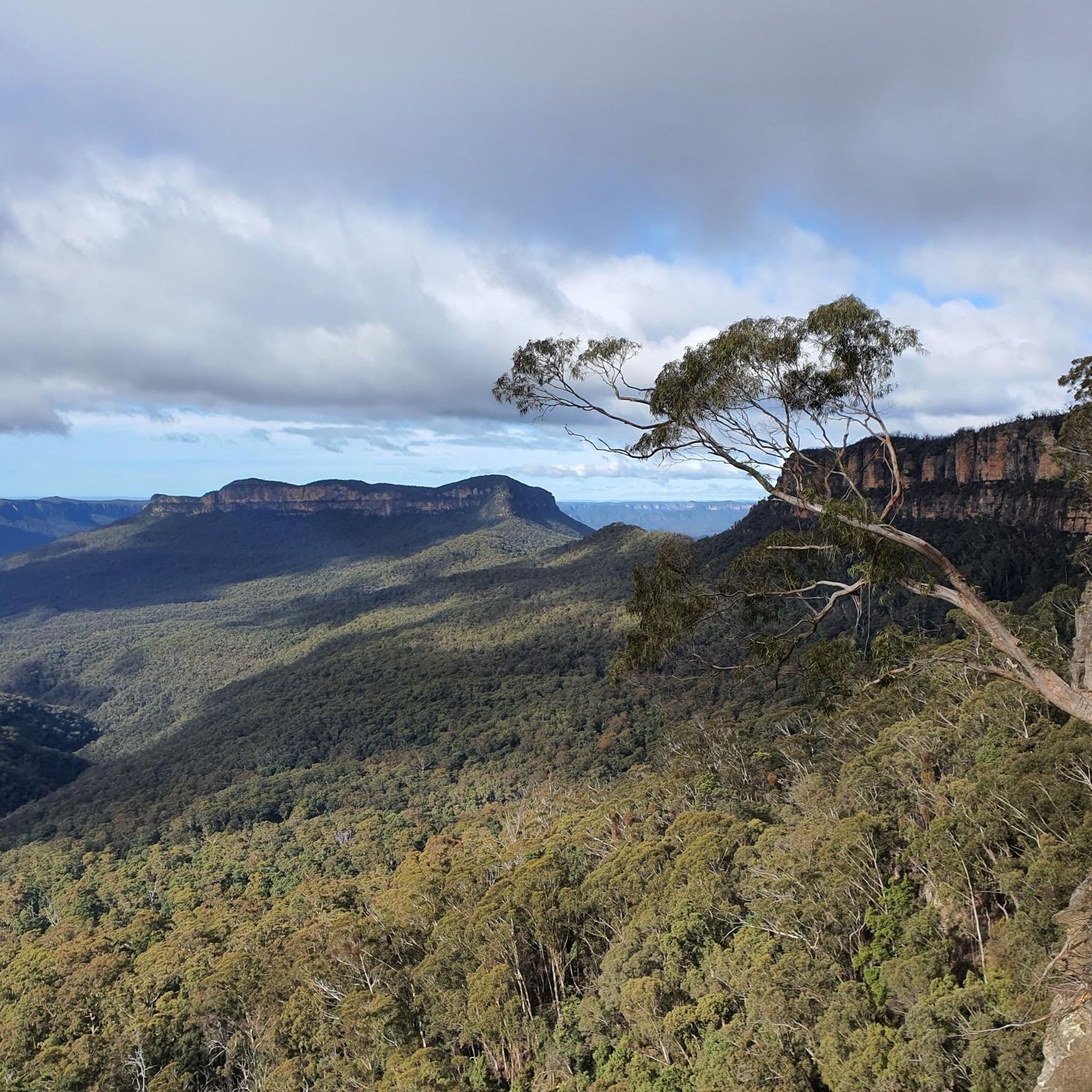
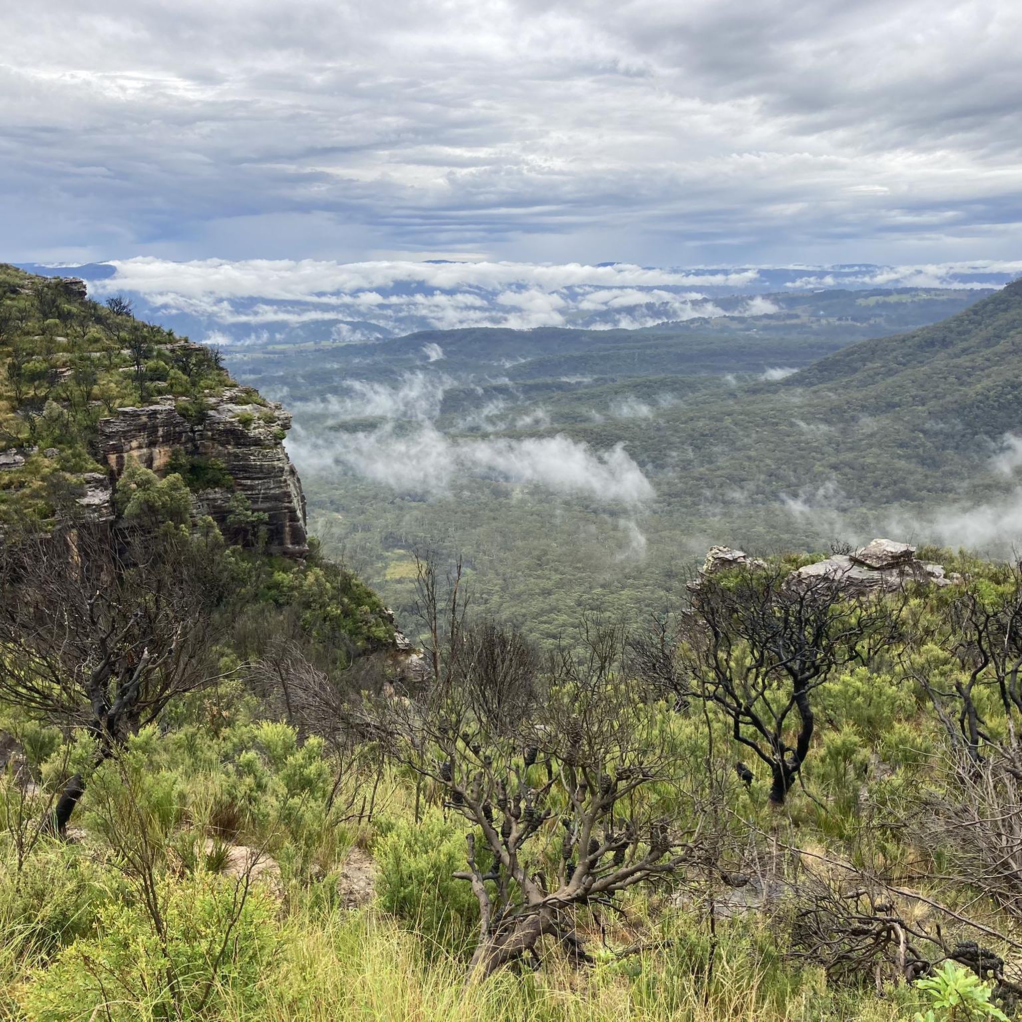
Hiking trails in Ngula Bulgarabang Regional Park traverse a landscape characterized by towering sandstone cliffs and extensive tall eucalypt forests. This park, located west of Katoomba in the Blue Mountains, offers sweeping views of the Megalong Valley and Shipley Plateau. Hikers can explore diverse flora, including rare Blue Mountain Swamps and endangered plants, within its pristine natural bushland. The park's topography provides varied terrain for outdoor activities.
Best hiking trails in Ngula Bulgarabang Regional Park
- The most popular hiking route…
Last updated: July 31, 2026
4.3
(4)
21
hikers
9.40km
03:26
470m
480m
Hard hike. Good fitness required. Sure-footedness, sturdy shoes and alpine experience required.
4.7
(48)
380
hikers
6.80km
02:40
510m
510m
Moderate hike. Good fitness required. Mostly accessible paths. Sure-footedness required.

Sign up for free
5.0
(1)
47
hikers
14.6km
05:42
770m
770m
Hard hike. Very good fitness required. Sure-footedness, sturdy shoes and alpine experience required.
5.0
(3)
32
hikers
8.88km
03:11
340m
340m
Hard hike. Good fitness required. Sure-footedness, sturdy shoes and alpine experience required.
4.5
(2)
30
hikers
8.90km
02:53
380m
380m
Moderate hike. Good fitness required. Easily-accessible paths. Suitable for all skill levels.
Get access to more routes and recommendations from other explorers.
Sign up for free
Already have an account?
Our route recommendations are based on thousands of hikes, rides, and runs completed by other people on komoot.
Start today with a free account
Your next adventure awaits.
Login or Signup
Tips from the Community

Bonnie Doon Falls is a thin waterfall cascading over the sandstone cliffs of Nellies Glen. Reached by a short detour from the Six Foot Track, the falls plunge into a beautiful fern-lined amphitheatre where you can even walk behind the curtain of water when conditions allow. It’s a peaceful, hidden gem that’s especially impressive after rain.
0
0
Devils Hole is a narrow gap in the cliffs with an enormous boulder wedged high between the towering walls. The rocky, moderately steep section of the track passes under the boulder through a cool, fern-filled passage that, even though not far from Cliff Drive, feels like stepping back in time. This section is not technical and relatively easy to manage, especially when conditions are dry. It’s one of the most memorable sections of the walk, and a fantastic area to explore and admire this unique natural feature that makes this part of the park so special.
0
0

This small parking area has excellent views across the Blue Mountains as well as access to trails that can take you to iconic locations such as the Golden Stairs, Castle Head, and the Ruined Castle. You'll also find a picnic table where you can have your lunch before or after a hike.
0
0
In a national park known for its amazing viewpoints, Castle Head might just be the best of them all. From the edge of the rocky outcropping you'll have a truly panoramic view of the Ruined Castle, Mount Solitary, and the surrounding Jamison and Cedar Valleys.
0
0

The Scenic Cableway brings bushwalkers over Blue Mountains National Park. The Scenic Cableway Top Station is an exciting, busy area, where the train and Skyway also depart. There are toilets, Skyway Souvenirs and the Terrace Cafe & Bar, all indoors, ideal in case of rain. Here visitors descend the steep cliff into the valley below, and by steep, it's steep, the cableway is at 36° incline. The Scenic Cableway is open Friday from 10:00 am to 4:00 pm and every other day of the week from 9:00 am to 5:00 pm. Cars depart around every 10 minutes from the top and bottom stations, and ticket prices start at $39 per adult and $21 per child but provides unlimited rides for the day. If you would like to avoid taking the cableway, the climb in and out can be done from the Giant Stairway track.
0
0
The Scenic Cableway brings bushwalkers over Blue Mountains National Park and is part of the park's network of cableways, a historic incline railway, and elevated forest boardwalks and scenic skyway. This is the bottom of the cableway. If you get on at the bottom, you will be effortlessly taken up a steep part of the park. By steep, it's quite a steep ride, the cableway travels at a 36° incline and moves at a speed of 3.8 metres per second. The cableway is open Friday from 10:00 am to 4:00 pm and every other day of the week from 9:00 am to 5:00 pm. Cars depart around every 10 minutes from the top and bottom stations, and ticket prices start at $39 per adult and $21 per child but gives unlimited rides for the day. If you would like to avoid taking the cableway, the climb in and out can be done from the Giant Stairway track.
0
0
Katoomba Cascades is a picturesque series of small cascades on the Kedumba River, where the water tumbles over wide sandstone shelves before continuing downstream to Katoomba Falls. There are boardwalks, bridges, benches and viewing platforms that surround the cascades for a close-up view of the flowing water within the lush gully of ferns and rainforest vegetation. It’s one of the few places where you can experience the river up close before it drops into the Jamison Valley.
0
0
This informal lookout sits along the western side of Mount Solitary, where the view opens up across the forested Jamison Valley, with rugged sandstone cliffs and layered escarpments stretching toward Katoomba. The expansive scenery is worth taking a moment to pause and appreciate the scale of your surroundings before continuing down the mountain.
0
0
Frequently Asked Questions
How many hiking trails are available in Ngula Bulgarabang Regional Park?
Ngula Bulgarabang Regional Park offers a wide selection of hiking opportunities, with over 115 routes recorded on komoot. These range from easy strolls to more challenging, longer expeditions, catering to various fitness levels.
Are there any dog-friendly hiking options in Ngula Bulgarabang Regional Park?
Yes, Ngula Bulgarabang Regional Park is dog-friendly. You can enjoy walks with your dog, provided they are kept on a leash at all times to protect the park's wildlife and ensure the safety of other visitors.
What kind of landscapes and natural features can I expect to see while hiking?
Hikers in Ngula Bulgarabang Regional Park will encounter stunning topography, including towering sandstone cliffs and extensive tall eucalypt forests. The park offers panoramic views of the Megalong Valley and Shipley Plateau from various lookouts. You can also discover diverse flora, such as areas blooming with wildflowers in late spring and early summer, and rare Blue Mountain Swamps.
Are there any easy or family-friendly hikes in the park?
Yes, the park has options for all abilities. Among the easier routes is the Katoomba Falls – Katoomba Cascades loop from Katoomba Falls, which is 5.1 km long and takes around 1 hour 35 minutes, making it suitable for families.
What are some notable viewpoints or landmarks in Ngula Bulgarabang Regional Park?
The park is home to several spectacular viewpoints. Megalong Head and Megalong Trig offer sweeping views over the Megalong Valley and Shipley Plateau. Additionally, the historic Blacks Ladder, an ancient Aboriginal pathway, provides unique perspectives and ledges for bushwalkers. While not directly within the park, the iconic Three Sisters Rock Formation is also a popular nearby landmark accessible via a loop from Katoomba Falls.
What is the best time of year to go hiking in Ngula Bulgarabang Regional Park?
Late spring and early summer are particularly beautiful times to visit, as many areas of the park bloom with wildflowers like golden hairpin banksia and white flowering tea tree. However, the park's diverse ecosystems and stunning views make it a rewarding destination for hiking throughout the year, with each season offering a different experience.
Are there any circular hiking routes available?
Yes, there are several circular routes. For example, the Three Sisters Rock Formation – Katoomba Cascades loop from Katoomba Falls is a moderate 8.8 km trail that allows you to return to your starting point after exploring iconic landmarks and waterfalls.
What kind of wildlife might I encounter in the park?
Ngula Bulgarabang Regional Park is excellent for wildlife spotting. Birdwatchers can frequently see colorful crimson rosellas, king parrots, and sulphur-crested and yellow-tailed black cockatoos. Lucky visitors might also spot lyrebirds or soaring wedge-tailed eagles. At night, the park is home to yellow-bellied gliders and the elusive spotted-tailed quoll.
What do other hikers enjoy most about hiking in Ngula Bulgarabang Regional Park?
The area is highly rated by the komoot community, with an average score of 4.6 stars from over 1300 reviews. Reviewers often praise the park's spectacular clifflines, diverse natural bushland, and the extensive network of trails that cater to various skill levels, all while offering breathtaking views of the Megalong Valley.
Are there any longer, more challenging hikes for experienced trekkers?
Absolutely. For experienced hikers, the Narrow Neck Trail Bushwalk is a challenging 24.8 km path that follows a prominent ridge, offering expansive vistas and a significant physical test. This route typically takes around 7 hours 27 minutes to complete.
Is parking available for hikers visiting Ngula Bulgarabang Regional Park?
Yes, parking is generally available at various access points to the park's trailheads. Specific parking details can often be found on individual route pages on komoot or local Blue Mountains visitor information sites.
What is the general terrain like on the hiking trails?
The terrain in Ngula Bulgarabang Regional Park is diverse. While much of the walking is on fire trails, there are also foot tracks that lead to key attractions. You can expect a mix of sandstone cliffs, eucalypt forests, and varied surfaces, with some sections requiring a topographical map and GPS for navigation, especially to hidden features.
Most popular routes in Ngula Bulgarabang Regional Park

Get inspired with the komoot mobile app


Explore more
Browse the best Hikes in other regions.
