The best walks and hikes in Pacific Rim National Park Reserve - Long Beach Unit
4.7
(1398)
10,524
hikers
21
hikes
Hiking in Pacific Rim National Park Reserve - Long Beach Unit offers diverse terrain characterized by expansive sandy beaches, lush temperate rainforests, and rugged coastlines along the Pacific Ocean. The region features old-growth forests with massive trees like Douglas fir and Western Red Cedar, alongside unique ecosystems such as the Shorepine Bog. The landscape includes hills like Radar Hill and Vargas Cone, remnants of the area's volcanic past.
Best hiking trails in Pacific Rim National Park Reserve - Long Beach Unit
- The most popular hiking route is Canso Plane Wreck – Canso Bomber Ruins Trail loop from Radar Hill Rd Parking Lot, an easy 3.0 miles (4.8 km) trail that takes 1 hour 17 minutes to complete, leading to an intriguing plane wreck site within the forest.
- Another top favourite among local hikers is Wickaninnish Beach – Lismer Beach loop from Parking Lot E, a moderate 5.5 miles (8.8 km) path. This route offers scenic coastal views and access to extensive sandy beaches.
- Local hikers also love the Pillar of the Community – Ancient Monarch Cedar loop from Rainforest Reconstruction Zone, a 1.6 miles (2.6 km) trail leading through old-growth forests of giant Western Red Cedar, often completed in about 39 minutes.
- Hiking in Pacific Rim National Park Reserve - Long Beach Unit is defined by temperate rainforests, expansive sandy beaches, and rugged coastlines. The network offers options for different ability levels, from easy boardwalk loops to more challenging coastal paths.
- The routes in Pacific Rim National Park Reserve - Long Beach Unit are highly rated by the komoot community with an average score of 4.8 stars from over 400 reviews. More than 3000 hikers have used komoot to explore Pacific Rim National Park Reserve - Long Beach Unit's varied terrain.
Last updated: August 18, 2026
5.0
(1)
12
hikers
659m
00:12
20m
20m
Hard hike. Great for any fitness level. Sure-footedness, sturdy shoes and alpine experience required.
2
hikers
10.3km
02:43
80m
80m
Moderate hike. Good fitness required. Easily-accessible paths. Suitable for all skill levels.

Sign up for free
2
hikers
1.59km
00:40
50m
50m
Hard hike. Great for any fitness level. Sure-footedness, sturdy shoes and alpine experience required.
820m
00:12
0m
0m
Easy hike. Great for any fitness level. Easily-accessible paths. Suitable for all skill levels.
4.8
(99)
971
hikers
Easy hike. Great for any fitness level. Easily-accessible paths. Suitable for all skill levels.
Get access to more routes and recommendations from other explorers.
Sign up for free
Already have an account?
Our route recommendations are based on thousands of hikes, rides, and runs completed by other people on komoot.
Start today with a free account
Your next adventure awaits.
Login or Signup
Popular around Pacific Rim National Park Reserve - Long Beach Unit
Tips from the Community

Radar Hill offers the highest viewpoint in the Long Beach Unit of Pacific Rim National Park Reserve, with sweeping views over the Pacific Ocean, surrounding rainforest, and the mountains beyond. During the Second World War, the summit was the site of a military radar station built to help defend Canada's west coast. A later radar installation operated here in the early 1950s before being decommissioned, giving the hill the name it still carries today. A short paved trail leads to the observation platform, making it one of the park's most accessible viewpoints.
0
0
This memorial honours the Canadian and Australian soldiers who fought in the Battle of Kapyong during the Korean War in April 1951. Unveiled on Radar Hill in 1988, it commemorates one of Canada's most celebrated military engagements and serves as a place of remembrance overlooking the forests and coastline of Pacific Rim National Park Reserve. It's a worthwhile stop before continuing to the nearby viewpoint.
0
0
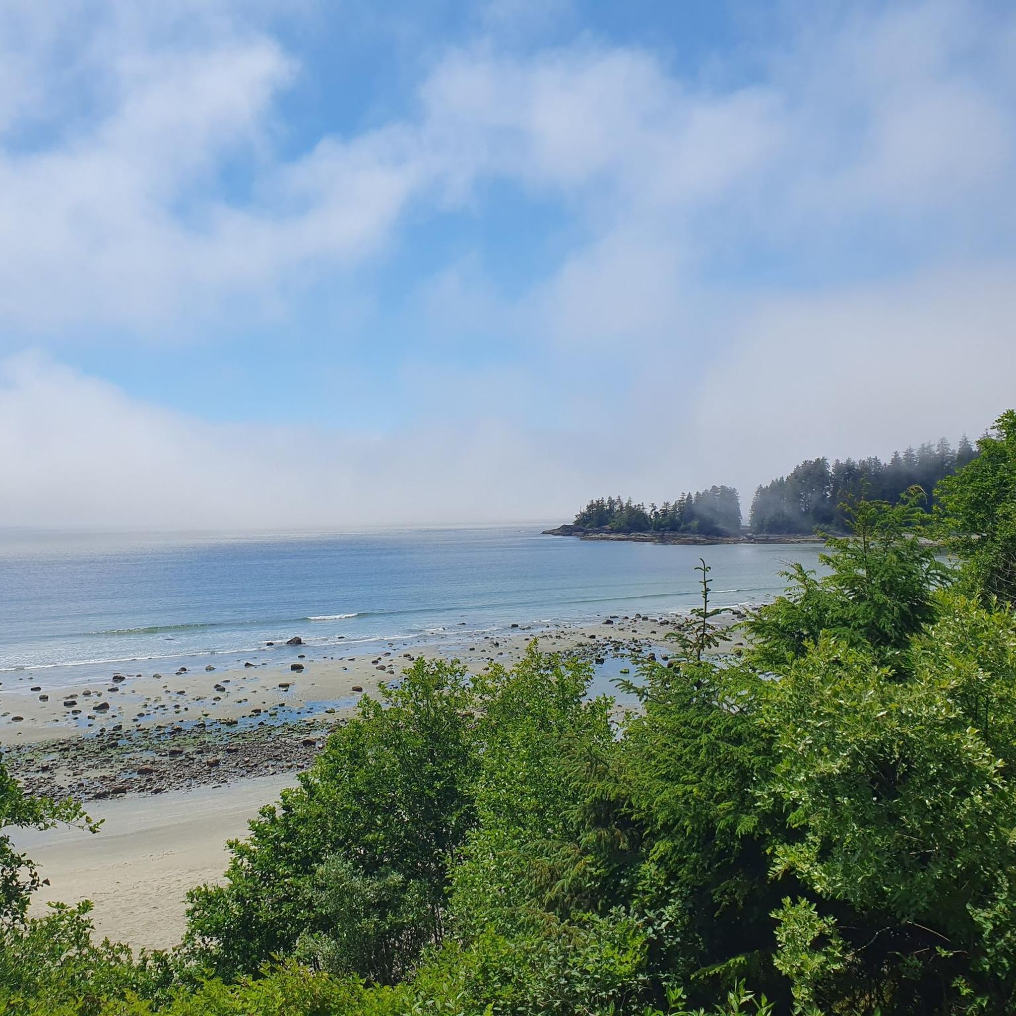
Radar Beach is a quiet, sandy stretch of shoreline backed by dense coastal forest and scattered driftwood logs. A small creek often winds across the sand before meeting the ocean, adding to its tucked-away feel. It’s a peaceful place to sit, watch the waves, or explore the shoreline. While it’s not known for classic rocky tide pools, at very low tide you may spot small patches of intertidal life along parts of the coast.
0
0
Radar Beach Trail is short and fun, but far from easy. Expect muddy sections, exposed roots, and steep scrambling where you’ll use ropes and tree roots to climb. It can be slippery, especially after rain, so sturdy footwear is essential. Navigation can also be a bit confusing in spots, so keep an eye out for trail markers. The effort pays off at the end with a wide, rugged beach and open ocean views that make the challenging approach worthwhile.
0
0

Incinerator Rock is a striking rock formation on Long Beach in Pacific Rim National Park Reserve. The beach is popular with surfers. There is paid parking for cars and small RVs – included in the entrance ticket to Pacific Rim National Park Reserve. During World War II, the Royal Canadian Air Force maintained a waste incinerator next to this rock to burn waste from the Tofino Air Force Base. https://www.knowbc.com/limited/Books/The-Encyclopedia-of-Raincoast-Place-Names/I/Incinerator-Rock We are at the beach early in the morning on May 18, 2025. The temperature is pleasant under blue skies and light clouds. At low tide, we take the opportunity to walk far out on the beach and observe the numerous surfers – a magnificent setting.
1
0
Ancient Monarch is the oldest tree on the Rainforest Trail. The red cedar stands at the northernmost point of Trail A and is approximately 950 years old. https://cortescurrents.ca/learning-about-old-growth-on-the-rainforest-trail/
1
0
Pillar of the Community is the oldest tree on Rainforest Trail B; the red cedar is more than 800 years old.
3
0
RVs and buses are not permitted at the small parking lot on either of the rainforest trails. So, we walk from the Combers Beach parking lot along the ʔapsčiik t̓ašii to the trailhead; the paved pedestrian/bicycle path runs parallel to the highway. Rainforest Trail A is located north of the Pacific Rim Highway, while Trail B is south of the road at the parking lot. Both routes lead approximately 1,200 meters through a breathtaking forest of giant Western Red Cedar and Western Hemlock trees. The trails are constructed almost entirely of wooden boardwalks with numerous stairs and bridges, some of which are made from whole tree trunks. Walking through the forests is a beautiful experience. https://parks.canada.ca/pn-np/bc/pacificrim/activ/randonnee-hiking
2
0
Frequently Asked Questions
How many hiking trails are available in Pacific Rim National Park Reserve - Long Beach Unit?
There are over 15 hiking trails in Pacific Rim National Park Reserve - Long Beach Unit, offering a variety of experiences from easy strolls through ancient forests to more challenging coastal paths. The komoot community has explored these routes over 3000 times.
What is the best time of year to go hiking in Pacific Rim National Park Reserve - Long Beach Unit?
The Long Beach Unit is a year-round destination, but the best time for hiking depends on your preference. Summer offers warmer, drier weather ideal for beach walks and forest trails. However, the temperate rainforest thrives with abundant rainfall, making spring and fall lush and vibrant. Winter brings dramatic storm watching opportunities, though trails can be muddy.
What makes the hiking trails in Pacific Rim National Park Reserve - Long Beach Unit unique?
The trails here are unique due to their diverse landscape, blending expansive sandy beaches, lush temperate rainforests with massive old-growth trees, and rugged coastlines. You can explore ecosystems like the Shorepine Bog, which features stunted, twisted trees and ancient sphagnum moss, or walk along the longest sandy beach on Vancouver Island.
What do other hikers say about the trails in Pacific Rim National Park Reserve - Long Beach Unit?
The trails in Pacific Rim National Park Reserve - Long Beach Unit are highly rated by the komoot community, with an average score of 4.8 stars from over 400 reviews. Hikers often praise the stunning natural beauty, the variety of terrain from beaches to ancient forests, and the well-maintained paths, including boardwalks through sensitive ecosystems.
Are there any easy or family-friendly hiking trails in the Long Beach Unit?
Yes, the Long Beach Unit offers several easy and family-friendly options. The Shorepine Bog Trail is an accessible 0.8 km boardwalk loop through a unique bog ecosystem. The Rainforest Trails (A & B) are also popular 1 km loops that lead through old-growth forests on constructed boardwalks and stairs, perfect for all ages.
Are dogs allowed on the hiking trails in Pacific Rim National Park Reserve - Long Beach Unit?
While dogs are generally welcome in the park on leash, specific trail regulations may apply to protect wildlife and sensitive ecosystems. It's always best to check the official park regulations or signage at trailheads for the most current information regarding dog access on specific hiking trails and beaches.
Are there any loop trails available for hiking?
Yes, there are several loop trails. For instance, the Canso Plane Wreck – Canso Bomber Ruins Trail loop from Radar Hill Rd Parking Lot is an easy 4.8 km loop leading to an intriguing plane wreck. Another option is the Pillar of the Community – Ancient Monarch Cedar loop from Rainforest Reconstruction Zone, a 2.6 km trail through old-growth forests.
What kind of wildlife might I see while hiking?
The Long Beach Unit is rich in wildlife. Along the coast, you might spot eagles, various seabirds, and marine life like whales (especially during migration seasons) and sea lions. In the rainforests, keep an eye out for deer and smaller forest creatures. Remember to maintain a safe distance and never feed wildlife.
What are some notable natural features or landmarks to look out for on the trails?
You can explore several unique features. The Rainforest Trail offers breathtaking old-growth forests. The Canso Plane Wreck is an intriguing historical site deep within the forest. You can also visit the Wickaninnish Beach and Lismer Beach for stunning coastal views and beachcombing.
Is there parking available at the trailheads?
Yes, parking is available at various trailheads throughout the Long Beach Unit. Popular spots like the Rainforest Trail, Shorepine Bog Trail, and Combers Beach have designated parking lots. It's advisable to arrive early during peak season as spaces can fill up quickly.
Are there any trails that offer coastal views?
Absolutely. The Wickaninnish Beach – Lismer Beach loop from Parking Lot E is a moderate 8.8 km path offering extensive scenic coastal views. The South Beach Trail also provides dramatic views of rugged cliffs and crashing waves, leading to a pebble beach known for the sound of rolling stones.
What are the entry fees for Pacific Rim National Park Reserve - Long Beach Unit?
Pacific Rim National Park Reserve requires a valid park pass for entry. These fees contribute to the maintenance of facilities and conservation efforts. You can purchase passes at the park gates or visitor centers. For detailed and up-to-date fee information, please check the official Parks Canada website.
Can I find ancient trees or old-growth forests on the hikes?
Yes, the Long Beach Unit is renowned for its ancient trees and old-growth temperate rainforests. Trails like the Rainforest Trail and the Pillar of the Community – Ancient Monarch Cedar loop specifically lead you through areas with massive Douglas fir, Western Red Cedar, and Sitka spruce trees, some reaching up to 100 meters in height.
Most popular routes in Pacific Rim National Park Reserve - Long Beach Unit
Most popular attractions in Pacific Rim National Park Reserve - Long Beach Unit

Get inspired with the komoot mobile app


Explore more
Browse the best Hikes in other regions.
