The best walks and hikes in Fraser River Ecological Reserve
4.8
(11)
236
hikers
10
hikes
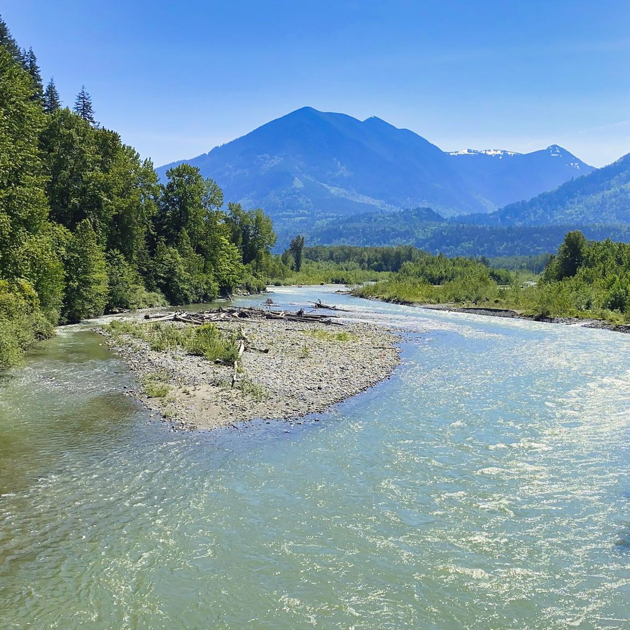
Hiking in Fraser River Ecological Reserve offers routes through unique riverine landscapes and preserved floodplain islands. The terrain features extensive mature cottonwood forests, diverse wetland environments, and sandy shores along the Fraser River. Trails generally present minimal elevation changes, making them accessible for nature observation. The area provides views of the Cheam Mountain Range in the distance.
Best hiking trails in Fraser River Ecological Reserve
- The most popular hiking route is Dyke Road — Fraser Valley, a 6.4 miles (10.2 km) trail that takes 2 hours 35 minutes to complete. This moderate path follows the dyke, offering expansive views of the Fraser River.
- Another top favourite among local hikers is Vedder River loop from Peach Creek Spawning Channels, an easy 4.0 miles (6.5 km) path. This route winds through scenic areas along the Vedder River, suitable for relaxed exploration.
- Local hikers also love the Vedder River loop from Keith Wilson at Carter (WB), a 5.0 miles (8.0 km) trail leading through riverine scenery and forested sections, often completed in about 2 hours 2 minutes.
- Hiking in Fraser River Ecological Reserve is defined by floodplain islands, mature cottonwood forests, and tranquil wetlands. The network offers options for different ability levels, from easy strolls to moderate loops.
- The routes in Fraser River Ecological Reserve are highly rated by the komoot community with an average score of 4.7 stars from over 7 reviews. More than 200 hikers have used komoot to explore Fraser River Ecological Reserve's varied terrain.
Last updated: October 8, 2026
3
hikers
10.2km
02:35
10m
10m
Moderate hike. Good fitness required. Easily-accessible paths. Suitable for all skill levels.
1
hikers
2.10km
00:35
40m
30m
Easy hike. Great for any fitness level. Easily-accessible paths. Suitable for all skill levels.

5.0
(1)
6
hikers
4.25km
01:05
10m
10m
Easy hike. Great for any fitness level. Easily-accessible paths. Suitable for all skill levels.
5.0
(1)
34
hikers
6.48km
01:39
20m
20m
Easy hike. Great for any fitness level. Easily-accessible paths. Suitable for all skill levels.
5.0
(4)
28
hikers
7.99km
02:02
20m
20m
Moderate hike. Good fitness required. Easily-accessible paths. Suitable for all skill levels.
Get access to more routes and recommendations from other explorers.
Already have an account?
Our route recommendations are based on thousands of hikes, rides, and runs completed by other people on komoot.
Start today with a free account
Your next adventure awaits.



Tips from the Community

Meadow Loop Trail descends from the entrance through the forest before reaching a marshy pond around the halfway point. The trail has a few short climbs and descents, with occasional peeks of the Fraser River through the trees and lovely open meadow areas. It’s a roughly 2-kilometre loop on gravel and dirt trails, with a few junctions along the way that cross the loop for a shorter option. Otherwise, you can keep right to continue enjoying the full route to explore this quiet side of the park.
0
0
Hillkeep Regional Park sits on top of Chilliwack Mountain, on the traditional, ancestral and unceded territory of the Coast Salish, S'ólh Téméxw (Stó:lō), Stz’uminus and Hul’qumi’num Treaty Group. The land was generously donated by local residents Pat and Paige Woodward, intended as a nature reserve for the public to enjoy. Two short trails explore the park, with one leading to a viewpoint over the Fraser Valley and the other looping through a meadow. Both are easy to complete together in under an hour, making this a convenient spot for a short walk close to town.
0
0
Reachable via a wide gravel road and a set of wooden stairs, this elevated viewpoint sits at the top of Chilliwack Mountain on a wooden platform overlooking the expansive valley toward the mountains surrounding Cultus Lake. The view is partly obstructed by trees in a couple of places, but still opens up to a fantastic lookout worthy of capturing a few photos while you’re here. It’s a short climb from the parking area and is a great place to take in the vast scenery before heading back down the trail.
0
0

Browne Creek Wetlands is a small, protected marsh and riparian habitat along Browne Creek. The area is key in filtering water and is easy to explore via a network of flat gravel paths and wooden boardwalks. Visitors come here for birdwatching, strolling, running, or biking.
0
0
The Vedder River flows along the southern edge of Chilliwack, beginning at Cultus Lake and running northwest until it joins the Fraser River. The river is famous for salmon fishing during fall salmon runs. Besides fishing, visitors like to swim, tube, kayak, and raft.
0
0
Dyke Road is less of a formal hiking trail and more of a wide dirt road used by walkers and bikers. If you want to walk side by side with a friend, this is the perfect trail. This road traces the top of the flood-control dike, across farms, fields, and sloughs. There is almost no elevation gain and loss, very flat the whole way, and keep your eyes open for all sorts of birds along the wetlands.
0
0
Nicomen Slough is a side channel and wetland area connected to the Fraser River, spanning 14 kilometers. The slough is very important to waterfowl under the Pacific Birds Habitat Joint Venture because it is an important migration area for wintering and breeding of many kinds of birds.
0
0
This short spur trail brings hikers to the sandy shores of the Fraser River. Sandy tree-covered islands dot the river, and the Cheam Mountain Range stands mighty in the backdrop. The River shaped early British Columbia, bringing tens and thousands of prospectors in 1858.
0
0
Frequently Asked Questions
How many hiking trails are available in Fraser River Ecological Reserve?
The Fraser River Ecological Reserve features nearly 10 distinct hiking routes, providing options for various skill levels. Most of these are easy, with a few moderate paths for those seeking a bit more challenge.
What kind of terrain and natural features can I expect to see while hiking?
Hikers will experience unique riverine landscapes, including preserved floodplain islands, extensive mature cottonwood forests, and diverse wetland environments. Trails often lead to sandy shores along the Fraser River, offering expansive views of tree-covered islands and the majestic Cheam Mountain Range in the distance. You'll also find swales that are dry at lower water levels and flood during the annual freshet, supporting unique plant communities.
Are the trails in Fraser River Ecological Reserve suitable for families or beginners?
Yes, many trails in the Fraser River Ecological Reserve are well-suited for families and beginners. The pathways generally have minimal elevation changes, making them accessible for nature observation and relaxed exploration. For example, the Vedder River loop from Peach Creek Spawning Channels is an easy 4.0-mile (6.5 km) path perfect for a leisurely outing.
Can I bring my dog on the hiking trails?
While the reserve is a natural area, it's generally advisable to check local regulations regarding dogs. If allowed, ensure your dog is kept on a leash to protect the sensitive wildlife and natural habitats, especially during bird nesting seasons or salmon spawning.
What kind of wildlife can I expect to see?
The reserve is a haven for wildlife, particularly for birdwatching. You might spot Bald Eagles nesting in mature cottonwoods, Ospreys fishing, and various migratory birds like Black-bellied Plovers and Dunlin on gravel bars. Evidence of mammals such as beavers, deer mice, coyotes, and black-tailed deer can also be found, and sometimes tracks of black bears, bobcats, and red foxes are seen. Pink Salmon spawn along the island shorelines, and their redds are occasionally visible.
Are there any circular routes available for hiking?
Yes, the Fraser River Ecological Reserve offers several circular routes. A popular option is the Vedder River loop from Keith Wilson at Carter (WB), which is a 5.0-mile (8.0 km) trail leading through riverine scenery and forested sections. Another easy loop is the Peach Creek Spawning Channels loop from Browne Creek Wetlands.
What are the typical lengths and durations of hikes in the reserve?
Hikes in the Fraser River Ecological Reserve vary in length and duration. You can find shorter, easy loops like the McFadden Pond – Peach Creek Spawning Channels loop, which is about 2.9 miles (4.7 km) and takes around 1 hour 10 minutes. Longer, moderate routes, such as Dyke Road — Fraser Valley, can be up to 6.4 miles (10.2 km) and take approximately 2 hours 35 minutes.
What do other hikers enjoy most about hiking in Fraser River Ecological Reserve?
The area is highly rated by the komoot community, with an average score of 4.7 stars from over 7 reviews. Hikers often praise the tranquil riverine scenery, the opportunity for birdwatching, and the accessible, easy-to-navigate trails that provide a peaceful escape into nature.
When is the best time of year to visit Fraser River Ecological Reserve for hiking?
The reserve offers unique experiences throughout the year. Spring and fall are excellent for birdwatching, especially during migratory periods. Summer provides lush green landscapes and warmer weather for leisurely strolls. Winter hiking is also possible, offering a different perspective of the river and its ecosystems, though conditions may vary.
Are there any specific points of interest or landmarks to look out for?
While there aren't traditional landmarks, the reserve itself is a natural spectacle. Keep an eye out for the extensive mature cottonwood forests, the dynamic floodplain islands, and the network of swales. The sandy shores of the Fraser River offer stunning views of the Cheam Mountain Range, and the Peach Creek Spawning Channels are a notable area for observing salmon during spawning season.
How can I access the Fraser River Ecological Reserve, and is parking available?
The reserve is generally accessible for public use. Specific parking information would depend on the trailhead you choose, but many popular access points for trails along the Vedder River or near the Peach Creek Spawning Channels typically have designated parking areas. Public transport options may be limited, so driving is often the most convenient way to reach the trailheads.
Most popular routes in Fraser River Ecological Reserve

Get inspired with the komoot mobile app


Explore more
Browse the best Hikes in other regions.
