The best walks and hikes in Robe Canyon Historic Trail Park
4.5
(37)
1,411
hikers
8
hikes
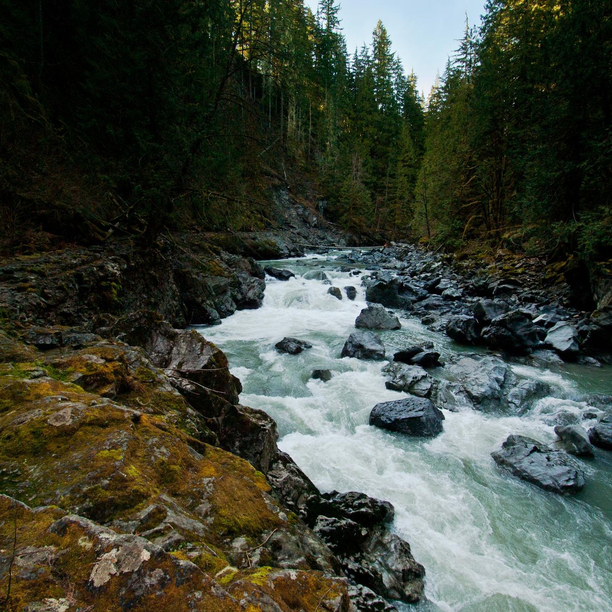
Hiking in Robe Canyon Historic Trail Park offers routes along the Stillaguamish River, which carves through a rocky canyon. The park encompasses nearly 970 acres of wilderness, characterized by dense forests and varied terrain. Trails often follow the historic Monte Cristo Railroad grade, providing a blend of natural beauty and historical significance. The landscape includes lush Pacific Northwest scenery, with rocky sections and marshes during wet seasons.
Best hiking trails in Robe Canyon Historic Trail Park
- The most popular hiking route is Robe Canyon Historic Trail, a 3.7 miles (6.0 km) trail that takes 1 hour 54 minutes to complete. This route follows a portion of the historic Monte Cristo Railroad grade along the Stillaguamish River.
- Another top favourite among local hikers is Lime Kiln Trail — Robe Canyon Historic Park, a moderate 6.6 miles (10.6 km) path. This trail leads through dense forests and offers views of the river.
- Local hikers also love the Mount Pilchuck Trail — Mount Pilchuck State Park, a 5.3 miles (8.5 km) trail leading through varied forest terrain, often completed in about 3 hours 14 minutes.
- Hiking in Robe Canyon Historic Trail Park is defined by the Stillaguamish River, historic railway grade, and dense forests. The network offers options primarily for moderate ability levels.
- The routes in Robe Canyon Historic Trail Park are highly rated by the komoot community with an average score of 4.5 stars from over 30 reviews. More than 1000 hikers have used komoot to explore Robe Canyon Historic Trail Park's varied terrain.
Last updated: October 10, 2026
2
hikers
5.96km
01:54
130m
130m
Embark on a moderate hike along the Robe Canyon Historic Trail, a 3.7-mile (6.0 km) route that takes you through a lush, moss-draped forest. You'll gain 442 feet (135 metres) in elevation over approximately 1 hour and 53 minutes, immersing yourself in a unique natural setting. The path largely follows the South Fork Stillaguamish River, offering serene views and glimpses of frothy rapids from various platforms. Look for the distinctive Robe Canyon Rock Formation, where the river carves through rocky crevices. You will experience a tranquil atmosphere as you explore this historic canyon.
When planning your visit, be aware that the trail is generally accessible, but conditions can be very muddy, especially during fall, winter, and spring. You might encounter fallen trees and boulders that require careful navigation. While the official trail ends around 1.1 to 1.2 miles in due to unsafe sections of the old railroad grade, the accessible portions still offer plenty to explore. Prepare for these conditions to ensure a pleasant outing.
The Robe Canyon Historic Trail offers a unique blend of natural beauty and historical intrigue. It largely follows the South Fork Stillaguamish River, allowing you to witness the river's power as it thunders through rocky crevices. You will also discover cliff walls interspersed with waterfalls, adding to the rugged canyon scenery. This route provides a glimpse into the region's past while surrounded by a vibrant ecosystem.
4.3
(3)
80
hikers
10.6km
02:53
160m
160m
Embark on a moderate hike along the Lime Kiln Trail, a 6.6-mile (10.6 km) route that takes you deep into a lush, moss-covered canyon. You will follow an old railway bed, winding through dense forests filled with ferns and moss-covered trees, with the South Fork Stillaguamish River flowing nearby. This journey involves a manageable 517 feet (158 metres) of elevation gain and typically takes around 2 hours and 53 minutes to complete. The highlight of your adventure will be discovering the historic lime kiln, a striking 20-foot tall stone structure from the 1800s, now beautifully integrated into the natural landscape.
Accessing the Lime Kiln Trail is straightforward, with convenient parking available directly at the trailhead. Be prepared for varying trail conditions; sections can become muddy, particularly after rainfall. The canyon's narrow environment often leads to cooler temperatures, so dressing in layers is a smart choice for your comfort. Plan your visit to allow ample time to explore the historical features and enjoy the serene forest setting.
This trail offers a unique blend of natural beauty and historical intrigue within Robe Canyon Historic Park. The path itself follows an old railway, hinting at the area's industrial past. The lime kiln stands as a testament to 19th-century industry, providing a fascinating glimpse into the region's heritage. It is a notable destination for those interested in both Pacific Northwest history and a refreshing outdoor experience.

622m
00:10
0m
20m
Discover the Granite Falls Fish Ladder Trail, an easy 0.4-mile (0.6 km) hike that offers a unique perspective on the powerful South Fork Stillaguamish River. You will gain only 4 feet (1 metres) in elevation, making it a quick 10-minute outing. The route features graded gravel paths and wooden steps, leading you onto a grated walkway that extends directly over the historic fish ladder. From this observation deck, you can witness the impressive 40-foot Granite Falls waterfall up close, surrounded by striking granite formations and moss-covered trees.
Planning your visit is straightforward, as parking is generally available, making this a convenient stop along the scenic Mountain Loop Highway. While the trail is considered kid-friendly, be aware that strollers are not recommended due to the presence of stairs and uneven surfaces. The route is also not ADA-accessible, so plan accordingly. This short trail is perfect for a quick break to stretch your legs and enjoy the natural surroundings.
This trail stands out for its blend of natural beauty and engineering, providing an intimate look at the fish ladder designed to help salmon navigate the falls. It offers a rare opportunity to observe the river's power and the surrounding geology from a unique vantage point. The combination of the waterfall, the river, and the innovative fish ladder makes this a notable attraction in the Granite Falls area, offering a glimpse into both the natural and human efforts to preserve the local ecosystem.
4.5
(8)
216
hikers
8.55km
03:15
600m
600m
Embark on the Mount Pilchuck Trail, a moderate hike spanning 5.3 miles (8.5 km) with a significant elevation gain of 1985 feet (605 metres). You will navigate through dense old-growth forests before emerging onto more exposed terrain with steep switchbacks. The route culminates in a rewarding ascent to the historic fire lookout, offering expansive views that make the estimated 3 hours and 14 minutes of effort worthwhile. Expect varied landscapes and a true sense of accomplishment as you climb.
Before you head out, be aware that the road leading to the trailhead can be rough and potholed, so drive carefully. You will need a Northwest Forest Pass or Discover Pass for parking at the trailhead. If you plan to visit in winter, conditions become much more challenging, often requiring snowshoes and traction devices, as the road may be gated and the path obscured by snow. Always check current conditions before your trip.
This trail is particularly notable for its historic Mount Pilchuck Lookout, which provides a unique destination and panoramic vistas. From the summit, you can take in sweeping views of the surrounding peaks, including Mount Baker, Mount Rainier, and the Olympic Mountains. The journey offers a blend of forest immersion and alpine exposure, making it a distinctive experience in the region.
3
hikers
9.29km
02:25
60m
60m
Embark on a moderate hike along the Pilchuck River Trail, a 5.8 miles (9.3 km) route that takes about 2 hours and 24 minutes to complete. You will experience a gentle elevation gain of 189 feet (57 metres) as you follow the river's course. The path winds through a diverse landscape, moving from shaded forests to open farm fields and even some suburban stretches. Keep an eye out for the distinct gravel bars and glacial terraces that line the river, offering unique geological features along the way. It's a generally easy hiking experience, perfect for a half-day outing.
For your visit, you can easily access the trail and find convenient amenities at nearby Pilchuck Park. This park provides parking facilities and restrooms, making it a good starting point for your adventure. You can also enjoy river access from a gravel beach within the park. The Pilchuck River Trail is a multi-use path, so be ready to share it with others who might be mountain biking or trail running. Consider an early start to enjoy the tranquility before it gets too busy.
The trail offers a unique perspective on the Pilchuck River, showcasing its journey through varied environments. You will observe how the river shapes the landscape, from its forested banks to the more open agricultural areas. This route is a great way to connect with nature close to urban settings, providing a refreshing escape without venturing too far. It highlights the natural beauty and recreational opportunities available in the local area.
Get access to more routes and recommendations from other explorers.
Already have an account?
Our route recommendations are based on thousands of hikes, rides, and runs completed by other people on komoot.
Start today with a free account
Your next adventure awaits.
Popular around Robe Canyon Historic Trail Park
Tips from the Community

Born in the Cascades, it flows west to Granite Falls, then south through Lochsloy and Machias to meet the Snohomish River near Snohomish. Its name means "red water," in the Chinook language.
0
0

Frequently Asked Questions
How many hiking trails are there in Robe Canyon Historic Trail Park?
Robe Canyon Historic Trail Park offers over 5 distinct hiking routes. These trails primarily cater to moderate ability levels, providing a good balance of challenge and accessibility for most hikers.
What is the general difficulty level of hiking trails in Robe Canyon Historic Trail Park?
The hiking trails in Robe Canyon Historic Trail Park are generally considered moderate. While they offer a rewarding experience, hikers should be prepared for varied terrain, including rocky sections that can be slick when wet, and potential mud, especially during the wetter seasons.
What natural features can I expect to see while hiking in Robe Canyon Historic Trail Park?
Hikers can expect to encounter the thundering Stillaguamish River as it carves through a rocky canyon, dense forests with moss-laden trees, and during the wet season, graceful waterfalls cascading into the river. The landscape also features wide river bottoms with cottonwoods and maples.
Are there any historical landmarks along the trails?
Yes, the trails follow a portion of the historic Monte Cristo Railroad grade, which was built in 1892. Remnants of this railway's past can still be observed, offering a unique glimpse into the area's history. While the historic railway tunnels are a notable feature, access beyond 1.1 miles is currently closed due to a rockslide.
What is the best time of year to hike in Robe Canyon Historic Trail Park?
While Robe Canyon Historic Trail Park can be visited year-round, the wet season (fall, winter, and spring) brings lush conditions, including potential waterfalls and marshes. However, trails can be muddy and slick during these times. Summer offers drier conditions, though the park retains a remote feel throughout the year.
Is Robe Canyon Historic Trail Park suitable for families?
The trails are generally considered moderately challenging. While the initial descent into the canyon involves switchbacks, the trail becomes fairly flat. Families with older children who are comfortable with varied terrain and potential mud may enjoy the historical and natural beauty. Always assess your family's hiking experience before setting out.
Are dogs allowed on the hiking trails?
Yes, Robe Canyon Historic Trail Park is generally dog-friendly. However, it's always recommended to keep dogs on a leash and ensure you pack out any waste to preserve the natural environment for all visitors.
What do other hikers enjoy most about Robe Canyon Historic Trail Park?
The area is highly rated by the komoot community, with an average score of 4.5 stars from over 30 reviews. Reviewers often praise the unique blend of natural beauty, the historical significance of the old railway grade, and the dramatic views of the Stillaguamish River and canyon.
Is there parking available at Robe Canyon Historic Trail Park?
Yes, parking is available at the trailhead. For more detailed information regarding facilities and any potential fees, you can visit the official Snohomish County Parks website: snohomishcountywa.gov.
Are there any circular hiking routes in the park?
The primary trails in Robe Canyon Historic Trail Park, such as the Robe Canyon Historic Trail, are typically out-and-back routes. While there are no prominent circular routes within the immediate park area, the varied terrain ensures a different perspective on the return journey.
What is the length of the main Robe Canyon Historic Trail?
The main Robe Canyon Historic Trail is approximately 3.7 miles (6.0 km) long, typically taking around 1 hour and 54 minutes to complete as an out-and-back journey.
Are there any longer or more challenging hikes nearby?
For those seeking a longer hike, the Lime Kiln Trail — Robe Canyon Historic Park offers a moderate 6.6-mile (10.6 km) path through dense forests with river views. Another option, though outside the immediate park, is the Mount Pilchuck Trail — Mount Pilchuck State Park, which is 5.3 miles (8.5 km) and features more significant elevation gain.
Most popular routes in Robe Canyon Historic Trail Park

Get inspired with the komoot mobile app


Explore more
Browse the best Hikes in other regions.
