The best road cycling routes in Bowen Island Ecological Reserve
4.8
(3)
306
riders
4
rides
Road cycling in Bowen Island Ecological Reserve offers a challenging experience due to its hilly terrain and constant elevation changes. The island's roads follow the natural topography, featuring numerous short, steep climbs. While the Ecological Reserve itself is primarily for preservation, the broader Bowen Island provides a scenic environment for road cyclists, with routes winding through forests and along the shoreline. The landscape is characterized by diverse forest ecosystems and rocky outcrops, contributing to demanding but rewarding rides.
Best road cycling routes in Bowen Island Ecological Reserve
- The most popular road cycling route is Bowen Cider House loop from Cates Hill, a 12.8 miles (20.6 km) trail that takes 1 hour 17 minutes to complete. This moderate route features significant elevation gain through the island's interior.
- Another top favourite among local road cyclists is Killarney Lake – Cape Roger Curtis loop from Bowen Island RCMP, a moderate 17.5 miles (28.2 km) path. This route offers varied terrain, including sections near Killarney Lake and along the coast.
- Local road cyclists also love the Bowen Cider House loop from Bowen Island RCMP, a 9.9 miles (15.9 km) trail leading through the island's rolling hills, often completed in about 56 minutes.
- Road cycling in Bowen Island Ecological Reserve is defined by hilly terrain, forested roads, and coastal views. The network offers options for different ability levels, though many routes are considered moderate due to elevation changes.
- The routes in Bowen Island Ecological Reserve are highly rated by the komoot community with an average score of 5.0 stars from more than 3 reviews. More than 300 road cyclists have used komoot to explore Bowen Island Ecological Reserve's varied terrain.
Last updated: August 2, 2026
8
riders
21.1km
01:23
540m
540m
Moderate road ride. Good fitness required. Some segments of this route may be unpaved and difficult to ride.
8
riders
15.9km
00:56
350m
350m
Moderate road ride. Good fitness required. Some segments of this route may be unpaved and difficult to ride.

Sign up for free
5.0
(1)
21
riders
Moderate road ride. Good fitness required. Some segments of this route may be unpaved and difficult to ride.
4.5
(2)
269
riders
75.3km
03:29
770m
770m
Moderate road ride. Good fitness required. Some segments of this route may be unpaved and difficult to ride.
Our route recommendations are based on thousands of hikes, rides, and runs completed by other people on komoot.
Start today with a free account
Your next adventure awaits.
Login or Signup
Popular around Bowen Island Ecological Reserve
Tips from the Community

Ambleside Park is a stunning waterfront public space on the shores of Howe Sound across the water from downtown Vancouver. This path is open for walking, jogging, or biking along the park's wide seaside boardwalk, which connects to the Centennial Seawalk. Looking south, freighters and sailboats dot the waters under the Vancouver skyline. The beach is a mix of sand and pebbles, popular for sunbathing, beachcombing, and swimming. Even dogs can enjoy the park in the designated off-leash zone. The park also has golfing, baseball, and pickleball fields, plenty of activities for everyone.
1
0
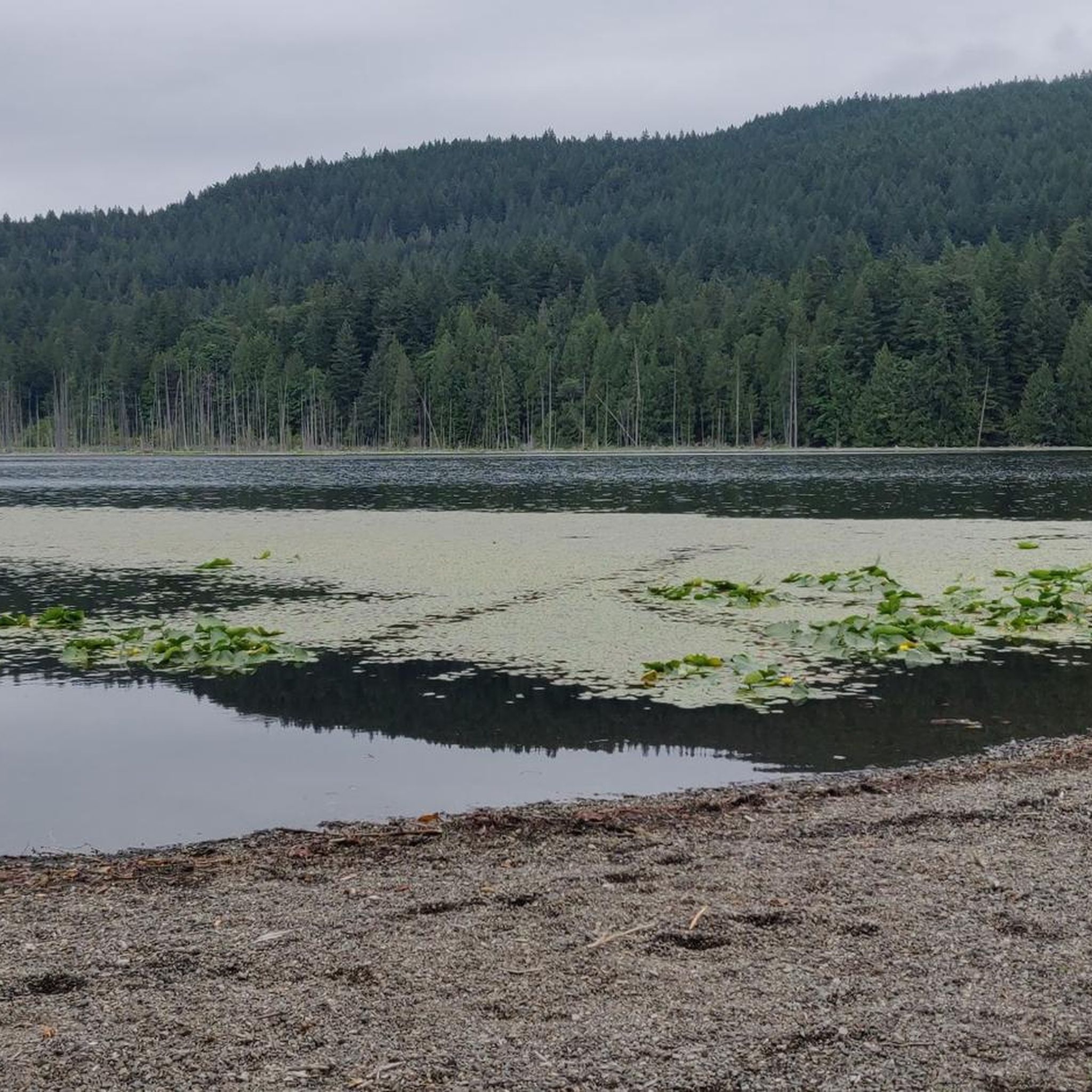
Killarney Lake View Point has a boulderous beach and great views from he south end of the lake to the north end. Swimming is allowed here but not recommended as there have been reporting of leeches in the water.
1
0

The Lions Gate Bridge crosses the First Narrows. Whether walking or cycling, the view is magnificent. To the west, the view extends across Burrard Inlet and the Strait of Georgia to the Gulf Islands, which lie off the coast of Vancouver Island. To the east, the high-rise buildings of the Vancouver skyline can be seen above the dense forest of Stanley Park and the striking roof structure of Canada Place. On occasion, you can watch large passenger and container ships leaving Vancouver Harbour.
1
0

Watch out for pedestrians. There is a scenic lane and a fast lane.
0
0

Beautiful views of Vancouver Harbour, Stanley Park, and the North Shore mountains! The cycle path is narrow and shared with pedestrians, so use caution. If you are not in a rush, I recommend looping through Stanley Park for the approach and exit rather than the Stanley Park causeway. Going southbound has a more challenging climb that passes over a sewage treatment plant.
0
0

Locarno Beach is one of the beaches that line English Bay in Vancouver. It is situated in the West Point Grey neighborhood, between Jericho Beach and the Spanish Banks beaches.
0
0
Landmark suspension bridge offering sweeping city views & a pedestrian walkway.
0
0

The lake has a healthy population of leeches. Swimming or wading is not advised.
0
0
Frequently Asked Questions
Can I road cycle within the Bowen Island Ecological Reserve?
No, the Bowen Island Ecological Reserve is primarily established for preserving dry subzone forest ecosystems and is not intended for general outdoor recreation like cycling. Road cycling routes are available on the broader Bowen Island, which offers challenging and scenic rides through its natural landscapes.
What is the general difficulty level for road cycling on Bowen Island?
Road cycling on Bowen Island is known for its challenging terrain, featuring numerous short, steep climbs with gradients that can reach up to 28%. Even seasoned riders find the continuous ascents demanding, making it an 'Intervall Island' experience. All routes listed, such as the Bowen Cider House loop from Cates Hill, are considered moderate due to significant elevation changes.
Are there any family-friendly road cycling routes on Bowen Island?
Due to the island's hilly terrain and narrow country roads without paved shoulders, many routes are considered moderate and require good fitness. While there are no specific 'easy' routes listed, families with older, experienced cyclists might find sections manageable. Cyclists should be aware of traffic and ride single file on the right side of the road.
What kind of natural features and landscapes can I expect to see while cycling on Bowen Island?
Bowen Island offers diverse natural features, including Douglas-fir forests, rocky outcrops, and scenic views along the shoreline. Routes like the Killarney Lake – Cape Roger Curtis loop from Bowen Island RCMP provide varied terrain, winding through forests and along coastal sections, offering a strong connection to nature.
How can I get to Bowen Island with my bike?
Bowen Island is accessible by ferry. Cyclists can take their bikes on the ferry from Horseshoe Bay. It's advisable to check the current ferry timetable for schedules and any specific requirements for cyclists. For more information on getting to the island, you can visit Tourism Bowen Island.
Are there options for e-bike rentals on Bowen Island?
Yes, e-bikes are suggested as a way to manage the demanding hills on Bowen Island. While specific rental locations are not detailed here, e-bikes can make the challenging terrain more accessible for many riders.
What is the best time of year for road cycling on Bowen Island?
The region generally offers pleasant conditions for cycling during the warmer months. However, the island's weather can be variable. It's always recommended to check local weather forecasts before heading out, especially considering the exposed nature of some coastal sections and forested roads.
Where can I find parking for cyclists in Snug Cove?
Snug Cove is the main hub on Bowen Island and the ferry terminal. While specific cyclist parking facilities are not detailed, parking is generally available in the area. It's advisable to arrive early, especially during peak season, to secure a spot.
Are there any cafes or pubs near the cycling routes on Bowen Island?
Snug Cove, the island's main village, offers various amenities including cafes, pubs, and accommodation options. Many cycling routes start or pass through areas accessible from Snug Cove, providing opportunities for refreshments before or after your ride.
What do other road cyclists enjoy most about road cycling on Bowen Island?
The area is highly rated by the komoot community, with an average score of 5.0 stars. Reviewers often praise the challenging yet rewarding nature of the rides, the scenic views, and the sense of accomplishment from tackling the island's continuous ascents. Routes like the Bowen Cider House loop from Bowen Island RCMP are popular for their rolling hills and picturesque surroundings.
Are there any permits required for road cycling on Bowen Island?
No specific permits are required for road cycling on the public roads of Bowen Island. However, cyclists should always respect private property and adhere to local traffic laws and regulations.
How many road cycling routes are available on Bowen Island?
There are several road cycling routes available on Bowen Island, with komoot featuring 5 distinct routes. These routes offer varied distances and elevation gains, catering to cyclists looking for a challenging experience.
What is the longest road cycling route available on Bowen Island?
The longest route featured is the View of English Bay – Stanley Park Drive loop from Horseshoe Bay, which covers approximately 75.2 kilometers (46.7 miles) and includes significant elevation gain, offering a substantial ride for experienced cyclists.
Most popular routes in Bowen Island Ecological Reserve

Get inspired with the komoot mobile app


Explore more
Browse the best Road cycling routes in other regions.
