The best walks and hikes in Codd Wetland Ecological Conservancy Area
4.6
(25)
346
hikers
26
hikes
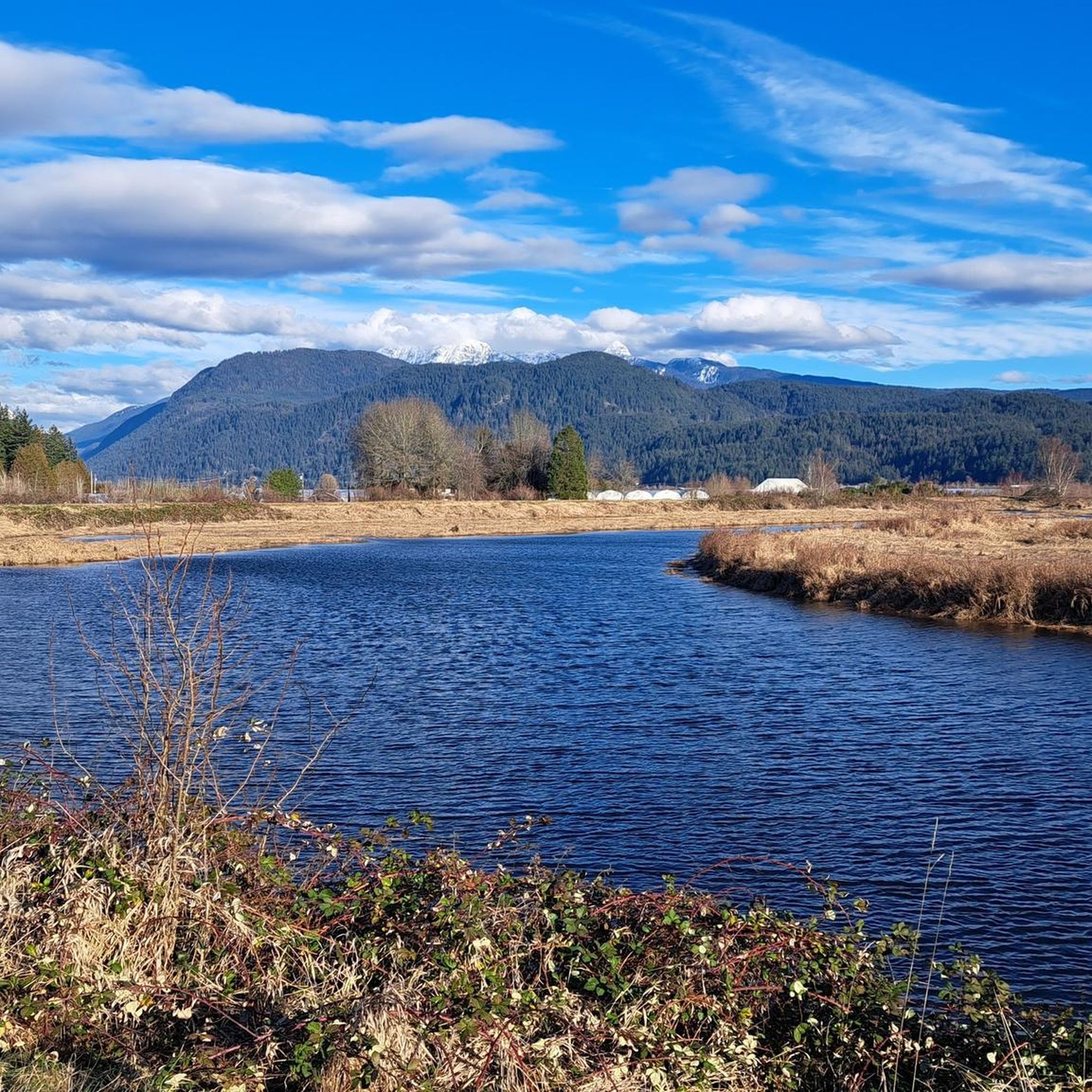
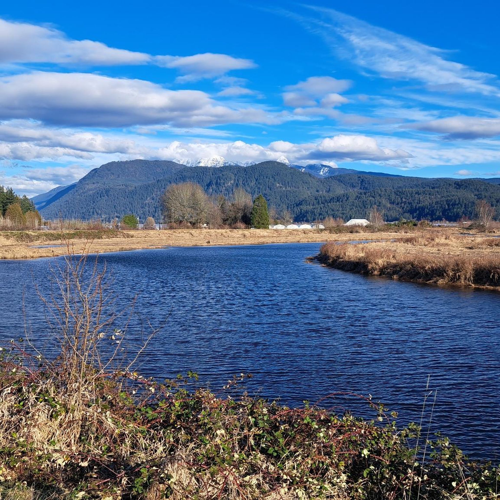
Hiking in Codd Wetland Ecological Conservancy Area features a landscape primarily characterized by extensive wetlands, floodplains, and tributary streams, including the Blaney Creek floodplain. The area encompasses coniferous and deciduous forests, with topography ranging from flat floodplain sections to gentle highlands. While primarily managed for ecological conservation, the region offers routes that explore its diverse natural features.
Best hiking trails in Codd Wetland Ecological Conservancy Area
- The most popular hiking route is Goose Lake Trail, a 2.0 miles (3.3…
Last updated: November 4, 2026
12
hikers
3.28km
01:23
180m
180m
Moderate hike. Mostly walkable paths. Sure-footedness required.
11
hikers
4.78km
01:12
0m
0m
Easy hike. Easily walkable paths.

5
hikers
2.49km
00:43
70m
70m
Easy hike. Easily walkable paths.
3
hikers
3.41km
01:00
100m
100m
Easy hike. Easily walkable paths.
1
hikers
3.10km
00:55
100m
100m
Easy hike. Easily walkable paths.
Get access to more routes and recommendations from other explorers.
Already have an account?
Our route recommendations are based on thousands of hikes, rides, and runs completed by other people on komoot.
Start today with a free account
Your next adventure awaits.
Popular around Codd Wetland Ecological Conservancy Area

Tips from the Community

Pitt-Addington Marsh Wildlife Management Area protects a vast stretch of marsh and wetland near the south end of Pitt Lake and is managed by the province for wildlife and public use. Raised dikes loop through the marshes, with wooden lookouts along the way and beautiful views across Pitt Lake and the surrounding mountains. During migration, more than 1,000 waterfowl can gather here, including trumpeter swans, wood ducks and Canada geese, so be sure to bring a pair of binoculars with you.
0
0
Homilk’um Marsh gets its name from the Katzie word for Canada goose, a fitting name for a marsh that draws so many of them. The Homilk’um Dike runs right across it, opening up to expansive views over the reeds and open water. In the evening, you might be lucky enough to see beavers swimming along the dike edges.
0
0
Mountain Dike runs along the edge of the marsh, linking up with the Homilk’um Dike to form a longer loop across the wetland. Tall grass covers some sections, and the open wetland is home to ospreys, great blue herons, eagles and deer, with the occasional bear as well. Dogs are welcome on a leash, and with Pitt Lake and the mountains all around, it’s a fantastic place for a peaceful walk that feels a world away from the city.
0
0


Tent Trail is a peaceful singletrack through beautiful forest, with a few streamside sections that can turn muddy after rain. Mountain bikers use this trail often, so stay alert on bends and enjoy the quieter moments between the trees.
1
0

Shull Trailhead is the end of the residential 236th Street and the start of Shull Trail. There are no restrooms here or trash cans, just some roadside parking and the start of the dirt trail into the woods. Come prepared with your full bottle of water, and in the spring and early summer, there are lots of wild flowers, even right at the trailhead, you can see pops of colour.
0
0

Shoesmith Trail is part of Maple Ridge’s Silver Valley network, following a broad gravel trail through the forest with very little technical terrain. The east and west sections are each about a kilometre long and are shared by hikers, mountain bikers and equestrians, so keep an ear out for other users. It’s a useful connector through the network, especially if you’re linking into nearby trails towards Golden Ears Provincial Park.
0
0
Tent Trail is a peaceful singletrack through beautiful forest, with a few streamside sections that can turn muddy after rain. Mountain bikers use this trail often, so stay alert on bends and enjoy the quieter moments between the trees.
0
0
Frequently Asked Questions
Is the Codd Wetland Ecological Conservancy Area open to the public for hiking?
No, the Codd Wetland Ecological Conservancy Area is primarily managed for ecological conservation and is not currently open to the public for recreational activities like hiking. Its main purpose is to protect critical wetland habitats and wildlife.
Why does komoot show hiking routes if the Codd Wetland Ecological Conservancy Area is closed to the public?
While the core conservancy area is closed, komoot's guide for 'Hiking in Codd Wetland Ecological Conservancy Area' refers to the broader Pitt Polder region of Pitt Meadows. This includes routes that may be adjacent to the conservancy boundaries or in nearby areas that share similar natural characteristics, offering a glimpse into the region's diverse landscape.
Are there any accessible trails or viewpoints near the Codd Wetland Ecological Conservancy Area?
The Codd Wetland Ecological Conservancy Area itself does not currently offer public trails or viewpoints due to its conservation status. However, the broader Pitt Polder region may have other accessible paths. Future plans for the conservancy include potential trail and viewpoint development, but ecological protection remains the primary focus.
What kind of terrain can I expect on routes in the Codd Wetland region?
Routes in the Codd Wetland region typically feature extensive wetlands, floodplains, and tributary streams, including the Blaney Creek floodplain. You'll find sections of coniferous and deciduous forests, with topography ranging from flat floodplain areas to gentle highlands. Expect varied surfaces, often characteristic of wetland environments.
What wildlife can be found in the Codd Wetland Ecological Conservancy Area?
The Codd Wetland is a vital ecosystem, home to over 200 species of wildlife, including birds, mammals, and amphibians. It's a key stopover on the Pacific Flyway, with more than 160 bird species observed. The wetlands and Blaney Creek are crucial for fisheries, supporting chum and Coho salmon and steelhead trout. Red-listed mammal species like the snowshoe hare and Pacific water shrew also inhabit the area.
Are there any circular hiking routes available in the Codd Wetland region?
Yes, the broader Codd Wetland region offers several circular routes. For example, the Neaves East 1 Pond loop from Yennadon is a moderate 6.2-mile (10.0 km) path, and the Rock Lookout Point loop from 133 Ave (EB) at 236 St is a 4.6-mile (7.3 km) trail that leads through forested areas.
What is the best time of year to explore the Codd Wetland region?
Given the region's wetland characteristics and importance as a bird stopover, spring and fall can be particularly rewarding for observing migratory birds. However, conditions can vary seasonally. Always check local weather and trail conditions before heading out, especially during wetter months.
Are there any family-friendly hiking options in the Codd Wetland region?
While the conservancy itself is closed, some routes in the surrounding area are suitable for families. The Goose Lake Trail, for instance, is a moderate 2.0-mile (3.3 km) trail that offers a manageable distance for many families, though it does feature some elevation gain.
Can I bring my dog on trails in the Codd Wetland region?
The Codd Wetland Ecological Conservancy Area is a sensitive ecological site and is not open to the public, including pets. For routes in the surrounding Pitt Polder region, it's essential to check specific trail regulations regarding dogs, as rules can vary to protect wildlife and natural habitats.
What do other hikers enjoy most about the Codd Wetland region?
The Codd Wetland region is highly rated by the komoot community, with an average score of 4.7 stars from over 20 reviews. Hikers often praise the quiet natural settings, the diverse wetland environment, and the opportunity to experience a unique ecological landscape, even if it's from adjacent areas.
Are there any easy hiking trails in the Codd Wetland region?
Yes, among the 17 routes in the broader Codd Wetland region, there are 3 classified as easy. These trails typically feature minimal elevation changes and are suitable for a more relaxed outdoor experience, allowing you to enjoy the natural surroundings without significant physical challenge.
What are the typical trail conditions like in the Codd Wetland region?
Due to the prevalence of wetlands and floodplains, trails in the Codd Wetland region can often be damp or muddy, especially after rain or during wetter seasons. Some routes may involve walking on unpaved paths through forested areas. Always wear appropriate footwear and be prepared for varying ground conditions.
Are there any specific landmarks or natural features to look out for on hikes in the Codd Wetland region?
The region is characterized by its extensive wetlands, the Blaney Creek floodplain, and a mix of coniferous and deciduous forests. While the conservancy itself is not publicly accessible, routes in the surrounding area may offer views of these natural features. The Rock Lookout Point loop, for example, provides views from a hill, showcasing the local topography.
Most popular routes in Codd Wetland Ecological Conservancy Area

Get inspired with the komoot mobile app


Explore more
Browse the best Hikes in other regions.
