The best walks and hikes in Telemark Cross-Country Ski Trails Recreation Site
4.8
(41)
463
hikers
13
hikes
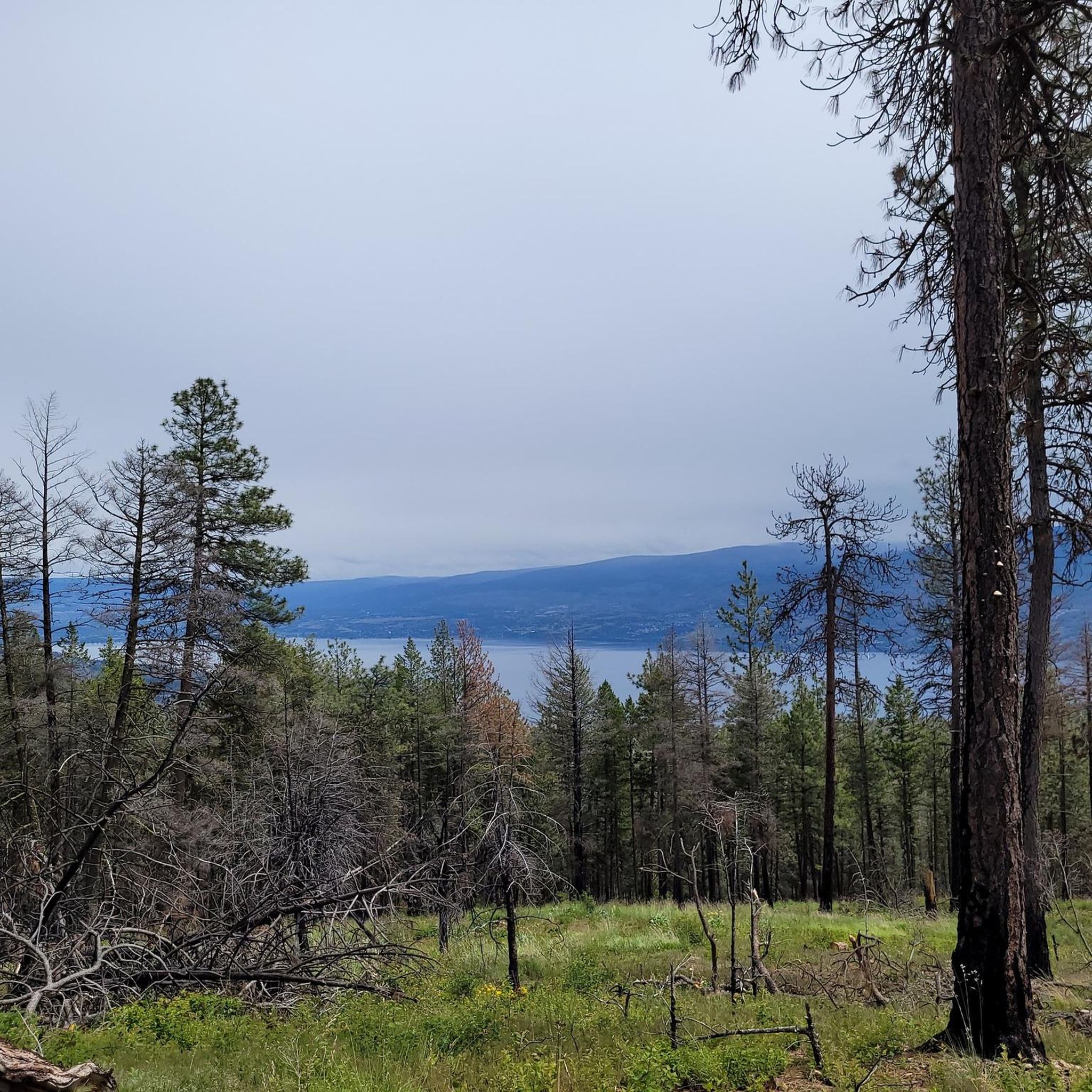
Hiking in Telemark Cross-Country Ski Trails Recreation Site offers access to a network of trails within a natural park in British Columbia. The area features varied topography, including gradual climbs and elevation changes, providing diverse hiking experiences. Trails often lead through forested areas and offer views of Okanagan Lake. The region is known for its extensive trail systems, catering to various outdoor activities.
Best hiking trails in Telemark Cross-Country Ski Trails Recreation Site
- The most popular hiking route is Lake…
Last updated: November 8, 2026
5.0
(1)
9
hikers
6.32km
01:43
90m
90m
Easy hike. Easily walkable paths.
7
hikers
3.94km
01:05
70m
70m
Easy hike. Easily walkable paths.

4.7
(11)
108
hikers
Easy hike. Easily walkable paths.
5.0
(1)
2
hikers
4.78km
01:30
180m
180m
Easy hike. Easily walkable paths.
5.0
(2)
21
hikers
5.14km
01:43
260m
260m
Easy hike. Easily walkable paths.
Get access to more routes and recommendations from other explorers.
Already have an account?
Our route recommendations are based on thousands of hikes, rides, and runs completed by other people on komoot.
Start today with a free account
Your next adventure awaits.
Popular around Telemark Cross-Country Ski Trails Recreation Site
Tips from the Community

Crazy Train is a narrow singletrack that starts at Carr Road and ends at Blue Jay Drive. It’s mainly a one-way downhill mountain bike trail, but this short section is ideal for connecting with the Flume Trail, and it is a natural dirt surface winding between the trees and along the hillside. The trail gets steeper and more bike-focused further along, so keep an eye out for riders as you make your way up.
0
0
Powers Creek runs through a forested canyon in West Kelowna, and has long been important to the area for local irrigation. Today, it provides a shaded, peaceful backdrop to the surrounding trail network. Here, the path comes out at the creek itself, with a natural spot beside the water that makes a nice place for a break before turning back or continuing onto the wider trail network into the canyon.
0
0
Flume Trail follows the route of an old irrigation flume along Powers Creek, winding through shaded forest on a mostly flat, easy path. You can still see remnants of the historic water system, which gives the walk a little more character than a typical forest trail. The trail is shared with mountain bikers, so it’s a good idea to stay alert and watch for riders as you explore.
0
0

You can park along Harrington Crescent to access the trail system north of Peachtree. There are a bunch of spur trails right when you start, so you'll want to download a GPS map to be certain of the main path - there are some that detour onto private land. Once you get further up into the Gladstone trail system the route becomes easier to follow.
0
0
Peachland was once a mining town, and the east side of the loop has a number of old mineshafts (now overgrown pits) from the 1890s. In its heyday, Gladstone Mine once exported gold, silver, copper, and other heavy metals.
0
0
The trail is well-maintained and there is a bench at the lookout to Okanagan Lake. It can be a bit rocky in places, but overall this trail is very new as it was constructed recently by the Peachland Outdoors Club.
0
0

The Trepanier Creek Trail follows a mostly flat, well-defined corridor along the creek. The terrain is mostly packed dirt and gravel, making it an accessible hike. Along the route, you’ll pass remnants of early hydro infrastructure, including segments of an old wooden stave pipeline that once operated here.
0
0
This is the entrance and parking area for Trepanier Regional Park, with ample parking, washrooms, and access to the Trepanier Creek Trail. The park is open during daylight hours, so its times change seasonally.
0
0
Frequently Asked Questions
How many hiking trails are available in Telemark Cross-Country Ski Trails Recreation Site?
Telemark Cross-Country Ski Trails Recreation Site offers several hiking trails, with a total of 7 routes documented on komoot. These trails cater to various skill levels, including 4 easy and 3 moderate options.
What kind of terrain can I expect on the hiking trails?
The trails in Telemark Cross-Country Ski Trails Recreation Site feature varied topography, including gradual climbs and significant elevation changes. You'll hike through forested areas, experiencing the beautiful Northwoods terrain, with many routes offering scenic views of Okanagan Lake.
Are there any easy hiking trails suitable for beginners or casual walkers?
Yes, there are several easy trails. For a pleasant walk with views, consider the Lake Okanagan viewpoint – Pincushion Mountain Summit loop from Pincushion Mountain, which is 2.2 miles long. Another easy option is the View of Okanagan Lake loop from Glenrosa, spanning 3.0 miles.
What do other hikers enjoy most about Telemark Cross-Country Ski Trails Recreation Site?
The area is highly rated by the komoot community, with an average score of 4.9 stars from over 20 reviews. Hikers often praise the varied terrain, the well-maintained paths, and the rewarding viewpoints overlooking Okanagan Lake.
Are there any trails with significant elevation gain for a more challenging hike?
For a more challenging experience with notable elevation gain, the Carrot Mountain Viewpoint loop from Davidson Creek is a moderate 3.1-mile route that includes over 550 meters of ascent, offering a good workout and panoramic views.
Are the hiking trails in Telemark Cross-Country Ski Trails Recreation Site suitable for families?
Yes, the area offers family-friendly options. Many trails, particularly the easy ones, are suitable for families. The varied terrain and scenic views provide an engaging experience for all ages. Always check the specific trail details for distance and elevation to match your family's capabilities.
Can I bring my dog on the hiking trails?
While the guide data does not explicitly state dog-friendly policies, many trails in natural recreation sites allow dogs on leash. It is always recommended to check local regulations or signage at the trailhead before heading out with your pet.
Are there any circular hiking routes available?
Yes, several routes are designed as loops. Examples include the Lake Okanagan viewpoint – Pincushion Mountain Summit loop from Pincushion Mountain and the View of Okanagan Lake loop from Glenrosa, both offering convenient circular paths.
What are the best trails for scenic views of Okanagan Lake?
Many trails offer beautiful vistas of Okanagan Lake. The Lake Okanagan viewpoint – Pincushion Mountain Summit loop from Pincushion Mountain is specifically noted for its views from Pincushion Mountain, and the View of Okanagan Lake loop from Glenrosa also provides excellent scenic overlooks.
Is there parking available at the trailheads?
While specific parking details for each trailhead are not provided in the guide, recreation sites like Telemark typically offer designated parking areas for visitors. It's advisable to look for signs or information boards upon arrival to confirm parking locations and any potential fees.
What is the typical duration for a hike in this area?
Hike durations vary depending on the trail's length and difficulty. Easy routes like the Lake Okanagan viewpoint – Pincushion Mountain Summit loop can take around 1 hour 20 minutes, while moderate trails such as the Big Sagebrush and Mountain Goat Trail might take about 2 hours 10 minutes.
Are there any trails that pass through unique natural features?
The Big Sagebrush and Mountain Goat Trail is known for leading through varied terrain, suggesting diverse flora and potentially wildlife, characteristic of the Northwoods landscape.
Most popular routes in Telemark Cross-Country Ski Trails Recreation Site

Get inspired with the komoot mobile app


Explore more
Browse the best Hikes in other regions.
