The best road cycling routes in Paratge Natural Municipal Barranc De La Fosch
4.4
(23)
2,172
riders
61
rides
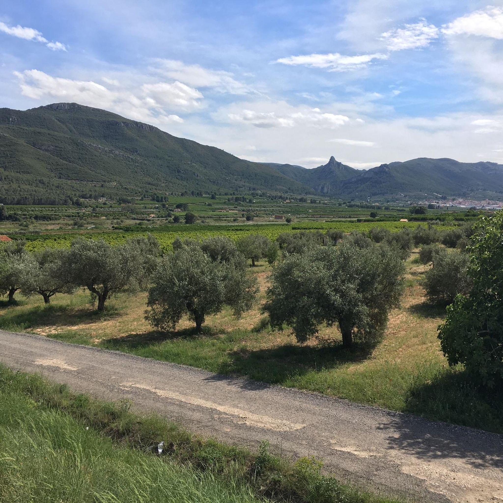
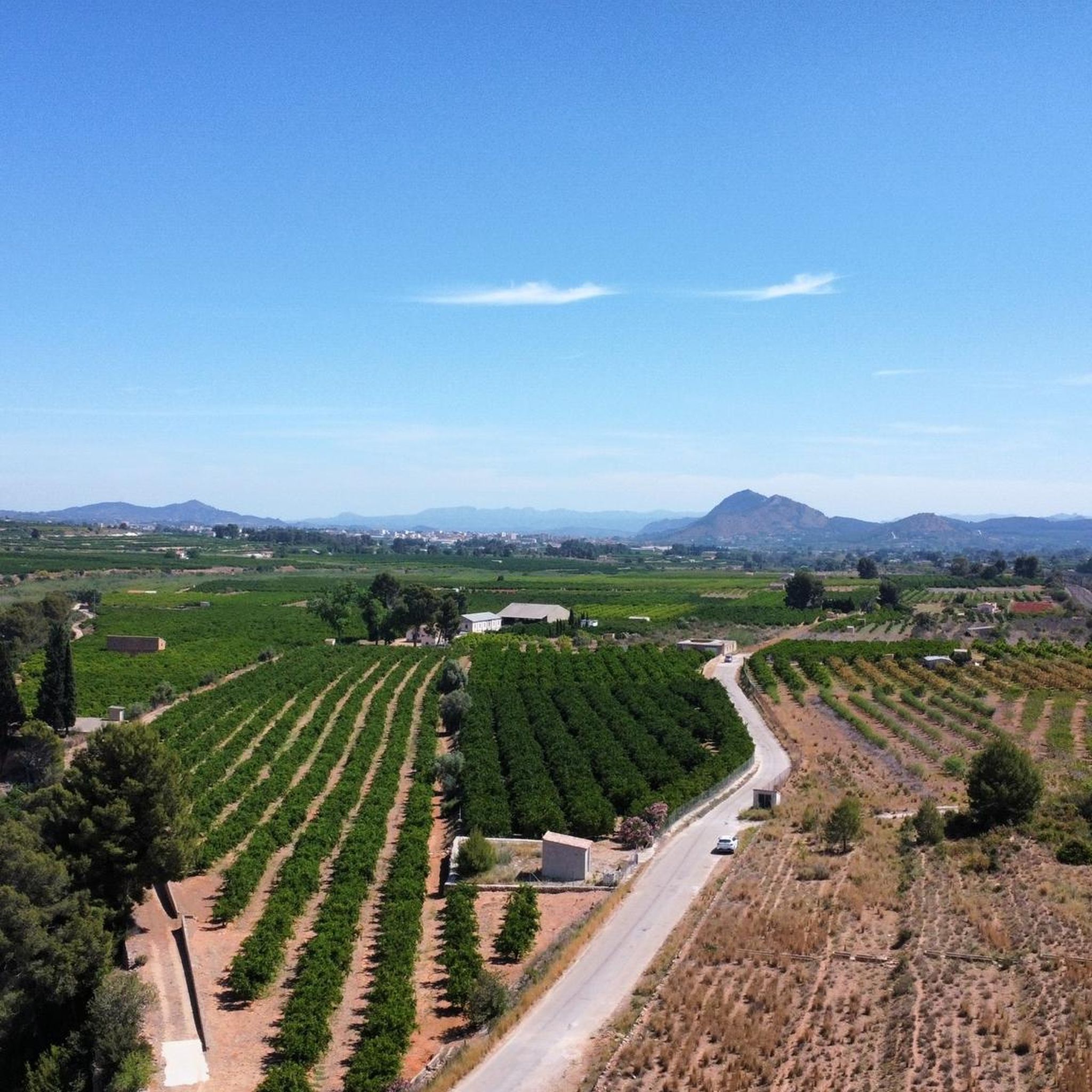
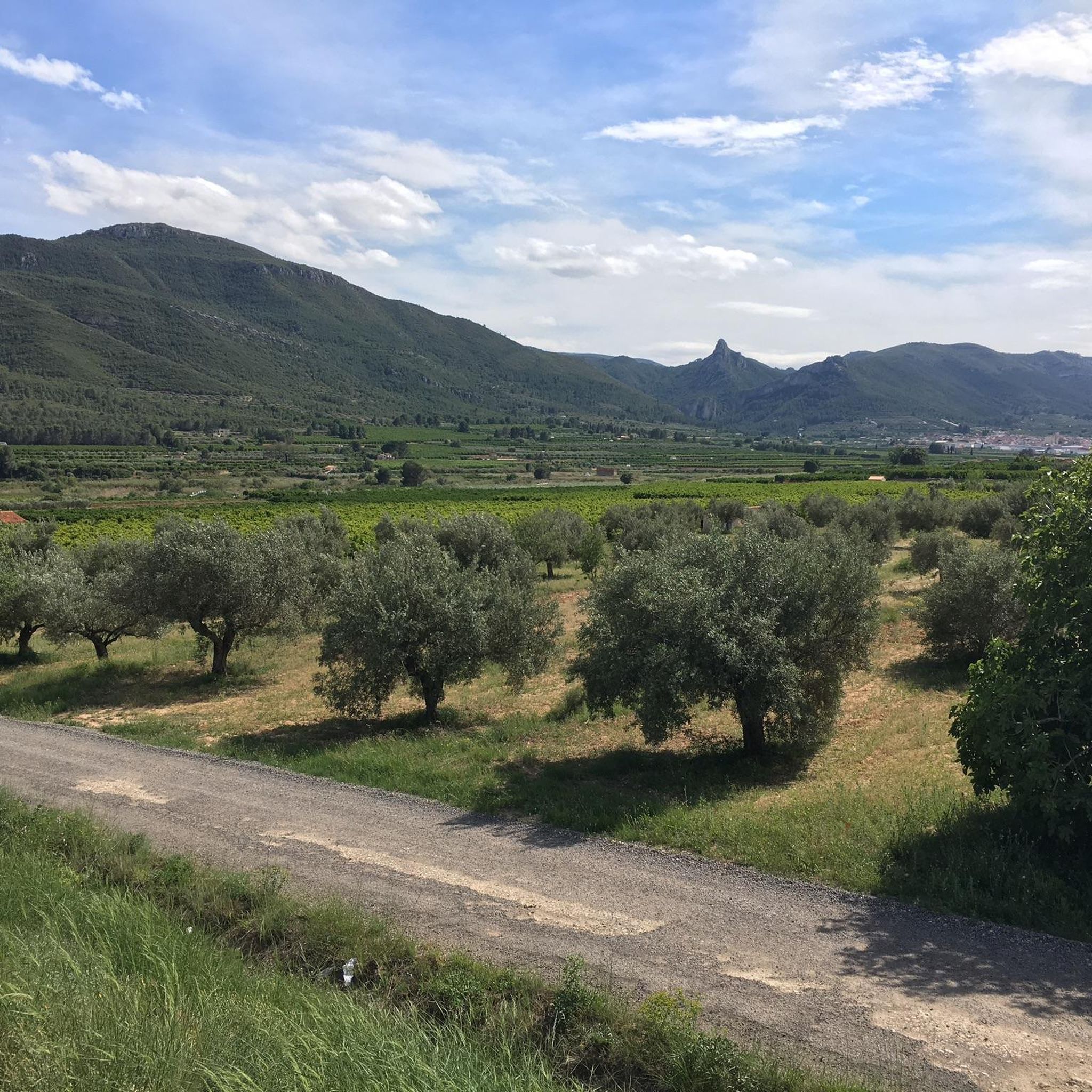
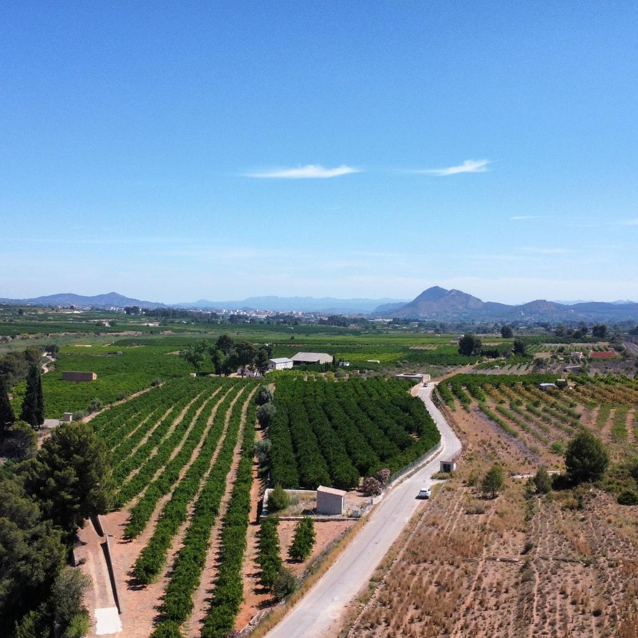
Road cycling in Paratge Natural Municipal Barranc De La Fosch, located in Montesa, Valencia, offers routes through a landscape characterized by the Serra Grossa mountains and the Cànyoles river valley. The region features varied terrain, from riverbanks with Mediterranean vegetation to ascents towards historic landmarks. Roads are generally well-maintained, providing diverse gradients suitable for different cycling abilities.
Best road cycling routes in Paratge Natural Municipal Barranc De La Fosch
- The most popular road cycling route is Public washhouse and Sants…
Last updated: May 14, 2026
5.0
(1)
17
riders
181km
08:59
2,220m
2,220m
Hard road ride. Very good fitness required. Mostly well-paved surfaces and easy to ride.
7
riders
151km
07:56
2,330m
2,330m
Hard road ride. Very good fitness required. Mostly well-paved surfaces and easy to ride.

Sign up for free
29
riders
45.0km
02:33
760m
760m
Moderate road ride. Good fitness required. Mostly well-paved surfaces and easy to ride.
22
riders
148km
09:18
2,260m
2,260m
Hard road ride. Very good fitness required. Some segments of this route may be unpaved and difficult to ride.
6
riders
Moderate road ride. Good fitness required. Mostly well-paved surfaces and easy to ride.
Get access to more routes and recommendations from other explorers.
Sign up for free
Already have an account?
Our route recommendations are based on thousands of hikes, rides, and runs completed by other people on komoot.
Start today with a free account
Your next adventure awaits.
Login or Signup
Popular around Paratge Natural Municipal Barranc De La Fosch
Tips from the Community

very nice, good road and little traffic
0
0


There is a pass through there on the way back to Ontinyente, some beautiful landscapes.
0
0


spectacular place to visit and take pictures!
0
0

The original construction could have been the work of the Almohads, who used to use the rammed earth technique for their defensive buildings. The remains of rammed earth walls in this castle, traditionally attributed to the Almohad period, were actually built during the first decades of Christian rule, at the end of the 13th century or the beginning of the 14th century. In the 14th century, Almansa and its fortress were incorporated into the Villena manor. Don Juan Manuel took advantage of the previous construction and ordered its walls to be rebuilt.
5
0

The port of Bosquet, 645 meters above sea level, is a "must pass" before the climb to Portixol on most of the road routes that take place through this beautiful area.
0
0
Frequently Asked Questions
What kind of terrain can I expect when road cycling in Paratge Natural Municipal Barranc De La Fosch?
The region offers diverse terrain, from riverbanks with Mediterranean vegetation along the Cànyoles river to ascents into the Serra Grossa mountains. You'll find varied gradients, from gentle slopes to demanding mountain passes, with generally well-maintained asphalt surfaces.
How many road cycling routes are available in Paratge Natural Municipal Barranc De La Fosch?
There are over 60 road cycling routes available in Paratge Natural Municipal Barranc De La Fosch, catering to various skill levels. This includes 9 easy routes, 35 moderate routes, and 19 difficult routes for experienced cyclists.
Are there any challenging road cycling routes for experienced riders?
Yes, the area is known for its challenging routes. For example, the Montesa Castle – Port de Bosquet loop from Montesa is a difficult 186.7 km trail that leads through mountainous terrain and challenging passes, typically taking over 9 hours to complete.
What do other road cyclists enjoy most about cycling in Paratge Natural Municipal Barranc De La Fosch?
The area is highly rated by the komoot community, with an average score of 4.2 stars from over 10 reviews. Cyclists often praise the varied terrain, the scenic views of the Serra Grossa mountains, and the opportunity to explore both natural landscapes and historic landmarks like Montesa Castle.
Are there any road cycling routes that pass by historical landmarks?
Yes, several routes offer views of historical landmarks. The Montesa Castle loop from Montesa is a challenging 112.7 km path that includes significant climbs and provides excellent views of the historic Montesa Castle.
What is the best time of year for road cycling in this region?
The Valencia region, including Paratge Natural Municipal Barranc De La Fosch, benefits from a Mediterranean climate, making it suitable for cycling for much of the year. Spring and autumn generally offer the most pleasant temperatures for longer rides, avoiding the peak heat of summer.
Are there any moderate road cycling routes suitable for intermediate cyclists?
Yes, there are 35 moderate routes available. A good option is the Port de Bosquet – Port d'El Paller loop from Vallada, a 45.0 km route with moderate elevation gain, typically completed in about 2 hours 32 minutes.
Where can I find parking when visiting Paratge Natural Municipal Barranc De La Fosch for cycling?
While specific parking areas within the natural park for cyclists are not detailed, Montesa, being the primary access point and starting location for many routes, offers various parking options within the town. It's advisable to check local signage upon arrival.
Are there any circular road cycling routes in the area?
Yes, many of the routes are designed as loops, allowing you to start and finish in the same location. For instance, the Public washhouse and Sants River – Casas de Benalí loop from Montesa is a popular 76.8 km difficult route that explores riverine landscapes and rural areas.
What kind of natural features can I expect to see while cycling?
The natural park is characterized by the dramatic Serra Grossa mountains and the Cànyoles river, which carves ravines and riverbanks. You'll encounter abundant Mediterranean vegetation, including aromatic plants, and may spot various raptors and other wildlife in this ecologically rich area.
Can I find long-distance road cycling routes in Paratge Natural Municipal Barranc De La Fosch?
Absolutely. The region offers routes suitable for long-distance cycling. The Pou Clar Natural Area – Pou Clar loop from Montesa is a challenging 151.0 km route, providing a substantial ride through diverse landscapes.
Is public transport available to reach the cycling routes in Paratge Natural Municipal Barranc De La Fosch?
Montesa, the town adjacent to the natural park and a common starting point for many routes, can be accessed via public transport. It's recommended to check local bus or train schedules for connections to Montesa from larger cities in the Valencia province.
Most popular routes in Paratge Natural Municipal Barranc De La Fosch

Get inspired with the komoot mobile app


Explore more
Browse the best Road cycling routes in other regions.
