Reserva Natural Laguna Ojos De Villaverde
Reserva Natural Laguna Ojos De Villaverde
The best MTB trails in Reserva Natural Laguna Ojos De Villaverde
5.0
(2)
90
riders
8
rides
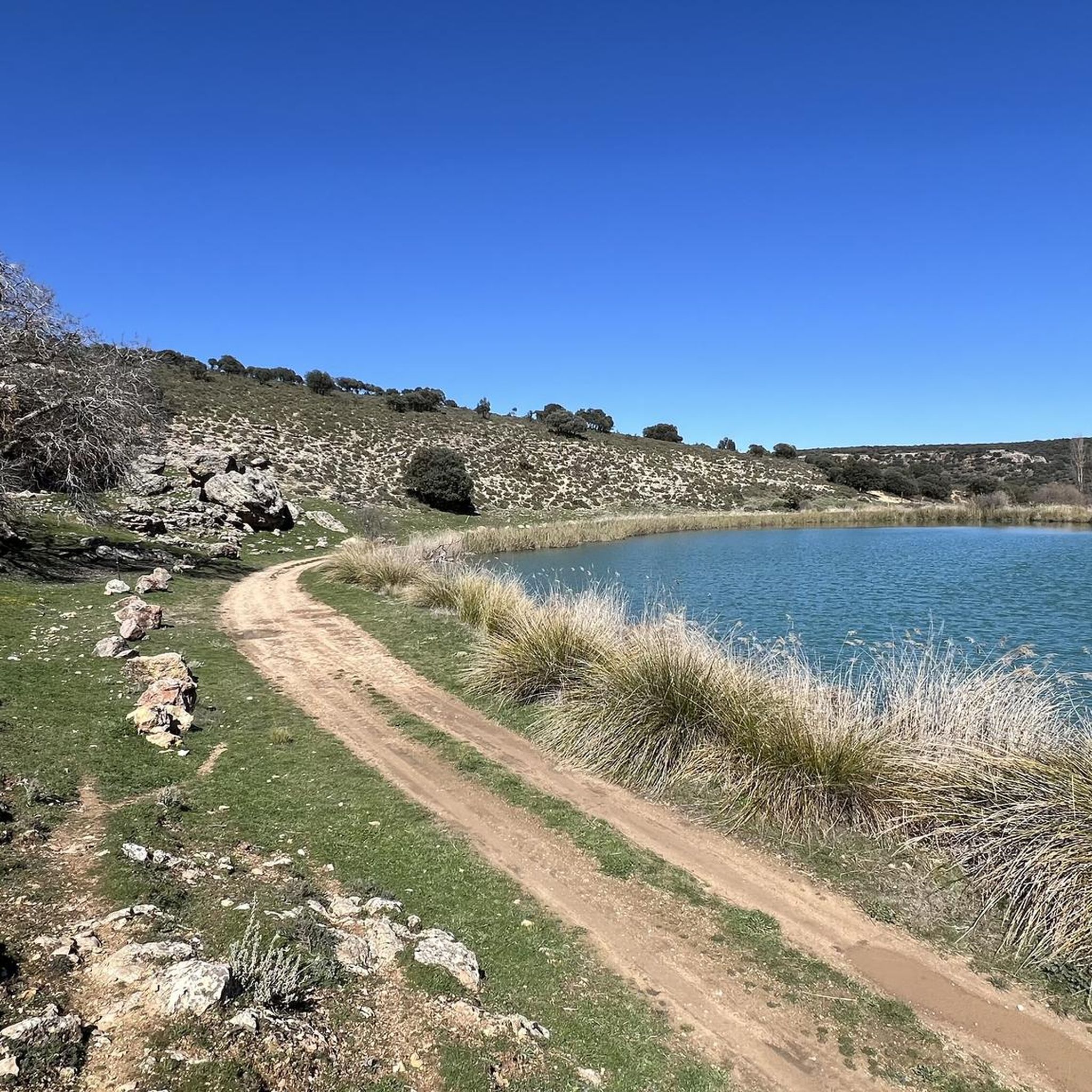
Mountain biking in Reserva Natural Laguna Ojos De Villaverde offers routes through a protected natural area centered around a permanent karstic wetland. The region is situated on an elevated plateau at 920 meters above sea level, featuring a moorland appearance dotted with springs. Trails traverse areas with dense reed beds, holm oak, and Spanish juniper forests, providing varied terrain for cyclists. The landscape includes a unique tongue-shaped karstic lake and surrounding natural features.
Best mountain bike trails in Reserva Natural…
Last updated: May 14, 2026
Moderate mountain bike ride. Good fitness required. Suitable for all skill levels.
5.0
(2)
52
riders
111km
07:26
660m
660m
Hard mountain bike ride. Very good fitness required. Suitable for all skill levels.

Sign up for free
3
riders
48.3km
03:46
660m
660m
Moderate mountain bike ride. Good fitness required. Suitable for all skill levels.
2
riders
34.3km
02:45
310m
310m
Moderate mountain bike ride. Good fitness required. Advanced riding skills necessary.
2
riders
35.7km
02:58
270m
270m
Moderate mountain bike ride. Good fitness required. Advanced riding skills necessary.
Get access to more routes and recommendations from other explorers.
Sign up for free
Already have an account?
Our route recommendations are based on thousands of hikes, rides, and runs completed by other people on komoot.
Start today with a free account
Your next adventure awaits.
Login or Signup
Popular around Reserva Natural Laguna Ojos De Villaverde

Tips from the Community

Ascent from the track that follows the Rio de Puentecillas starting from Casa Puentecillas, a slightly bumpy track suitable for mountain bikes or gravel bikes with at least 45mm tires. Once past the first kilometer (with a view of the Campo Santo de Arteaga), you will find a more passable forest track that joins an asphalt road for a beautiful descent to Los Catalmerejos (AB-515) and the main road CM-3216.
0
0

The Sierra de Alcaraz Greenway is part of a spectacular route that follows the old, unfinished Baeza-Utiel railway line. This greenway, ideal for hiking and cycling, stretches from Albacete to the town of Alcaraz, passing through a wide variety of landscapes, from agricultural plains to mountainous areas.
4
0

Attention. On April 8, the Albacete-Alcaraz greenway was closed due to highway construction in Balazote. A metal fence completely blocks the road, and I couldn't continue because no one could tell me how many kilometers of the stretch were closed to traffic.
2
0


Municipality in the Sierra de Alcaraz region with just over 300 inhabitants, affected by rural depopulation. There is a small square with a fountain. If you leave the town, go along the main road and take a path to the left, there is a very cool descent in the direction of the greenway along a path that is in perfect condition.
0
0
Good road for cycling or walking. Small stones, but in good condition and without potholes. After this point, if you go in the opposite direction to Albacete, there is an area of slight curves
0
0

Unfortunately the water fountain doesn’t work. But nice place
1
0

An old water pumping station was located here, there is nothing left
0
0
Frequently Asked Questions
How many mountain bike trails are available in Reserva Natural Laguna Ojos De Villaverde?
There are 9 mountain bike trails available in Reserva Natural Laguna Ojos De Villaverde. These routes cater to various skill levels, with 8 moderate and 1 difficult option.
What kind of terrain can I expect on mountain bike trails in Reserva Natural Laguna Ojos De Villaverde?
The terrain in Reserva Natural Laguna Ojos De Villaverde is diverse. You'll encounter routes through a protected natural area centered around a karstic wetland, elevated moorland plateaus, and sections with holm oak and Spanish juniper forests. The landscape includes the unique tongue-shaped karstic lake and surrounding natural features, offering varied experiences.
Are there any beginner-friendly mountain bike routes in Reserva Natural Laguna Ojos De Villaverde?
While there are no routes specifically graded as 'easy' in our current selection, many of the 8 moderate trails could be suitable for riders with some experience looking for a less strenuous ride. For example, the route La Laguna Ojos de Villaverde from El Ballestero - circular via the Arroyo de Ojo Lóbrego is a moderate 35.3 km loop with a relatively lower elevation gain.
What is the most challenging mountain bike trail in the area?
The most challenging mountain bike trail currently listed is Santa Ana Halt – Camino Casa Moreno loop from El Ballestero. This difficult route spans 110.9 km and features significant elevation gain, making it suitable for experienced mountain bikers.
Are there any circular mountain bike routes around Reserva Natural Laguna Ojos De Villaverde?
Yes, many of the routes in the area are circular. For instance, you can explore San Pedro desde El Jardín — circular por el Camino Natural Vía Verde de la Sierra de Alcaraz, a 55.8 km loop, or the Church of Peñascosa – Tunnel loop from El Ballestero, which is 54.0 km.
What natural features or landmarks can I see while mountain biking here?
The region is rich in natural beauty. You'll encounter the unique karstic lake, dense reed beds, and diverse vegetation including holm oak and Spanish juniper forests. The area is also known for its significant biodiversity, particularly avifauna, so keep an eye out for birds like the Grey Heron or Bonelli's Eagle. The elevated plateau itself offers a distinct moorland appearance.
What do other mountain bikers enjoy most about the trails in Reserva Natural Laguna Ojos De Villaverde?
The trails in Reserva Natural Laguna Ojos De Villaverde are highly rated by the komoot community, with an average score of 5.0 stars. Mountain bikers often praise the varied terrain, the unique natural setting of the karstic wetland, and the opportunity to explore the region's diverse landscapes, from forests to moorland plateaus.
Is Reserva Natural Laguna Ojos De Villaverde suitable for family mountain biking?
While there are no 'easy' graded routes, some of the moderate trails might be suitable for families with older children who have some mountain biking experience. The region's natural beauty and diverse landscapes offer an engaging environment. Always check the specific route details for distance and elevation to ensure it matches your family's ability.
Are dogs allowed on the mountain bike trails in Reserva Natural Laguna Ojos De Villaverde?
The Reserva Natural Laguna Ojos De Villaverde is a protected natural area known for its rich biodiversity, including sensitive bird species and other wildlife. While specific regulations for dogs on mountain bike trails are not detailed, it is generally advisable to keep dogs on a leash and adhere to any local signage to protect the wildlife and natural environment.
What is the best time of year to go mountain biking in Reserva Natural Laguna Ojos De Villaverde?
Given its location on an elevated plateau at 920 meters above sea level, the climate can vary. Spring and autumn generally offer the most pleasant temperatures for mountain biking, avoiding the heat of summer and potential colder conditions in winter. These seasons also provide beautiful natural scenery.
Are there any viewpoints along the mountain bike trails?
The elevated plateau and varied terrain naturally offer several scenic spots. While specific named viewpoints are not detailed, routes like View of El Ballestero loop from El Ballestero suggest opportunities for panoramic views of the surrounding countryside and the municipality of El Ballestero.
How long do mountain bike routes typically take in this region?
The duration of mountain bike routes varies significantly based on distance and difficulty. For example, a moderate route like La Laguna Ojos de Villaverde from El Ballestero - circular via the Arroyo de Ojo Lóbrego can take around 2 hours 54 minutes, while the difficult Santa Ana Halt – Camino Casa Moreno loop from El Ballestero can take over 7 hours.
Most popular routes in Reserva Natural Laguna Ojos De Villaverde

Get inspired with the komoot mobile app


Explore more
Browse the best MTB trails in other regions.
