The best cycling routes in Riserva Naturale Regionale Valle Dell'Arcionello
4.3
(162)
2,108
riders
202
rides
Touring cycling routes in Riserva Naturale Regionale Valle Dell'Arcionello traverse a landscape shaped by volcanic origins, featuring deep gorges carved by streams and dense forests. The reserve extends from Monte Palanzana, an 802-meter peak, towards Viterbo. Paths often follow historical aqueduct remnants and old mill sites, offering a blend of natural and industrial archaeology. The terrain includes varied elevations and natural features such as volcanic stone walls and lush woodlands.
Best touring cycling routes in Riserva Naturale Regionale Valle Dell'Arcionello
…Last updated: May 11, 2026
4.3
(12)
78
riders
46.5km
03:47
630m
620m
Hard bike ride. Very good fitness required. You may need to push your bike for some segments of this route.
4.1
(14)
63
riders
114km
08:29
1,470m
1,470m
Hard bike ride. Very good fitness required. Mostly paved surfaces. Suitable for all skill levels.

Sign up for free
4.3
(3)
69
riders
Hard bike ride. Very good fitness required. Mostly paved surfaces. Suitable for all skill levels.
3.5
(2)
46
riders
Hard bike ride. Very good fitness required. Mostly paved surfaces. Suitable for all skill levels.
4.2
(6)
35
riders
Easy bike ride. Great for any fitness level. Mostly paved surfaces. Suitable for all skill levels.
Get access to more routes and recommendations from other explorers.
Sign up for free
Already have an account?
Our route recommendations are based on thousands of hikes, rides, and runs completed by other people on komoot.
Start today with a free account
Your next adventure awaits.
Login or Signup
Popular around Riserva Naturale Regionale Valle Dell'Arcionello
Road Cycling Routes in Riserva Naturale Regionale Valle Dell'Arcionello
MTB Trails in Riserva Naturale Regionale Valle Dell'Arcionello
Running Trails in Riserva Naturale Regionale Valle Dell'Arcionello
Hiking in Riserva Naturale Regionale Valle Dell'Arcionello

Gravel biking in Riserva Naturale Regionale Valle Dell'Arcionello
Tips from the Community


Small medieval part of town that has only dead-end streets.
0
0
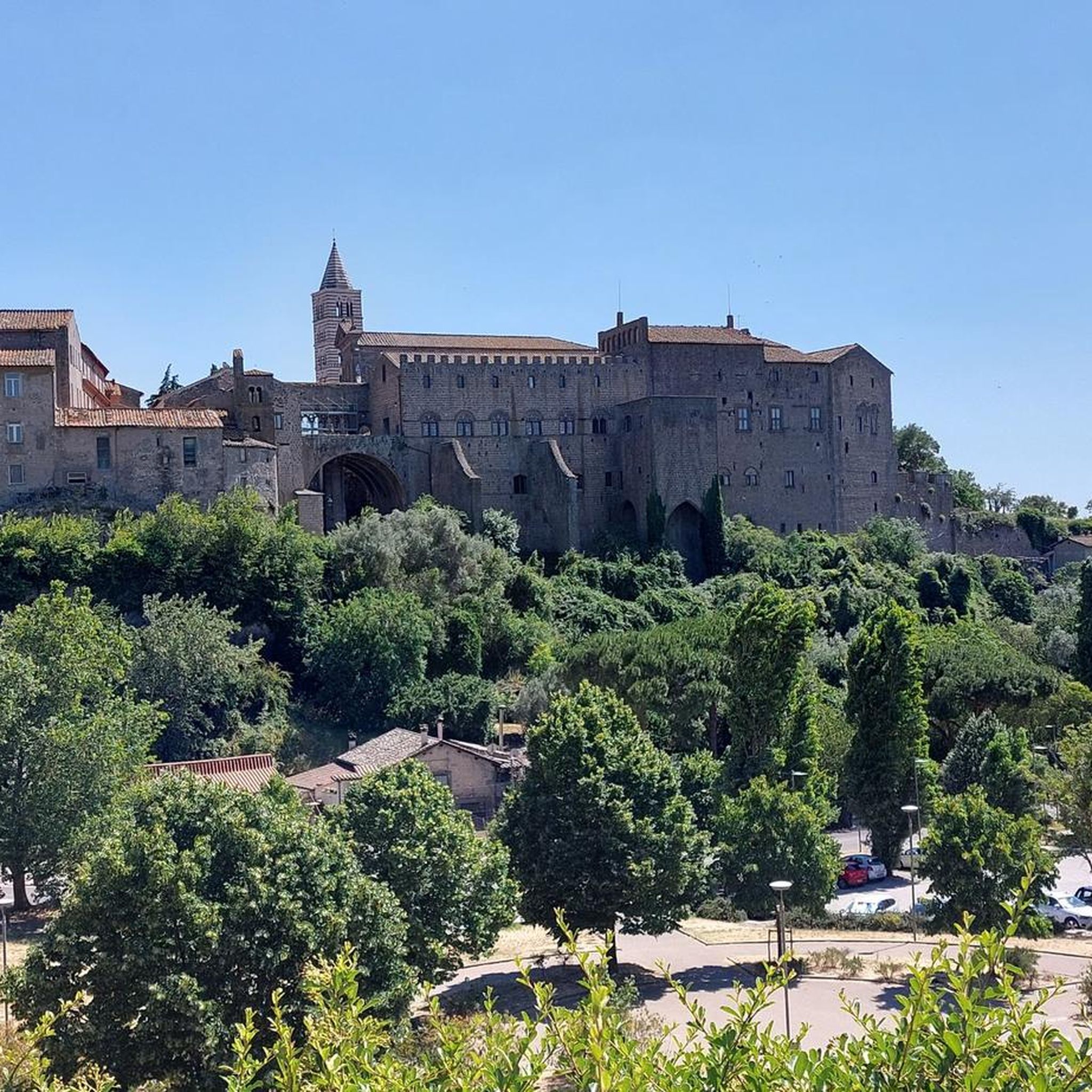
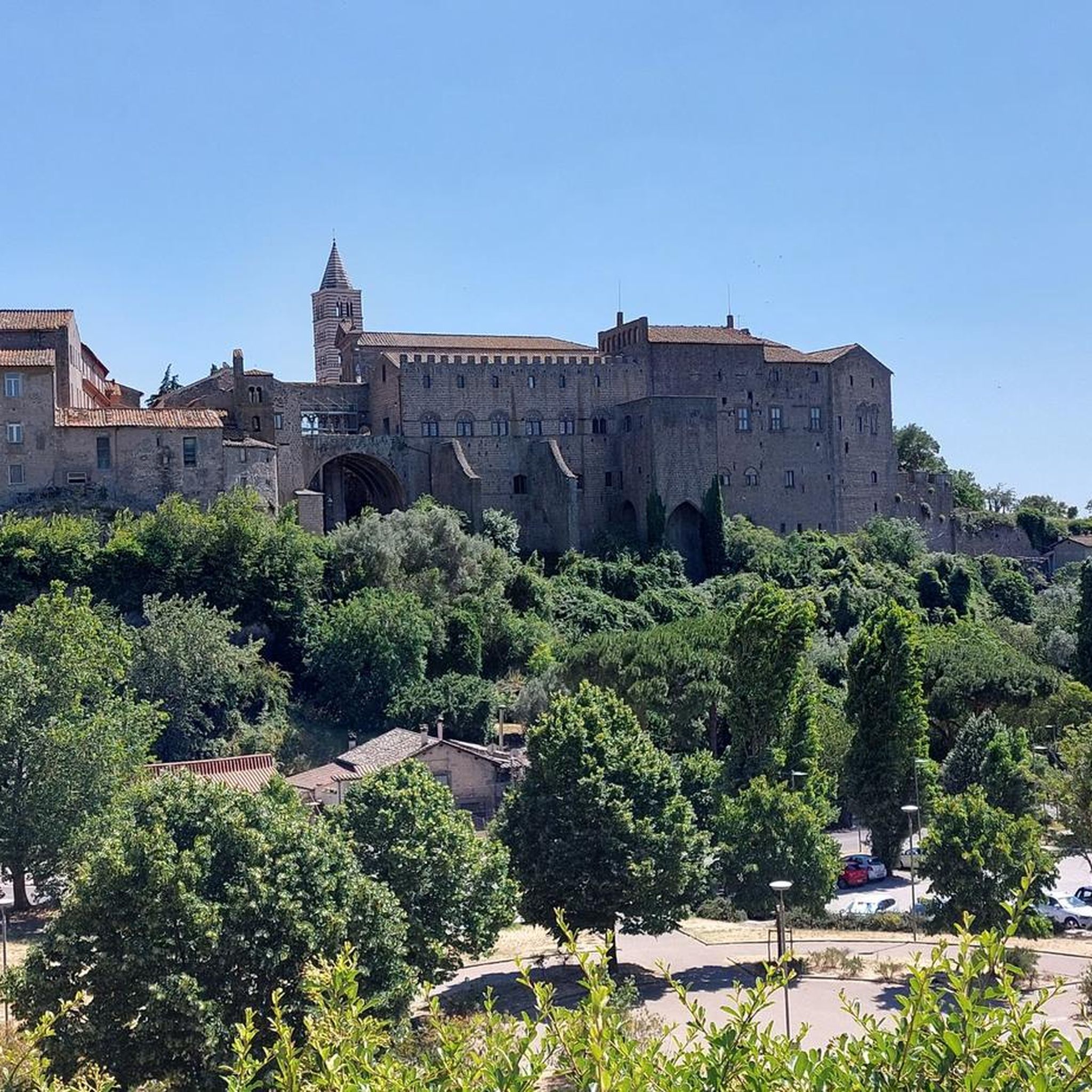
Viterbo lived its period of major splendor and power in the 13th century when it was chosen as the seat of the papacy instead of Rome, where powerful warring families made life too dangerous. Eight different popes lived in Viterbo making it is similar to Vatican City and Avignon in France. The longest papal conclave in history happened here from 1 December 1268 to 1 September 1271. Following Pope Clement IV's death, infighting between cardinals and political pressure led to a 34-month deadlock. The cardinals were locked up cum clave (hence the word conclave) inside the palace’s large Conclave Hall. In desperation the town’s population, who were feeding them and their entourages, eventually reduced the cardinals’ food and wine supplies, trying to speed up the election. Time wore on and they finally decided to remove the roof of the palace: in order to help the Holy Spirit come down and illuminate them, it was quipped. That worked.
0
0
Herbs Square / Piazza delle Erbe The square, originally dedicated to Saint Stephen, has changed name and appearance over the centuries. It is home to historic fountains, Palazzo Gatti, and the Casa della Pace.
0
0
Okay, the Parco Thermale di Bagnaccio is once again open daily. In winter from 8am to 8pm, in Summer open until 23pm or even midnight! Entry is 5€ for pilgrims with credential (or if you are lucky like me, also without). Else it is 10€. There are three simple changing rooms, some toilets, a snack automat and coffee maschine and, sometimes just outside, a mobile little restaurant selling hot meals.
0
0

The village of Sutri is located on the Via Cassia, it is worth a stop to visit the wonderful archaeological area and the rock necropolis
0
0

In the heart of Viterbo, Piazza delle Erbe owes its name to the vegetable market held there since the Middle Ages, when the square was a vital hub of city life. At its center is the Fountain of the Lions, built between 1621 and 1625, with its basin decorated with lions and marble coats of arms reminiscent of the city's coat of arms.
0
0

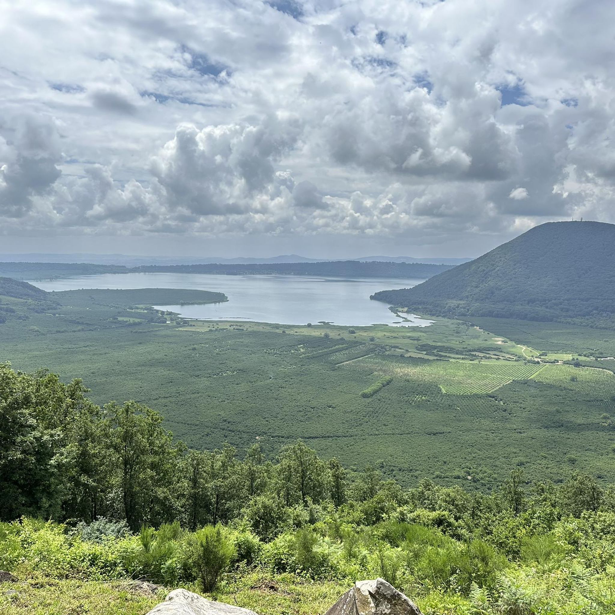
From here you have a beautiful view of the lake.
1
0
Frequently Asked Questions
How many touring cycling routes are available in Riserva Naturale Regionale Valle Dell'Arcionello?
There are over 200 touring cycling routes in Riserva Naturale Regionale Valle Dell'Arcionello. These routes cater to various skill levels, with options ranging from easy to difficult.
What kind of terrain should I expect when touring cycling in the reserve?
The terrain in Riserva Naturale Regionale Valle Dell'Arcionello is shaped by its volcanic origins, featuring varied elevations. You'll encounter deep gorges carved by streams, volcanic stone walls, and dense forests of beech and holm oak. While some paths follow historical aqueduct remnants, the area is generally more suited for off-road cycling like mountain biking or gravel touring due to its rugged and wild nature.
Are there any family-friendly touring cycling routes in Riserva Naturale Regionale Valle Dell'Arcionello?
Yes, there are routes suitable for families. While the reserve's terrain can be rugged, there are 10 easy routes available. For a relatively flat and accessible option, consider the Via Francigena Near Viterbo – Via Francigena loop from Viterbo, which is 13.4 miles (21.6 km) long with minimal elevation gain.
What natural features or landmarks can I see along the touring cycling routes?
The reserve is rich in natural and historical features. You can explore the deep gorge carved by the Fosso Luparo, with its impressive volcanic stone walls and small waterfalls. Monte Palanzana offers panoramic views. Historically, you'll find remnants of the Acquedotto della Palanzana, including canalizations and structures like the 'Cittadella delle Acque,' as well as old watermills and the former Segheria Anselmi.
Are there circular touring cycling routes available?
Yes, many routes in the region are designed as loops. For example, the popular Via Francigena Near Viterbo – Via Francigena loop from Viterbo offers an easy circular experience. Another option is the Via Francigena – Via Francigena Near Zepponami loop from Viterbo Porta Romana, a more challenging 26.9-mile (43.2 km) trail through varied terrain.
What is the best time of year to go touring cycling in Riserva Naturale Regionale Valle Dell'Arcionello?
The reserve's lush forests and volcanic features are enjoyable throughout much of the year. Spring and autumn generally offer the most pleasant temperatures for cycling, with vibrant foliage or blooming wildflowers. Summers can be warm, while winters might bring cooler, potentially wetter conditions, especially in the gorges.
What do other touring cyclists enjoy most about the routes in Riserva Naturale Regionale Valle Dell'Arcionello?
The routes in Riserva Naturale Regionale Valle Dell'Arcionello are highly rated by the komoot community, with an average score of 4.2 stars from over 160 reviews. Cyclists often praise the unique blend of wild nature, volcanic landscapes, and the discovery of historical industrial archaeology along the trails.
Are there routes suitable for advanced touring cyclists?
Absolutely. The reserve offers a significant number of challenging routes, with 136 classified as difficult. An example is the Viterbo to Bassano Romano on the trail of the Etruscans, a difficult 28.9-mile (46.5 km) path with significant elevation changes, passing through historical Etruscan areas.
Can I bring my dog on the touring cycling trails?
While the reserve is known for its natural beauty, specific regulations regarding dogs on cycling trails can vary. It's generally advisable to keep dogs on a leash to protect wildlife and ensure the safety of other visitors. Always check local signage or the official park website for the most current rules before your visit.
Are there any specific historical sites to look out for?
Yes, the reserve is rich in 'industrial archaeology.' You can explore the remnants of the Acquedotto della Palanzana, including ancient canalizations and the 'Cittadella delle Acque.' Keep an eye out for the ruins of old watermills, the former Segheria Anselmi (sawmill), and sites of old paper mills and power stations, all powered by the Urcionio stream.
Where can I find parking for touring cycling in the area?
As the reserve extends from Monte Palanzana towards Viterbo, parking options are typically available near entry points or trailheads around the Viterbo municipality. Specific parking areas might be designated for visitors accessing the reserve. It's recommended to check maps or local information for the most convenient parking spots depending on your chosen starting point.
How can I reach Riserva Naturale Regionale Valle Dell'Arcionello by public transport?
The reserve is located within the municipality of Viterbo. Viterbo is accessible by train and bus services. From Viterbo, local bus services or a short taxi ride might be necessary to reach specific entry points of the reserve, as public transport directly into the more rugged areas may be limited.
Most popular routes in Riserva Naturale Regionale Valle Dell'Arcionello

Get inspired with the komoot mobile app


Explore more
Browse the best Cycling routes in other regions.
