Réserve Naturelle Des Étangs De Mépieu
Réserve Naturelle Des Étangs De Mépieu
The best road cycling routes in Réserve Naturelle Des Étangs De Mépieu
4.4
(139)
2,240
riders
120
rides
Road cycling in Réserve Naturelle Des Étangs De Mépieu features routes traversing a landscape characterized by numerous ponds and wetlands, interspersed with agricultural areas and rolling terrain. The region offers varied elevation profiles, ranging from gentle gradients around the water bodies to more significant climbs on routes extending into the surrounding hills. This natural reserve provides a setting for road cyclists to experience both flat, scenic stretches and more challenging ascents.
Best road cycling routes in Réserve Naturelle Des Étangs De Mépieu
- The most popular road cycling route is La Tuille Pond – Ry Pond loop from Arandon-Passins, a 64.9 miles (104.4 km) trail that takes 4 hours 50 minutes to complete. This difficult route features significant elevation gain through the regional landscape.
- Another top favourite among local road cyclists is Pond loop from Arandon, a difficult 30.7 miles (49.4 km) path. This route includes substantial climbs and descents around the local ponds.
- Local road cyclists also love the La Tuille Pond – Lavoir d'Optevoz loop from Mépieu, a 21.3 miles (34.3 km) trail leading through pond areas and rural landscapes, often completed in about 1 hour 26 minutes.
- Road cycling in Réserve Naturelle Des Étangs De Mépieu is defined by its network of ponds, agricultural fields, and rolling hills. The routes offer options for various ability levels, from easy rides around the water to more difficult climbs.
- The routes in Réserve Naturelle Des Étangs De Mépieu are highly rated by the komoot community with an average score of 4.5 stars from over 150 reviews. More than 2,000 road cyclists have used komoot to explore Réserve Naturenelle Des Étangs De Mépieu's varied terrain.
Last updated: November 3, 2026
42
riders
97.1km
04:44
1,330m
1,340m
Hard road ride. Very good fitness required. Mostly well-paved surfaces and easy to ride.
11
riders
113km
05:25
1,470m
1,470m
Hard road ride. Very good fitness required. Mostly well-paved surfaces and easy to ride.

12
riders
49.4km
02:41
920m
920m
Hard road ride. Very good fitness required. Mostly well-paved surfaces and easy to ride.
8
riders
34.5km
01:29
230m
230m
Moderate road ride. Some segments of this route may be unpaved and difficult to ride.
5.0
(1)
98
riders
111km
04:44
480m
480m
Moderate road ride. Good fitness required. Some segments of this route may be unpaved and difficult to ride.
Get access to more routes and recommendations from other explorers.
Already have an account?
Our route recommendations are based on thousands of hikes, rides, and runs completed by other people on komoot.
Start today with a free account
Your next adventure awaits.
Popular around Réserve Naturelle Des Étangs De Mépieu


Tips from the Community

The commune of Vertrieu, located in the department of Isère within the Balcons du Dauphiné, has the unique particularity of housing two major historical buildings: the Château Vieux (or Maison-Forte) and the Château Neuf (or Château Moderne).
0
0

here I replenished my drink supply again
0
0

In 1920, after the First World War, the Barron-Vialle company based in Lyon settled on a 100-hectare property on the edge of the Serre ponds [archive]. Founded by Antoine Vialle, it manufactured trucks, coaches, and luxury cars. The "conical gear axle" which replaced the chain drive on trucks was invented in the Vialle foundry in Arandon. Activity ceased in 1937[2],[3]. Between January 1939 and March 1940, the town's inhabitants lived through a little-known episode. After the fall of Barcelona to the Francoists on January 26, 1939, many Spanish refugees arrived in Grenoble, where they were very poorly housed. At the request of the authorities, in February 1939, Mr. Vialle, the mayor, agreed to rent out the premises of his inactive factory; from July 12 onwards, 1300 Spanish Republicans, mainly families[4] of refugees, were welcomed there and stayed until October. Two days after the declaration of war on September 3, 1939, the government of the Third Republic ordered the internment of men "nationals of enemy powers", considered suspicious. These were almost exclusively anti-Nazis, men, mostly Jewish refugees from Germany and Austria, who were interned from October 1939 under particularly harsh conditions. The camp is said to have closed its doors around February 1940, apparently by sending the last occupants, 90 Jews, to the Loriol camp on March 11. The activity of this center then ceased, a few months before the establishment of the Vichy regime on July 7, 1940[8]. Mr. Vialle was subsequently dismissed from his duties as mayor by the Vichy regime. The factory regained its purpose in 1946 with SOFAL (aluminum foundry) until its cessation of activity in 1967, with the factory being transferred to the company Pierre Calignon (cast iron foundry). The latter filed for bankruptcy in 1987 and was taken over by G-H Bouyer foundries, which permanently closed the site in 1993. The site was then used for storing tires and then chlorinated materials until its remediation[9]. srce wikipédia to learn more, https://ajpn.org/internement-Camp-d-Arandon-7.html
0
0
The property is private, but Paul Claudel's tomb is accessible
0
0

cycle path very busy in good weather
1
0


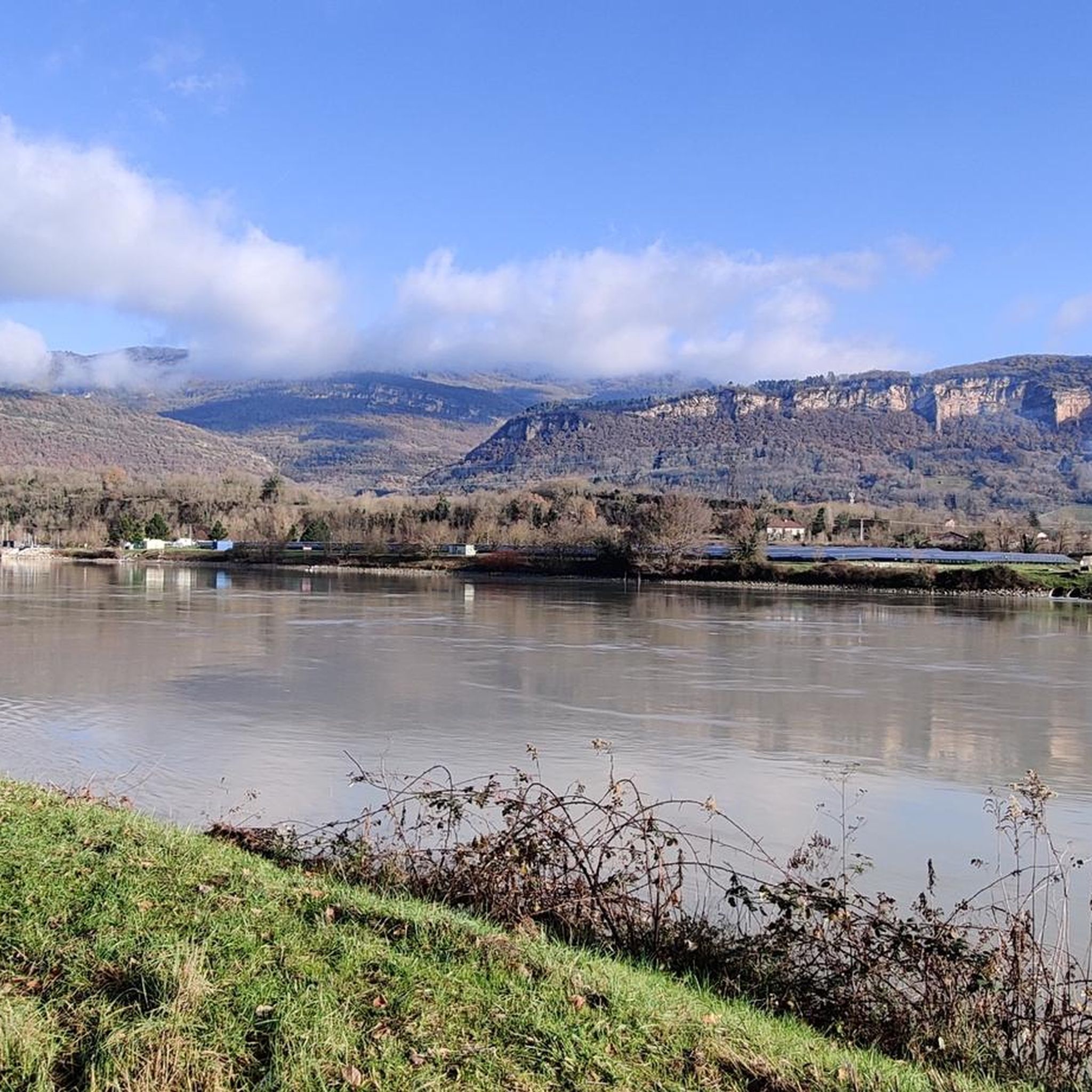
Beautiful view of the Rhône and the Jura mountains
0
0

A big surprise was the reference to the grave of this poet and philosopher. His grave is located in a corner of the park of the Château de Brangues and is open to the public.
0
0
Frequently Asked Questions
How many road cycling routes are available in Réserve Naturelle Des Étangs De Mépieu?
There are over 120 road cycling routes in Réserve Naturelle Des Étangs De Mépieu, offering a wide range of options for different skill levels and preferences.
Are there easy road cycling routes suitable for beginners in the reserve?
Yes, Réserve Naturelle Des Étangs De Mépieu offers 23 easy road cycling routes. An example is the La Tuille Pond – Lavoir d'Optevoz loop from Mépieu, which is 21.3 miles (34.3 km) long and features gentle gradients through pond areas and rural landscapes.
What is the typical duration for road cycling routes in Réserve Naturelle Des Étangs De Mépieu?
Route durations vary significantly. Shorter, easier routes like the Courtenay Church – Lavoir d'Optevoz loop from Quirieu can be completed in about 1 hour 18 minutes, while more challenging routes, such as the La Tuille Pond – Ry Pond loop from Arandon-Passins, can take nearly 5 hours.
Where can I find parking for road cycling in the Réserve Naturelle Des Étangs De Mépieu area?
Many routes start from villages surrounding the reserve, such as Arandon-Passins, Mépieu, or Quirieu. You can typically find public parking in these village centers, which serve as convenient starting points for your ride.
Is Réserve Naturelle Des Étangs De Mépieu accessible by public transport for road cyclists?
Public transport options directly into the heart of the reserve are limited. It is generally recommended to arrive by car, especially if you are bringing your own road bike, and start your ride from one of the nearby towns or villages.
What kind of terrain can I expect on road cycling routes in the reserve?
The region is characterized by a mix of flat stretches around the numerous ponds and wetlands, interspersed with rolling hills and agricultural areas. You'll encounter varied elevation profiles, from gentle gradients to more significant climbs, particularly on routes extending into the surrounding countryside.
Are there any challenging road cycling routes for experienced riders?
Yes, the reserve offers 22 difficult road cycling routes. The Pond loop from Arandon is a challenging 30.7 miles (49.4 km) path with substantial climbs and descents around the local ponds, ideal for experienced cyclists.
What is the best time of year for road cycling in Réserve Naturelle Des Étangs De Mépieu?
Spring and autumn generally offer the most pleasant conditions for road cycling, with milder temperatures and beautiful scenery as the landscape changes. Summer can also be enjoyable, but it's advisable to ride earlier in the morning or later in the afternoon to avoid the midday heat.
What do other road cyclists enjoy the most about road cycling in Réserve Naturelle Des Étangs De Mépieu?
The area is highly rated by the komoot community, with an average score of 4.5 stars. Reviewers often praise the diverse landscape, combining tranquil pond views with rolling agricultural fields, and the variety of routes suitable for different fitness levels.
Are there any circular road cycling routes in Réserve Naturelle Des Étangs De Mépieu?
Many of the routes in the reserve are designed as loops, allowing you to start and finish at the same point. For example, the Ain by Bike: Le Bugey, Paradise for Col Hunters is a long circular route that explores the wider region.
Are there cafes or places to stop for refreshments along the road cycling routes?
While the reserve itself is natural, the routes often pass through or near small villages and towns where you can find local cafes, bakeries, or small shops to refuel and take a break. Planning your route with potential stops in mind is recommended.
Most popular routes in Réserve Naturelle Des Étangs De Mépieu

Get inspired with the komoot mobile app


Explore more
Browse the best Road cycling routes in other regions.
