Vallei Van Het Schijn Met Kastelen Schilde, Bleekhof En Vrieselhof
Vallei Van Het Schijn Met Kastelen Schilde, Bleekhof En Vrieselhof
The best running trails in Vallei Van Het Schijn Met Kastelen Schilde, Bleekhof En Vrieselhof
4.3
(686)
31,825
runners
918
runs
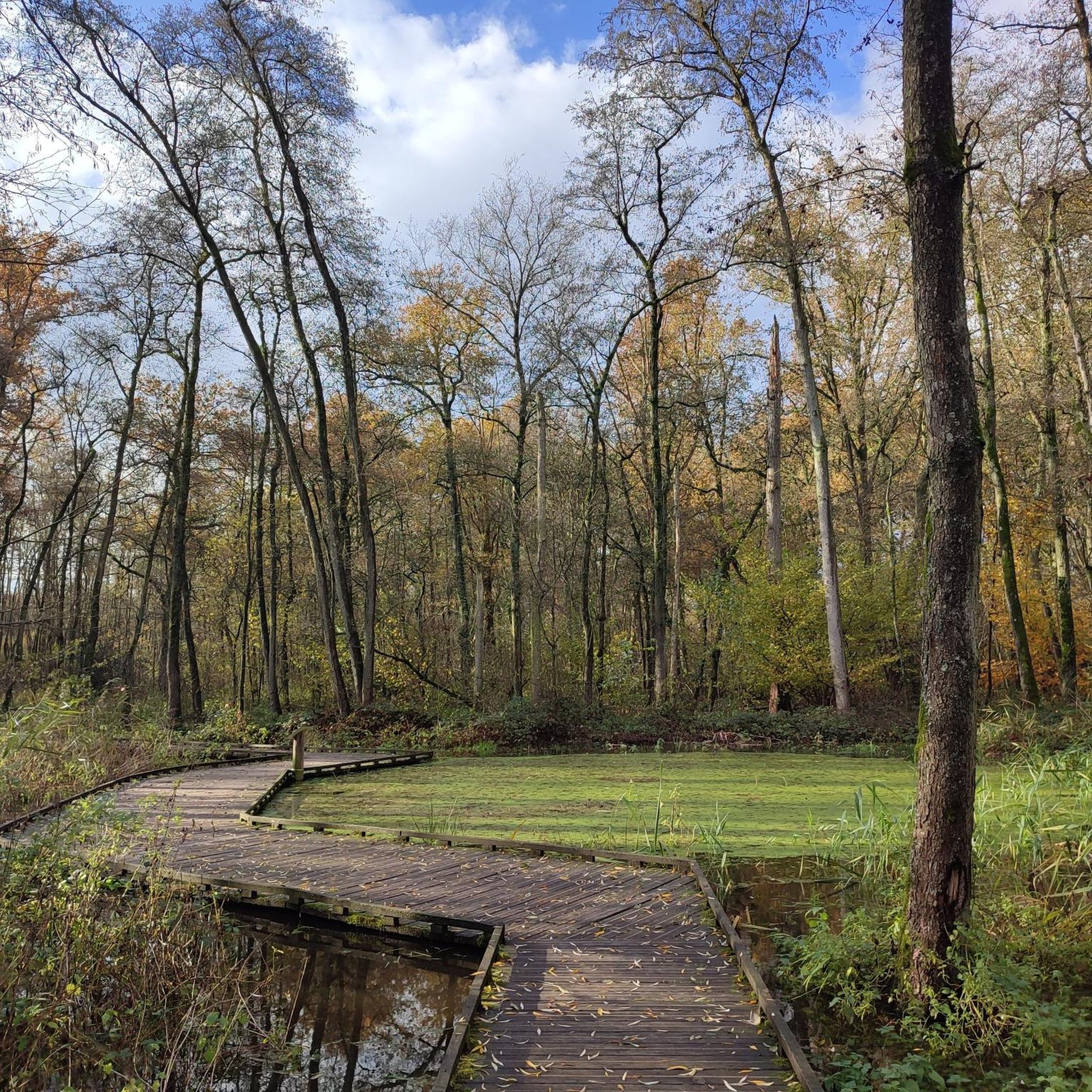
Jogging routes in Vallei Van Het Schijn Met Kastelen Schilde, Bleekhof En Vrieselhof traverse a varied landscape characterized by an alternation of open and closed structures, creating an intimate feel. The Groot Schijn river is a central natural feature, contributing to a water-rich environment with diverse ecosystems. Runners can explore a mix of forests, grasslands, and thickets, often along an extensive system of paths and avenues. The area also features historical castles like Vrieselhof, Schilde, and Bleekhof, adding to the scenic appeal of the running experience.
Best jogging routes in Vallei Van Het Schijn Met Kastelen Schilde, Bleekhof En Vrieselhof
- The most popular jogging route is Jozef Simonslaan Arch Bridge – Pidpa Drinking Water Fountain loop from Oelegem, a 5.4 miles (8.7 km) trail that takes about 54 minutes to complete. This moderate route offers a scenic loop through the local landscape.
- Another top favourite among local runners is View of Hazewinkel Lake – Fort Oelegem loop from Schilde, a moderate 8.0 miles (12.9 km) path. This route provides views of Hazewinkel Lake and passes by the historic Fort Oelegem.
- Local runners also love the Pidpa Drinking Water Fountain – Wooden Bridge loop from Schilde, a 5.2 miles (8.4 km) trail leading through a water-rich environment, often completed in about 55 minutes.
- Jogging in Vallei Van Het Schijn Met Kastelen Schilde, Bleekhof En Vrieselhof is defined by its extensive path network, historical castles, and diverse natural features like forests and grasslands. The region offers routes for various ability levels, from easy paths to more challenging trails.
- The routes in Vallei Van Het Schijn Met Kastelen Schilde, Bleekhof En Vrieselhof are highly rated by the komoot community with an average score of 4.3 stars from more than 400 reviews. More than 25,000 runners have used komoot to explore Vallei Van Het Schijn Met Kastelen Schilde, Bleekhof En Vrieselhof's varied terrain.
Last updated: November 4, 2026
4.0
(1)
43
runners
Moderate run. Good fitness required. Mostly paved surfaces.
36
runners
7.07km
00:45
10m
10m
Moderate run. Good fitness required. Mostly paved surfaces.

26
runners
13.0km
01:21
20m
20m
Moderate run. Good fitness required. Mostly paved surfaces.
4.0
(2)
33
runners
8.39km
00:55
10m
10m
Moderate run. Good fitness required. Mostly paved surfaces.
4.3
(3)
28
runners
5.30km
00:34
10m
10m
Moderate run. Good fitness required. Mostly paved surfaces.
Get access to more routes and recommendations from other explorers.
Already have an account?
Our route recommendations are based on thousands of hikes, rides, and runs completed by other people on komoot.
Start today with a free account
Your next adventure awaits.
Popular around Vallei Van Het Schijn Met Kastelen Schilde, Bleekhof En Vrieselhof

Hiking in Vallei Van Het Schijn Met Kastelen Schilde, Bleekhof En Vrieselhof
Road Cycling Routes in Vallei Van Het Schijn Met Kastelen Schilde, Bleekhof En Vrieselhof

Cycling in Vallei Van Het Schijn Met Kastelen Schilde, Bleekhof En Vrieselhof

MTB Trails in Vallei Van Het Schijn Met Kastelen Schilde, Bleekhof En Vrieselhof

Gravel biking in Vallei Van Het Schijn Met Kastelen Schilde, Bleekhof En Vrieselhof
Tips from the Community

halfway along the canal there is a fishing pond, and the fishing club has a pleasant terrace, where bicycles can be placed on the side.
0
0

good construction to walk through swamp
2
0
beautiful view and a kind of flood plain
3
0

It is indeed beautiful to walk and cycle along the anti-tank ditch. And hereby: it is a ditch and not a canal. I am lucky to be able to enjoy it every day because I live along the anti-tank ditch (in Sint Job in't Goor)
2
0

It is very quiet here to walk. Just enjoy the green surroundings,
8
0

Easily accessible gravel path along the Antietank Canal.
7
0

The Defense Line of Antwerp was decided upon by the choice of Antwerp as the National Reduit in 1859. The idea behind this was that Antwerp was most suitable as a last fortress until help from allies could arrive. The National Reduit would consist of: a siege wall, a fort belt and underwater settlements. The fort belt would consist of eight Brialmont forts (built in 1859) in an 18 km long belt from Wijnegem to Hoboken. After the Franco-Prussian War of 1870, it was initially decided to build three bridgehead forts and then to build an outer line adapted to more modern weapons. The latter plan was ratified by law of March 30, 1906. This main resistance position included 16 forts and 10 redoubts on the right bank and 5 forts and 2 redoubts on the left bank.
8
0

Historical interpretation: The anti-tank ditch is a 33 km long defensive ditch northeast of Antwerp, between the Scheldt and the Albert Canal. The canal was constructed between 1938 and 1940 as part of the Antwerp fortress. In the 1930s, the Belgian army reoriented the fortress into a defense for infantry (support points) and machine gun companies. The military added the anti-tank ditch and bunker lines (KW line) to the existing defense by forts and redoubts. The aim was to stop tanks. That is why the anti-tank ditch had to have a slope, depth and width that a tank of that time could not exceed: a bottom of at least six meters width a width of 18m at the water surface a depth of at least three meters a minimum water level of two meters slopes of 45° Originally, the Antitankgracht was going to be a dry canal, but because it filled up with water, it was forced to be converted into a wet canal. The route had to bridge a height difference of approximately 3 to 18.5 m (DTM). That is why it was divided into about 45 sections with locks. A slide in the lock regulated the water flow and thus maintained the level. The water came partly from seepage water or local streams and partly from the Maas, supplied via the Dessel-Schoten canal. Because control over water levels was so important, each lock was defended by a bunker. The bunkers at the Antitankgracht consist of lock bunkers with flanking daughter bunkers and flanking bunkers. The lock bunkers are elongated free-standing bunkers with a large blank wall, camouflaged by 'eggs' and were usually equipped for two machine guns.
10
0
Frequently Asked Questions
How many running routes are available in Vallei Van Het Schijn Met Kastelen Schilde, Bleekhof En Vrieselhof?
There are nearly 900 dedicated running routes in Vallei Van Het Schijn Met Kastelen Schilde, Bleekhof En Vrieselhof. This extensive network ensures a wide variety of options for all fitness levels, from easy paths to more challenging trails.
What kind of terrain can I expect on the jogging trails in this region?
The jogging trails in Vallei Van Het Schijn Met Kastelen Schilde, Bleekhof En Vrieselhof offer a diverse mix of landscapes. You'll encounter open fields, shaded woodland paths, and routes alongside water features like ponds and the Groot Schijn river. Many paths are well-maintained and relatively flat, making them suitable for various running preferences.
Are there any easy running routes suitable for beginners or a relaxed jog?
Yes, the region offers several easy running routes perfect for beginners or those seeking a relaxed jog. For instance, paths along the Groot Schijn are often described as 'super easy' with no significant elevation gain. While most routes are moderate, there are 44 specifically categorized as easy, providing gentle options to explore the valley's beauty.
What historical landmarks or attractions can I see while running in Vallei Van Het Schijn Met Kastelen Schilde, Bleekhof En Vrieselhof?
The region is rich in historical significance. You can run past impressive estates like Vrieselhof Castle, which is part of a provincial green domain, and the historic Fort Oelegem. The area also features the Bleyckhof, an 18th-century industrial building, and numerous historical pathways that add to the scenic appeal of your run.
Are there any circular jogging routes in the Vallei Van Het Schijn area?
Yes, many of the running routes in Vallei Van Het Schijn Met Kastelen Schilde, Bleekhof En Vrieselhof are circular, offering convenient loops. A popular example is the Jozef Simonslaan Arch Bridge – Pidpa Drinking Water Fountain loop from Oelegem, which is 8.7 km long and takes you through scenic local landscapes.
What natural features can I expect to see along the running paths?
The valley is characterized by its water-rich environment. You'll encounter the Groot Schijn river, various ponds, and lakes like Hazewinkel Lake. The landscape also features diverse ecosystems, including marshy grasslands, forests, and hedgerows. Keep an eye out for local flora and fauna, such as marsh birds, foxes, and buzzards, especially around areas like the Blue grassland or the Ridges forest.
What do other runners enjoy most about jogging in Vallei Van Het Schijn Met Kastelen Schilde, Bleekhof En Vrieselhof?
The area is highly rated by the komoot community, with an average score of 4.3 stars from over 500 reviews. Runners often praise the diverse terrain, the extensive network of well-maintained paths, and the beautiful blend of natural scenery with historical castles. The peaceful atmosphere and varied distances also contribute to its popularity.
Are there any running routes that pass by lakes or offer water views?
Absolutely. The region's water-rich environment means many routes offer beautiful water views. For example, the View of Hazewinkel Lake – Fort Oelegem loop from Schilde provides scenic vistas of Hazewinkel Lake. Another option is the Pidpa Drinking Water Fountain – Wooden Bridge loop from Schilde, which leads through a particularly water-rich environment.
Can I find routes that are suitable for a longer run, perhaps over 10 km?
Yes, there are several routes ideal for longer runs. The View of Hazewinkel Lake – Fort Oelegem loop from Schilde is a moderate 12.9 km path, perfect for a more extended jogging session. You can also find other routes that cater to varying distances, including those around Kasteel Vrieselhof and Fort van Oelegem that can extend up to 13.6 km.
Are there any specific points of interest or unique natural monuments to look out for?
Beyond the castles, the area holds unique natural monuments. You might encounter the Bomb crater at the Boardwalk, a fascinating historical natural feature, or the impressive Ancient sweet chestnut tree. These add an extra layer of discovery to your running experience.
What is the typical difficulty level of running trails in Vallei Van Het Schijn Met Kastelen Schilde, Bleekhof En Vrieselhof?
The majority of running trails in Vallei Van Het Schijn Met Kastelen Schilde, Bleekhof En Vrieselhof are classified as moderate. This means they are generally accessible with some varied terrain but are suitable for most runners. There are also easier options for a more relaxed pace and a smaller number of more challenging routes for experienced runners.
Most popular routes in Vallei Van Het Schijn Met Kastelen Schilde, Bleekhof En Vrieselhof
Most popular attractions in Vallei Van Het Schijn Met Kastelen Schilde, Bleekhof En Vrieselhof

Get inspired with the komoot mobile app


Explore more
Browse the best Running Trails & Routes in other regions.
