The best road cycling routes in Dreiländereck
4.6
(65)
1,060
riders
58
rides
Road cycling in Dreiländereck, specifically within the Vogtlandkreis, offers routes through a natural park characterized by rolling landscapes and varied elevation. The region features mostly well-paved surfaces suitable for road cycling, with routes ranging from easy to difficult. Cyclists can expect a mix of scenic views and historical points of interest.
Best road cycling routes in Dreiländereck
- The most popular road cycling route is Rehau Road – Regnitzlosau Church loop from Ebmath, a 23.6 miles (38.0 km) trail that…
Last updated: October 13, 2026
15
riders
37.9km
01:47
460m
460m
Moderate road ride. Good fitness required. Mostly well-paved surfaces and easy to ride.
5.0
(1)
15
riders
Moderate road ride. Good fitness required. Some segments of this route may be unpaved and difficult to ride.

4
riders
Moderate road ride. Good fitness required. Some segments of this route may be unpaved and difficult to ride.
5.0
(1)
6
riders
38.3km
02:17
440m
440m
Moderate road ride. Good fitness required. Some segments of this route may be unpaved and difficult to ride.
3
riders
52.1km
03:17
800m
790m
Moderate road ride. Good fitness required. Some segments of this route may be unpaved and difficult to ride.
Get access to more routes and recommendations from other explorers.
Already have an account?
Our route recommendations are based on thousands of hikes, rides, and runs completed by other people on komoot.
Start today with a free account
Your next adventure awaits.
Tips from the Community

One of the last remaining buildings in the former center of Asch
0
0

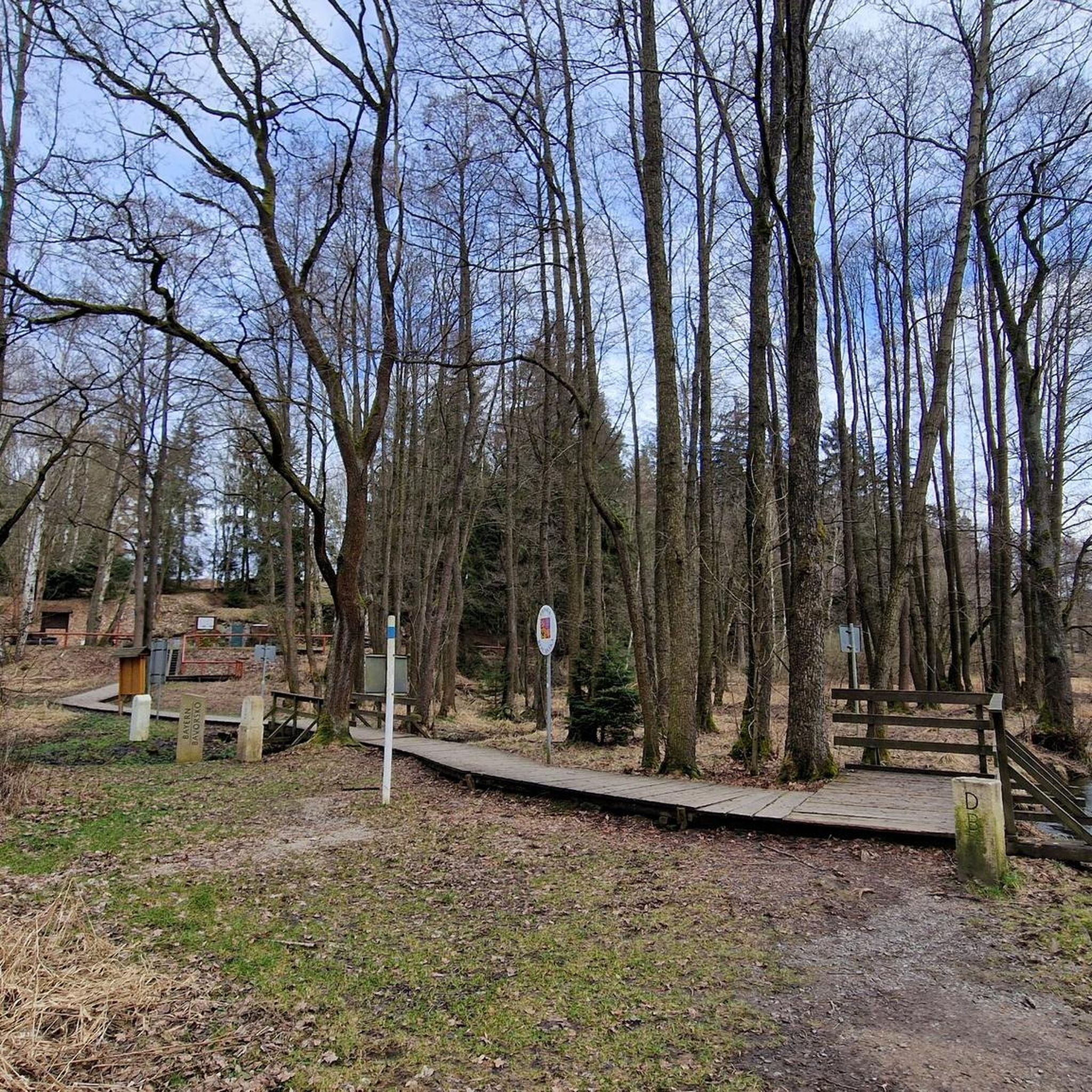
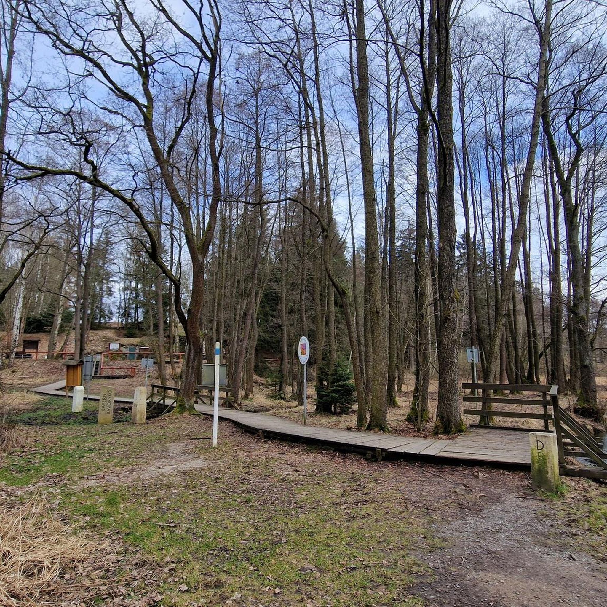
A historical border post of the GDR and a still-used Bavarian border post frame a monument to the reunification of Germany
0
0

👌Very nice resting place and 🌧️shelter👍for enough 🍺🥂🥛is usually provided😀
0
0

Really good junction for hiking, in winter also connection to the cross-country ski trail (Attention: Very high difficulty level!) However, the signage is not so good. So it's better to check the map one more time 😁
0
0

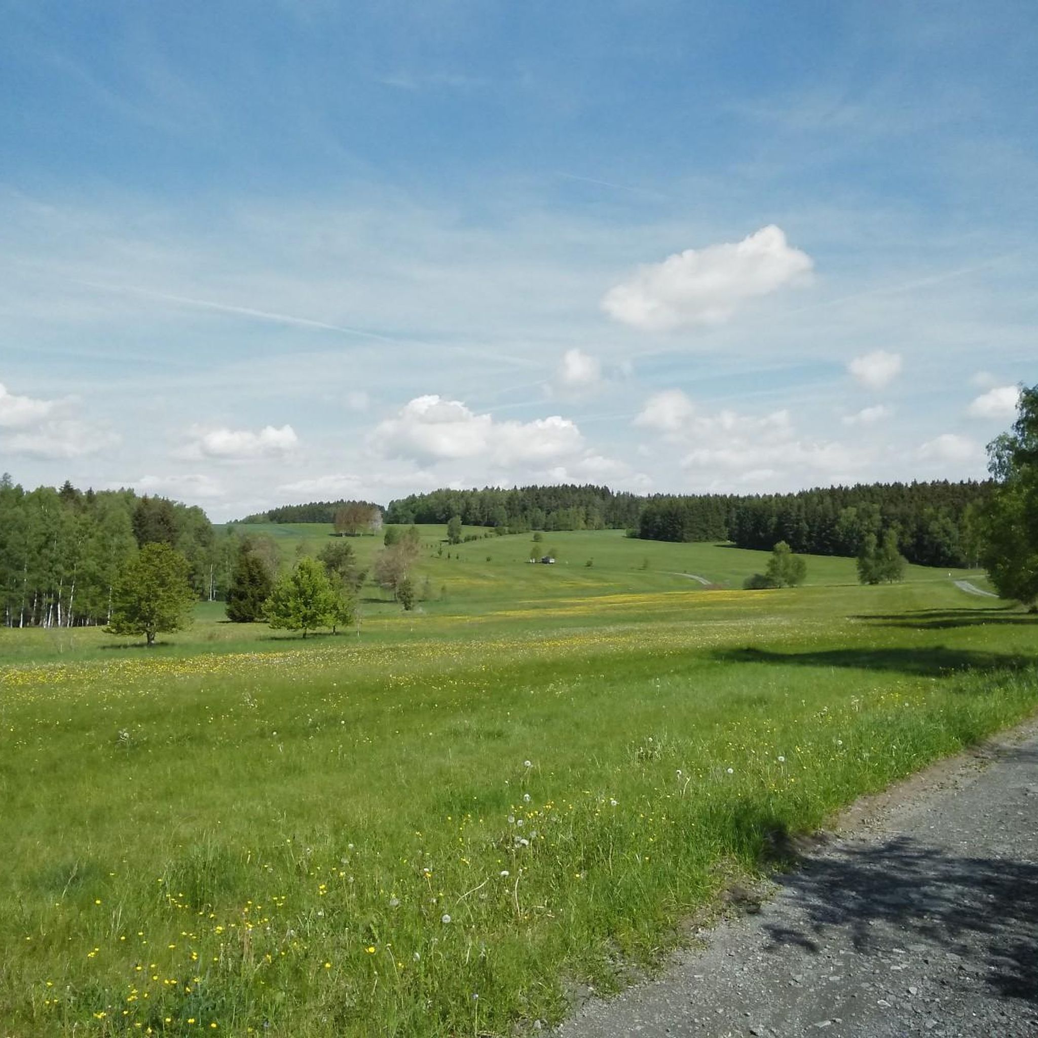
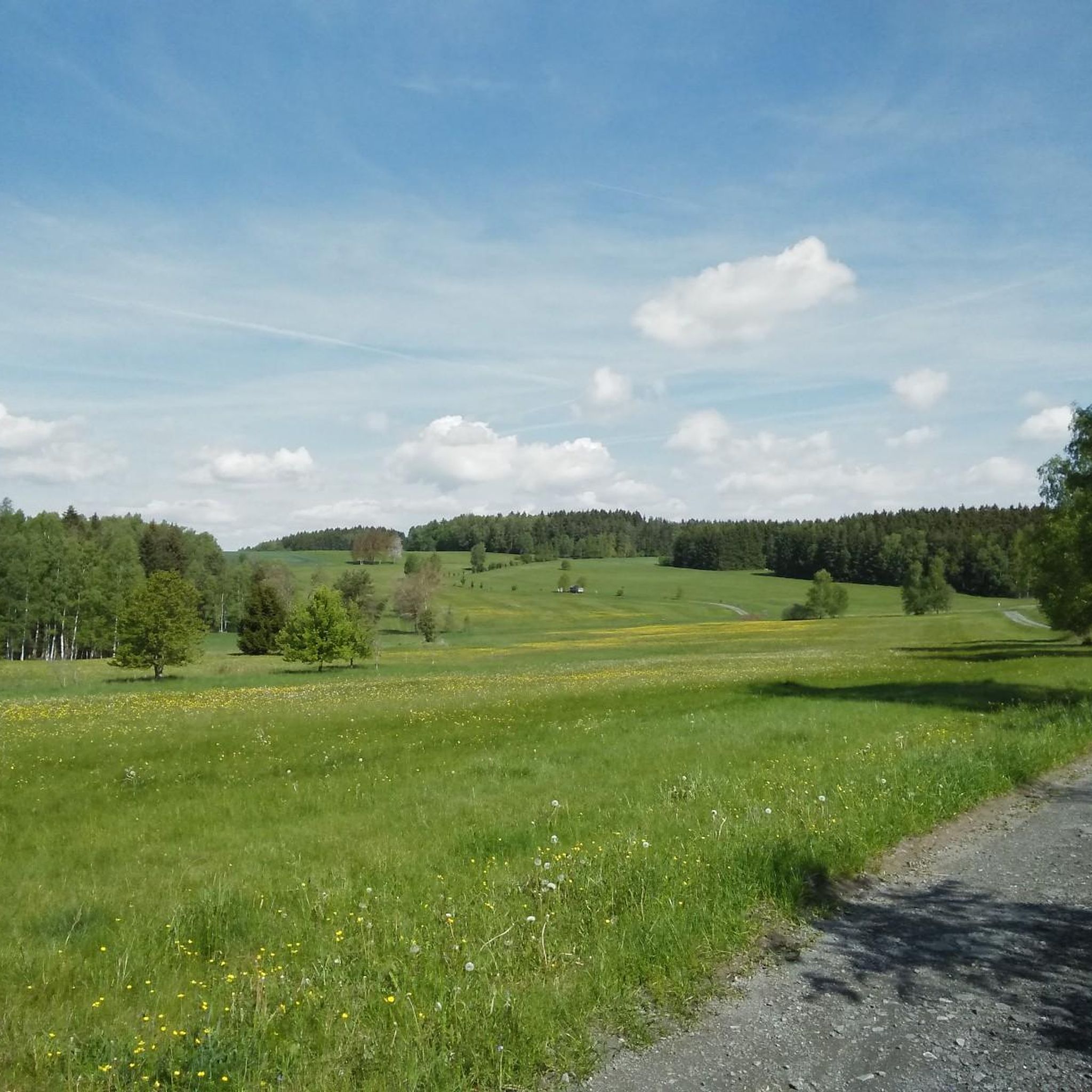
Moderate climb, tarmac bumpy
0
0

The single-nave church in Rossbach, perched on a rock, rests on a chapel of Saint Martin. In the 14th century, there was a wooden chapel here, which was burned down by the Hussites in 1430, but reconsecrated in 1432. The chapel was a branch of St. Ägidien in Regnitzlosau; the common mother parish was St. Lorenzkirche in Hof. Rossbach did not become an independent parish church until 1502. In 1719, the old church gave way to a baroque church.
17
0

Historic marketplace in Adorf
0
1
An 8-meter-high Buddha statue in the garden of the Buddhist meditation center in Adorf
0
0
Frequently Asked Questions
How many road cycling routes are available in Dreiländereck?
There are over 50 road cycling routes available in Dreiländereck, specifically within the Vogtlandkreis. These routes offer a diverse range of experiences through a beautiful natural park.
What is the overall difficulty level of road cycling routes in Dreiländereck?
The routes in Dreiländereck cater to various fitness levels. You'll find 6 easy routes, 39 moderate routes, and 14 difficult routes, ensuring options for beginners to experienced cyclists.
Are there easy road cycling routes suitable for beginners in Dreiländereck?
Yes, Dreiländereck offers 6 easy road cycling routes. These typically feature mostly well-paved surfaces and are suitable for any fitness level, allowing for a relaxed exploration of the natural park.
Can I find challenging road cycling routes with significant climbs in Dreiländereck?
Absolutely. For those seeking a challenge, Dreiländereck has 14 difficult road cycling routes. These routes often include significant elevation gains, such as the View of Erlbach – Eubabrunn Ramp loop from Hranice v Čechách, which features over 1200 meters of ascent.
What natural features and landscapes can I expect to see while road cycling in Dreiländereck?
Road cycling in Dreiländereck, particularly in the Vogtlandkreis, takes you through a beautiful natural park characterized by rolling landscapes and varied elevation. You'll enjoy scenic views, green hills, and charming cherry tree landscapes, especially along routes like the Zinnbachstraße – View of Dobeneck loop from Hranice v Čechách.
Are there any interesting landmarks or attractions along the road cycling routes in Dreiländereck?
Yes, many routes pass by historical points of interest and unique landmarks. For instance, the Sculpture Park Bad Elster – Zinnbachstraße loop from Hranice v Čechách leads directly past the Pabstleithen Historical Information Point. Other notable attractions in the region include the Tripoint Bavaria–Saxony–Czech Republic and the Dreiländereck on the German Green Belt.
What do other road cyclists say about the routes in Dreiländereck?
The road cycling routes in Dreiländereck are highly regarded by the komoot community, with an average rating of 4.6 stars from over 50 reviews. Cyclists often praise the varied terrain, well-paved surfaces, and the scenic beauty of the natural park.
Are there circular road cycling routes in Dreiländereck?
Yes, many of the road cycling routes in Dreiländereck are designed as loops, allowing you to start and end at the same point. Examples include the popular Rehau Road – Regnitzlosau Church loop from Ebmath and the Zinnbachstraße – Wiedersberg Church loop from Hranice v Čechách.
What is the best time of year for road cycling in Dreiländereck?
The spring, summer, and early autumn months generally offer the most favorable conditions for road cycling in Dreiländereck. During these seasons, you can expect pleasant temperatures and the full beauty of the natural park's rolling landscapes.
Are there options for parking at the trailheads for road cycling routes in Dreiländereck?
While specific parking information for every trailhead isn't detailed, routes often start from towns or villages like Ebmath or Hranice v Čechách, where public parking facilities are typically available. It's advisable to check local parking options for your chosen starting point.
Can I combine road cycling in Dreiländereck with exploring other tripoints?
The term 'Dreiländereck' refers to several tripoints across Europe. While this guide focuses on the Vogtlandkreis region, other notable tripoints like the one near Basel (Germany, France, Switzerland) offer extensive international cycle paths such as the 193 km 'Dreilandradweg'. For more information on the Dreilandradweg, you can visit schwarzwald-tourismus.info.
Are there any specific road cycling routes that connect different countries in the broader Dreiländereck regions?
Beyond the Vogtlandkreis, other Dreiländereck regions are known for cross-border cycling. For example, the Weinviertel Dreiländereck (Austria, Czechia, Slovakia) features a 46.81 km cycling route that follows the Czech border. The Dreiländereck near Basel also boasts the 'Dreilandradweg', an international path connecting Germany, France, and Switzerland.
Most popular routes in Dreiländereck
Most popular attractions in Dreiländereck

Get inspired with the komoot mobile app


Explore more
Browse the best Road cycling routes in other regions.
