The best running trails in Klamm Und Kastlhäng
4.7
(144)
2,940
runners
164
runs
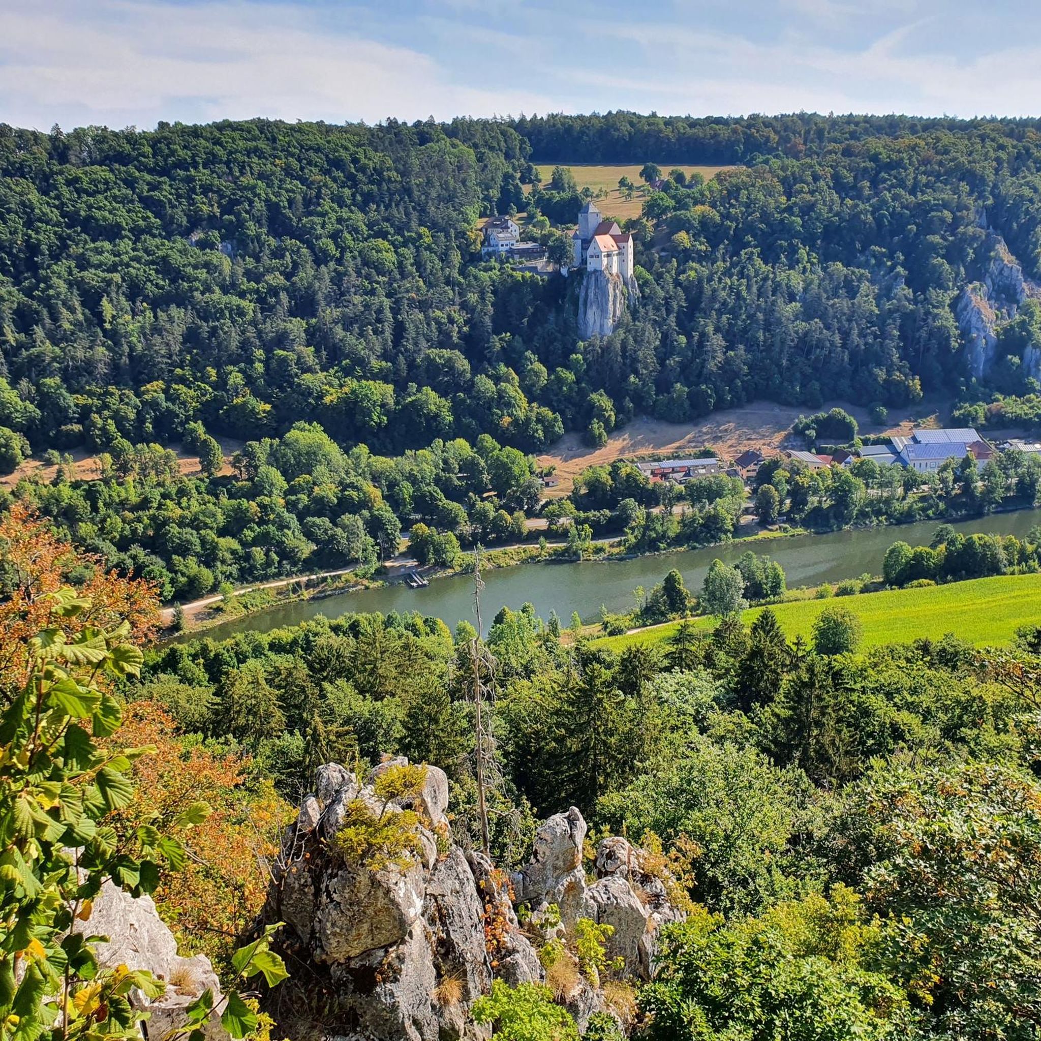
Jogging in Klamm Und Kastlhäng offers a diverse landscape for runners, characterized by its hilly terrain and scenic views, often featuring historical landmarks like castles. The region provides a mix of forest paths and open stretches, suitable for various fitness levels. Runners can find routes that navigate through woodlands and along elevated sections, providing both challenge and natural beauty.
Best jogging routes in Klamm Und Kastlhäng
- The most popular jogging route is View of Prunn Castle – View of Prunn Castle loop from Schloss Prunn, a 6.0 miles (9.6 km) trail that takes 1 hour 4 minutes to complete. This moderate route offers views of Prunn Castle and surrounding landscapes.
- Another top favourite among local runners is St. Anna Bridge – View of Riedenburg loop from Riedenburg, a difficult 10.4 miles (16.8 km) path. This route features varied terrain, including sections near St. Anna Bridge and views towards Riedenburg.
- Local runners also love the Stone Fountain in Riedenburg loop from Schloss Prunn, a 4.5 miles (7.2 km) trail leading through natural surroundings, often completed in about 47 minutes.
- Jogging in Klamm Und Kastlhäng is defined by hilly paths, forest trails, and castle views. The network offers options for easy, moderate, and difficult running, catering to different ability levels.
- The routes in Klamm Und Kastlhäng are highly rated by the komoot community with an average score of 4.8 stars from over 100 reviews. More than 2800 runners have used komoot to explore Klamm Und Kastlhäng's varied terrain.
Last updated: October 9, 2026
71
runners
Moderate run. Good fitness required. Mostly paved surfaces. Suitable for all skill levels.
5.0
(2)
7
runners
16.8km
02:03
340m
340m
Hard run. Very good fitness required. Mostly paved surfaces. Suitable for all skill levels.

5.0
(1)
10
runners
7.22km
00:47
80m
80m
Moderate run. Good fitness required. Mostly paved surfaces. Suitable for all skill levels.
8
runners
12.7km
01:30
250m
250m
Moderate run. Good fitness required. Mostly paved surfaces. Suitable for all skill levels.
12
runners
12.9km
01:32
220m
220m
Moderate run. Good fitness required. Mostly paved surfaces. Suitable for all skill levels.
Get access to more routes and recommendations from other explorers.
Already have an account?
Our route recommendations are based on thousands of hikes, rides, and runs completed by other people on komoot.
Start today with a free account
Your next adventure awaits.
Tips from the Community

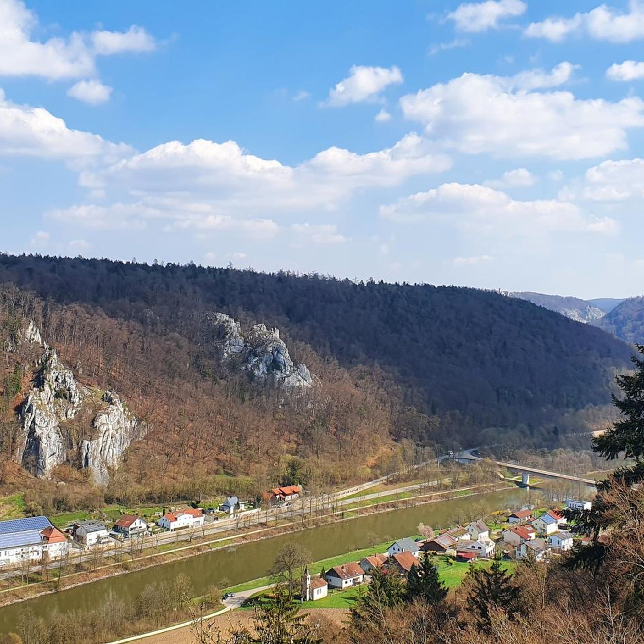
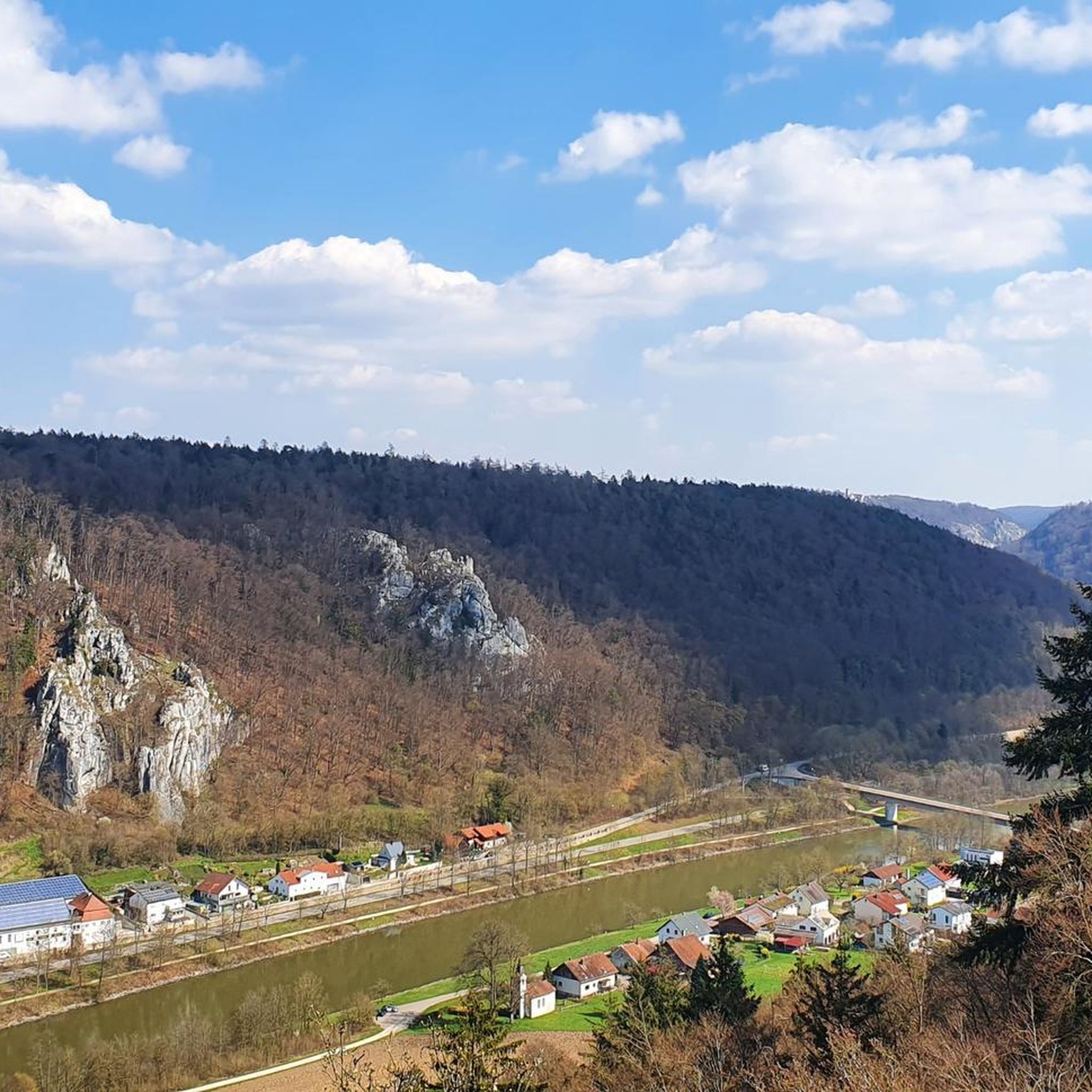
Very beautiful viewpoint high above the Main-Danube Canal.
1
0


Exciting section of the Altmühltal cycle path in the Altmühltal nature park. Here you cycle between high rock faces, juniper bushes and the Altmühl river.
0
0

Stream from the Karst Quelle near Prunn that flows via the former Altmühl into the Main Danube Canal
1
0

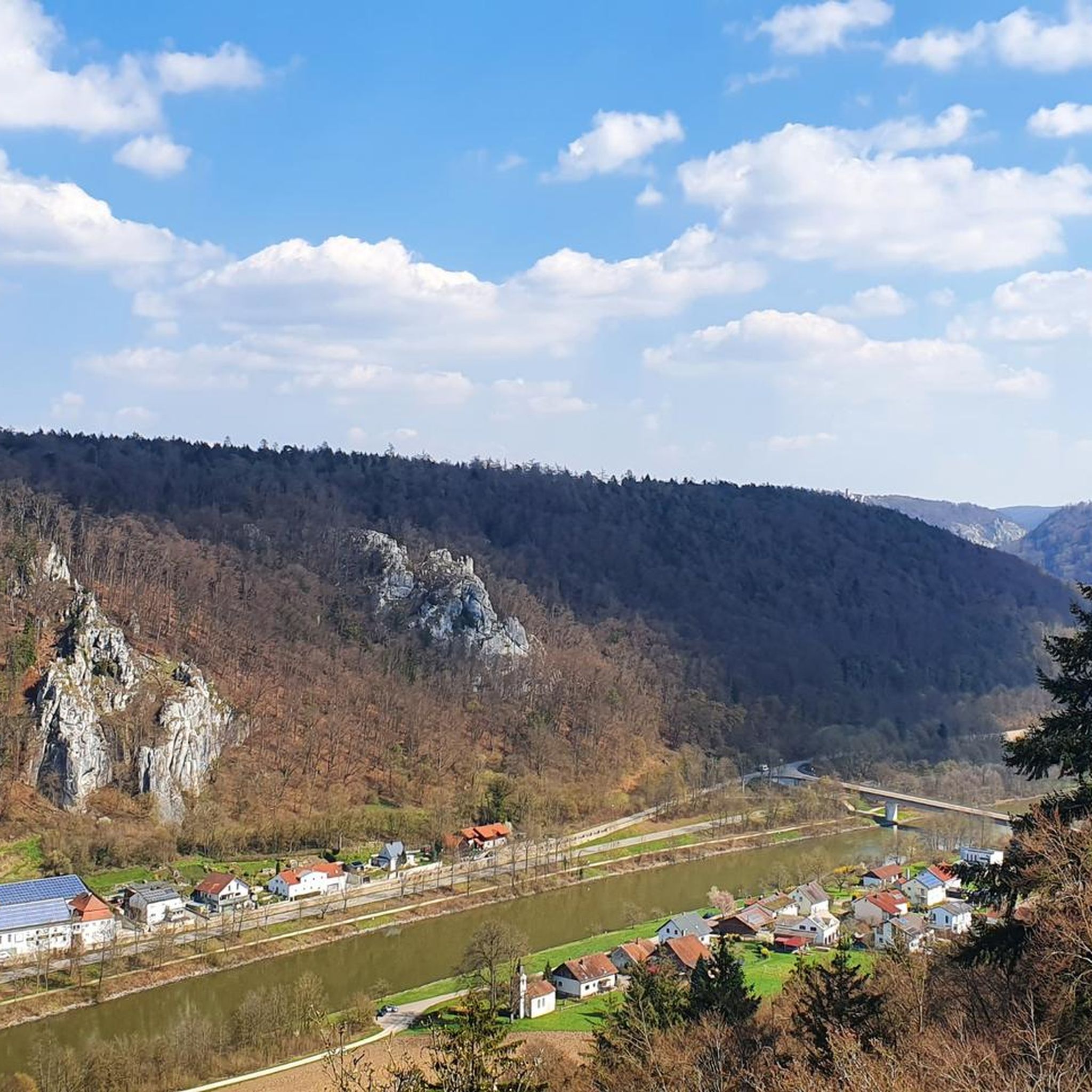
Beautiful view of Riedenburg
0
0


Truly a picturesque sight.
0
0
Frequently Asked Questions
How many running routes are available in Klamm Und Kastlhäng?
There are over 170 running routes in Klamm Und Kastlhäng, offering a wide range of options for different fitness levels and preferences.
Are there running routes for all skill levels in Klamm Und Kastlhäng?
Yes, the region offers a mix of easy, moderate, and difficult running trails. You'll find 9 easy routes, 126 moderate routes, and 35 challenging routes, ensuring options for beginners and experienced runners alike.
Can I find circular running routes in Klamm Und Kastlhäng?
Many routes in Klamm Und Kastlhäng are designed as loops. For example, the moderate Stone Fountain in Riedenburg loop from Schloss Prunn is a popular choice, covering 7.2 km.
What kind of terrain can I expect on the running trails in Klamm Und Kastlhäng?
The running trails in Klamm Und Kastlhäng are characterized by hilly paths, forest trails, and open stretches. You'll encounter varied terrain, including sections with significant elevation changes and natural surfaces.
Are there any scenic viewpoints or landmarks along the running routes?
Yes, many routes offer scenic views and pass by notable landmarks. You can enjoy views of Prunn Castle, explore the Gorge and view of Prunn Castle, or discover the Klamm Cave near Einthal. The View of Prunn Castle – View of Prunn Castle loop from Schloss Prunn is particularly known for its castle vistas.
What do other runners enjoy most about the trails in Klamm Und Kastlhäng?
The running trails in Klamm Und Kastlhäng are highly rated by the komoot community, with an average score of 4.8 stars from over 100 reviews. Runners often praise the diverse landscapes, the challenging hilly sections, and the beautiful views, especially those featuring Prunn Castle.
Are there any particularly challenging running routes for experienced runners?
For experienced runners seeking a challenge, the region offers several difficult routes. The St. Anna Bridge – View of Riedenburg loop from Riedenburg is a difficult 16.8 km path with significant elevation changes, providing a demanding workout.
Are there any routes that are less crowded for a more peaceful run?
While specific crowd levels can vary, exploring some of the less-trafficked forest paths or routes slightly off the main castle viewpoints might offer a more serene experience. Consider routes that venture deeper into the natural reserves for quieter stretches.
What are the typical distances of running trails in Klamm Und Kastlhäng?
Running trails in Klamm Und Kastlhäng vary widely in distance. You can find shorter routes around 5-7 km, such as the 5.6 km View of Prunn Castle – Prunn Castle loop from Schloss Prunn, up to longer, more challenging runs like the 16.8 km St. Anna Bridge – View of Riedenburg loop from Riedenburg.
Are there any natural monuments to see while running?
Yes, the area is rich in natural monuments. You can encounter the Stone Steps through the Klamm and Kastlhäng Nature Reserve or the Steep Stone Steps in the Klamm (Naturpark Altmühltal), which are highlights in themselves.
What is the best time of year for running in Klamm Und Kastlhäng?
The region's diverse landscape makes it suitable for running in various seasons. Spring and autumn offer pleasant temperatures and vibrant scenery, while summer provides longer daylight hours. Winter running is also possible, though conditions on hilly and forest paths may require appropriate gear.
Are there any running routes that pass by gorges or canyons?
Yes, the region is known for its gorges. The Gorge and view of Prunn Castle is a prominent feature, and some trails, like the Klamm and Prunn Castle circular hiking trail from Riedenburg, traverse these dramatic natural formations.
Most popular routes in Klamm Und Kastlhäng
Most popular attractions in Klamm Und Kastlhäng

Get inspired with the komoot mobile app


Explore more
Browse the best Running Trails & Routes in other regions.
