The best cycling routes in Fóti-Somlyó Természetvédelmi Terület
4.4
(228)
2,359
riders
64
rides
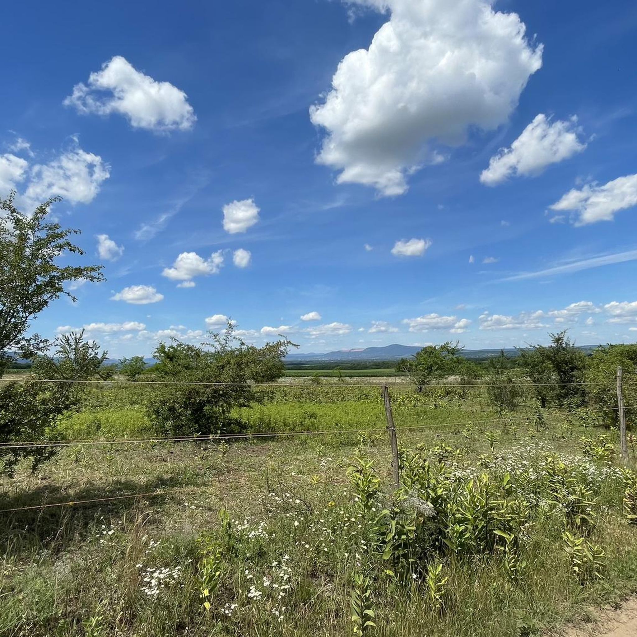
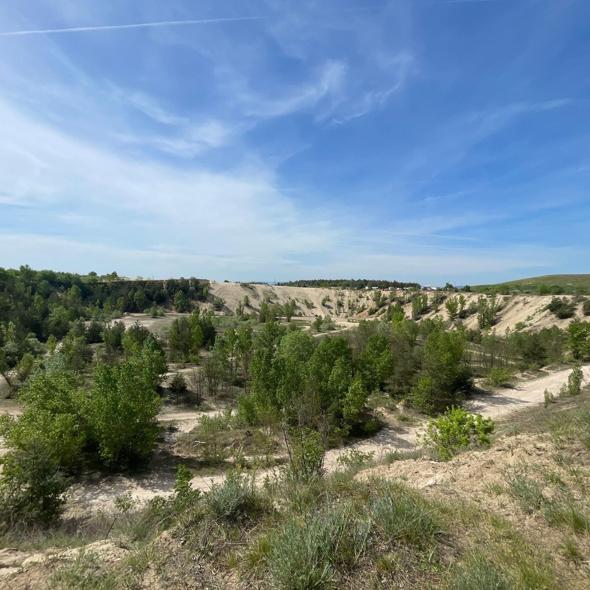
Touring cycling in Fóti-Somlyó Természetvédelmi Terület offers routes through a region characterized by diverse geological formations, including loess, sandy sediments, and limestone. Despite a modest elevation, the area provides a varied landscape with a mountain-like impression. From its higher points, panoramic views extend across the Buda Hills, Pilis Mountains, and the Danube Bend. The region is known for its rich biodiversity and serves as a protected natural area.
Best touring cycling routes in Fóti-Somlyó Természetvédelmi Terület
- The most popular touring…
Last updated: May 25, 2026
7
riders
27.3km
01:38
170m
170m
Moderate bike ride. Good fitness required. Mostly paved surfaces. Suitable for all skill levels.
4
riders
18.8km
01:07
100m
100m
Easy bike ride. Great for any fitness level. Mostly paved surfaces. Suitable for all skill levels.

Sign up for free
8
riders
14.9km
00:54
80m
80m
Easy bike ride. Great for any fitness level. Mostly paved surfaces. Suitable for all skill levels.
32
riders
Hard bike ride. Very good fitness required. Mostly paved surfaces. Suitable for all skill levels.
3.0
(1)
23
riders
Moderate bike ride. Good fitness required. Mostly paved surfaces. Suitable for all skill levels.
Get access to more routes and recommendations from other explorers.
Sign up for free
Already have an account?
Our route recommendations are based on thousands of hikes, rides, and runs completed by other people on komoot.
Start today with a free account
Your next adventure awaits.
Login or Signup
Tips from the Community

The Maboni Café in Dunakeszi is a charming, rather seasonal meeting point, which particularly stands out due to its location and relaxed atmosphere. It is the ideal place for a stopover if you are on the Danube Cycle Path or planning a Sunday excursion from Budapest. The atmosphere is less 'hectic city café' and more 'relaxed break by the water'.
0
0
The beach in Dunakeszi (often referred to as Dunakeszi Szabadstrand) is a popular natural beach on the Danube, about 20 kilometers north of Budapest. It is considered one of the best-developed "wild" beaches (Szabadstrand) in the Danube Bend region. The beach is about 250 meters long. The shore and the bottom of the water are gravelly to stony. It is therefore advisable to bring water shoes.
0
0
The beach of Dunakeszi (Hungarian: Dunakeszi Szabadstrand) is a real insider tip for everyone who wants to enjoy the flair of the Danube without plunging into the hustle and bustle of Budapest city center. Since Dunakeszi is located only about 15 kilometers north of Budapest, it is a popular destination for a relaxed day trip.
0
0

Fastest way to go to the Szentendre island from the city center of Szentendre.
0
0

The road from Szentendre into Budapest is very well developed and leads through dense forest, especially as you approach Budapest – highly recommended!
0
0


The path goes from one side of Danube to another. It is located along the road, so sometimes it can be a bit noisy
2
0
Frequently Asked Questions
How many touring cycling routes are available in Fóti-Somlyó Természetvédelmi Terület?
There are over 70 touring cycling routes available in Fóti-Somlyó Természetvédelmi Terület, offering a wide range of options for different skill levels and preferences. These routes are highly rated by the komoot community, with an average score of 4.4 stars.
What are the typical difficulty levels for touring cycling routes in this region?
The routes in Fóti-Somlyó Természetvédelmi Terület cater to various abilities. You'll find approximately 30 easy routes, 26 moderate routes, and 14 more challenging options. For example, the Szent István domb loop from Kurjancs is an easy path, while the Maboni Café – Danube Beach loop from Mogyoród offers a moderate challenge.
Are there any family-friendly touring cycling routes in Fóti-Somlyó Természetvédelmi Terület?
Yes, the region offers several easy routes suitable for families. These often feature gentle gradients and scenic views. The Riverside Beach on the Danube – Danube Beach loop from Fót is a good example of a shorter, easier route that leads through pleasant riverside landscapes.
What kind of natural attractions or viewpoints can I expect along the cycling routes?
Fóti-Somlyó Természetvédelmi Terület, despite its modest elevation, offers diverse landscapes and impressive panoramic views. From higher points, you can often see the Buda Hills, Pilis Mountains, Visegrád Mountains, and even parts of the Danube Bend. The area is also known for its rich biodiversity, including a remarkable butterfly fauna.
Is off-road touring cycling permitted in Fóti-Somlyó Természetvédelmi Terület?
The Fóti-Somlyó Természetvédelmi Terület is a protected natural area with a sensitive ecosystem. Nature conservationists actively work to prevent damage to the hillside caused by off-road vehicles, including terrain motorcycles and mountain bikes. While road cycling in the vicinity might be possible, off-road touring cycling within the protected area is generally discouraged to preserve its unique natural heritage.
What is the best time of year to go touring cycling in this region?
While specific seasonal recommendations for cycling are not detailed, the Fóti-Somlyó Természetvédelmi Terület is known for its exceptional butterfly fauna, particularly in warmer months. Spring and early autumn typically offer pleasant weather conditions for cycling, allowing you to enjoy the natural beauty without extreme heat or cold.
Are there any circular touring cycling routes available?
Yes, many of the touring cycling routes in the region are designed as loops, allowing you to start and end at the same point. Examples include the Maboni Café – Danube Beach loop from Mogyoród and the Szent István domb loop from Kurjancs, providing convenient options for your ride.
Where can I park my car when visiting Fóti-Somlyó Természetvédelmi Terület for cycling?
While specific parking areas for cyclists are not detailed in the guide, visitors often find parking in the vicinity of the Fáy Wine Press House (Fáy Présház), which serves as a starting point for the educational trail and is a known local landmark. It's advisable to check local regulations upon arrival.
Are there any cafes or restaurants near the touring cycling routes?
Yes, the Fáy Wine Press House (Fáy Présház), a historically significant building, operates as a restaurant today and is located near the educational trail. The nearby town of Fót also offers various dining options. The Maboni Café – Danube Beach loop from Mogyoród route even includes a café in its name, suggesting convenient stops along the way.
What kind of wildlife might I encounter while cycling in Fóti-Somlyó Természetvédelmi Terület?
The Fóti-Somlyó Természetvédelmi Terület is a haven for biodiversity. It's particularly famous for its hundreds of butterfly species, including the highly protected Fóti Blue butterfly. You might also spot various lizard species, including the critically endangered Hungarian lizard, and a rich birdlife featuring nearly all woodpecker species and bee-eaters. Mammals like the forest dormouse have also been identified.
Can I reach the touring cycling routes using public transport?
The Fóti-Somlyó Természetvédelmi Terület is located on the edge of the Gödöllő Hills near Budapest, making it accessible by public transport from the capital. While specific bus or train connections directly to trailheads are not detailed, Fót is a town with public transport links, from which you can access the protected area.
Are there any longer, more challenging touring cycling routes in the area?
For those seeking a greater challenge, routes like the New Bike Path Along the Danube – Bike Path to Szentendre loop from Mogyoród offer a difficult rating, covering a significant distance of over 80 km with substantial elevation changes. This route provides an extensive exploration of the wider region.
Most popular routes in Fóti-Somlyó Természetvédelmi Terület

Get inspired with the komoot mobile app


Explore more
Browse the best Cycling routes in other regions.
