The best walks and hikes in Panemunių Regioninis Parkas
4.7
(4)
38
hikers
6
hikes
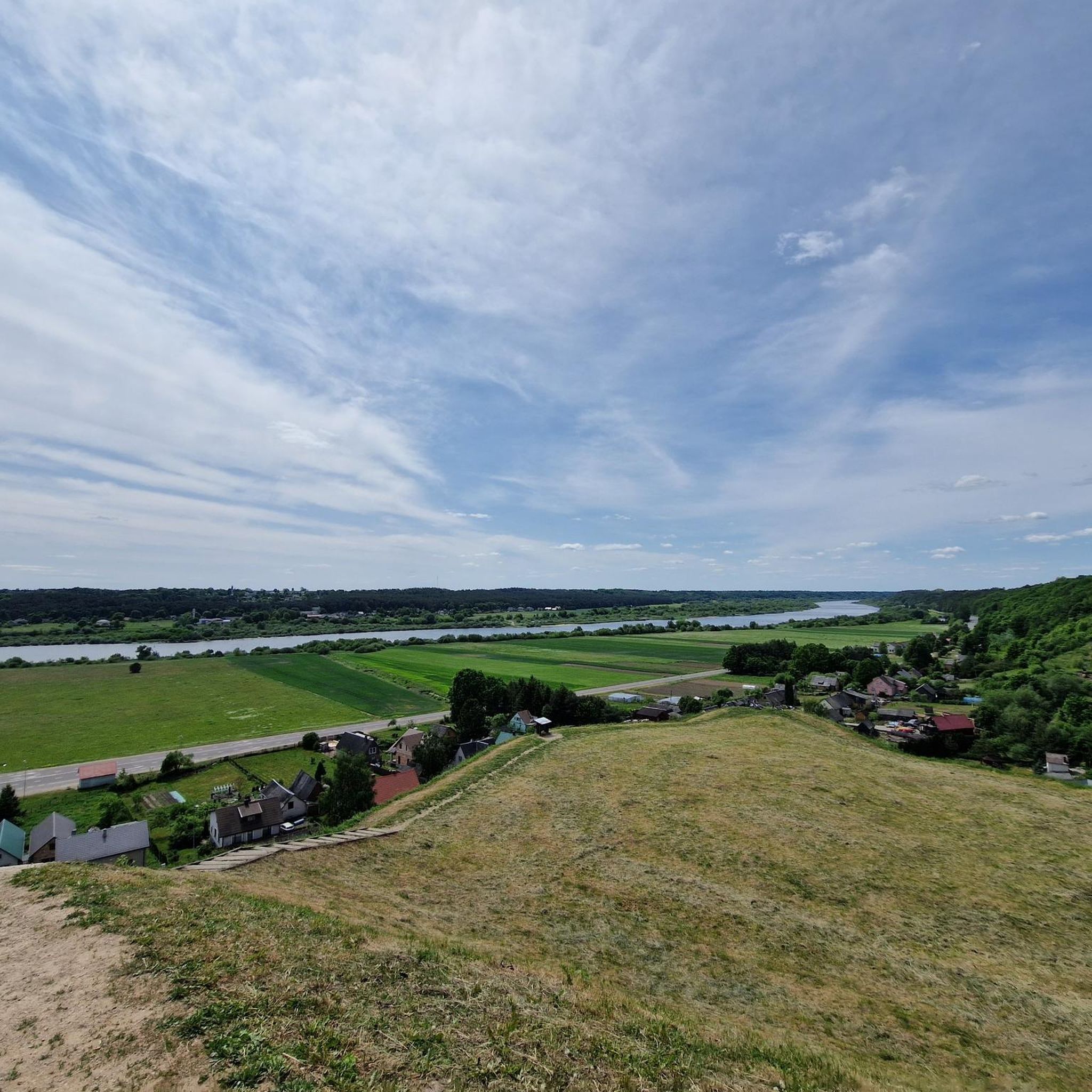
Hiking in Panemunių Regioninis Parkas offers routes through the picturesque Nemunas River valley, characterized by wide spaces and steep erosional slopes. The park's terrain includes deep valleys formed by small streams and narrow forest strips, particularly on slopes and along the river. This diverse landscape provides varied hiking experiences, from riverbank paths to trails exploring historical defensive mounds. The region also features fragments of Lithuania's 13th-15th century defensive line, including castles and manors.
Best hiking trails in Panemunių Regioninis Parkas
…Last updated: May 14, 2026
5.0
(2)
27
hikers
3.82km
01:02
50m
50m
Easy hike. Great for any fitness level. Easily-accessible paths. Suitable for all skill levels.
3.49km
00:57
50m
50m
Easy hike. Great for any fitness level. Easily-accessible paths. Suitable for all skill levels.

Sign up for free
5
hikers
11.7km
02:59
40m
40m
Moderate hike. Good fitness required. Easily-accessible paths. Suitable for all skill levels.
2
hikers
29.1km
07:27
110m
110m
Hard hike. Very good fitness required. Easily-accessible paths. Suitable for all skill levels.
4.0
(1)
1
hikers
21.4km
05:35
150m
140m
Hard hike. Very good fitness required. Easily-accessible paths. Suitable for all skill levels.
Our route recommendations are based on thousands of hikes, rides, and runs completed by other people on komoot.
Start today with a free account
Your next adventure awaits.
Login or Signup
Popular around Panemunių Regioninis Parkas
Tips from the Community

The Nemunas is the longest river in Lithuania . Its total length is 937 km, 359 km of which flows within Lithuania. The remaining part flows through Belarus (462 km) and borders Lithuania's border with Belarus (17.3 km) and the Russian Kaliningrad Oblast (98.7 km). The Nemunas basin area is 98,200 km², of which 46,600 km² are in Lithuania covering 72% of Lithuania's territory.
0
0
In the second half of the 19th century, Vilkija was home to the Litvak Karnowskis family – the future adoptive parents of jazz legend Louis Armstrong. At the end of the century, the Karnovskis left for the United States and settled in New York. When the family moved to New Orleans in the early 20th century, a fateful meeting with little Louis took place. An event square was opened in Vilkija in 2021 to commemorate jazz legend Louis Armstrong and his adoptive parents, the Karnowskis. The square is equipped with music players playing 13 of his most popular songs.
0
0
Florian (Latin: Florianus; AD 250 – c. 304) was a Christian holy man and the patron saint of chimney sweeps, soapmakers, and firefighters. His feast day is 4 May. Florian is also the patron saint of Poland; the city of Linz, Austria; and Upper Austria, jointly with Leopold III, Margrave of Austria. Florian was adopted as patron saint of Poland in 1184, when Pope Lucius III consented to the request of Prince Casimir II to send relics of Florian to that country. Kraków thus claims some of his relics. Thus Florian also became important to Lithuania, ever since the Krewo Agreement of 1385 (Polish–Lithuanian union) and the subsequent marriage of Queen Jadwiga of Poland to Grand Duke Jogaila of Lithuania. Jogaila was a lifelong pagan and vowed to adopt Catholicism upon marriage by signing the Union of Krewo on 14 August 1385. The Act imposed Christianity in Lithuania and transformed Poland into a diarchy, a kingdom ruled over by two sovereigns; their descendants and successive monarchs held the titles of king and grand duke respectively.
0
0
It seems that the ferry crosses as soon as people/cars arrive, from May to October.
0
0

TURN LEFT AFTER CHURCH AND HAVE GREAT VIEWS AND CALM ROADS BY THE RIVER :)
1
0

The wooden church was built in 1923. In 2012 May 9 the church was destroyed by fire In 2015 September the newly built church was consecrated. A heart-shaped stone found under the foundations of the burned-out old church was transformed into a stylized stone bowl, which was placed in the revived sanctuary (right side) and used for baptism.
2
0
A poplar tree growing in the village of Paštuva reminds of the difficult times of serfdom. Ignas Karpis, the owner of the Paštuva manor who lived in 18th-19th centuries, fell in love with his serf Marta. After he went abroad, on the eve of his return, the landlord's sister Jadvyga ordered several serfs to be whipped, including her brother's lover, "to save the family's honor". When Karpis returned, he did not find his beloved alive and ordered to plant the whips used to beat the serfs - one took root and a poplar tree grew. Landlord Karpis was the first to abolish serfdom in his estates in Lithuania and freed 700 serfs. in 2011 the poplar was damaged by lightning.
1
0
Frequently Asked Questions
What kind of terrain can I expect on hikes in Panemunių Regioninis Parkas?
Hikes in Panemunių Regioninis Parkas primarily feature the picturesque Nemunas River valley, characterized by wide spaces and steep erosional slopes. You'll encounter deep valleys formed by small streams and narrow forest strips, especially on slopes and along the river. This diverse landscape offers varied experiences, from riverbank paths to trails exploring historical defensive mounds.
Are there hiking options for beginners or families in Panemunių Regioninis Parkas?
Yes, Panemunių Regioninis Parkas offers several easy routes suitable for beginners and families. For instance, the Hiking loop from Plokščiai is a 3.8 km trail that provides views of the Nemunas River valley. Another easy option is the Palemono Hill – Three Pines Rest Area loop from Belvederio dvaras, which is 3.3 km and explores historical sites and river views.
What historical sites or landmarks can I see while hiking in the park?
The park is rich in historical and cultural attractions. You can explore valuable fragments of Lithuania's 13th to 15th-century defensive line. Notable sites include Raudonė Castle, Panemunė Castle, and Veliuona Manor. The Šilinė Tavern Visitor Center also serves as a good starting point and offers exhibitions on the area's nature and culture.
Are dogs allowed on the trails in Panemunių Regioninis Parkas?
While specific regulations for dogs on trails are not detailed, regional parks in Lithuania generally welcome dogs on leash. It's always recommended to keep your dog under control to protect wildlife and ensure a pleasant experience for all hikers. Please clean up after your pet.
Are there circular hiking routes available in the park?
Yes, Panemunių Regioninis Parkas features several circular hiking routes. Examples include the Hiking loop from Plokščiai and the Hiking loop from Lekėčiai, which leads through forest patches and river valley terrain.
Where can I find information or facilities before starting a hike?
The Šilinė Tavern Visitor Center is an excellent resource. It houses exhibitions on the area's nature and culture and serves as a good starting point for hikes and bike rides, offering information and potentially facilities.
What are the more challenging hikes available in Panemunių Regioninis Parkas?
For those seeking a more challenging experience, the park offers difficult routes. An example is the longer Hiking loop from Lekėčiai, which spans 29.1 km. Another demanding option is the Paštuva St. Barbara's Church – Karpis Poplar loop from Vilkija, covering 21.2 km with significant elevation changes.
When is the best time of year to go hiking in Panemunių Regioninis Parkas?
The park's diverse landscape is enjoyable throughout the warmer months, typically from spring to autumn, when the weather is mild and the trails are clear. Spring brings blooming flora, while autumn offers vibrant fall colors. Winter hiking is possible, but conditions may vary, and some trails might be more challenging due to snow or ice.
Is there parking available for hikers in Panemunių Regioninis Parkas?
Yes, parking is generally available at popular trailheads and near key attractions within the park. The visitor center at Šilinė is a good place to start, and you'll find designated parking areas at various points along the Nemunas River valley, especially near castles and manors.
What do other hikers enjoy the most about hiking in Panemunių Regioninis Parkas?
The area is highly rated by the komoot community, with an average score of 4.7 stars. Reviewers often praise the unique blend of natural beauty, especially the dramatic Nemunas River valley views, and the rich historical tapestry provided by the defensive mounds and castles. The varied topography also offers engaging routes for all skill levels.
Are there places to eat or stay near the hiking trails?
Yes, the park and its surroundings offer options for refreshments and accommodation. The Šilinė Tavern Visitor Center might offer some amenities, and you can find local cafes, restaurants, and guesthouses in nearby urban complexes like Veliuona and Seredžius. The Šilinė Campsite also provides accommodation options.
Most popular routes in Panemunių Regioninis Parkas
Most popular attractions in Panemunių Regioninis Parkas

Get inspired with the komoot mobile app


Explore more
Browse the best Hikes in other regions.
