The 10 Most Amazing Peaks around Zerf
Mountain peaks around Zerf are characterized by rolling hills and low mountain valleys, offering numerous high points and impressive rock formations. The region provides scenic hiking opportunities through solitary forest paths, beautiful meadow paths, and meandering streams. Unique geological features, such as quartzite rock formations, contribute to the natural beauty and offer engaging elements for exploration. Zerf's landscape is ideal for those seeking natural tranquility and rewarding vistas.
Best mountain peaks around Zerf
- The most popular mountain peaks is Maunert…
Last updated: November 1, 2026
Adelsfelsen
Highlight • Natural Monument
Translated by Google •
Tip by

Maunert Summit Cross (416 m)
Highlight • Summit
Translated by Google •
Tip by

Sign up now to discover places like this
Get recommendations on the best single tracks, peaks, & plenty of other exciting outdoor places.
Bockstein Summit
Highlight • Summit
Translated by Google •
Tip by

Schimmelkopf (Highest Point in Saarland)
Highlight • Summit
Above:
komoot.de/highlight/212463
Bottom:
komoot.de/highlight/212460
Translated by Google •
Tip by

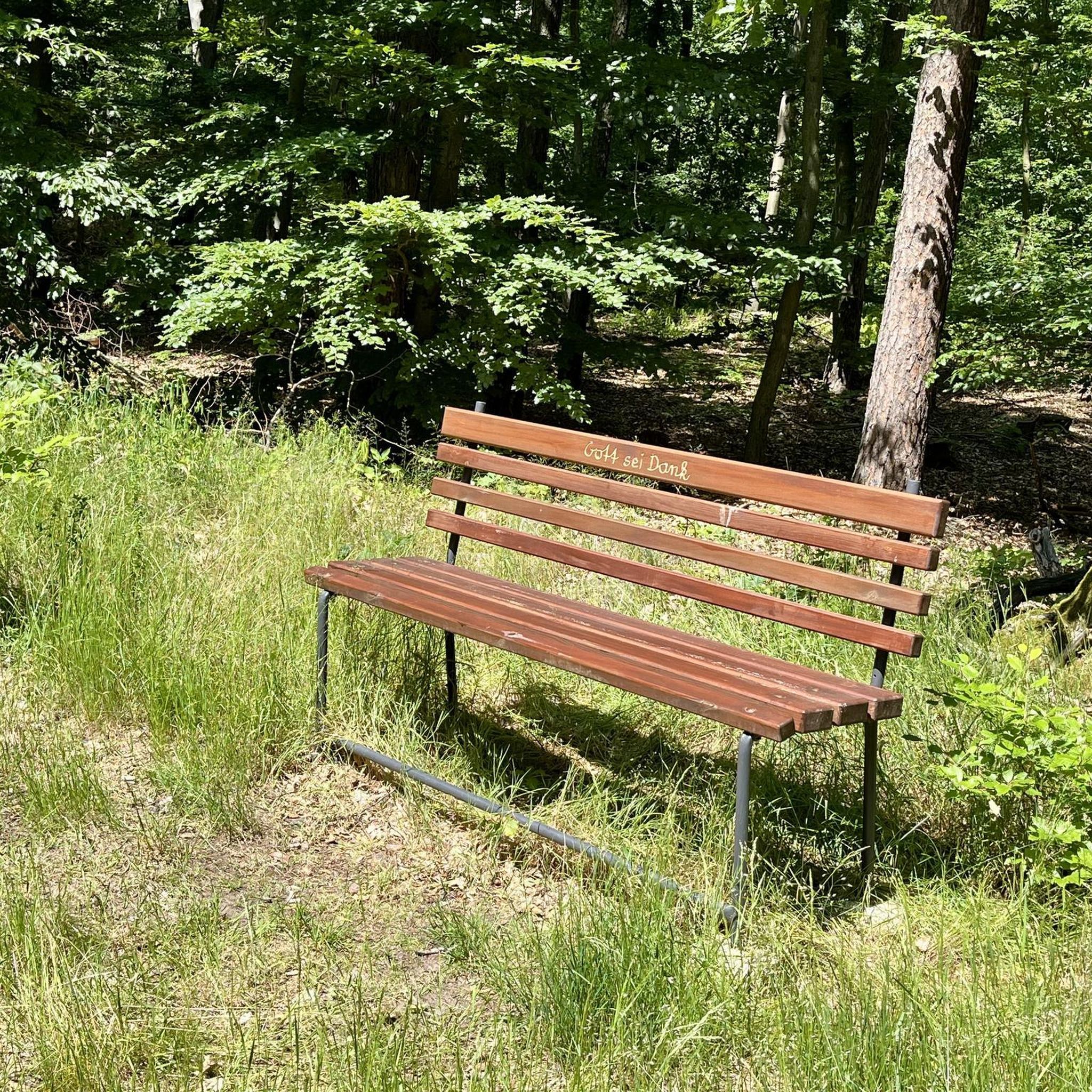
Highest point of the Felsenweg (569 m)
Highlight • Summit
Translated by Google •
Tip by

Sign up for free to discover even more peaks around Zerf.
Already have an account?
Start today with a free account
Your next adventure awaits.
Tips from the Community

The route is 13.5 km long and runs through hilly terrain with several challenging climbs (highest point 569 m), as well as smaller climbing sections, and is therefore classified as moderately difficult. Allow 5 to 6 hours with breaks.
2
0
The Adelsfelsen are a highlight of the dream loop Felsenweg in the Saar-Hunsrück-Steig near Losheim-Waldhölzbach. They offer an impressive quartzite rock formation, which is often used as a climbing passage with rope support. The 13.7 km long, moderately difficult loop leads through the picturesque Wölzbachtal, offers spectacular views, Kneipp facilities, and a “Roman castle“.
1
0

Is very easy to walk, ropes are also available if necessary.
0
0

A long way to get there. From then on the tour was pretty easy to walk.
1
0
Sturdy shoes recommended for the stony descent!
0
0

Very nice hiking trail, highly recommended.
0
0

An experience even in fog. You are completely with yourself and
1
0
Frequently Asked Questions
What are some notable high points or "peaks" to explore around Zerf?
While Zerf is known for rolling hills rather than towering peaks, you can explore several impressive high points and rock formations. The Maunert Summit Cross (416 m) offers fantastic distant views, and the Schimmelkopf is recognized as the highest point in Saarland. Other significant spots include the Bockstein Summit and the Adelsfelsen.
What kind of unique rock formations can I expect to see on hikes near Zerf?
The Zerf region is home to several striking quartzite rock formations that add a unique geological element to your hikes. Notable examples include the Adelsfelsen, which features bizarre formations along wonderful forest trails. Other impressive formations mentioned in the region are Hohe Fels, Iltisfels, Teufelsfels, and Eulenfels, often found along narrow trails through the Black Forest highlands.
Which mountain peaks offer the best panoramic views in the Zerf region?
For impressive panoramic views, the Maunert Summit Cross (416 m) is highly recommended. From here, you can enjoy fantastic distant views towards Serrig and across the Saar valley. The Gipfelkopf, though not listed as a highlight, is also noted for its impressive views over the Schwarzwälder Hochwald.
Are there any challenging trails or sections when exploring the high points around Zerf?
Yes, some sections of the trails leading to Zerf's high points and rock formations can be challenging. For instance, the path to the Maunert Summit Cross involves a ridge path over stones that can feel like a climbing part, though it's manageable for sure-footed individuals. The descent from the Adelsfelsen is also described as somewhat arduous but is secured with ropes. Sure-footedness and good hiking shoes are often recommended.
Are there family-friendly options for exploring the high points around Zerf?
Many trails around Zerf are suitable for families, especially those with sure-footed children. While some sections, like the path to the Maunert Summit Cross, can be challenging, they are generally considered easy to walk for children who are accustomed to hiking. The region's natural beauty and diverse trails offer engaging experiences for all ages, but always check specific route details for suitability.
What makes the <a href="https://www.komoot.com/highlight/695053" target="_blank" rel="noopener">Maunert Summit Cross (416 m)</a> a popular destination?
The Maunert Summit Cross (416 m) is popular for its fantastic distant views towards Serrig and across the Saar valley. The summit area provides benches and rest areas, making it an ideal spot for a break. The path leading to it, a ridge path over stones, is considered an absolute highlight by many visitors, offering a rewarding hiking experience.
Where is the highest point in Saarland located, and what can I expect there?
The highest point in Saarland is the Schimmelkopf. Visitors can expect to find hidden trails that are sometimes a bit tricky to navigate, offering a more adventurous hiking experience. It's a must-see spot for those looking to explore the region's highest elevations.
What kind of trails lead to the <a href="https://www.komoot.com/highlight/579911" target="_blank" rel="noopener">Bockstein Summit</a>?
Beautiful trails lead up to the Bockstein Summit, with many considering this section to be among the most scenic parts of the Saar-Riesling-Steige. From the top, you are rewarded with a beautiful view and excellent photo opportunities. Due to some sections, sure-footedness and sturdy shoes are recommended.
What outdoor activities can I do near the mountain peaks around Zerf?
Beyond exploring the peaks and rock formations, the Zerf region offers a variety of outdoor activities. You can find numerous running trails, such as the 'Ruwer-Steg Bridge – Heckelsbuschfelsen loop from Hentern', or enjoy road cycling routes like the 'Losheim Reservoir – Losheim am See Reservoir loop from Bergen'. For off-road adventures, there are gravel biking options, including the 'Hill and reservoir Tour'. You can find more details on these activities in the Running Trails around Zerf, Road Cycling Routes around Zerf, and Gravel biking around Zerf guides.
When is the best time of year to visit the mountain peaks around Zerf?
The Zerf region is beautiful year-round, but the best time for hiking and exploring the mountain peaks is typically from spring through autumn. During these seasons, the weather is generally mild, and the trails are clear, allowing you to fully appreciate the natural beauty, solitary forest paths, and meandering streams. Winter can also be an option for those prepared for colder conditions and potentially snowy or icy trails.
What should I wear for hiking the mountain peaks and rock formations in Zerf?
Given the varied terrain, including some challenging rock paths and steep descents, it's essential to wear appropriate gear. Good hiking shoes that provide ankle support and grip are crucial for sure-footedness. Layered clothing is advisable to adapt to changing weather conditions, and bringing water and snacks is always a good idea for longer excursions.
Are there any hidden gem mountain peaks or viewpoints in the Zerf area?
While the main highlights are well-known, the region's charm lies in its tranquil, less-traveled paths. The Adelsfelsen, with its bizarre rock formations and sensory benches, offers a unique and somewhat secluded experience. Exploring the numerous forest paths can also lead you to quiet viewpoints and natural spots away from the main routes.
Most popular routes around Zerf
Most popular attractions around Zerf

Get inspired with the komoot mobile app


Explore more
See even more amazing summits around Zerf with these guides:
