The best road cycling routes in Fjärhanabergen
4.0
(2)
42
riders
9
rides
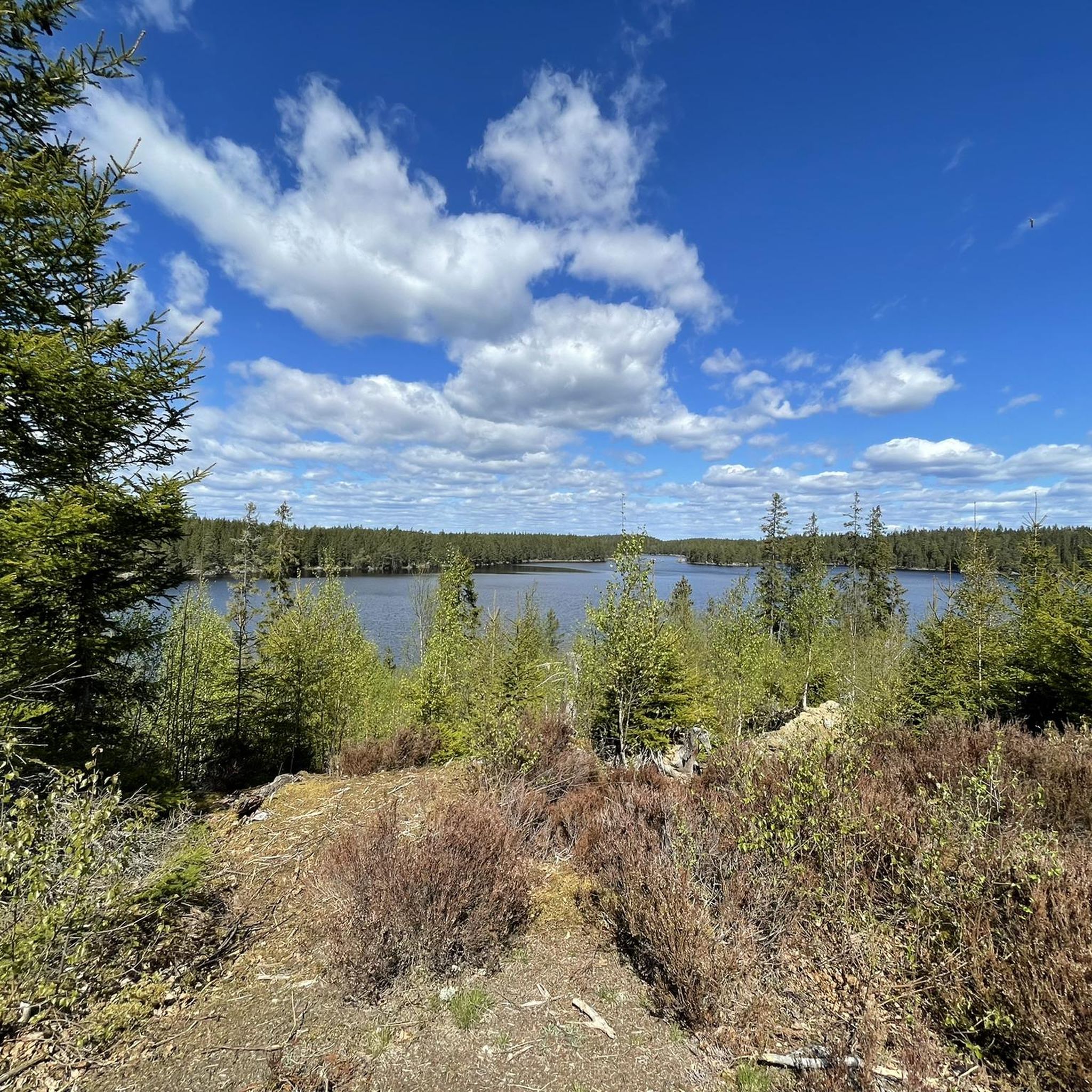
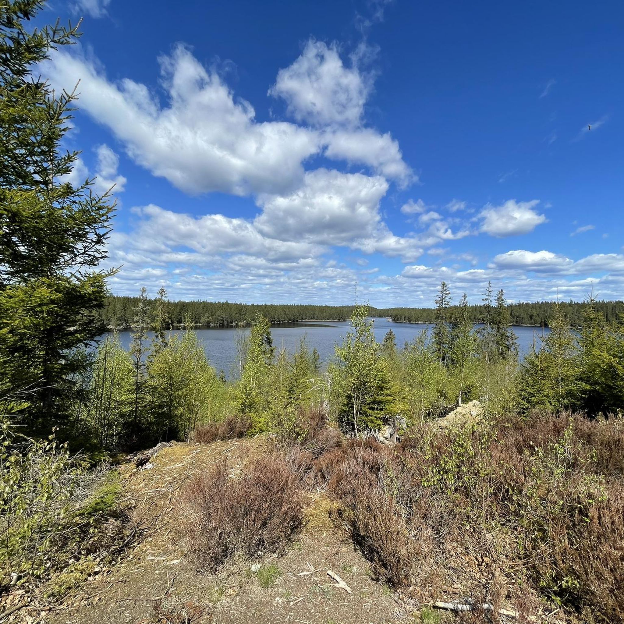
Road cycling routes in Fjärhanabergen are situated within a natural park in Örebro, Sweden. The region features a landscape characterized by lakes, rural roads, and gentle elevation changes. Cyclists can expect routes that traverse varied terrain, including areas around water bodies and through the countryside. The area also includes ancient forests and wetlands, offering a diverse natural environment.
Best road cycling routes in Fjärhanabergen
- The most popular road cycling route is Knappfors Canal Lock – Kosia Road loop from Sandviken…
Last updated: May 13, 2026
8
riders
67.8km
02:49
410m
410m
Moderate road ride. Good fitness required. Some segments of this route may be unpaved and difficult to ride.
6
riders
104km
04:22
610m
610m
Moderate road ride. Good fitness required. Some segments of this route may be unpaved and difficult to ride.

Sign up for free
3
riders
83.0km
03:40
570m
570m
Moderate road ride. Good fitness required. Some segments of this route may be unpaved and difficult to ride.
6
riders
43.0km
01:48
290m
290m
Moderate road ride. Great for any fitness level. Some segments of this route may be unpaved and difficult to ride.
4.3
(3)
4
riders
34.0km
01:26
200m
200m
Moderate road ride. Great for any fitness level. Some segments of this route may be unpaved and difficult to ride.
Get access to more routes and recommendations from other explorers.
Sign up for free
Already have an account?
Our route recommendations are based on thousands of hikes, rides, and runs completed by other people on komoot.
Start today with a free account
Your next adventure awaits.
Login or Signup
Popular around Fjärhanabergen


Tips from the Community

The Nobel Trail is a 2.3 km floodlit track in a tranquil forest environment. There is an outdoor gym here to train in the summer if you want to walk, hike and have a workout. In the winter months, when the snow has consolidated, it becomes a ski track. The lights are lit until around 11.30pm.
0
0

Knappfors canal connects Alkvettern and Lonnen lakes. The system is part of the huge waterways of the area, and it allows navigation through the two lakes ultimately ending towards lake Vänern.
0
0
In this stretch, a series of secondary roads allow you to cycle on quiet and car-free ways avoiding the main 205 road which runs parallel connecting Grythyttan and Karlskoga.
0
0
The bike path here follows along the shore of Möckeln lake. The area's flat terrain and well-maintained paths make it accessible for all riders. You can enjoy a nice landscape and experience the lake with ample opportunities for camping, swimming or relaxation.
0
0
Small and quiet road connecting Granbergsdal to the main Noravägen road. Enjoy the ride through nature and don't miss the little villages along the way.
0
0
Svartälven river, winding through Värmland, offers scenic cycling routes. The bridge on the bike path entering Karlskoga provides a key crossing, with views of the river's calm flow. It's a perfect spot for a break, enjoying the tranquil landscape.
0
0

This little village is one of the gastronomic centers of Sweden, so there are many places to enjoy delicious food or traditional swedish "fika".
1
0
Frequently Asked Questions
What kind of terrain can I expect on road cycling routes in Fjärhanabergen?
Fjärhanabergen, located within a natural park in Örebro, Sweden, features a landscape characterized by lakes, rural roads, and gentle elevation changes. You can expect routes that traverse varied terrain, including areas around water bodies and through the countryside.
What is the typical difficulty level for road cycling routes in Fjärhanabergen?
The road cycling network in Fjärhanabergen primarily offers moderate difficulty options. There is one easy route, and nine moderate routes, making it suitable for cyclists looking for longer rides without extreme challenges.
Are there any long-distance road cycling routes in Fjärhanabergen?
Yes, Fjärhanabergen offers several longer routes. For instance, the Grythyttan – Möckeln lake loop from Sandviken is a substantial 66.4 miles (106.9 km) trail, often completed in about 4 hours 26 minutes.
What are some of the natural features or scenic viewpoints I can enjoy while cycling in Fjärhanabergen?
Road cycling in Fjärhanabergen is defined by picturesque lake views, rural roads, and the natural park landscapes. Many routes, like the Möckeln lake – Kosia Road loop from Sandviken, offer scenic views of Möckeln lake and the surrounding countryside.
Are there circular road cycling routes available in Fjärhanabergen?
Yes, many of the routes in Fjärhanabergen are designed as loops, allowing you to start and end your ride in the same location. Examples include the Knappfors Canal Lock – Kosia Road loop from Sandviken and the Kosia Road – Möckeln lake loop from Karlskoga.
What do other road cyclists say about their experience in Fjärhanabergen?
The road cycling routes in Fjärhanabergen are highly rated by the komoot community, with an average score of 4.3 stars from over 5 reviews. Cyclists often praise the varied terrain, the beautiful lake views, and the rural roads that define the region's cycling experience.
How many road cycling routes are there in Fjärhanabergen?
There are 10 road cycling routes available in Fjärhanabergen, offering a good selection for exploring the natural park.
What is the typical elevation gain on road cycling routes in Fjärhanabergen?
The routes feature gentle elevation changes. For example, the Möckeln lake – Kosia Road loop from Sandviken, which is 83 km long, has an elevation gain of approximately 565 meters, indicating a rolling rather than mountainous profile.
Are there any routes that explore specific landmarks or areas of interest?
Yes, some routes are designed to highlight specific features. The Knappfors Canal Lock – Kosia Road loop from Sandviken, for instance, explores the area around the Knappfors Canal Lock, offering a blend of natural scenery and local points of interest.
What is the longest road cycling route available in Fjärhanabergen?
The longest road cycling route in Fjärhanabergen is the Grythyttan – Möckeln lake loop from Sandviken, which spans 66.4 miles (106.9 km).
Is Fjärhanabergen suitable for road cyclists looking for a moderate challenge?
Absolutely. The majority of routes in Fjärhanabergen are classified as moderate, providing a good balance of distance and elevation without being overly strenuous. This makes it ideal for cyclists seeking engaging, longer rides.

Get inspired with the komoot mobile app


Explore more
Browse the best Road cycling routes in other regions.
