The best MTB trails in Jærstrendene Plantefredningsområde
5.0
(1)
17
riders
5
rides
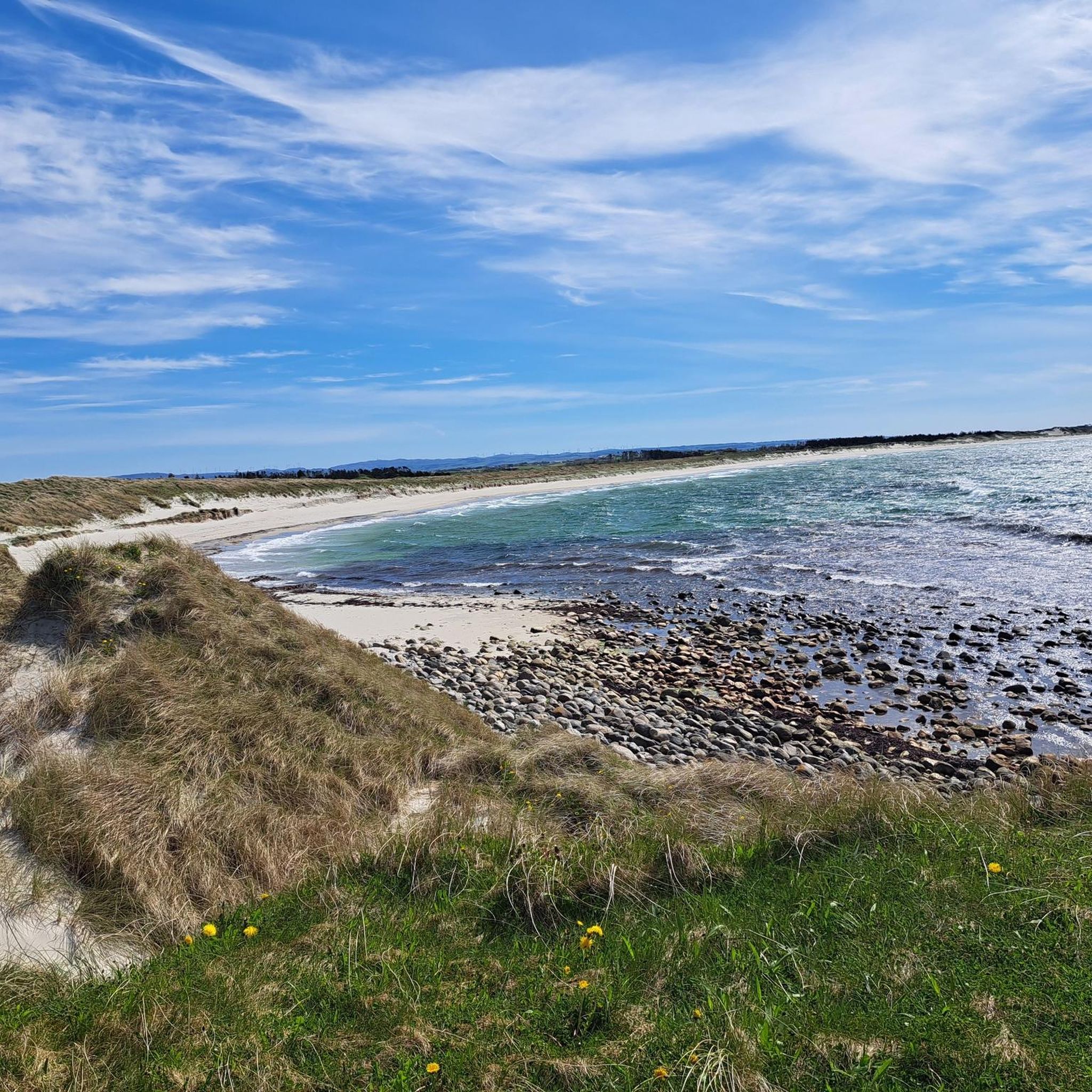
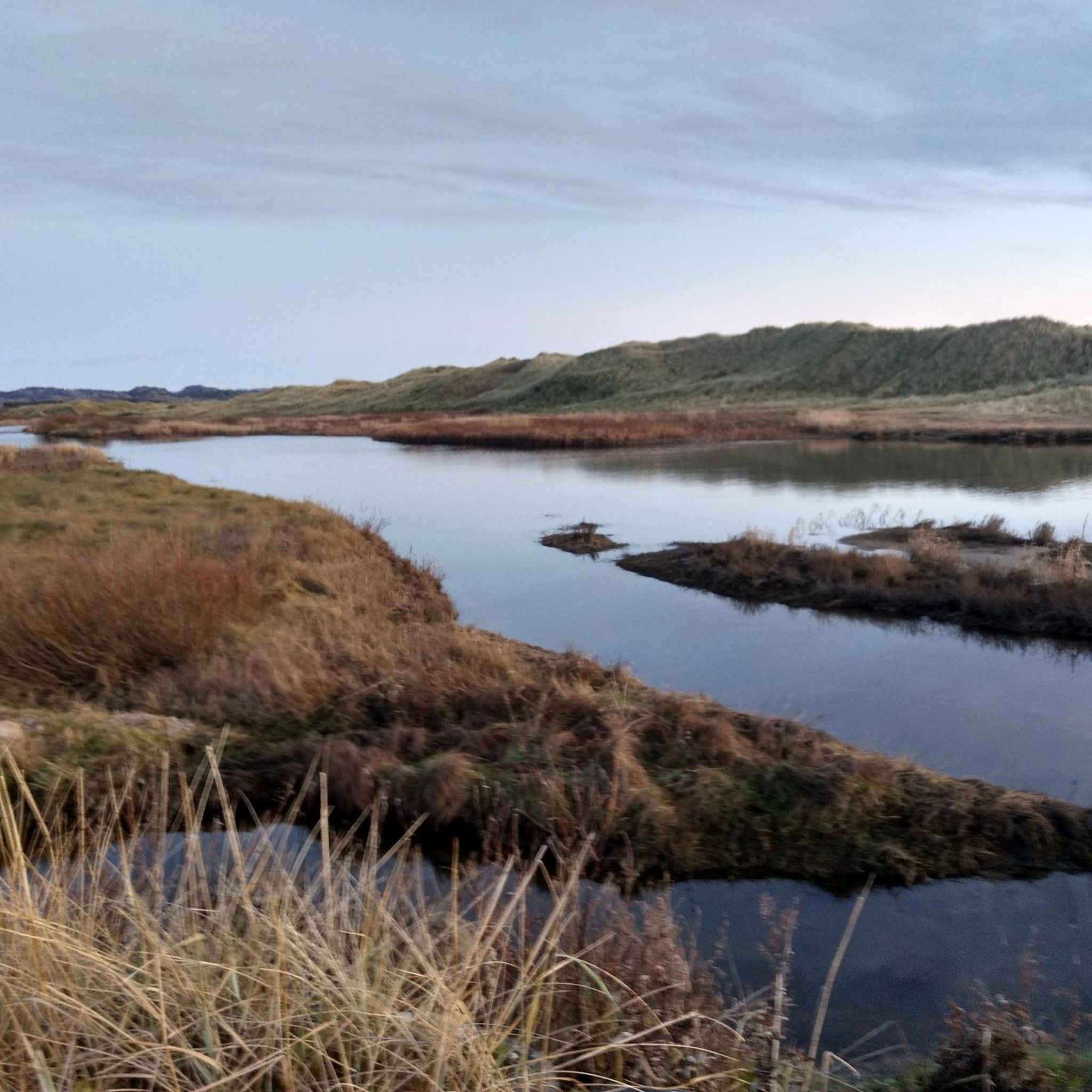
Mountain bike trails in Jærstrendene Plantefredningsområde traverse a unique coastal landscape along the Jæren coast in southwestern Norway. The area features extensive sandy beaches, dynamic sand dunes, and varied coastal formations including pebble and rocky shores. These diverse terrains offer a range of mountain biking experiences, from coastal paths to routes through cultural landscapes.
Best mountain bike trails in Jærstrendene Plantefredningsområde
- The most popular mountain bike trail is Trailhead – Ice Cream Shop loop from Sirevåg, a 28.8 miles…
Last updated: October 2, 2026
3
riders
22.0km
01:13
160m
160m
Easy mountain bike ride. Great for any fitness level. Suitable for all skill levels.
7
riders
33.6km
02:18
430m
430m
Hard mountain bike ride. Good fitness required. Advanced riding skills necessary. Some portions of the route may require you to push your bike.

5.0
(1)
5
riders
46.2km
02:58
600m
600m
Moderate mountain bike ride. Good fitness required. Suitable for all skill levels.
45.9km
02:33
290m
290m
Moderate mountain bike ride. Good fitness required. Suitable for all skill levels.
2
riders
44.7km
03:09
530m
530m
Hard mountain bike ride. Good fitness required. Advanced riding skills necessary. Some portions of the route may require you to push your bike.
Our route recommendations are based on thousands of hikes, rides, and runs completed by other people on komoot.
Start today with a free account
Your next adventure awaits.
Tips from the Community


From the bridges spanning the Figgjo River, you often have a beautiful view of the interesting river landscape. Carpets of water lilies, green reeds and many other aquatic plants provide plenty of variety.
0
0

Stokkelandsvatnet is a lake located in Ganddal, Sandnes. The loop the water shore is about 4 kilometers long on a flat, well-maintained gravel path, making it perfect for walking, running, or cycling. The area is known for its rich birdlife, often visible from the trail. It connects seamlessly to the end of Sandvedparken, allowing you to extend your route from the city center.
0
0
Planetstien turns your hike through Sandvedparken into a journey through the solar system. Stretching along the Storåna river, this 1:1 billion scale model starts with the Sun near Sandnes center and ends with Pluto towards Ganddal. It is a flat, easy gravel path suitable for cycling and walking. As you travel the green corridor, you pass sculptures representing each planet at their relative distances.
0
0

A perfect picnic spot by the lake where you can enjoy peaceful tranquility and natural beauty. The view is dominated by the calm, shimmering lake surface and framed by mature trees or gentle shoreline vegetation, creating a sheltered environment ideal for relaxation.
0
0
Ålgård is the largest town and administrative centre of Gjesdal municipality. Historically known for its wool and textile industry driven by the Figgjo River, it has evolved into a modern center that was once awarded Norway's prestigious National Prize for Architecture. Today, Ålgård is perhaps best known as the home of Kongeparken, the largest amusement park in Western Norway.
0
0
Here you will find a bench overlooking the river, ideal for a rest stop. At the edge of the terrace, you can see the fast-flowing waters of the Figgjo River, while all around, the trees are painted in the typical colors of the season; the paved path is comfortable for walking.
0
0

A very beautiful harbor with lots of flair
0
0
Frequently Asked Questions
What kind of terrain can I expect on mountain bike trails in Jærstrendene Plantefredningsområde?
The trails in Jærstrendene Plantefredningsområde offer a diverse coastal landscape. You'll encounter extensive sandy beaches, dynamic sand dunes, and varied coastal formations including pebble and rocky shores. Some routes may include unpaved segments, while others are primarily on paved surfaces, providing a mix of experiences.
Are there mountain bike trails suitable for beginners or families in Jærstrendene Plantefredningsområde?
Yes, there are several easy mountain bike trails perfect for beginners or families. For instance, the Solastranden loop from Sola is an easy 15.2 km ride with minimal elevation gain, offering scenic views of sandy beaches and coastal dunes. Another easy option is the Tormodsteinen loop from Stangaland, which is 22.1 km long.
What is the typical length of mountain bike trails in Jærstrendene Plantefredningsområde?
Mountain bike trails in the area vary in length. You can find shorter routes like the easy Solastranden loop from Sola at 15.2 km, up to longer, more challenging rides such as the Trailhead – Ice Cream Shop loop from Sirevåg, which spans 46.4 km.
Are there any specific rules or restrictions for mountain biking in Jærstrendene Plantefredningsområde?
Jærstrendene Plantefredningsområde is a designated plant and bird protection area, as well as a Ramsar site for its significant wetlands. While mountain biking is generally allowed on established trails, it's crucial to be mindful of the vulnerable wildlife, especially birds during nesting season, and to respect the protected status of the landscapes and plant life. Always stay on marked trails to minimize impact.
What kind of views or natural features can I expect to see along the mountain bike trails?
The trails offer stunning views of Norway's unique coastal landscapes. You'll experience extensive sandy beaches, impressive sand dunes, and varied coastlines including pebble beaches and rocky shores. The area is also rich in biodiversity, with a remarkable array of plant species and a crucial habitat for many bird species. You can also visit specific highlights like Brusand Beach or Ognasanden.
Are there any cultural or historical points of interest along the mountain bike routes?
Yes, Jærstrendene is one of Norway's oldest cultural landscapes, featuring numerous historical and cultural monuments. While specific routes may vary, you might encounter historical sites that add an extra layer of interest to your ride. For example, the Revtangen Navigation Marker is a notable man-made monument in the area.
What do other mountain bikers enjoy most about mountain biking in Jærstrendene Plantefredningsområde?
The area is highly rated by the komoot community, with an average score of 5.0 stars. Mountain bikers often praise the unique coastal landscapes, the variety of terrain from sandy beaches to rocky shores, and the opportunity to explore a culturally rich region. The diverse trails cater to different skill levels, making it appealing to many.
Are there any challenging mountain bike routes for experienced riders?
Yes, for experienced riders seeking a challenge, there are difficult routes available. The Planetstien loop from Gausel is a difficult 34.6 km trail that leads through varied landscapes and involves significant elevation gain, often completed in about 2 hours 19 minutes.
What is the best time of year to go mountain biking in Jærstrendene Plantefredningsområde?
The Jærstrendene area can be enjoyed year-round, but the best time for mountain biking often depends on weather conditions. Spring and summer offer milder temperatures and longer daylight hours, ideal for exploring the coastal trails. Autumn can also be beautiful with changing colors, while winter might present colder, windier conditions, especially along the exposed coastline.
Are the mountain bike trails in Jærstrendene Plantefredningsområde typically circular routes?
Many of the mountain bike routes in Jærstrendene Plantefredningsområde are designed as circular loops, allowing you to start and end your ride at the same point. Examples include the Trailhead – Ice Cream Shop loop from Sirevåg, the Solastranden loop from Sola, and the Planetstien loop from Gausel.
How many mountain bike trails are available in Jærstrendene Plantefredningsområde?
There are 7 mountain bike trails listed in Jærstrendene Plantefredningsområde, offering a range of options from easy to difficult, and varying in length and elevation.
Most popular routes in Jærstrendene Plantefredningsområde
Most popular attractions in Jærstrendene Plantefredningsområde

Get inspired with the komoot mobile app


Explore more
Browse the best MTB trails in other regions.
