The best walks and hikes in Gygrestolen Naturreservat
4.5
(152)
752
hikers
9
hikes
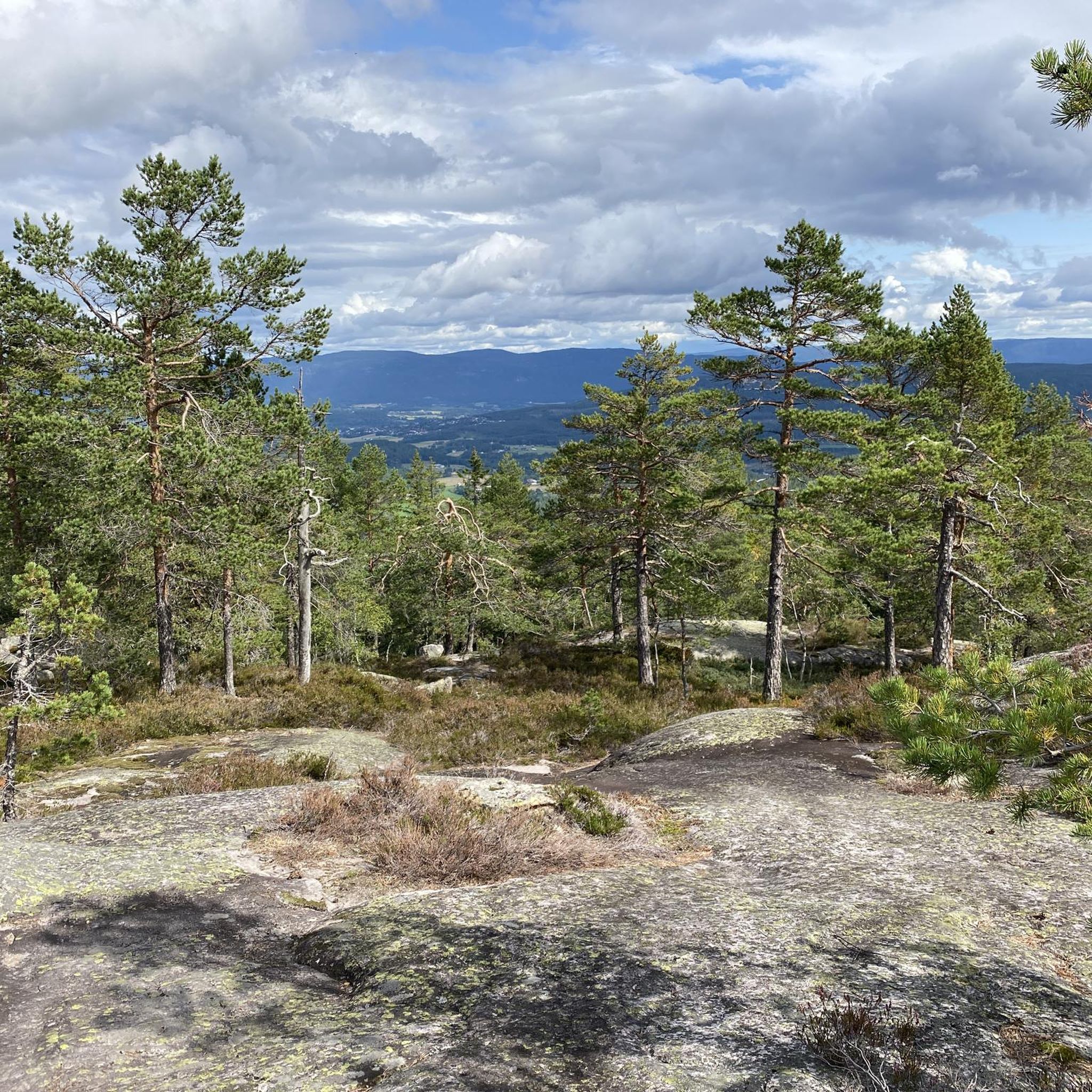
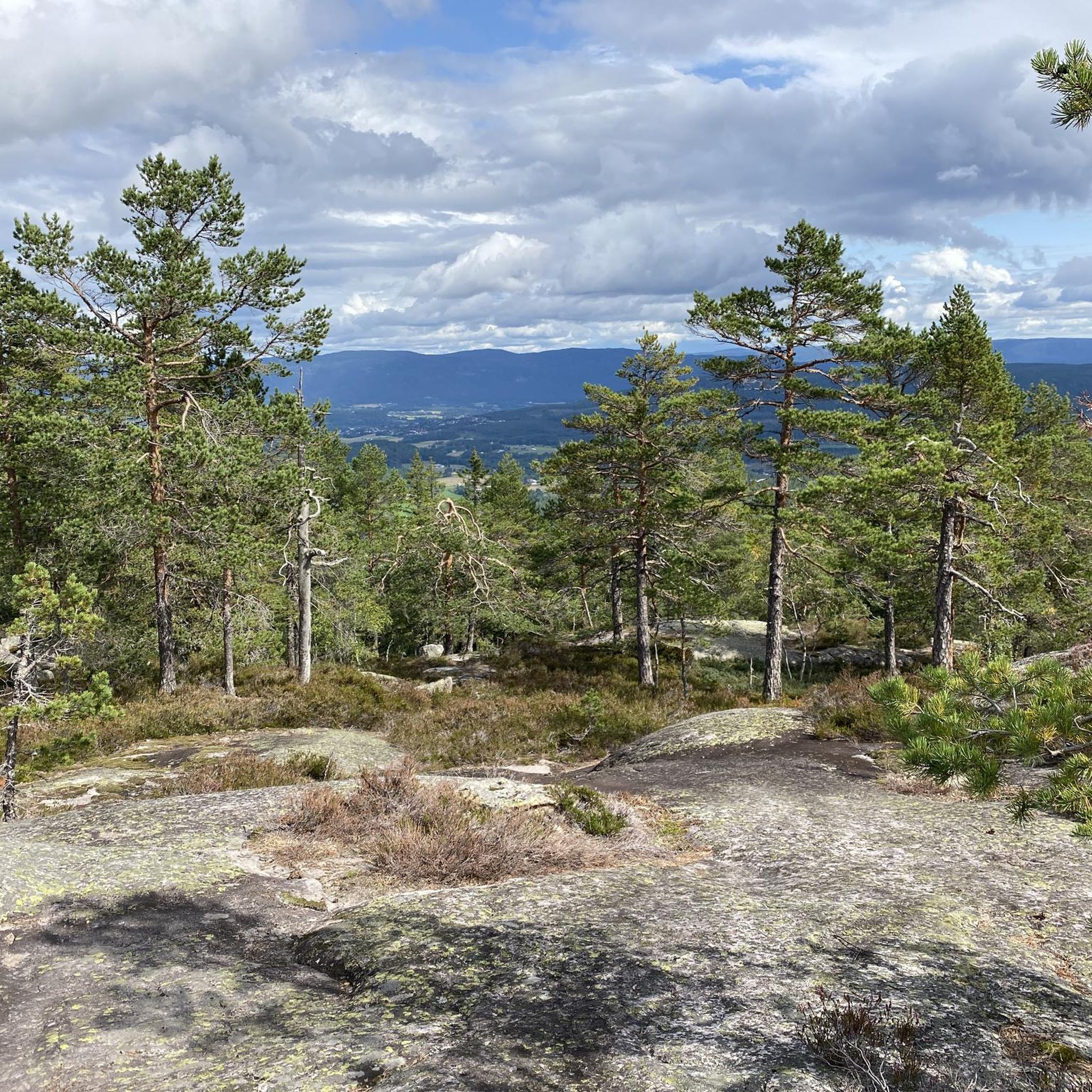
Hiking in Gygrestolen Naturreservat offers routes through a landscape shaped by the last ice age, featuring unique geological formations and diverse natural environments. The area is characterized by dense forests transitioning to open pine forests, boulders, and smooth rock slabs. The reserve protects significant biodiversity, including old-growth mixed and spruce forests. From elevated points, hikers can find panoramic views of the surrounding cultural and natural landscape.
Best hiking trails in Gygrestolen Naturreservat
- The most popular hiking route is Gygrestolen Rock…
Last updated: May 17, 2026
4.8
(124)
603
hikers
Moderate hike. Good fitness required. Easily-accessible paths. Suitable for all skill levels.
5.0
(3)
5
hikers
8.25km
02:43
370m
370m
Moderate hike. Good fitness required. Easily-accessible paths. Suitable for all skill levels.

Sign up for free
4.0
(2)
7
hikers
4.25km
01:11
80m
80m
Easy hike. Great for any fitness level. Easily-accessible paths. Suitable for all skill levels.
5.0
(3)
13
hikers
13.5km
03:36
150m
150m
Moderate hike. Good fitness required. Easily-accessible paths. Suitable for all skill levels.
5.0
(1)
5
hikers
8.36km
02:16
120m
120m
Moderate hike. Good fitness required. Easily-accessible paths. Suitable for all skill levels.
Get access to more routes and recommendations from other explorers.
Sign up for free
Already have an account?
Our route recommendations are based on thousands of hikes, rides, and runs completed by other people on komoot.
Start today with a free account
Your next adventure awaits.
Login or Signup
Tips from the Community

A small, free open-air museum on Kvennøya Island. There are a few well-preserved wooden huts from the historic Bø. Apart from the large sign at the entrance indicating the individual buildings, there are no other signs on the site.
0
0
Newly marked and signposted section due to the effects of flooding.
0
0
The entire circular trail around the Bøelva River, from Oterholtfossen to Gaara Bridge, is a beautiful, easy walk/hike. Well-marked, with a few information boards along the trail (in Swedish) and pleasant benches. As of May 2025: A few short sections are being rerouted because they have apparently been washed away. Restoration is underway, but the effects are currently still clearly visible, including large deposits from swept-away trees and washed-out culverts, etc.
0
0

Much longer than 2 hours and 10 minutes. The route consists of 80% steep slope with rocks and tree roots. So it's a lot of scrambling. We reached the top in 2 hours and then the descent had to begin. Beautiful view, but not a short walk.
2
0

Beautiful lake above where you can swim (Venetjønn). Lots of roots on the paths, but that makes it feel like climbing a gigantic tree. Tip: you have to pay for parking, but this is only possible via Vipps. If you live outside Scandinavia, these apps are unfortunately not available. We asked a Norwegian hiker to pay for us (because the sign must be passed on) and simply gave her 4.5 euros in cash). I have no idea if there are many checks there. There is nothing but forest, a sign with a map and a parking lot. No catering.
1
1

Very steep for the most part. Lots of rocks and roots. Hiking boots highly recommended, actually mandatory
1
1

Frequently Asked Questions
What is the typical terrain and difficulty level for hiking in Gygrestolen Naturreservat?
The trails in Gygrestolen Naturreservat are known for being steep and demanding, often traversing dense forests, areas with boulders, and smooth rock slabs. Hikers should expect sections with rocks and tree roots, which can be challenging, especially after rain. Fixed ropes are installed in steeper parts to assist. The main round trip to the Gygrestolen rock formation typically involves an elevation gain of approximately 365 meters and is rated as moderate, such as the Gygrestolen Rock Formations – Fagerliåsane loop.
What natural landmarks or viewpoints can I expect to see in Gygrestolen Naturreservat?
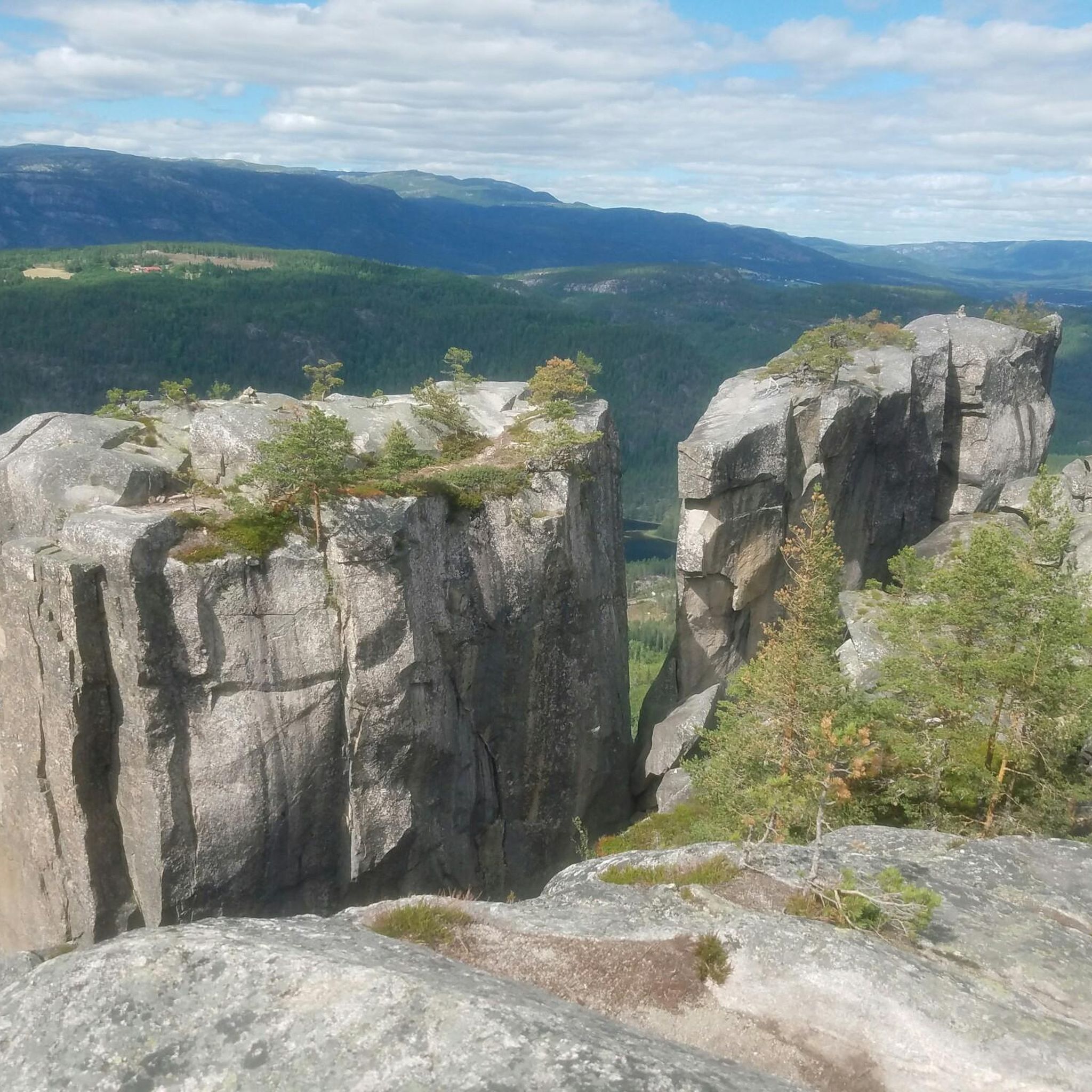
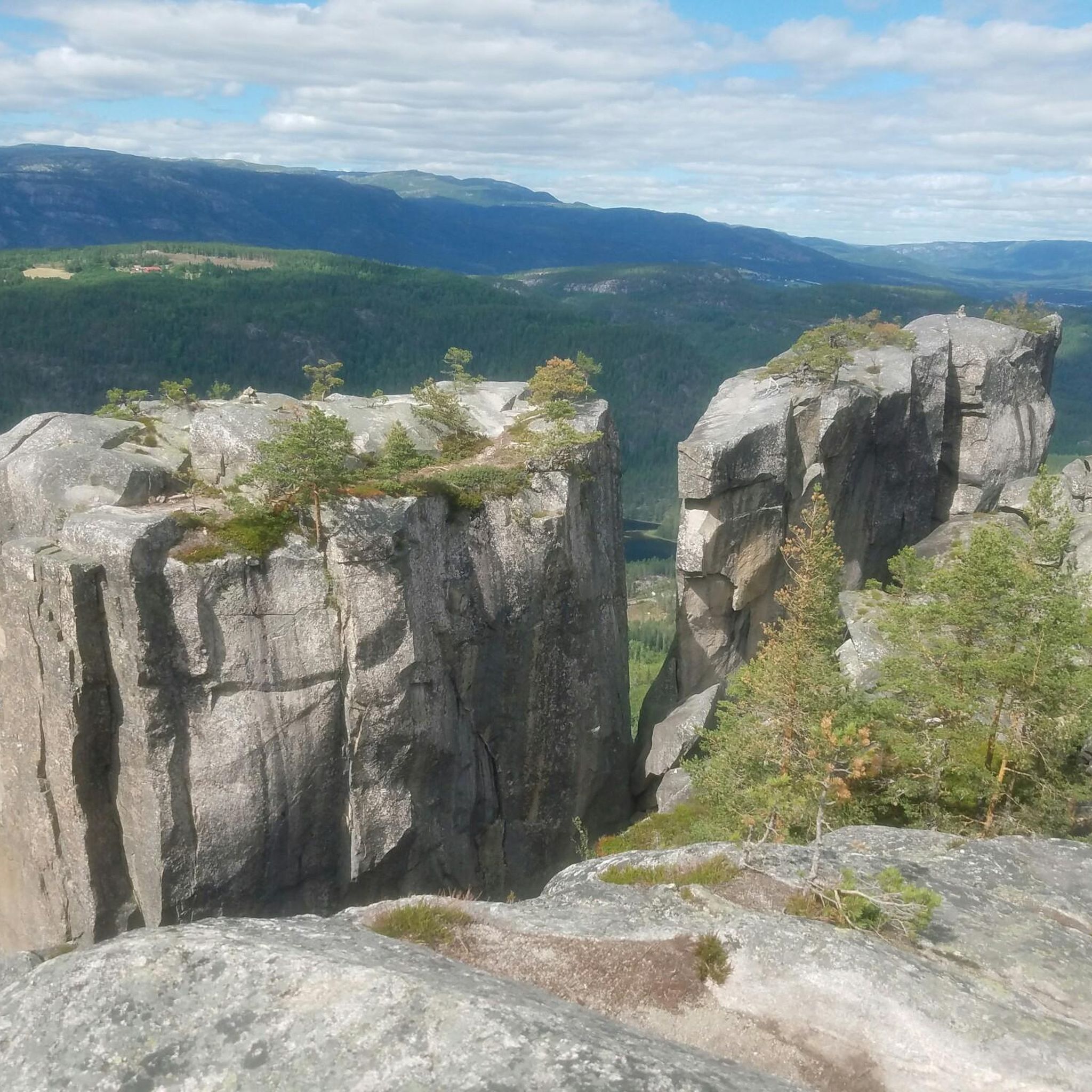
The centerpiece is the distinctive Gygrestolen rock formation itself, a landmark shaped by the last ice age, featuring a chair-like structure and two massive boulders. From the Gygrestolen cliff, you are rewarded with fantastic panoramic views of the surrounding cultural and natural landscape, including the town of Bø and the Lifjell mountains. Along some trails, you'll pass Svarttjønn pond, near which a unique two-story cave can be explored, and Venetjønn lake, which offers a spot for a swim.
Are there any family-friendly hiking options in Gygrestolen Naturreservat?
While many trails are steep and demanding, there are easier options available. For instance, the Hogga sluse loop from Hogga is a 4.2 km trail leading through a more gentle landscape, often completed in about 1 hour 11 minutes, making it suitable for families looking for a less strenuous walk.
Can I bring my dog on the hiking trails in Gygrestolen Naturreservat?
Gygrestolen Naturreservat is generally dog-friendly, but it's important to keep dogs on a leash, especially during nesting seasons and to protect wildlife. Given the varied and sometimes challenging terrain, ensure your dog is accustomed to hiking on rocky and steep paths. Always check local regulations for any specific restrictions.
Are there any circular hiking routes available in the area?
Yes, many of the trails in Gygrestolen Naturreservat are designed as circular routes, allowing you to experience diverse landscapes without retracing your steps. A popular example is the Gygrestolen Rock Formations – Fagerliåsane loop, which takes you to the main rock formation and back.
What is the best time of year to visit Gygrestolen Naturreservat for hiking?
The best time to visit for hiking is typically from late spring through early autumn (May to October). During these months, the trails are generally free of snow and ice, and the weather is more favorable. Summer offers warmer temperatures, ideal for a swim in Venetjønn lake, while autumn provides beautiful fall foliage. Winter hiking is possible but requires appropriate gear due to snow and ice.
Is there parking available at the trailheads for Gygrestolen Naturreservat?
Yes, parking is available at or near the main trailheads for Gygrestolen Naturreservat. Specific parking information can often be found on local tourism websites or detailed route descriptions. It's advisable to arrive early during peak season to secure a spot.
How can I reach Gygrestolen Naturreservat using public transport?
While direct public transport to the immediate trailheads might be limited, you can often reach nearby towns like Bø by bus or train. From there, you might need to arrange for a taxi or check for local bus services that can take you closer to the reserve. For detailed public transport options, it's best to consult local transport providers or the Visit Bø website.
What do other hikers enjoy most about Gygrestolen Naturreservat?
The area is highly rated by the komoot community, with an average score of 4.5 stars from over 150 reviews. Reviewers often praise the fantastic panoramic views from the Gygrestolen cliff, the unique geological formations, and the rewarding challenge of the trails. The diverse natural environment, including old-growth forests and the sense of wilderness, is also frequently highlighted.
Are there any waterfalls near Gygrestolen Naturreservat?
While Gygrestolen Naturreservat itself is known for its rock formations and forests, the broader region offers other natural attractions. For example, the Bø Museum – Olterholtfossen Waterfall loop from Bø is a moderate 8.3 km hike that includes a visit to the Olterholtfossen Waterfall, offering a different natural highlight in the vicinity.
What kind of wildlife can I expect to encounter in Gygrestolen Naturreservat?
The reserve's diverse habitats, including old-growth mixed and spruce forests, support a variety of wildlife. Hikers might encounter abundant birdlife, including ravens, and potentially larger animals like moose. The area's status as a nature reserve, established to protect its significant biodiversity, ensures a rich natural experience.
Most popular routes in Gygrestolen Naturreservat

Get inspired with the komoot mobile app


Explore more
Browse the best Hikes in other regions.
