The best MTB trails around Hettenleidelheim
4.6
(892)
2,744
riders
266
rides
Mountain biking around Hettenleidelheim offers extensive trail networks within the northern Palatinate Forest Nature Park. The region features picturesque landscapes, including idyllic vineyards and diverse natural features. Terrain varies from former clay and sand mining areas, now the Erdekaut adventure landscape, to protected bog ponds like the Ungeheuersee. These physical features provide a varied backdrop for mountain bike trails.
Best mountain bike trails around Hettenleidelheim
- The most popular mountain bike trail is Diemer-Kreuz Memorial – Rahnenhof Naturefriends House loop from Wattenheim, a 13.5 miles (21.7 km) trail that takes 1 hour 42 minutes to complete. This easy route explores the scenic surroundings of Wattenheim.
- Another top favourite among local mountain bikers is Eistal Viaduct (Eistalviadukt) – Neuleiningen Castle loop from Wattenheim, a moderate 24.0 miles (38.7 km) path. This route features historical sights and varied forest terrain.
- Local mountain bikers also love the Diemer-Kreuz Memorial – Lauberhof loop from Tiefenthal, a 19.8 miles (31.9 km) trail leading through the Palatinate Forest, often completed in about 2 hours 30 minutes.
- Mountain biking around Hettenleidelheim is defined by dense woodlands of the Palatinate Forest, rolling vineyards, and unique landscapes like the Erdekaut adventure landscape. The network offers options for different ability levels, from easy paths to more challenging routes.
- The routes in Hettenleidelheim are highly rated by the komoot community with an average score of 4.6 stars from over 600 reviews. More than 2,500 mountain bikers have used komoot to explore Hettenleidelheim's varied terrain.
Last updated: November 8, 2026
4.5
(18)
76
riders
Moderate mountain bike ride. Good fitness required.
4.5
(10)
45
riders
46.6km
04:04
770m
770m
Moderate mountain bike ride. Good fitness required.

4.6
(11)
27
riders
53.9km
04:10
860m
860m
Moderate mountain bike ride. Good fitness required. Advanced riding skills necessary.
3.9
(14)
34
riders
Easy mountain bike ride.
4.4
(9)
28
riders
43.0km
02:37
300m
300m
Moderate mountain bike ride. Good fitness required. Advanced riding skills necessary.
Get access to more routes and recommendations from other explorers.
Already have an account?
Our route recommendations are based on thousands of hikes, rides, and runs completed by other people on komoot.
Start today with a free account
Your next adventure awaits.

Tips from the Community

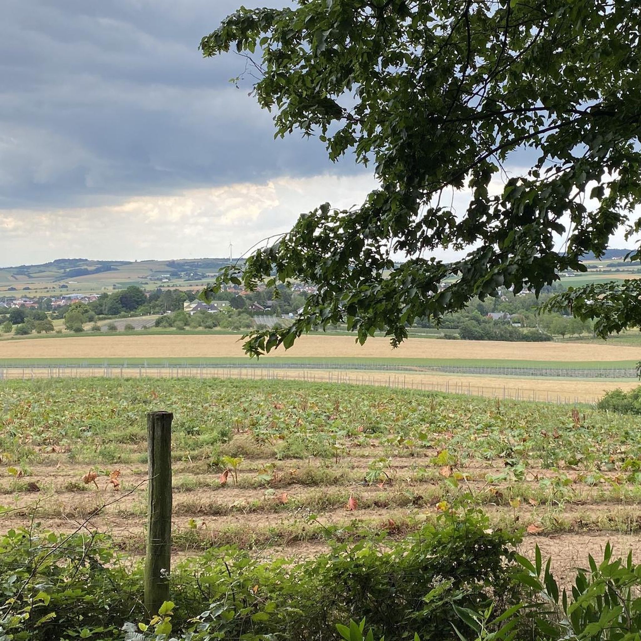
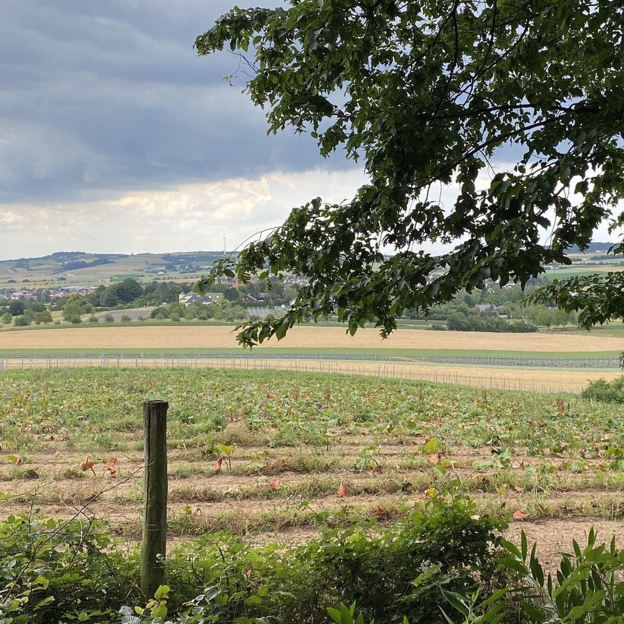
Nature-oriented course of the stream in this section, therefore the characteristics of a nature-oriented course can be well recognized here, including the interlocking with the bankside vegetation
0
0

The Pfrimmweiher is located in the Donnersberg district in Rhineland-Palatinate, not far from the Pfrimm spring in the Sippersfelder Weiher nature reserve. Southeast of the municipality of Sippersfeld, near the hamlet of Pfrimmerhof in the Palatinate Forest Nature Park. The Pfrimmweiher (a small reservoir or pond) is located just a few hundred meters below the captured Pfrimm spring.
2
0
The Retzberghütte is located directly on the idyllic Retzbergweiher in Sippersfeld on the edge of the Palatinate Forest and is a popular destination for hikers and day-trippers. The pond and the hut are located near 67729 Sippersfeld (Donnersbergkreis / northern Palatinate Forest). The serviced hut offers classic Palatinate cuisine (like Saumagen and Leberknödel), homemade cakes, special dishes on Thursdays, and fresh fish variations on Fridays. See: https://www.retzberghuette.de/
2
0

August 2026 The hut is super to reach by bike! And the family cooks great! The cake is also delicious.
1
0

The Eiswoog (often also referred to as Eiswoogsee) is a picturesque reservoir of approximately 2.7 hectares in the northern Palatinate Forest, more precisely in the wooded Stumpfwald near the municipality of Ramsen. The body of water is fed by the Eisbach – regionally also affectionately called „die Eis“ – whose name historically derives from the region's rich iron ore deposits. Contrary to popular myths, the lake's name therefore has nothing to do with frozen water. Originally formed as a natural lake, in the Middle Ages, the nuns of the Ramosa monastery further dammed the stream as a fishpond. Later, in 1812, the famous ironworks owner Ludwig von Gienanth acquired the lake to secure the water power supply for his downstream ironworks and mills, even during dry periods. To this day, the body of water remains privately owned by the Gienanth entrepreneurial family. Nowadays, the Eiswoog has developed into one of the most popular natural and excursion destinations in West and Vorderpfalz. Directly on the historic dam lies the well-known hotel-restaurant [„Seehaus Forelle“](1.1.6, 1.4.4), which is appreciated for its regional fish specialties. Around the body of water runs a roughly three-kilometer-long, barrier-free nature trail with interactive stations and a wooden viewing platform that juts out flat into the lake. To protect the sensitive ecosystem and the local fish farming – the lake serves, among other things, as a habitat for the rare kingfisher – private swimming and boating are now strictly forbidden.
11
1

The Wattenheimer Häuschen is located at about 440 m. The old hut from 1895 is closed, but there are covered seating areas and further outdoor seating.
1
0
In the Brunnengärten there are two fountains. This is fountain No. 1 in the Brunnengärten, fountain No. 2 is located 230 m east on the Burgenweg.
1
0

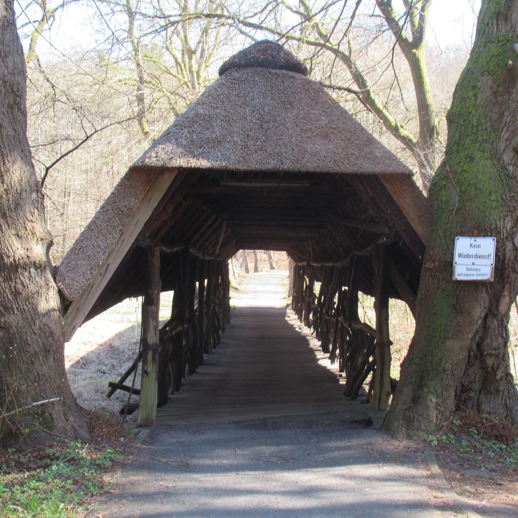
Old mining carts and a small bridge tucked into the Bockbach Valley, a fun little glimpse into the region's mining heritage.
0
0
Frequently Asked Questions
How many mountain bike trails are available around Hettenleidelheim?
There are over 260 mountain bike trails around Hettenleidelheim, offering a wide range of options for all skill levels. The komoot community has explored these routes over 2,500 times.
What are the difficulty levels of mountain bike trails in Hettenleidelheim?
The trails around Hettenleidelheim cater to various skill levels. You'll find a good mix of easy (88 routes) and moderate (168 routes) trails, with a few more challenging options (5 routes) for experienced riders. This diversity ensures there's something for everyone, from beginners to advanced mountain bikers.
Are there any family-friendly mountain bike trails in the area?
Yes, Hettenleidelheim offers several easy mountain bike trails suitable for families. For instance, the Diemer-Kreuz Memorial – Rahnenhof Naturefriends House loop from Wattenheim is an easy 21.7 km route with moderate elevation, perfect for a family outing. The region's diverse network includes many paths with lower technical demands.
What kind of landscapes can I expect to see while mountain biking around Hettenleidelheim?
Mountain biking around Hettenleidelheim takes you through diverse and picturesque landscapes. You'll encounter dense woodlands of the Palatinate Forest, idyllic vineyards, and unique natural features like the former clay and sand mining region, now the Erdekaut adventure landscape. Trails also pass by protected bog ponds such as the Ungeheuersee.
Are there any circular mountain bike routes available?
Yes, many mountain bike trails around Hettenleidelheim are designed as loops, allowing you to start and end at the same point. Examples include the Eistal Viaduct (Eistalviadukt) – Neuleiningen Castle loop from Wattenheim, a moderate 38.7 km route, and the View of Grünstadt – Hab-Acht-Weg Bird Nature Trail loop from Hettenleidelheim, a moderate 20.3 km option.
What historical sights or landmarks can I explore along the trails?
The region around Hettenleidelheim is rich in history. You can encounter historical sights like the Kriemhildenstuhl Roman Quarry, where Roman legionnaires once worked, and the ruins of Neuleiningen Castle. These offer interesting stops and scenic views during your ride.
What do other mountain bikers say about the trails in Hettenleidelheim?
The mountain bike trails in Hettenleidelheim are highly rated by the komoot community, with an average score of 4.6 stars from over 600 reviews. Riders often praise the varied terrain, the well-maintained paths, and the beautiful natural scenery, particularly the dense woodlands and vineyards.
Is it possible to find viewpoints along the mountain bike routes?
Absolutely. Many trails in the Palatinate Forest region offer impressive views. For example, the Kaiser-Wilhelm-Höhe Viewpoint is a notable spot where you can pause and enjoy panoramic vistas of the surrounding landscape.
Are there any specific natural attractions worth visiting near the mountain bike trails?
Yes, the area boasts unique natural attractions. The Ungeheuersee, a protected bog pond, is a natural monument worth seeing. Additionally, the Erdekaut adventure landscape, a former mining region transformed into a valuable landscape protection area, offers signposted trails and viewpoints.
What is the best season for mountain biking in Hettenleidelheim?
The Palatinate region generally offers good mountain biking conditions throughout much of the year. Spring and autumn are particularly popular due to pleasant temperatures and vibrant foliage. Summer is also suitable, though it can be warmer, while winter rides are possible on many trails, depending on snow and ice conditions.
Are there options for advanced mountain bikers seeking a challenge?
While the majority of trails are easy to moderate, Hettenleidelheim does offer a few more difficult routes for advanced riders. The wider Palatinate Forest, which surrounds Hettenleidelheim, features an extensive network with trails up to S6 difficulty, providing options for those seeking significant elevation gains and technical challenges.
Can I find places to eat or stay near the mountain bike trails?
Yes, the Palatinate Forest region is known for its cozy huts and local cuisine. Many villages and towns, including Hettenleidelheim itself, offer various options for cafes, pubs, and accommodation, allowing you to refuel and relax after your ride.
Most popular routes around Hettenleidelheim
Most popular attractions around Hettenleidelheim

Get inspired with the komoot mobile app


Explore more
Browse the best MTB trails in other regions.
