The best running trails in Tronadora
4.8
(14)
474
runners
20
runs
Jogging in Tronadora offers routes through diverse landscapes, including cloud forests and areas with panoramic viewpoints. The region features undulating terrain with moderate elevation changes, providing varied running experiences. Many trails lead through natural reserves, showcasing the local flora and fauna. The area around Tronadora is characterized by its lush greenery and scenic vistas, ideal for outdoor activity.
Best jogging routes in Tronadora
- The most popular jogging route is Monteverde Sunset Viewpoint loop from Monteverde, a 5.0 miles (8.0 km) trail that takes 54 minutes to complete, offering scenic views.
- Another top favourite among local runners is Running loop from Santa Elena, a moderate 5.1 miles (8.2 km) path. This route features varied terrain with moderate elevation gain.
- Local runners also love the Running loop from Cañitas, a 4.7 miles (7.5 km) trail leading through natural landscapes, often completed in about 51 minutes.
- Jogging in Tronadora is defined by cloud forest paths, scenic viewpoints, and undulating terrain. The network offers options for different ability levels, from moderate to difficult.
- The routes in Tronadora are highly rated by the komoot community with an average score of 4.7 stars from over 10 reviews. More than 400 runners have used komoot to explore Tronadora's varied terrain.
Last updated: July 29, 2026
5.0
(1)
61
runners
7.99km
00:54
230m
230m
Moderate run. Good fitness required. Mostly paved surfaces. Suitable for all skill levels.
4.2
(5)
39
runners
8.21km
00:56
230m
230m
Moderate run. Good fitness required. Mostly paved surfaces. Suitable for all skill levels.

Sign up for free
4.0
(3)
31
runners
7.50km
00:52
210m
210m
Moderate run. Good fitness required. Mostly paved surfaces. Suitable for all skill levels.
5.0
(1)
36
runners
9.24km
01:14
310m
310m
Hard run. Very good fitness required. Mostly paved surfaces. Suitable for all skill levels.
19
runners
7.21km
00:55
210m
210m
Moderate run. Good fitness required. Mostly paved surfaces. Suitable for all skill levels.
Get access to more routes and recommendations from other explorers.
Sign up for free
Already have an account?
Our route recommendations are based on thousands of hikes, rides, and runs completed by other people on komoot.
Start today with a free account
Your next adventure awaits.
Login or Signup
Popular around Tronadora
Tips from the Community

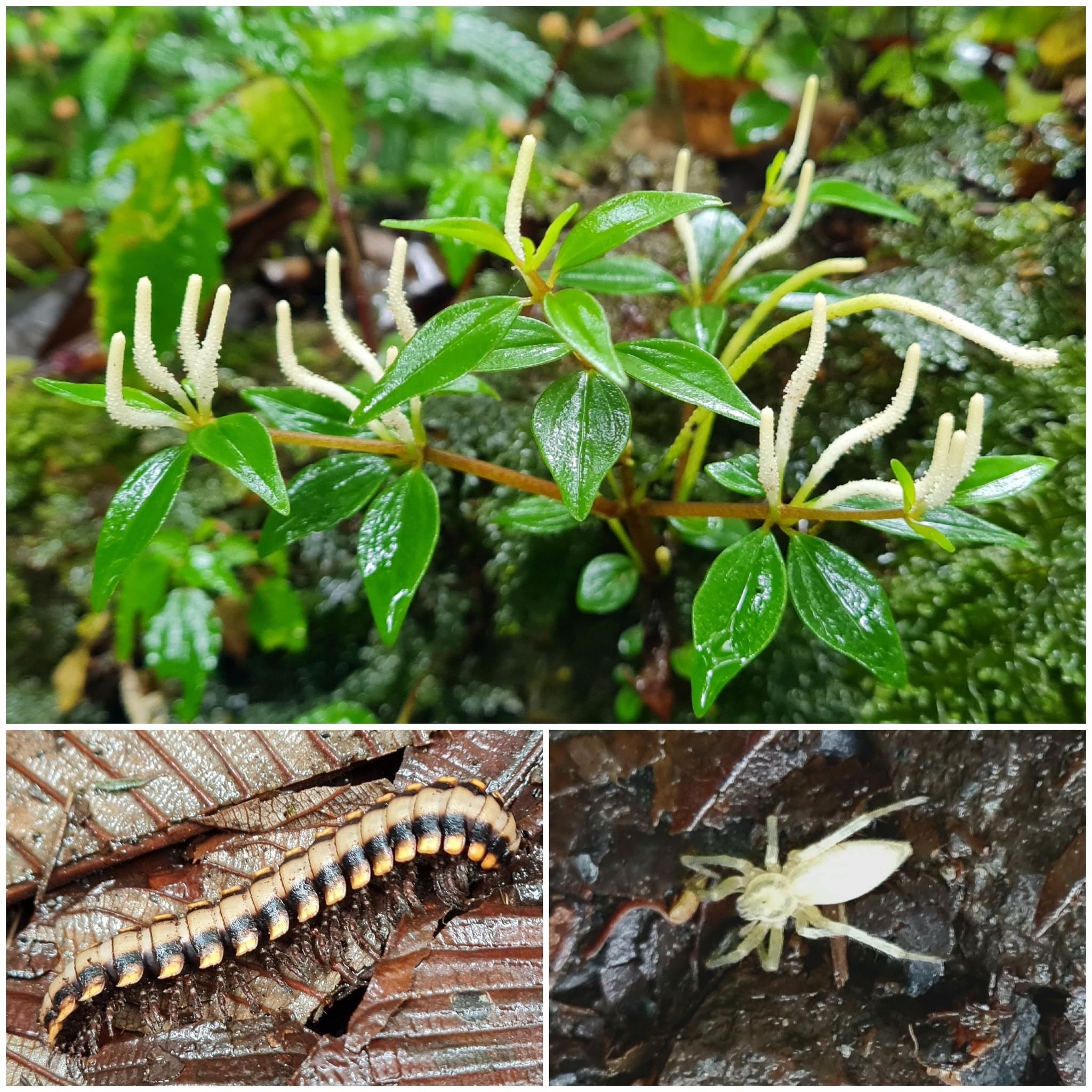
Yes, the Monteverde Cloud Forest has earned its reputation. Water drips from the trees and fog stalks hang in the treetops.
0
0
The ferns in the cloud forest are fantastic and some are over 2 meters tall.
0
0
Great view of the forest from above. You are in the middle of the treetops. Awesome!
0
0

Not far from the entrance to the reserve in Monteverde there is a small waterfall. You can take photos from a wooden platform.
0
0

Compared to the other trails in the reserve, we were able to hike here for 3.5 hours without seeing other people 🌴🌳 🐛
0
0

A quite idyllic place to take a brake. If you want to do so, there is a bench situated right on the observation deck.
1
0
A quite idyllic place to take a brake.
0
0
Frequently Asked Questions
How many running routes are available in Tronadora?
Tronadora offers a selection of over 20 running routes, catering to various preferences. The majority are moderate, with some more challenging options for experienced runners.
Are there any easy jogging routes for beginners in Tronadora?
While most routes in Tronadora are rated moderate due to the undulating terrain and elevation changes, many can be enjoyed at a slower pace. There are no routes specifically classified as 'easy' for jogging, but routes like the Running loop from Cañitas offer a manageable distance of 4.7 miles (7.5 km) with moderate elevation.
What are the typical distances and durations for jogging trails in Tronadora?
Running routes in Tronadora generally range from 4.5 to 5.5 miles (7 to 9 km). Most moderate routes, such as the Monteverde Sunset Viewpoint loop from Monteverde (5.0 miles / 8.0 km), can be completed in approximately 50 to 60 minutes, depending on your pace and the elevation.
Are there any circular running routes in Tronadora?
Yes, many of the popular running routes in Tronadora are circular, allowing you to start and finish at the same point. Examples include the Running loop from Santa Elena and the Monteverde Sunset Viewpoint loop from Monteverde, both offering scenic round trips.
What kind of viewpoints or natural attractions can I expect along the jogging trails?
Tronadora's jogging trails often lead through cloud forests and offer panoramic vistas. You might encounter highlights such as the Mistico Arenal Hanging Bridges Park, the Curi-Cancha Reserve, or even a Waterfall in Monteverde Cloud Forest Reserve. The Mirador loop from Refugio Nacional de Vida Silvestre Curi-Cancha is specifically known for its scenic outlooks.
Are there any running routes that pass by waterfalls in Tronadora?
Yes, some areas near Tronadora's running routes feature waterfalls. For instance, the Waterfall in Monteverde Cloud Forest Reserve is a notable natural monument in the vicinity, which you might be able to incorporate into a longer run or visit separately.
What do other runners enjoy most about jogging in Tronadora?
The running experience in Tronadora is highly rated by the komoot community, with an average score of 4.7 stars. Runners often praise the diverse landscapes, including cloud forest paths and scenic viewpoints, as well as the undulating terrain that provides a varied and engaging workout.
Are the jogging routes in Tronadora suitable for families?
Given that most routes are moderate with elevation changes, families with younger children or those new to running might find them challenging. However, active families used to outdoor activities can enjoy the scenic trails. Consider shorter, less strenuous sections or adjust your pace accordingly.
Is Tronadora a dog-friendly region for running?
While many natural areas in Costa Rica have specific regulations regarding pets, some trails may allow dogs on a leash. It's always best to check the specific rules of individual reserves or parks, such as the Curi-Cancha Reserve or the Santa Elena Cloud Forest Reserve Long Trail, before bringing your dog.
What is the best time of year to go jogging in Tronadora?
Tronadora, being in a cloud forest region, experiences a relatively consistent climate. However, the dry season (typically December to April) offers more predictable weather with less rain, making it ideal for outdoor activities like jogging. The trails will be less muddy, and conditions generally more pleasant.
Are there any hidden gem running routes in Tronadora?
For a slightly less frequented but rewarding experience, consider exploring routes that venture deeper into the natural reserves. The View of Caño Negro loop from Reserva Bosque Nuboso Santa Elena offers a beautiful journey through the cloud forest, providing a sense of discovery away from the most popular spots.
Where can I find parking for the jogging trails in Tronadora?
Parking availability varies by trailhead. For routes starting near towns like Monteverde or Santa Elena, you can often find public parking areas. For trails within nature reserves, designated parking lots are usually available at the entrance, such as near the Refugio Nacional de Vida Silvestre Curi-Cancha.
Most popular routes in Tronadora
Most popular attractions in Tronadora

Get inspired with the komoot mobile app


Explore more
Browse the best Running Trails & Routes in other regions.
