The best MTB trails in Monterrey
4.6
(11)
187
riders
13
rides
Mountain biking in Monterrey is defined by its dramatic mountainous backdrop and the expansive Cumbres de Monterrey National Park. The region features rugged terrain, deep canyons, and majestic mountain peaks reaching up to 7,410 feet (2,260 meters) above sea level. This diverse landscape provides a wide array of challenging and scenic routes for mountain bikers.
Best mountain bike trails in Monterrey
- The most popular mountain bike trail is View of Arenal Volcano – Caño Negro River Bike Crossing loop from…
Last updated: July 31, 2026
5.0
(1)
52
riders
149km
10:47
2,550m
2,550m
Hard mountain bike ride. Very good fitness required. Advanced riding skills necessary.
4.2
(5)
29
riders
43.6km
02:56
690m
690m
Moderate mountain bike ride. Good fitness required. Advanced riding skills necessary.

Sign up for free
3.0
(1)
30
riders
Easy mountain bike ride. Great for any fitness level. Suitable for all skill levels.
5.0
(2)
25
riders
32.8km
02:32
670m
670m
Moderate mountain bike ride. Good fitness required. Suitable for all skill levels.
5.0
(1)
13
riders
43.7km
03:36
1,120m
1,120m
Hard mountain bike ride. Very good fitness required. Suitable for all skill levels.
Get access to more routes and recommendations from other explorers.
Sign up for free
Already have an account?
Our route recommendations are based on thousands of hikes, rides, and runs completed by other people on komoot.
Start today with a free account
Your next adventure awaits.
Login or Signup



Tips from the Community


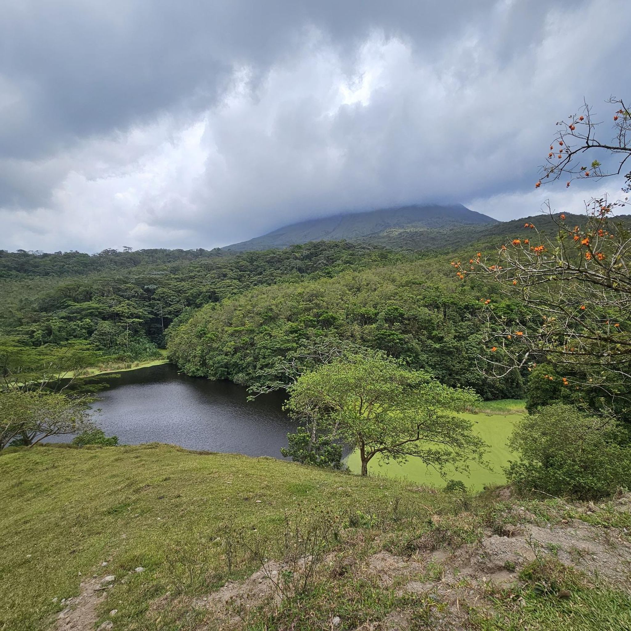
These views can be seen along the entire route around the lake.
0
0
The Black River has changed; it now curves, not in a straight line as it used to. The flow is somewhat choppy; proceed with caution.
0
0

When visiting the region, the "Tabacon Hot Springs" are certainly a must, but also quite expensive.
0
0

Often no side trips, so constantly check the traffic behind you!
0
0

From the tour round the Arenal, a couple of crisp detours can be made on the volcano. Bike shop at the entrance to Fortuna works there is a good selection (also Specialized!!)
0
1

This must be the only free attraction in the area, specially involving Hot Springs. Whole area is privatised by the Tabacon Hotels corporation, that people with limited budget cannot afford to experience this natural phenomenon. At this spot, locals were coming for the swim many years ago but tourists discovered it. It is just off the road 142, payed parking available, bikes are free. As always, be there EARLY, it will be crowded. Night visits are possible but not recommended. Short walk down will get you to the hot river. Walkway is properly build but after that is all natural, rough. Be very careful and move slowly over the wet and slippery stones. I'm pretty sure they caused many broken bones. Water temperature is just right for endless bath. Please don't use any toiletries as I would like to come back one day and see it still exist. Please don't leave any garbage. There are no changing clothes facilities. Enjoy it responsibly so our kids can come back one day. Happy riding.
0
0
Some of the fellow riders told me that they didn't ride south side of the Arenal Lake circle because of inability to cross Cano Negro. I did ride this road twice and it is my favourite area in CR. Please do not give up on trying! First time I did it with organised group and support vehicle, west to east. We made it over the river with just the bikes but SAG van got stuck in the middle of the river. While waiting for the van, night rolled in. We had to continue with the moon light and fireflies showing us the way. It was unforgettable! Van waited for big truck to pull him out. Second time, I did it by myself, fully loaded, east to west. It was end of January. From the banks it looks scary, fast and big, but don't get discouraged. It's all in the head. You have to unload the bike and make multiple trips over the river! At the deepest it's around 60cm but it's fast with big rocks on the bottom. With hands full of stuff, You can easily lose your balance so take it easy and double check every step. Water is refreshing. That section is only 10-15m wide, the rest is easy and manageable no problem. The rest of the south lake route has 4 more river crossings but they are all easy and don't require bike unpacking. Hope that you make it over there and see why I love it so much. Happy Riding!
2
0
Frequently Asked Questions
What kind of terrain can I expect on mountain bike trails in Monterrey?
Monterrey's mountain biking terrain is characterized by its dramatic mountainous backdrop, including the Sierra Madre Oriental and Cumbres de Monterrey National Park. You'll find rugged landscapes, towering limestone walls, deep canyons, and diverse trails ranging from dense forests to rocky peaks. This variety offers everything from technical challenges to scenic, flowing paths.
Are there mountain bike trails suitable for beginners in Monterrey?
Yes, Monterrey offers trails for all skill levels. While many routes are challenging, there are options for beginners. For example, the View of Arenal Volcano – Caño Negro River Bike Crossing loop from Informacion de Parque Nacional Volcan Arenal is an easy 20.6 km route that provides a good introduction to the region's diverse landscapes.
Are there any family-friendly mountain bike trails in Monterrey?
While specific family-friendly routes are not detailed, areas like Chipinque Ecological Park offer a more accessible mountain environment with nearly 80 km of trails. When choosing a route, look for those rated 'easy' to ensure a suitable experience for families. Always check the route's description for elevation gain and technical difficulty.
What are some notable natural features or landmarks I might see while mountain biking in Monterrey?
Monterrey's trails often pass through stunning natural areas. You might encounter towering limestone walls in La Huasteca Canyon or enjoy panoramic views from trails on Cerro de la Silla. While not directly on the routes listed, nearby attractions include the impressive La Fortuna Waterfall and the scenic Arenal Volcano.
Are there any circular mountain bike routes in Monterrey?
Yes, many mountain bike routes in Monterrey are designed as loops, allowing you to start and end at the same point. Examples include the challenging View of Arenal Volcano – Caño Negro River Bike Crossing loop from La Fortuna (151 km) and the moderate View of Lake Arenal – View of Arenal Volcano loop from La Fortuna (43.5 km).
What do other mountain bikers say about the trails in Monterrey?
The mountain bike trails in Monterrey are highly regarded by the komoot community, with an average rating of 4.6 stars from over 11 reviews. Riders frequently praise the region's diverse terrain and the challenging yet rewarding experiences offered by its mountainous landscapes.
Are there any challenging mountain bike trails for experienced riders?
Absolutely. Monterrey is known for its challenging routes. Experienced riders can tackle trails like the View of Arenal Volcano – Caño Negro River Bike Crossing loop from La Fortuna, a difficult 151 km route with significant elevation gain, or the Monterrey Friends Club – Arenal Volcano loop from La Fortuna, another difficult 43.6 km option.
What is the best time of year for mountain biking in Monterrey?
Monterrey's climate generally allows for mountain biking year-round, but the cooler, drier months from October to April are often preferred to avoid the intense summer heat and potential rainy season conditions. Always check local weather forecasts before heading out.
Are there any trails that offer scenic views in Monterrey?
Many trails in Monterrey provide breathtaking scenic views, especially those ascending the Sierra Madre Oriental. Cerro de la Silla, an iconic symbol of Monterrey, offers panoramic vistas of the city. The View of Lake Arenal – View of Arenal Volcano loop from La Fortuna is a moderate route specifically highlighted for its scenic views of the lake and volcano.
How many mountain bike trails are available in Monterrey on komoot?
There are over 15 mountain bike trails available in Monterrey on komoot, catering to various skill levels. This includes 2 easy routes, 7 moderate routes, and 6 difficult routes, ensuring options for every type of rider.
Can I find trails with significant elevation gain in Monterrey?
Yes, Monterrey's mountainous topography means many trails feature significant elevation gain. For instance, the difficult View of Arenal Volcano – Caño Negro River Bike Crossing loop from La Fortuna includes over 2,600 meters of ascent, providing a substantial challenge for riders seeking climbs.
Are there any natural hot springs near the mountain bike trails in Monterrey?
While not directly adjacent to the listed mountain bike routes, the region does feature natural attractions like the Free Hot Springs at Río Tabacón. These can be a relaxing stop after a day of riding, though you may need to plan separate transport to reach them.
Most popular attractions in Monterrey

Get inspired with the komoot mobile app


Explore more
Browse the best MTB trails in other regions.
