Attractions and Places To See around Mürlenbach - Top 20
Best attractions and places to see around Mürlenbach include a blend of historical landmarks, unique natural features, and cultural sites within the Vulkaneifel district of Rhineland-Palatinate, Germany. The region is characterized by its volcanic origins, the Kyll River, and impressive rock formations. Visitors can explore ancient caves, medieval castle ruins, and significant geological formations. This area offers diverse opportunities for outdoor activities and historical discovery.
Best attractions and places to see around Mürlenbach
- The most popular attractions is Buchenloch Cave…
Last updated: October 23, 2026
Buchenloch Cave
Highlight • Cave
Translated by Google •
Tip by

View of Gerolstein from the Munterley
Highlight • Viewpoint
Translated by Google •
Tip by
Sign up now to discover places like this
Get recommendations on the best single tracks, peaks, & plenty of other exciting outdoor places.
Gerolsteiner Dolomiten Rock Formations
Highlight • Natural Monument
+ animal species found: bat
+ plant species found: …
Translated by Google •
Tip by

Millstone Cave at Nerother Kopf
Highlight • Cave
The millstone cave consists of lava boards and is an artificial cave in the Vulkaneifel, Rhineland-Palatinate. It was created by the production of …
Translated by Google •
Tip by

Freudenkoppe Castle Ruins
Highlight • Castle
Translated by Google •
Tip by
Sign up for free to discover even more attractions around Mürlenbach.
Already have an account?
Start today with a free account
Your next adventure awaits.

Tips from the Community

The steep climb to the castle is quite difficult. A real calf biter! But once at the top you forget it all. Beautiful ruin and the cave is more than worth it.
5
0

https://de.m.wikipedia.org/wiki/Gerolsteiner Dolomiten The tour was really beautiful... It won't be the last time I'm there ❤️
9
0

The great rocks rise impressively in front of us. Just great to experience something like this here. The name Gerolsteiner Dolomites speaks for itself.
12
1

The trail leads to the 'Buchenloch Cave' which lies at the far edge of the Munterley Plateau. This was created 1.8 million years ago from a millimeter-wide crack in the rock massif and was used by people in the Neolithic Age 300,000 years ago.
12
1
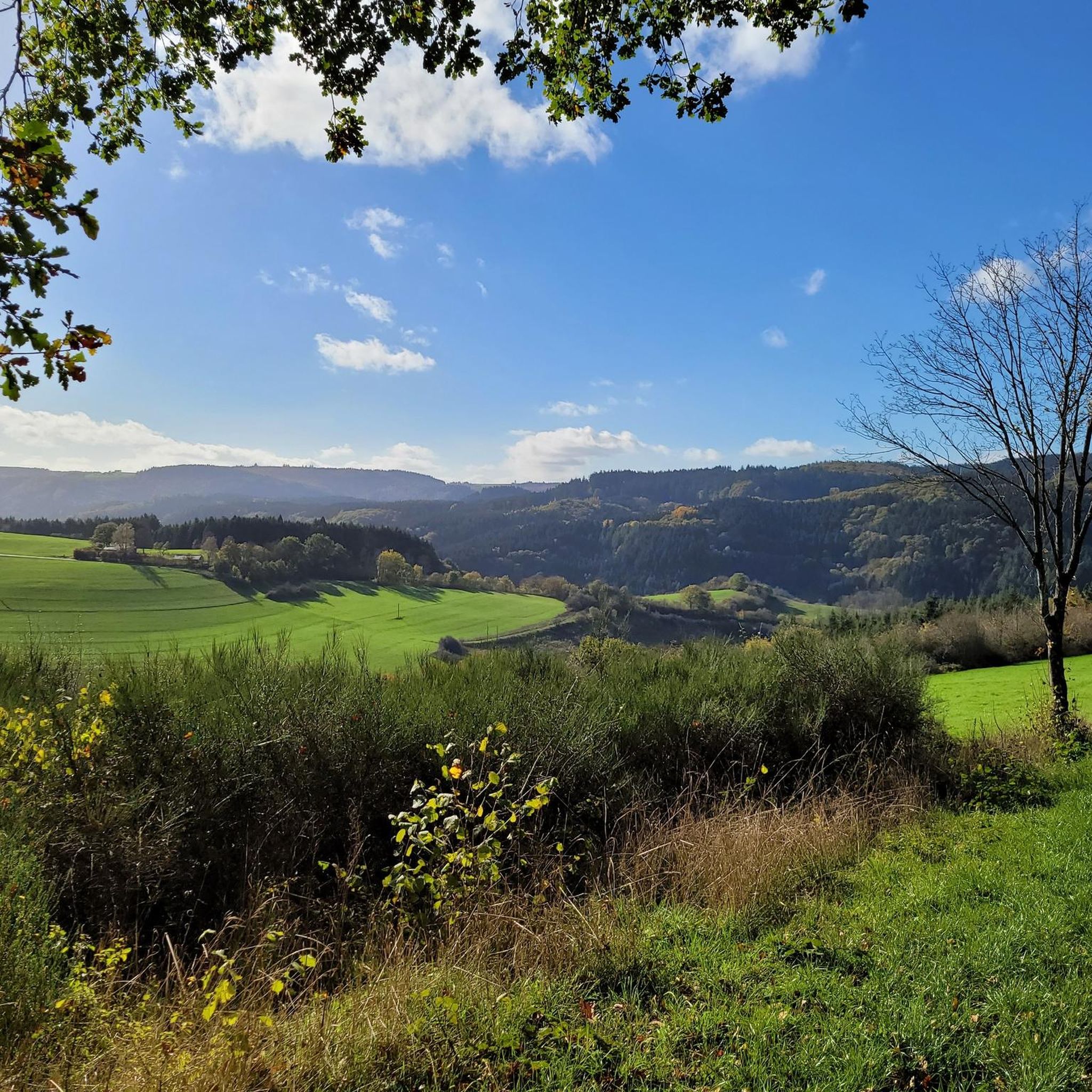
Almost 400 million years ago, where the Gerolsteiner Dolomites rise today, there was a subtropical shallow sea with a huge reef that is one of the oldest reefs on earth. This particularly beautiful and attractive hiking trail with scenic and geological features takes the hiker into an exciting past of our planet with beautiful views from Munterley and Hustley into the Kylltal.
10
1
"With an area of around 102 hectares, the area around the Gerolstein Dolomites has been designated a nature reserve since 1990. + animal species found: bat + plant species found: juniper, orchids, characteristic plants, calcareous grassland, woodrush beech forest, woodruff beech forest, orchid calcareous beech forest Around 380 million years ago, there was a warm, subtropical shallow sea here, in which mighty reefs of stromatoporoids - relatives of sponges - and corals formed. After the dolomitization, sinking and folding of the rocks, the Devonian deposits were lifted out again. This created today's Gerolstein Dolomites, which rise steeply above the Kyll valley north of the center of Gerolstein. The rocks "Hustley", "Munterley", "Drohende Ley", "Große Kanzel" and "Auberg" characterize the cityscape even from afar and form the landmark Gerolsteins. The most famous peak of the Gerolstein Dolomites is the "Munterley" - with a height of 482 meters - and offers a breathtaking view over Gerolstein, the Kyll valley and far into the Volcanic Eifel. This view was obviously also enjoyed by Stone Age people who settled here 30,000 years ago, as evidenced by stone tools and bones found in the nearby Buchenloch cave. Visit to the Gerolstein Dolomites can be perfectly combined with hiking the rock path - the northern part of the "Gerolstein Dolomites Eight". The almost eight-kilometer-long circular tour offers many magical places and geological traces." https://www.eifel.info/a-gerolsteiner-dolomiten
13
0
"With an area of approx. 102 hectares, the area around the Gerolsteiner Dolomites has been a nature reserve since 1990. + occurring animal species: bat + occurring plant species: juniper, orchids, character plants calcareous grassland, grove rush-beech forest, woodruff-beech forest, orchid-limestone-beech forest Around 380 million years ago there was a warm, subtropical shallow sea here, in which mighty reefs of stromatopores - relatives of sponges - and corals formed. After the dolomitization, sinking and folding of the rocks, the Devonian deposits were lifted out again. Today's Gerolsteiner Dolomites were formed, which rise steeply above the Kylltal north of the center of Gerolstein. The rocks "Hustley", "Munterley", "Drohende Ley", "Große Kanzel" and "Auberg" characterize the cityscape from afar and form the landmark of Gerolstein. The most famous summit of the Gerolsteiner Dolomites is the "Munterley" - with a height of 482 meters - and offers a breathtaking view over Gerolstein, the Kylltal and far into the Vulkaneifel. Stone Age people, who settled here 30,000 years ago, obviously enjoyed this view, as evidenced by stone tools and bones found at the nearby Buchenloch Cave. Visiting the Gerolsteiner Dolomites can be perfectly combined with hiking the Felsenpfad - the northern part of the "Gerolsteiner Dolomiten Acht". The almost eight-kilometer round tour offers many magical places and geological traces." https://www.eifel.info/a-gerolsteiner-dolomites
10
0
Very well preserved ruin. Exploring them with children is a very special experience. Especially nice in late spring when the trees all around are fresh green.
8
0
Frequently Asked Questions
What natural features can I explore around Mürlenbach?
The region boasts impressive natural features, including the Gerolsteiner Dolomiten Rock Formations, which are remnants of a subtropical shallow sea. You can also visit the Buchenloch Cave, known for its archaeological significance, and the Millstone Cave at Nerother Kopf, an artificial cave created by millstone production.
Are there any significant historical sites in Mürlenbach?
Yes, Mürlenbach is home to several historical sites. The medieval Bertradaburg, though partly a ruin, features a preserved gatehouse and hosts an annual castle festival. The Pfarrkirche St. Lucia (Saint Lucy's Catholic Parish Church) showcases Baroque architecture. You can also find historic houses and various wayside crosses dating back centuries throughout the village.
Where can I find the best viewpoints in the area?
For breathtaking panoramic views, head to the View of Gerolstein from the Munterley. This spot, located on a Devonian reef, offers vistas over Gerolstein and the Kyll Valley. The Gerolsteiner Dolomites themselves, including peaks like Munterley, Hustley, and Drohende Ley, provide numerous scenic overlooks.
What outdoor activities are popular near Mürlenbach?
The area around Mürlenbach is ideal for various outdoor activities. You can enjoy hiking on trails like the Kylltalroute or the Felsenpfad, which explores the Gerolsteiner Dolomites. Cycling is also popular, with the Kylltalradweg passing directly through Mürlenbach. For more specific routes, explore options for cycling, MTB trails, and gravel biking around Mürlenbach.
Are there family-friendly attractions or activities available?
Many of the natural attractions are suitable for families. Hiking through the Gerolsteiner Dolomiten Rock Formations is often recommended for children. Exploring the Buchenloch Cave can also be an exciting adventure for younger visitors, though a flashlight is recommended.
What is the best time of year to visit Mürlenbach?
The spring and autumn months are generally ideal for visiting Mürlenbach, especially for hiking and cycling, as the weather is pleasant and the landscapes are vibrant. Summer offers warmer temperatures for outdoor activities, while winter can provide a different charm, though some cave access might be restricted due to bat hibernation.
Can I go fishing in the Kyll River?
Yes, the Kyll River, which flows through Mürlenbach, is known for its fishing opportunities. It is home to native brown trout and grayling, and rainbow trout have also been introduced. Flyfishing courses are available for those interested in learning or honing their angling skills.
What is the Künstlersiedlung Weißenseifen?
The Künstlersiedlung Weißenseifen, located approximately 4 km from Mürlenbach's center, is an artist settlement. It's a unique cultural site known for its creative community and a curative education home, offering a different kind of cultural experience in the region.
What should I know before visiting the Millstone Cave at Nerother Kopf?
The Millstone Cave at Nerother Kopf is an artificial cave, 18 meters deep and up to ten meters high, created from volcanic rock. It is accessible via a hiking trail. It's important to note that the cave is unlit, so you should bring a flashlight for exploration.
Are there any specific considerations for visiting the Buchenloch Cave?
The Buchenloch Cave is freely accessible, but entry is restricted between October 1st and March 31st to avoid disturbing bats during their hibernation period. A flashlight is highly recommended to explore the approximately 30-meter-long cave.
What do visitors enjoy most about the attractions around Mürlenbach?
Visitors frequently praise the stunning natural beauty, particularly the Gerolsteiner Dolomiten Rock Formations and the panoramic views from the Munterley. The historical depth of sites like the Bertradaburg and the intriguing Buchenloch Cave also receive high appreciation for their unique blend of nature and history.
Most popular routes around Mürlenbach
Most popular attractions around Mürlenbach

Get inspired with the komoot mobile app


Explore more
Still not found the Highlight you’re looking for? See guides of the top attractions in other regions:
