The best MTB trails in Amecameca
4.8
(25)
45
riders
8
rides
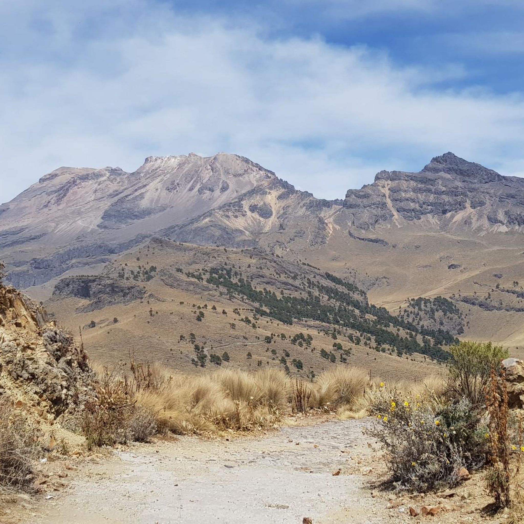
Mountain bike trails in Amecameca are situated in the Sierra Nevada mountain range, characterized by volcanic landscapes and diverse natural features. The region, nestled between the iconic Popocatépetl and Iztaccíhuatl volcanoes, features an average altitude of 4,000 meters above sea level. Pine forests, waterfalls, and the historic Paso de Cortés mountain pass define the terrain, offering varied conditions for mountain biking. This mountainous environment provides a range of elevation changes and scenic backdrops for outdoor activities.
Best mountain bike trails…
Last updated: May 21, 2026
5.0
(2)
16
riders
15.6km
01:30
340m
340m
Hard mountain bike ride. Good fitness required. Advanced riding skills necessary. Some portions of the route may require you to push your bike.
4.8
(4)
8
riders
36.7km
03:57
1,180m
1,180m
Hard mountain bike ride. Very good fitness required. Suitable for all skill levels.

Sign up for free
5.0
(2)
4
riders
40.3km
04:32
1,430m
1,430m
Hard mountain bike ride. Very good fitness required. Suitable for all skill levels.
5.0
(7)
5
riders
42.1km
03:31
830m
830m
Moderate mountain bike ride. Good fitness required. Suitable for all skill levels.
3.9
(7)
6
riders
50.7km
03:59
1,330m
1,330m
Hard mountain bike ride. Very good fitness required. Suitable for all skill levels.
5.0
(1)
2
riders
20.6km
01:48
460m
460m
Moderate mountain bike ride. Good fitness required. Suitable for all skill levels.
Get access to more routes and recommendations from other explorers.
Sign up for free
Already have an account?
Our route recommendations are based on thousands of hikes, rides, and runs completed by other people on komoot.
Start today with a free account
Your next adventure awaits.
Login or Signup
Popular around Amecameca
Tips from the Community

Amecameca de Juaréz is the municipal capital. It's a well-known town and a popular destination for visitors to the volcanoes, as it's located right at the foot of the volcanoes and is a national tourism area. There's almost everything here, plenty of food (the market, stalls, and shops), and there are bike repair shops if you need them. The plaza is large, with a traditional kiosk and church.
2
0
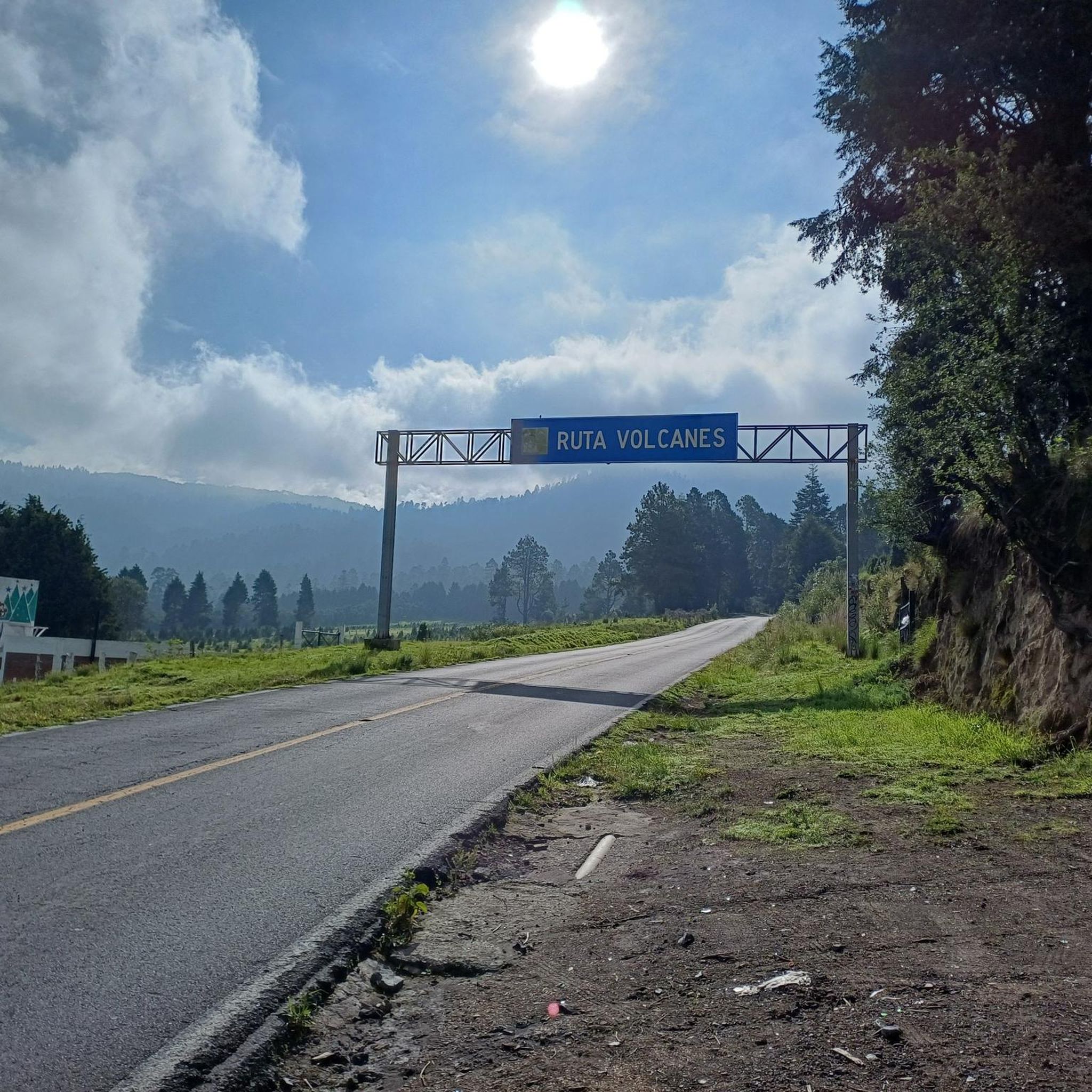
A monument depicting the passage of Spanish conquistador Hernán Cortés into the Valley of Mexico in 1520, mounted on a roundabout that provides access in several directions: Tlamacas (closed since the 1990s), Izta-Popo Refuge, Xalitzintla, Iztaccíhuatl, and San Pedro Nexapa. Its now-classic "Paso de Cortés" sign is a place where you can take a souvenir photo (of the achievement), which is currently obscure due to the countless stickers pasted by people from various cycling, motorcycling, mountaineering, and other clubs. Here, in addition to the beautiful view, you'll also find plenty of food on weekends; during the week, it's difficult to find supplies. The cold is usually very high, so always be prepared for the changes in mountain weather.
3
0

It is a place where even though the trees are contaminated and dry, nature abounds and the landscape looks incredible. Like a postcard.
0
0


Food market next to Amecameca church
0
0

The starting point for climbing the volcano ... the only place where I haven't met any Germans or German speakers for two weeks in 11 months.
0
0
Frequently Asked Questions
What kind of terrain can I expect on mountain bike trails in Amecameca?
Mountain bike trails in Amecameca are characterized by stunning volcanic landscapes and diverse natural features. You'll encounter mountainous terrain with significant elevation changes, pine forests, and areas with natural waterfalls and streams. The region is nestled between the iconic Popocatépetl and Iztaccíhuatl volcanoes, offering breathtaking scenery throughout your ride.
Are there mountain bike trails suitable for beginners in Amecameca?
While Amecameca is known for its challenging routes, there are moderate options available. For example, the The Rolling Stones – Amecameca town center loop from Ayapango is a moderate 26.2-mile trail with an elevation gain of around 830 meters. Another moderate option is the Muro del Aguileón – Hidden Waterfall loop from Amecameca, which is shorter at 8.6 miles.
What are some of the more challenging mountain bike routes in Amecameca?
Amecameca offers several difficult routes for experienced riders. The Paso de Cortés Monument – La Joya Pass – 4,000 m loop from Paso de Cortés is a challenging 9.7-mile trail that reaches high elevations, offering panoramic views between the volcanoes. Another demanding option is the Hidden Waterfall – Stream loop from Amecameca, a 22.8-mile path navigating diverse terrain.
Are there any circular mountain bike routes in Amecameca?
Yes, many of the mountain bike trails in Amecameca are designed as loops, allowing you to start and end in the same location. Examples include the Amecameca town center – Hidden Waterfall loop from Parque Nacional Sacromonte, a 25.1-mile route, and the Paso de Cortés Monument – Amecameca town center loop from Amecameca, which spans 31.5 miles.
What natural features or landmarks can I see along the mountain bike trails?
The trails often pass by stunning natural features and historical landmarks. You can expect to see the iconic Popocatépetl and Iztaccíhuatl volcanoes, and many routes incorporate beautiful waterfalls like the 'Hidden Waterfall' and Cascada El Encanto. The historic Paso de Cortés Monument is a prominent landmark and starting point for several routes, offering spectacular panoramic views.
Are there any family-friendly mountain biking options in Amecameca?
While many trails in Amecameca are rated moderate to difficult due to elevation and technical sections, families looking for a less strenuous experience might consider exploring areas like Eco Parque San Pedro or Temazcal Park, which offer trails and natural settings suitable for general outdoor activities. For specific mountain biking, it's best to assess the difficulty of moderate routes like the Hidden Waterfall – Amecameca town center loop from Amecameca to see if they match your family's skill level.
What do other mountain bikers say about the trails in Amecameca?
The mountain bike trails in Amecameca are highly regarded by the komoot community, with an average score of 4.8 stars from over 25 reviews. Riders often praise the diverse terrain, the challenging climbs, and the breathtaking volcanic scenery. Many appreciate the well-maintained paths and the sense of adventure offered by routes that reach high elevations.
What is the best time of year to go mountain biking in Amecameca?
Amecameca's mountainous environment means weather conditions can vary. Generally, the dry season (roughly November to May) offers more stable weather and clearer views of the volcanoes, making it ideal for mountain biking. During the rainy season (June to October), trails can become muddy and slippery, and visibility might be reduced, especially at higher altitudes.
Are there places to explore or relax near the mountain bike trails?
Absolutely. Beyond the trails, Amecameca offers several attractions. The Amecameca town center itself is a charming place to visit. You can also find spots like Place to relax, or explore the Eco Parque San Pedro. For those interested in history and culture, Hacienda Panoaya offers a recreational park and museums, while the Santuario del Señor del Sacromonte is a significant pilgrimage site.
How long do mountain bike trails in Amecameca typically take to complete?
The duration of mountain bike trails in Amecameca varies significantly based on their length and difficulty. Shorter, moderate routes like the Muro del Aguileón – Hidden Waterfall loop from Amecameca (8.6 miles) can take around 1 hour 19 minutes. Longer, more difficult trails, such as the Amecameca town center – Hidden Waterfall loop from Parque Nacional Sacromonte (25.1 miles), might take approximately 4 hours 32 minutes.
Most popular attractions in Amecameca

Get inspired with the komoot mobile app


Explore more
Browse the best MTB trails in other regions.
