The best walks and hikes around Burgdorf
4.5
(788)
3,358
hikers
396
hikes
Hiking around Burgdorf, nestled in Switzerland's Emmental region, offers a diverse landscape for outdoor enthusiasts. The area is characterized by rolling hills, lush green meadows, and extensive forests. The Emme River flows through the region, providing serene riverside paths, while the striking Gysnauflühe rock faces offer a dramatic visual backdrop. This varied terrain provides a network of trails suitable for different fitness levels.
Best hiking trails around Burgdorf
- The most popular hiking route is Kohlshorn Gravel Ponds – Kolshorner Teich loop from Beinhorn, a 6.0 miles (9.7 km) trail that takes 2 hours 27 minutes to complete. This route offers views of the local gravel ponds and surrounding natural areas.
- Another top favourite among local hikers is Wulbeck Bridge – Wulbek Bridge & Heidschnucken 🥰 loop from Ramlingen, a moderate 8.0 miles (12.9 km) path. This trail leads through varied terrain, including open fields and wooded sections.
- Local hikers also love the Wulbeck Bridge – Wulbek Bridge & Heidschnucken 🥰 loop from Schillerslage, a 11.2 miles (18.0 km) trail leading through the Emmental's characteristic rolling hills and green meadows, often completed in about 4 hours 33 minutes.
- Hiking around Burgdorf is defined by rolling hills, the Emme River paths, and tranquil forests. The network offers options for various ability levels, from easy strolls to more challenging hikes.
- The routes in Burgdorf are highly rated by the komoot community with an average score of 4.6 stars from over 600 reviews. More than 3000 hikers have used komoot to explore Burgdorf's varied terrain.
Last updated: July 24, 2026
4.3
(55)
154
hikers
9.70km
02:27
20m
20m
Moderate hike. Good fitness required. Easily-accessible paths. Suitable for all skill levels.
4.9
(24)
79
hikers
Moderate hike. Good fitness required. Easily-accessible paths. Suitable for all skill levels.

Sign up for free
4.9
(21)
58
hikers
Moderate hike. Good fitness required. Easily-accessible paths. Suitable for all skill levels.
3.9
(13)
38
hikers
Moderate hike. Good fitness required. Easily-accessible paths. Suitable for all skill levels.
4.0
(13)
42
hikers
Moderate hike. Good fitness required. Easily-accessible paths. Suitable for all skill levels.
Get access to more routes and recommendations from other explorers.
Sign up for free
Already have an account?
Our route recommendations are based on thousands of hikes, rides, and runs completed by other people on komoot.
Start today with a free account
Your next adventure awaits.
Login or Signup
Tips from the Community

I have actually ridden this path behind the gate with my MTB before, but I would only recommend trying it in spring and late autumn/winter...
0
0
Without this stable, sufficiently wide bridge over the Wulbeck, the beautiful route alternative off Schillerslager Straße between Schillerslage and Engensen would be unusable at least from autumn to spring for people who want to avoid wet dirt. In summer, the Wülbeck not infrequently dries out at this point…
0
0

The Burgdorfer Holz is a sprawling forest area between Burgdorf, Uetze, and Lehrte, which is particularly popular with hikers, joggers, and families.
0
0
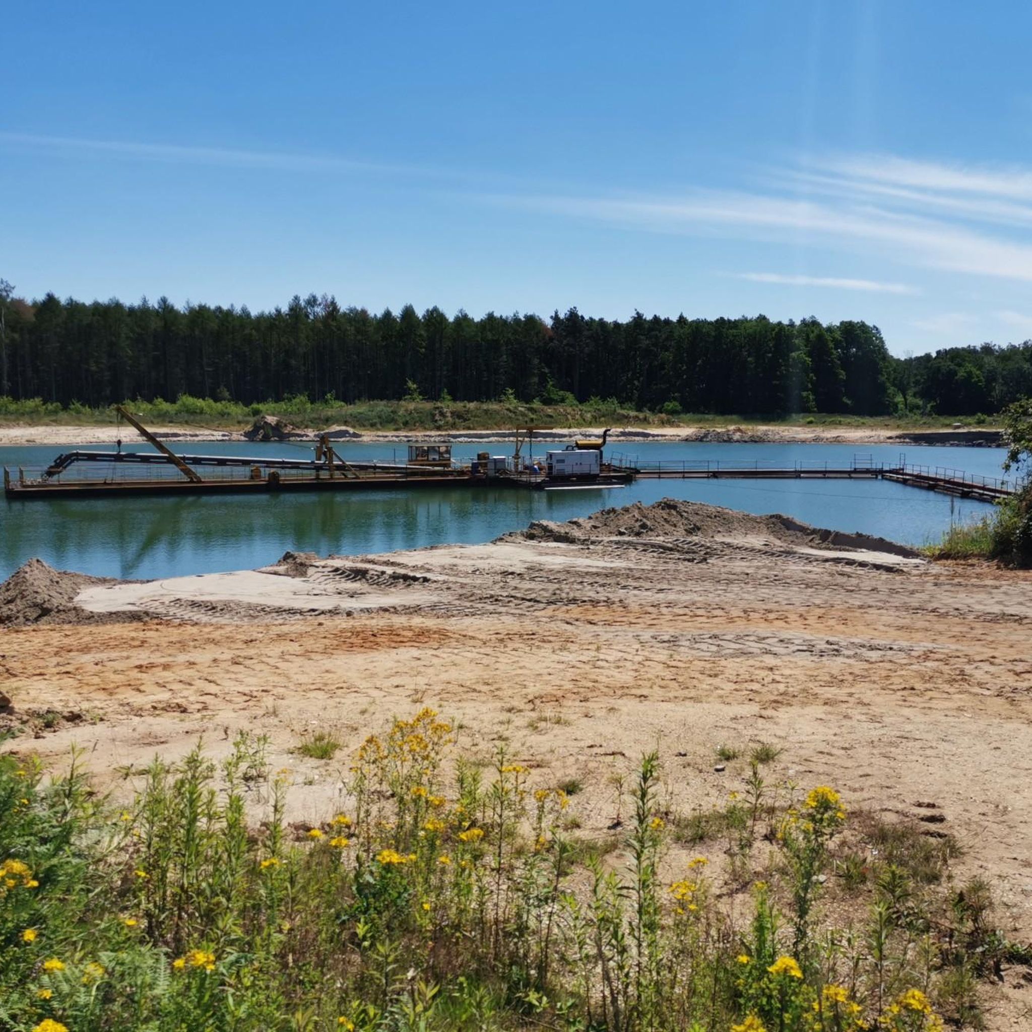
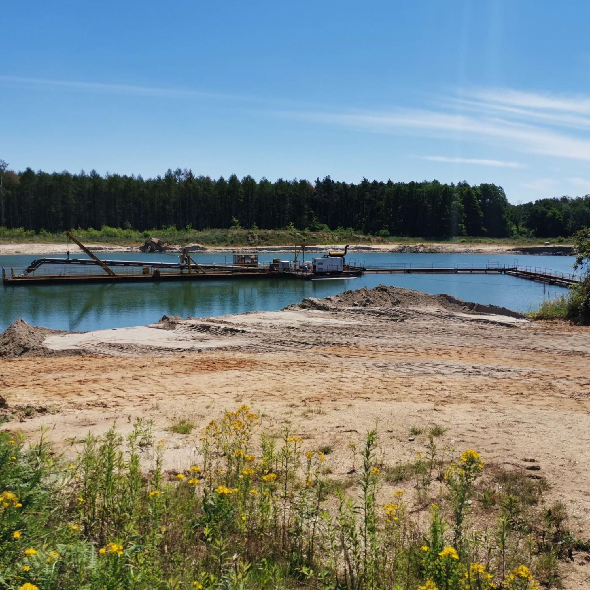
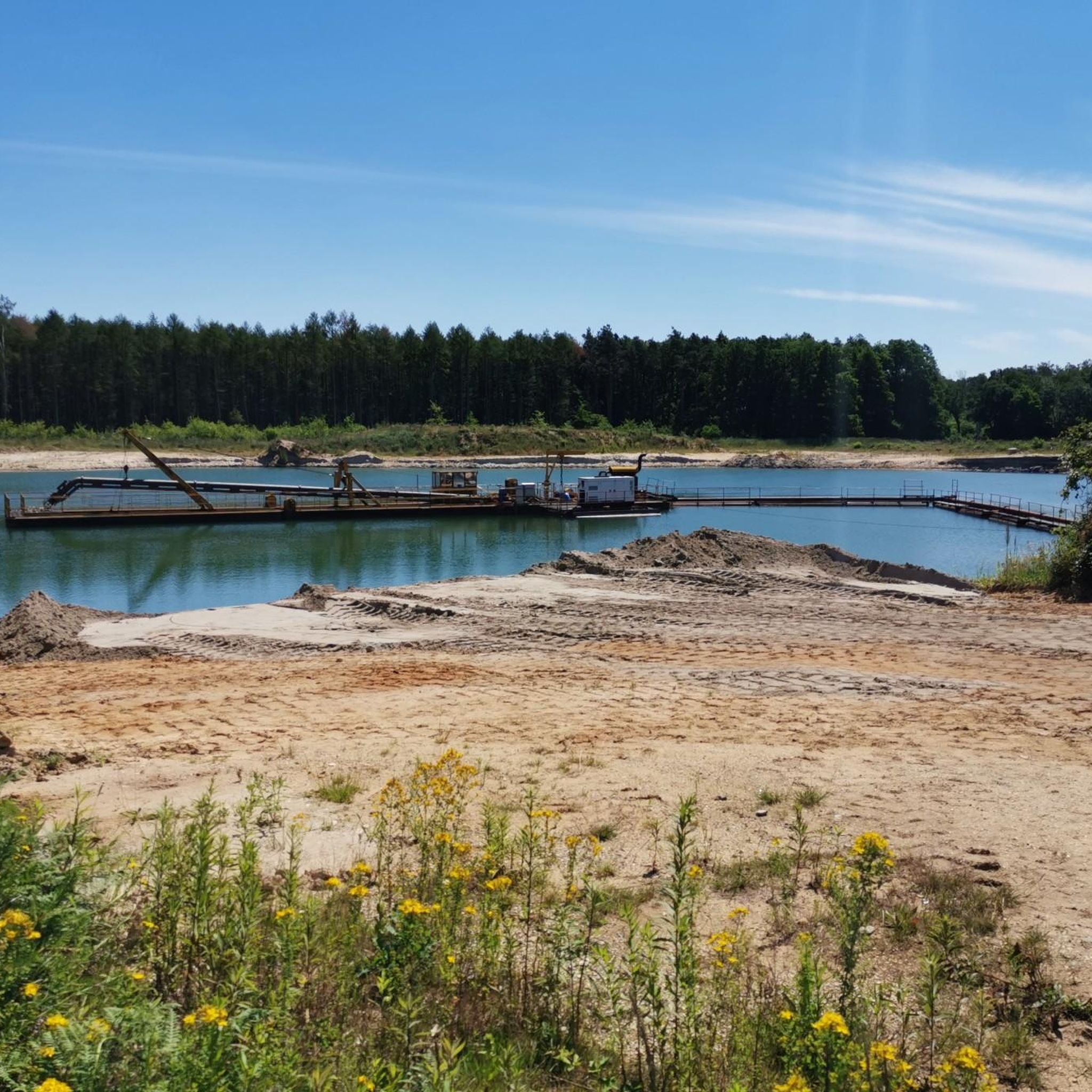
The view of the old part of the gravel pit is a joy at any time of year and day!
0
0
In the heart of Kolshorn, on the village square at Bürgermeister-Fuge-Straße, stands a tower with a clock at its top. How the words 'clock' and 'tower' came to be swapped in the name of this landmark can be found here: www.stadtmarketing-lehrte.de/Sehensw%C3%BCrdigkeiten/75
0
0

Kolshorn Pond is a gravel pit lake near Kolshorn. There is a second, smaller pond opposite, but it is not accessible. Both are fishing ponds.
1
0
The fire station with its hose tower, built in 1949, stands in the village square. Next to it is a bell tower with a clock, erected in 1998. The bell tower had been dismantled from the former schoolhouse, which is now privately owned. After restoration, the tower was placed in the village square.
1
1

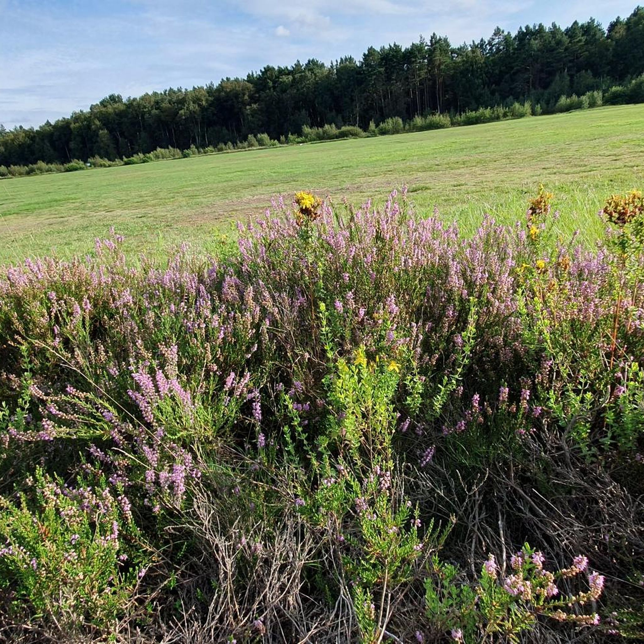
I love these narrow trails. They're kind of rustic. Lots of roots (be careful during/after rain), and they always run along the Wulbeck River, which is dry in many places (September 12th).
0
0
Frequently Asked Questions
How many hiking trails are available around Burgdorf?
Burgdorf offers a comprehensive network of over 370 hiking trails. These routes cater to various preferences, from leisurely strolls along the Emme River to more challenging treks through the rolling hills.
What kind of terrain can I expect on hikes near Burgdorf?
The terrain around Burgdorf is quite diverse. You'll find gentle paths along the Emme River, trails winding through lush green meadows and tranquil forests, and routes that ascend the striking Gysnauflühe rock faces. The region is characterized by its rolling hills, offering varied landscapes for exploration.
What do other hikers say about the trails in Burgdorf?
The hiking trails in Burgdorf are highly regarded by the komoot community, boasting an average rating of 4.6 stars from over 600 reviews. Hikers often praise the well-maintained paths, the scenic views, and the diverse natural environment.
Are there easy hiking trails suitable for beginners or families in Burgdorf?
Yes, Burgdorf is very family-friendly, with over 250 easy routes available. Many trails offer minimal elevation gain, such as those along the Emme River. The Kohlshorn Gravel Ponds – Kolshorner Teich loop from Beinhorn is a popular easy option, offering pleasant views over 6 miles (9.7 km).
Are there more challenging hikes for experienced hikers?
While many trails are moderate, there are 5 routes classified as difficult for those seeking a greater challenge. These routes often involve more significant elevation changes and longer distances, providing a good workout amidst Burgdorf's varied landscape.
What natural attractions can I discover while hiking in Burgdorf?
Hikers can explore several natural highlights. The dramatic Gysnauflühe rock faces offer a unique backdrop, while the serene Emme River provides tranquil riverside paths. You can also find beautiful lakes like the Lily Pond in Beerbusch Forest, which is part of the Lily Pond in Beerbusch Forest – Great Star (Burgdorf Wood) loop from Dachtmissen route.
Are there any themed trails or historical points of interest to explore?
Absolutely! The Wienhausen Abbey is a notable historical site nearby. For a unique experience, the Planetenweg (Planet Trail) near Wynigen offers a scaled model of the solar system, perfect for families. The Pestalozzi Trail, starting at Burgdorf Castle, also provides an interactive way to learn about the educator Johann Heinrich Pestalozzi.
Where can I find the best viewpoints around Burgdorf?
For panoramic vistas, head to Burgdorf Castle Hill, Schlossberg, or Himmelreich. These spots offer sweeping views of the surrounding forests, valleys, and on clear days, even the Jura Mountains. The Lueg viewpoint is also highly recommended for magnificent scenery, potentially including Alpine views.
Are there circular hiking routes available in Burgdorf?
Yes, many of Burgdorf's trails are designed as circular routes, allowing you to start and end at the same point. Examples include the popular Wulbeck Bridge – Wulbek Bridge & Heidschnucken 🥰 loop from Ramlingen, which covers 8 miles (12.9 km) through varied terrain.
Is Burgdorf a good destination for dog-friendly hiking?
Burgdorf's natural landscape, with its extensive forests and riverside paths, is generally welcoming for dogs. Many trails offer open spaces and natural environments for your canine companion to enjoy. It's always advisable to keep dogs on a leash in certain areas and respect local regulations.
What is the best time of year to go hiking in Burgdorf?
Burgdorf offers enjoyable hiking experiences throughout the year. Spring brings lush greenery and blooming meadows, while summer provides warm weather for exploring. Autumn showcases vibrant fall foliage, and even winter offers tranquil, snow-dusted landscapes for those prepared for colder conditions. The rolling hills and forests are beautiful in every season.
Are there options for public transport access to hiking trails in Burgdorf?
Burgdorf is well-connected by public transport, making many trailheads accessible without a car. The town's central location in the Emmental region means that local buses and trains can often get you close to various starting points for your hikes. Check local transport schedules for specific routes.
Are there cafes or pubs near the hiking trails for a break?
Yes, Burgdorf's historic town center offers charming cafes and traditional pubs where you can relax and refuel after your hike. Many routes are designed to pass through or near villages that provide opportunities for a refreshing stop.
Most popular routes around Burgdorf
Most popular attractions around Burgdorf

Get inspired with the komoot mobile app


Explore more
Browse the best Hikes in other regions.
