The best walks and hikes in Santa Isabel Cholula
4.6
(15)
133
hikers
4
hikes
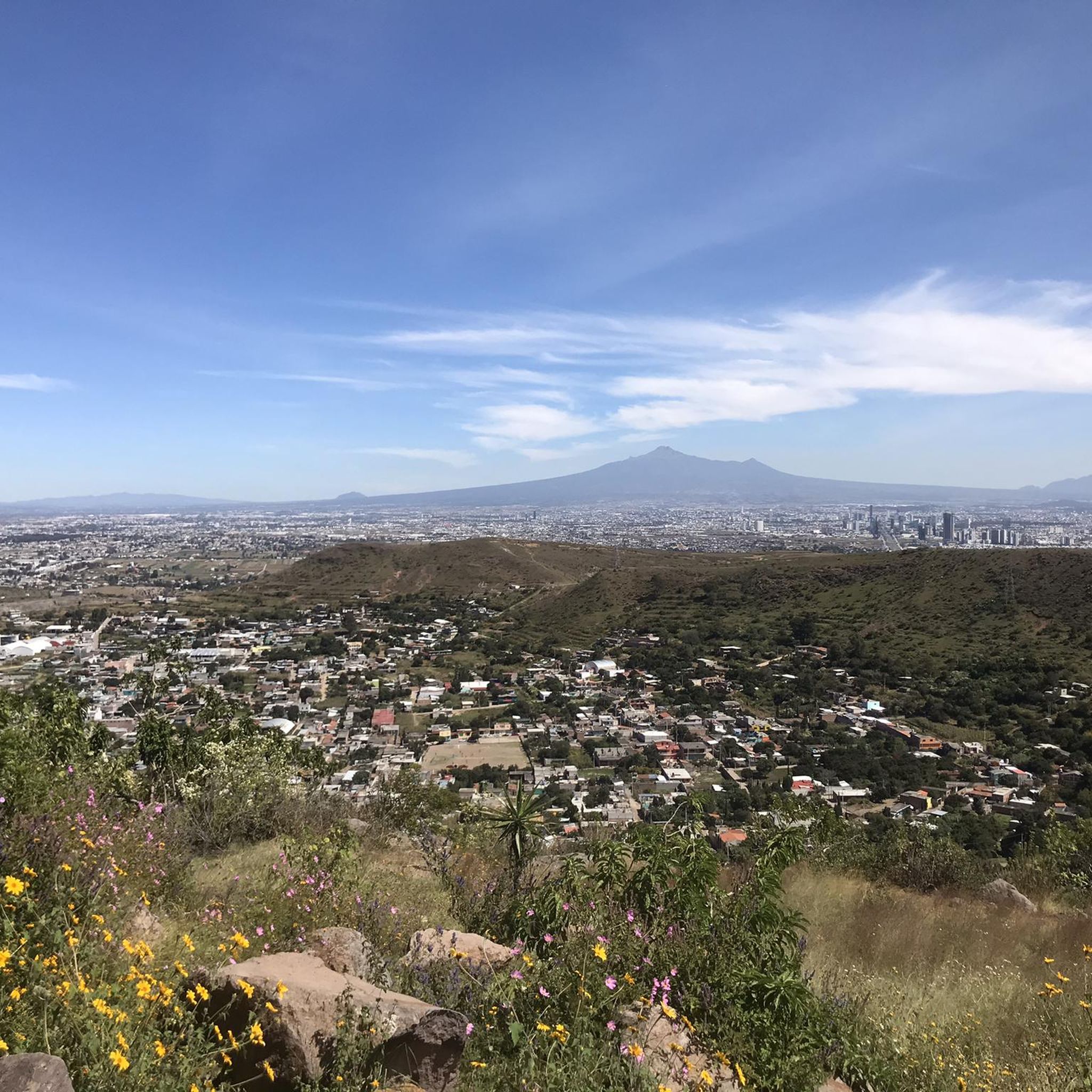
Hiking in Santa Isabel Cholula offers trails through a landscape shaped by volcanic activity and agricultural areas. The region features prominent hills like Cerro Zapo and Cerro Zapotecas, providing views of the Popocatépetl volcano. Trails often traverse areas with prickly pear cactus plantations and lead to cultural landmarks such as the Great Pyramid of Cholula. The terrain includes varied elevations, from gentle slopes to more sustained climbs on the hills.
Best hiking trails in Santa Isabel Cholula
- The most popular…
Last updated: July 29, 2026
4.7
(6)
39
hikers
13.8km
03:53
250m
250m
Moderate hike. Good fitness required. Easily-accessible paths. Suitable for all skill levels.
5.0
(4)
28
hikers
8.84km
02:27
170m
170m
Moderate hike. Good fitness required. Easily-accessible paths. Suitable for all skill levels.

Sign up for free
4.3
(3)
19
hikers
Moderate hike. Good fitness required. Easily-accessible paths. Suitable for all skill levels.
12
hikers
5.32km
01:29
100m
100m
Easy hike. Great for any fitness level. Easily-accessible paths. Suitable for all skill levels.
13
hikers
Moderate hike. Good fitness required. Easily-accessible paths. Suitable for all skill levels.
5.0
(1)
9
hikers
6.67km
01:55
160m
160m
Easy hike. Great for any fitness level. Easily-accessible paths. Suitable for all skill levels.
4
hikers
Moderate hike. Good fitness required. Easily-accessible paths. Suitable for all skill levels.
9.19km
02:39
210m
210m
Moderate hike. Good fitness required. Easily-accessible paths. Suitable for all skill levels.
3
hikers
1.96km
00:31
10m
10m
Easy hike. Great for any fitness level. Easily-accessible paths. Suitable for all skill levels.
4.0
(1)
3
hikers
Easy hike. Great for any fitness level. Easily-accessible paths. Suitable for all skill levels.
Our route recommendations are based on thousands of hikes, rides, and runs completed by other people on komoot.
Start today with a free account
Your next adventure awaits.
Login or Signup


Tips from the Community

The climb is not easy, but the view is worth the effort - provided the weather is clear
0
0
If volume is your priority: Gran Pirámide de Cholula / Tlachihualtepetl
0
0

Possibility of parking your car in the surroundings
0
0

This street is full of beautifully painted houses. The restaurant at the intersection is a very nice photo opportunity
1
0
On the market square there is a sign that serves as a photo motif with the pyramid in the background
1
0
Frequently Asked Questions
How many hiking trails are available in Santa Isabel Cholula?
Santa Isabel Cholula offers a selection of hiking trails, with komoot currently featuring 4 routes. These trails cater to various preferences, from easy walks to more moderate climbs.
Are there easy hiking options suitable for beginners or families in Santa Isabel Cholula?
Yes, Santa Isabel Cholula has several easy hiking options. For instance, the Cerro Zapotecas – Miguel Viderique Gallery loop from Cholula is an easy 3.3-mile (5.3 km) trail that takes about 1 hour 29 minutes. Another accessible option is the Great Pyramid of Cholula – La Lunita, Cholula loop from Cholula, which is a shorter 0.9-mile (1.5 km) route.
What kind of landscapes and sights can I expect to see while hiking in Santa Isabel Cholula?
Hiking in Santa Isabel Cholula offers diverse scenery shaped by volcanic activity and agricultural areas. You'll encounter prominent hills like Cerro Zapo and Cerro Zapotecas, often providing views of the Popocatépetl volcano. Trails frequently traverse prickly pear cactus plantations and lead to cultural landmarks such as the Great Pyramid of Cholula.
Are there any circular hiking routes in Santa Isabel Cholula?
Many of the hiking routes in Santa Isabel Cholula are designed as loops, allowing you to start and end at the same point. Examples include the Summit of Cerro Zapo (2,380 m) – View of Popocatépetl loop from Cholula and the View of Popocatépetl – Prickly Pear Cactus Plantation loop from Cholula.
What is the typical duration for hikes in Santa Isabel Cholula?
Hike durations vary depending on the route's length and difficulty. Shorter, easy trails like the Great Pyramid of Cholula – La Lunita, Cholula loop from Cholula can be completed in under an hour. More moderate routes, such as the Summit of Cerro Zapo (2,380 m) – View of Popocatépetl loop from Cholula, typically take around 3 hours 47 minutes.
What do other hikers enjoy most about hiking in Santa Isabel Cholula?
The hiking experience in Santa Isabel Cholula is highly rated by the komoot community, with an average score of 4.6 stars. Hikers often praise the panoramic views of the Popocatépetl volcano, the unique landscapes featuring prickly pear cactus plantations, and the opportunity to explore both natural and cultural landmarks like the Great Pyramid of Cholula.
Are there any challenging hikes for experienced hikers in Santa Isabel Cholula?
While most routes are easy to moderate, trails like the Miguel Viderique Gallery – Summit of Cerro Zapo (2,380 m) loop from Cholula offer more sustained climbs and longer distances, providing a good workout for those seeking a moderate challenge. The region's terrain includes varied elevations, especially around hills like Cerro Zapo.
What is the best time of year to go hiking in Santa Isabel Cholula?
The best time for hiking in Santa Isabel Cholula generally depends on local weather patterns. It's advisable to check local forecasts for comfortable temperatures and minimal rainfall, especially if planning to hike during the rainy season. The region's volcanic and agricultural landscapes are enjoyable in pleasant weather conditions.
Are there any specific landmarks or points of interest along the hiking trails?
Yes, several routes incorporate notable landmarks. For example, the Cerro Zapotecas – Miguel Viderique Gallery loop from Cholula takes you through the Cerro Zapotecas hill area and past the Miguel Viderique Gallery. The Great Pyramid of Cholula is also a significant cultural landmark accessible on some shorter routes.
What should I wear or bring for hiking in Santa Isabel Cholula?
Given the varied terrain and potential for sun exposure, it's recommended to wear comfortable hiking shoes, layered clothing, and sun protection such as a hat and sunscreen. Carrying sufficient water is always advisable, especially on longer routes or during warmer periods. Checking the weather forecast before you go is also a good practice.
Is it possible to see wildlife on the trails in Santa Isabel Cholula?
While specific wildlife sightings can vary, the natural and agricultural landscapes of Santa Isabel Cholula, including areas around Cerro Zapo and prickly pear cactus plantations, may offer opportunities to observe local bird species and smaller animals. Maintaining a quiet presence increases your chances of encountering local fauna.
Are there any hidden gem hikes in Santa Isabel Cholula that are less frequented?
While the komoot community actively explores the area, routes like the Summit of Cerro Zapo (2,380 m) – Prickly Pear Cactus Plantation loop from Cholula offer a blend of prominent features and unique landscapes, potentially providing a more secluded experience compared to the most popular trails. Exploring the less-trafficked sections of the agricultural areas can also reveal quieter paths.
Most popular routes in Santa Isabel Cholula

Get inspired with the komoot mobile app


Explore more
Browse the best Hikes in other regions.
