The 9 Most Amazing Peaks around Beguildy
Mountain peaks around Beguildy, a village in Powys, Wales, are characterized by tranquil, unspoiled countryside and elevated landscapes. The area features prominent hills and is integrated into renowned walking trails, offering expansive views and a rich natural experience. These prominent hills around Beguildy Powys provide diverse walking and hiking opportunities, from gentle strolls to more challenging climbs. The landscape includes open moorland, ancient woodlands, and picturesque valleys.
Best mountain peaks around Beguildy
- The most popular mountain peaks is Cwm-Sanaham Hill…
Last updated: July 31, 2026
Cwm-Sanaham Hill Trig Point
Highlight • Viewpoint
Tip by

Llanfair Hill Trig Point
Highlight • Trail
Tip by

Sign up now to discover places like this
Get recommendations on the best single tracks, peaks, & plenty of other exciting outdoor places.
Sign up for free
Black Mixen Summit
Highlight • Structure
Tip by

Bache Hill Summit
Highlight • Viewpoint
Tip by
Ysgŵd-ffordd
Highlight • Summit
Tip by

Sign up for free to discover even more peaks around Beguildy.
Sign up for free
Already have an account?
Start today with a free account
Your next adventure awaits.
Login or Signup

Other adventures around Beguildy

Tips from the Community

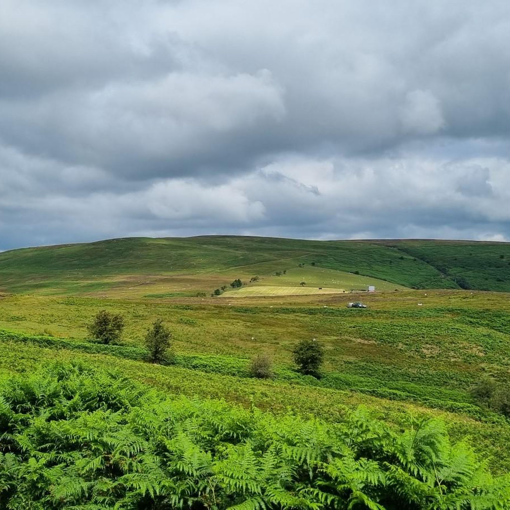
Rising to 1,443 feet (440 m), Ysgŵd-ffordd is a fine moorland summit. It features on the Glyndŵr’s Way National Trail, one of three in Wales. The summit trig point lies around 400 feet (120 m) west of the trail.
1
0

Cwm-Sanaham is an elevated hilltop located near Knighton in Shropshire. From this vantage point, you can enjoy wonderful panoramic views of the surrounding countryside across rolling hills, meandering streams and picturesque landscapes.
2
0

Llanfair Hill lies near the Welsh/English border in Shropshire and has far-reaching views in every direction. Grassy and exposed the hill is also home to a stretch of Offa's Dyke and the long-distance footpath, Jack Mytton Way. There's a trig point at 1,410 feet (430 m).
1
0

Black Mixen is a subsidiary summit of Rhos Fawr or Great Rhos in the Radnor Forest. The summit is large peat bog plateau. The summit is marked with a cairn, and is next to a radio transmitter and its building. Black Mixen is the only UK registered Nuttall to have a communications mast on its summit.
3
0
Bache Hill is a subsidiary summit of Rhos Fawr or Great Rhos, in the Radnor Forest in Wales. It is located to the east of Black Mixen. The summit is marked by a trig point built on an ancient burial mound, probably of Bronze Age date, like most of the summit cairns and round barrows in Wales. It is a UK registered Nuttall.
3
0

Before I tell you about the most amazing views on top of Cwm-Sanaham Hill, I want to explain about how I got to the trig point so that you can follow what I did. Firstly, there is a steep ascent up the hill which can be very tough, so it's best if you are prepared if you're tackling it. What I did was that I charged straight up the steep pathway to which I found myself on a very narrow ledge. You can take your time when walking up that first section of footpath. There is even a shear drop down below, so I walked along the path slowly and carefully. Secondly came the easier part, which was when I saw the trig point straight up ahead with the path still visible to follow. After I went past the narrow ledge, the path was then more grassy, which made things a lot more straightforward. There was no more drops to worry about, but instead the path was more even. Eventually, I arrived at the top of the hill where the trig point was located. I was then met with the most beautiful views I had ever seen, which stretched from Knighton all the way to nearby Knucklas and the rest of the Welsh valleys. It was also where I had my lunch, which was quite a relief after all the hill climbing I did. Cwm-Sanaham Hill is 406m high and it's the perfect vantage point to see some of the most glorious views in that part of Wales.
2
0
While I was planning my route out, I noticed on one of the ordnance maps online that there is a hill called Llanfair Hill on Offa's Dyke Path. It measures at 430m high, which is somewhere I really wanted to go and see for myself. On the day of the walk, I eventually arrived at the trig point located in a field right next to a metal fence. Llanfair Hill does offer gorgeous views of the Welsh valleys in the distance if you are planning on going walking on a clear day, just like I did.
0
0
Frequently Asked Questions
What are the most prominent hills and peaks around Beguildy?
The Beguildy area, while not featuring towering mountains, offers several prominent hills and elevated landscapes. Notable peaks include Cwm-Sanaham Hill Trig Point, offering panoramic views, and Llanfair Hill Trig Point, known for its far-reaching vistas and a section of Offa's Dyke. Other significant summits include Bache Hill Summit, built on an ancient burial mound, and Ysgŵd-ffordd, a moorland summit on the Glyndŵr’s Way National Trail. Beacon Hill (Beguildy Beacon) is also a significant local feature, offering expansive views from its heather-clad moorland.
Are there any historical features on the peaks around Beguildy?
Yes, the peaks and hills around Beguildy are rich in history. Llanfair Hill Trig Point notably encompasses a section of Offa's Dyke, an ancient earthwork marking the border between England and Wales. Additionally, Bache Hill Summit features a trig point built on what is believed to be an ancient Bronze Age burial mound, adding a layer of historical intrigue to your hike.
What kind of views can I expect from the peaks near Beguildy?
The peaks and hills around Beguildy offer spectacular panoramic views of the tranquil, unspoiled countryside. From Cwm-Sanaham Hill Trig Point, you can see views stretching from Knighton to Knucklas and across the Welsh valleys. Beacon Hill provides breathtaking vistas in all directions over rolling hills and heather moorland. Llanfair Hill Trig Point also boasts far-reaching views across the landscape.
Are there family-friendly walks or easy mountain hikes around Beguildy?
While some ascents can be challenging, the Beguildy area offers a range of walking opportunities. The Beguildy Circular Trail, which includes Beacon Hill, is considered an easy to moderate walk, suitable for families looking for scenic views without extreme difficulty. The overall landscape provides diverse options, from gentle strolls through valleys to more challenging hill climbs, allowing you to choose routes that match your family's fitness level.
What wildlife and nature can I observe on the peaks near Beguildy?
The heather-clad moorlands and open spaces of the Beguildy area are a haven for wildlife. Beacon Hill, for instance, is an upland nature reserve known for birdwatching, with species like Wheatear, Meadow Pipit, Whinchat, Stonechat, and Red Kite frequently sighted. The remote sections of the Glyndwr's Way National Trail, which passes through the area, also offer abundant opportunities to observe various birds and other wildlife in a peaceful setting.
What are some popular long-distance trails that pass through the Beguildy area?
The Beguildy area is integrated into several renowned walking trails. The Glyndwr's Way National Trail, a 135-mile (217 km) long path, meanders through mid-Wales, including Beguildy, offering tranquil beauty through moorland, farmland, and woodlands. Llanfair Hill Trig Point is also part of the long-distance footpath, Jack Mytton Way, and encompasses a section of Offa's Dyke.
What other outdoor activities can I do near the peaks around Beguildy?
Beyond hiking and walking, the region around Beguildy offers excellent opportunities for cycling. You can explore various routes for mountain biking, touring cycling, and road cycling. These guides provide routes ranging from easy to difficult, allowing you to experience the diverse landscape on two wheels.
What is the best time to hike the peaks around Beguildy?
The Beguildy area is beautiful year-round, but the best time for hiking is generally from spring to autumn (April to October) when the weather is milder and the days are longer. During these months, the heather moorlands are vibrant, and conditions are ideal for enjoying the panoramic views. While winter hiking is possible, be prepared for colder temperatures, potentially challenging conditions, and shorter daylight hours.
Are there circular walks available around Beguildy's peaks?
Yes, there are circular walks that allow you to experience the local elevated landscapes. The Beguildy Circular Trail is a notable example, taking hikers around Beacon Hill and providing scenic views of the Teme Valley. Many sections of the Glyndwr's Way National Trail also contribute to local circular walks from Beguildy, offering accessible ways to explore the area.
What are some tips for hiking Cwm-Sanaham Hill?
Hiking Cwm-Sanaham Hill Trig Point involves a steep ascent, so it's best to be prepared for a challenging climb. The path can become narrow in sections with a sheer drop, so proceed slowly and carefully. After the initial steep part, the path becomes more grassy and even, leading directly to the trig point. The reward is the most beautiful panoramic views stretching across the Welsh valleys.
Where can I find more information about the Beguildy Circular Trail?
For more detailed information about the Beguildy Circular Trail, including route specifics and maps, you can refer to resources provided by local tourism initiatives. A useful PDF guide can be found at visitknighton.co.uk.
What makes the Glyndwr's Way National Trail appealing in this region?
The Glyndwr's Way National Trail, passing through the Beguildy area, is renowned for its tranquil and unspoiled beauty. Its appeal lies in its remoteness, offering a peaceful hiking experience where encounters with other walkers are rare. It takes you through open moorland, rolling farmland, woodlands, and forests, providing diverse scenery and abundant opportunities to observe birds and wildlife.
Most popular attractions around Beguildy

Get inspired with the komoot mobile app


Explore more
See even more amazing summits around Beguildy with these guides:
