The best road cycling routes around Newton-On-Ouse
4.7
(207)
5,096
riders
262
rides
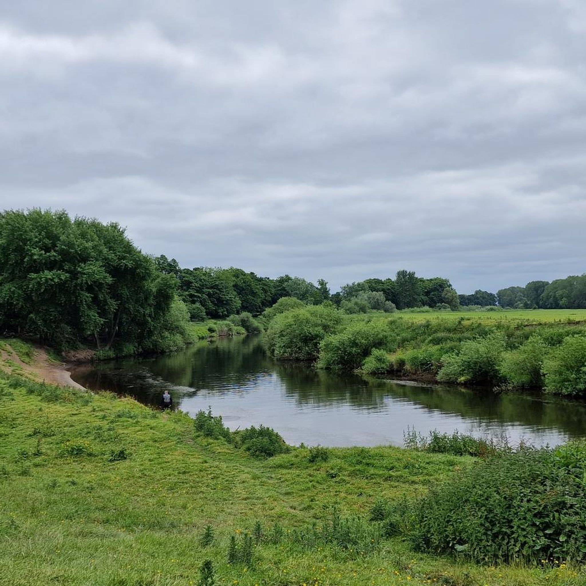
Road cycling routes around Newton-On-Ouse are characterized by a landscape featuring the River Ouse and River Ure, with many routes utilizing paved surfaces. The area includes open grasslands like Clifton Ings, which offer scenic views along the riverbanks. Terrain varies from predominantly flat sections ideal for road bikes to routes with moderate elevation gains. This region provides a network of paths suitable for various fitness levels, often passing by notable landmarks.
Best road cycling routes around Newton-On-Ouse
- The most popular…
Last updated: May 25, 2026
5.0
(1)
29
riders
28.1km
01:04
70m
70m
Easy road ride. Great for any fitness level. Mostly well-paved surfaces and easy to ride.
30
riders
64.7km
02:40
180m
180m
Moderate road ride. Good fitness required. Some segments of this route may be unpaved and difficult to ride.

Sign up for free
28
riders
82.1km
03:13
310m
310m
Moderate road ride. Good fitness required. Mostly well-paved surfaces and easy to ride.
5.0
(2)
25
riders
49.8km
02:07
400m
400m
Moderate road ride. Good fitness required. Mostly well-paved surfaces and easy to ride.
24
riders
76.0km
03:10
320m
320m
Moderate road ride. Good fitness required. Mostly well-paved surfaces and easy to ride.
Get access to more routes and recommendations from other explorers.
Sign up for free
Already have an account?
Our route recommendations are based on thousands of hikes, rides, and runs completed by other people on komoot.
Start today with a free account
Your next adventure awaits.
Login or Signup

Tips from the Community

Byland Abbey is a ruined 12th-century monastery located in the North York Moors National Park in North Yorkshire, England, managed today by English Heritage. Once a powerhouse of the Cistercian order, it stands as one of the finest examples of early Gothic architecture in the country and famously inspired the design of the iconic Rose Window at York Minster.
0
0

On a sunny day like today, you get hit by the smell of rapeseed. Blue sky and yellow fields 🇺🇦
0
0


You get a true sense of scale when you turn onto Museum Street with the view of the cathedral in front of you, it dwarfs the surrounding buildings. York is a busy city centre with packed streets
0
0

The Devil's Arrows are three aligned standing stones. The standing stone alignment consists of some of the tallest standing stones in the United Kingdom. Erected during the Stone Age and distinctively grooved by millennia of rainfall, the tallest southernmost stone is 22.5 feet (6.85 m) in height, making this the second tallest menhir in the United Kingdom.
0
0


Iconic view looking northeast up Museum Street, get the sense of scale that is difficult to appreciate when stood right next to it. Another great view is the eastern end of the Minster from College Street.
1
0
Frequently Asked Questions
How many road cycling routes are available around Newton-On-Ouse?
Newton-On-Ouse offers a wide variety of road cycling routes, with over 240 options recorded on komoot. These include approximately 80 easy routes, 140 moderate routes, and 20 more challenging trails, catering to all fitness levels.
Are there easy road cycling routes suitable for beginners or families?
Yes, Newton-On-Ouse has numerous easy routes perfect for beginners or family outings. A great option is the Helperby Stores & Deli – Helperby Village loop from Easingwold, which is 17.5 miles (28.1 km) long and takes just over an hour on mostly paved surfaces. The area's flat sections along the River Ouse and River Ure are generally very accessible.
What are some scenic highlights or landmarks I can see along the road cycling routes?
Many routes offer picturesque views and pass by notable landmarks. You can cycle through the tranquil grounds of Beningbrough Hall, a National Trust property, or enjoy the waterside scenery along the River Ouse and River Ure, particularly around Aldwark Bridge. The open grasslands of Clifton Ings also provide expansive views.
Are there any longer or more challenging road cycling routes for experienced riders?
Absolutely. For those seeking a greater challenge, routes like the Boroughbridge High Street – Aldwark Bridge loop from Alne cover 51.0 miles (82.1 km) with over 300 meters of elevation gain, taking around 3 hours 12 minutes. Another moderate option is the Micklegate Bar – Marston Moor Battle Monument loop from Beningbrough, which is 40.2 miles (64.7 km) and features a mix of open countryside.
Can I find circular road cycling routes in the Newton-On-Ouse area?
Yes, many of the road cycling routes around Newton-On-Ouse are designed as loops, allowing you to start and finish at the same point. Examples include the Helperby Stores & Deli – Helperby Village loop from Easingwold and the York Minster – Easingwold Cafes loop from Alne, providing convenient circular journeys.
What is the best time of year for road cycling in Newton-On-Ouse?
The spring and summer months generally offer the most pleasant conditions for road cycling in Newton-On-Ouse, with warmer weather and lush landscapes. However, the paved surfaces make many routes accessible year-round, though some segments on longer rides might be unpaved and more challenging in wet conditions.
Are there places to stop for refreshments or food along the routes?
Yes, several routes pass through or near villages and towns where you can find amenities. For instance, the York Minster – Easingwold Cafes loop from Alne includes stops in Easingwold, known for its cafes and bakeries. The area around Beningbrough Hall also offers refreshment opportunities.
What do other road cyclists say about the routes in Newton-On-Ouse?
The road cycling routes in Newton-On-Ouse are highly regarded by the komoot community, holding an average rating of 4.7 stars from over 190 reviews. Cyclists often praise the varied terrain, the scenic views along the rivers, and the well-maintained paved surfaces that make for an enjoyable ride.
Are there any routes that explore the River Ure area?
Yes, the River Ure is a prominent feature in several routes. The Boroughbridge High Street – Aldwark Bridge loop from Alne, for example, leads through the River Ure area, offering pleasant waterside cycling experiences and views of the surrounding countryside.
What kind of terrain can I expect on road cycling routes around Newton-On-Ouse?
The terrain around Newton-On-Ouse is quite varied. You'll find predominantly flat sections, especially along the River Ouse and River Ure, which are ideal for road bikes. However, some routes, particularly the moderate to difficult ones, include more significant elevation changes, offering a mix of gentle and more challenging climbs.
Are there routes that pass through historical sites or significant monuments?
Yes, some routes incorporate historical elements. For instance, the Micklegate Bar – Marston Moor Battle Monument loop from Beningbrough passes by the Marston Moor Battle Monument, offering a glimpse into the region's history while you cycle.
Most popular attractions around Newton-On-Ouse

Get inspired with the komoot mobile app


Explore more
Browse the best Road cycling routes in other regions.
