The best walks and hikes around Walkerburn And District
4.6
(191)
2,399
hikers
122
hikes
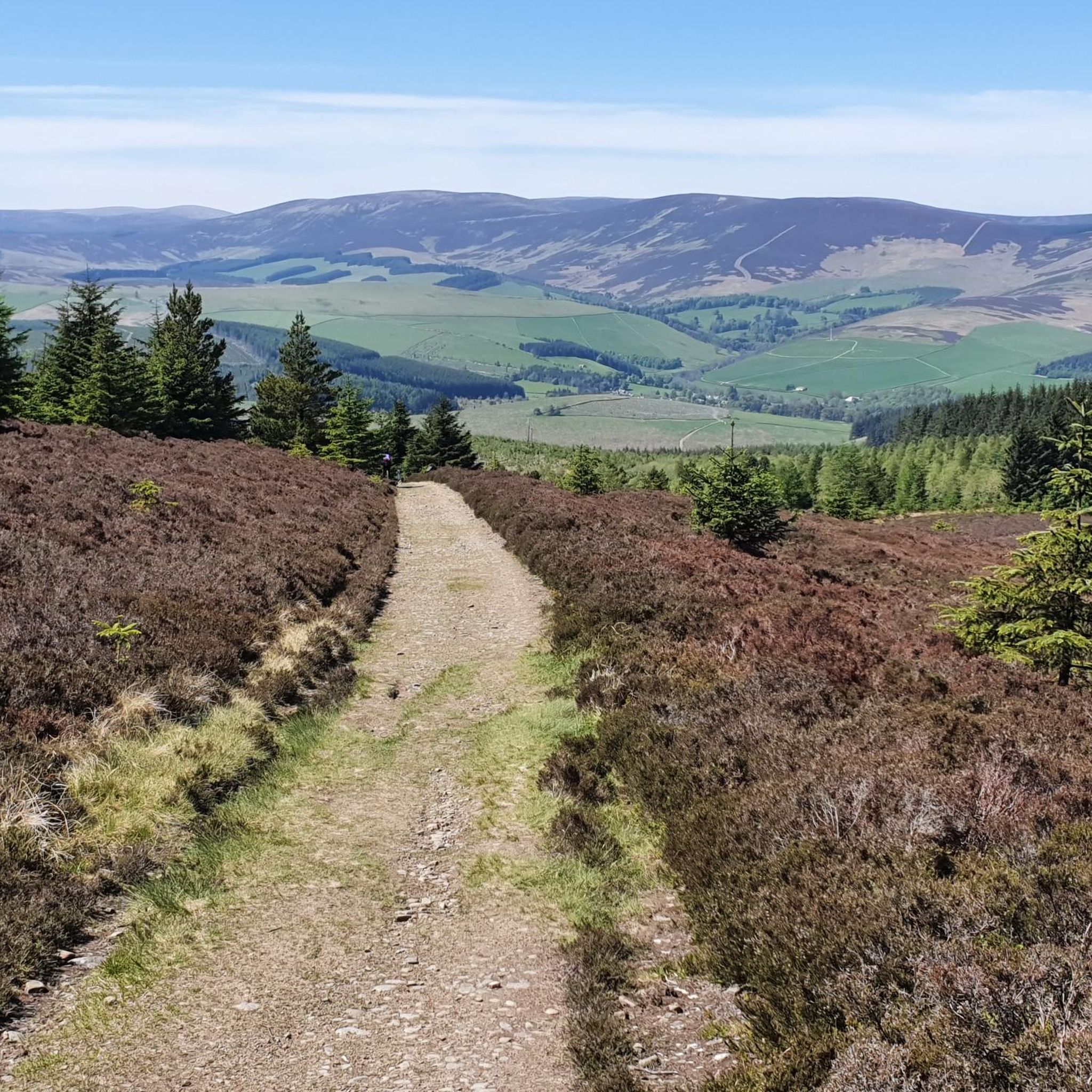
Hikes around Walkerburn and district are set within the Tweed Valley, characterized by rolling hills and extensive forestry tracks. The landscape features numerous paths that follow the course of the River Tweed. The region offers a mix of riverside walks and upland treks through a combination of woodland and open moorland.
Best hiking trails around Walkerburn And District
- The most popular hiking route is Kirnie Law loop, a 4.8 mile (7.8 km) trail that takes 2 hours 30 minutes…
Last updated: November 7, 2026
4.0
(4)
14
hikers
7.78km
02:30
310m
320m
Moderate hike. Good fitness required. Easily walkable paths.
5.0
(2)
114
hikers
Moderate hike. Good fitness required. Easily walkable paths.

4.6
(5)
32
hikers
6.91km
02:03
210m
210m
Moderate hike. Good fitness required. Easily walkable paths.
4.0
(3)
28
hikers
25.3km
07:37
830m
830m
Hard hike. Very good fitness required. Easily walkable paths.
3.0
(1)
20
hikers
Moderate hike. Good fitness required. Easily walkable paths.
Get access to more routes and recommendations from other explorers.
Already have an account?
Our route recommendations are based on thousands of hikes, rides, and runs completed by other people on komoot.
Start today with a free account
Your next adventure awaits.
Tips from the Community

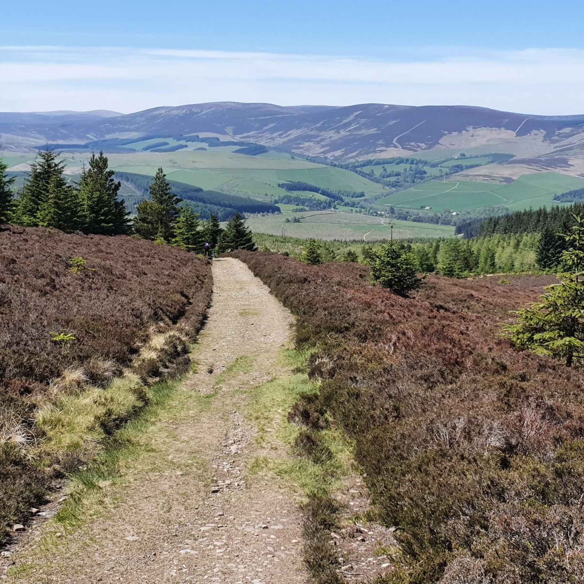
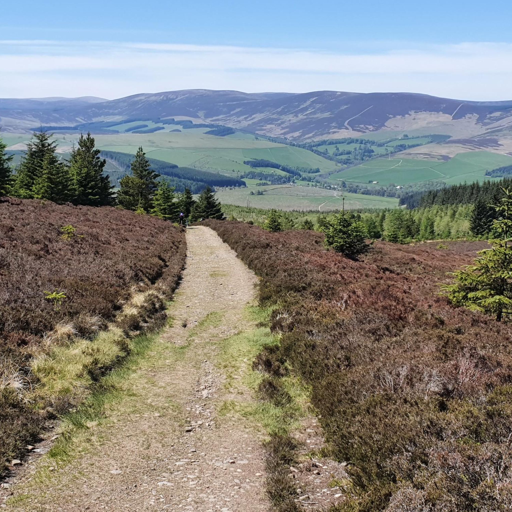
This excursion from the Southern Upland Way and the Cross Borders Drove Road is well worth the effort. On a clear day, you can see the hills surrounding the Tweed and Yarrow valleys. It's a special feeling, standing in a place where travelers, shepherds, and (Roman) armies passed through centuries ago.
0
0


The tarmac cycle path following the river Tweed from Glentress makes Innerleithen super accessible which in turn provides you with free range to pedal the ‘old’ XC & DH trails, it also provides easy access to the current ‘trendy’ gravity orientated hot spot of Golfie, named so, as it’s situated above the golf course. First off the Old XC, (starts from the carpark over the bridge by the river) it was very sad to see the current trashed & sorry state of what appears to be the forgotten XC Trail, after having ridden it many times since the early eighties! The long climb at the start is currently cut short & diverted with no access up to the top from what I could see? The remainder of the trails are just trashed with the mighty Caddon Bank DH a shadow of its former self. Golfie is an easy pedal across the village with some great coffee stop opportunities enroute. One in particular Findra on the high st deserves a Big shout out, it’s stylish, MTB rider (muddy bum) friendly, sells fantastic coffee & food has uber cool curated music. Oh it also sells very cool artisan made clothing. There are others in the village which all look fab but Findra was the one we stopped at. The Findra staff ride mountain bikes, are super friendly & great for local riding knowledge 😉👍 Golfie is a short pedal through the village towards the Golf club & then a longish pedal up a Forest road with ‘natural’ trails spilling off the side of the hill in varying degrees of difficulty. Be prepared for full on gnar, chunder, roots, very steep drop offs & lots n lots of muddy gloop if the weather has not been kind. No manicured trails here! If you keep pedalling you’ll eventually reach the old reservoir where the views are magnificent & several trail go off in several directions. My advice, if it’s your first time riding Golfie try & take someone who’s ridden it before as some of the trails start off very benign but then transform like Dr Jekyll & Mr Hyde! Wear body armour that allows you to pedal, but all the same wear body armour😜👍
1
0


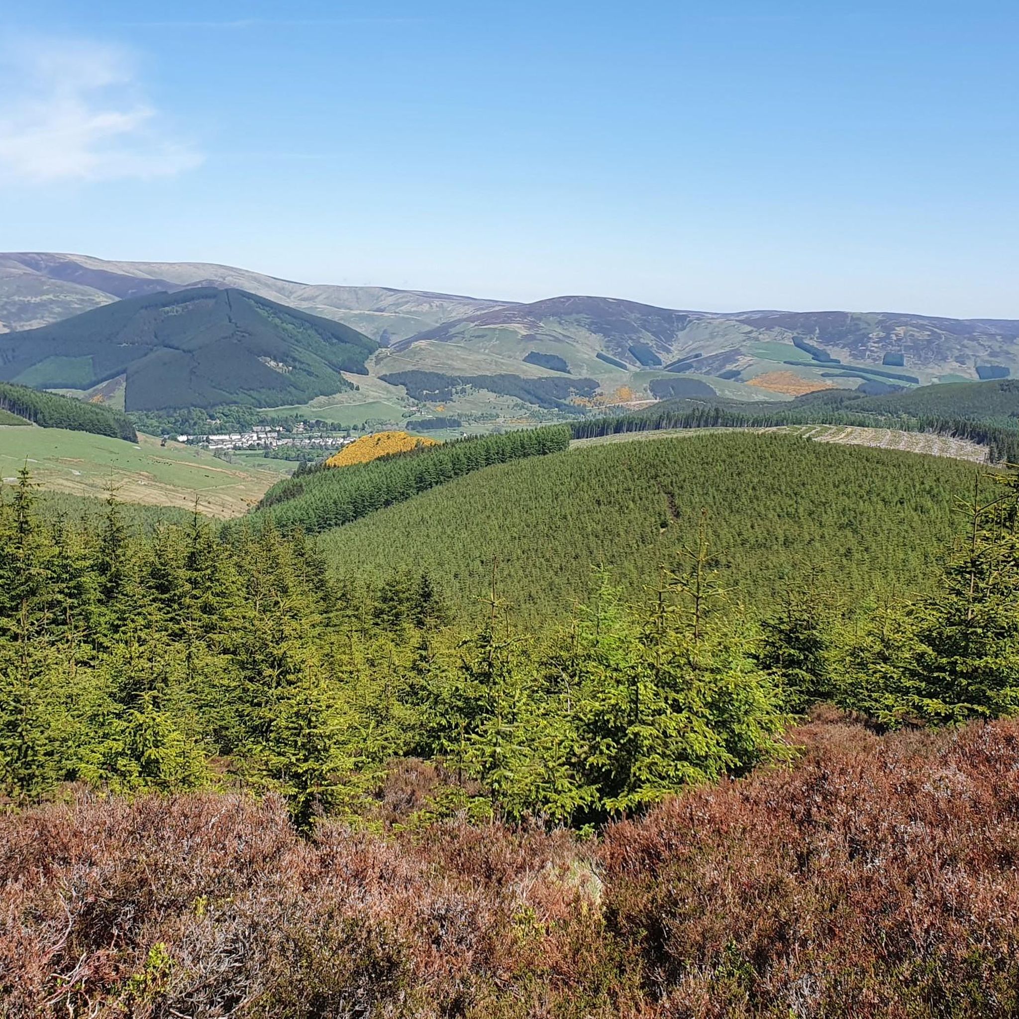
From this viewpoint near Minch Moor summit, you are afforded wonderful panoramic views of the surrounding landscape. On a clear day, you can see the rolling hills and valleys of the Scottish Borders region, with the Tweed Valley stretching out before you. You may also spot towns and villages such as Peebles and Innerleithen nestled among the greenery.
1
0
Traquair House is the oldest continually inhabited house in Scotland. It proudly states on a sign outside that it has been visited by 27 Scottish kings and queens since it was built in 1107. It's a magnificent building with equally magnificent gardens. You can access the house from the road here, but do keep in mind it is only open to the public seasonally, between March and October. You can find information on prices and daily opening times here https://www.traquair.co.uk/visitor-information/
1
0

Most people will stop and admire this bridge, there are not many about with features like this
0
0
Frequently Asked Questions
How many hiking trails are available around Walkerburn?
There are over 130 marked trails to explore in the Walkerburn and District area. These range from easy riverside paths to more demanding hill climbs, with the majority being of moderate difficulty.
Are there any easy, family-friendly walks in the area?
Yes, the region has many gentle walks suitable for families. The Wooden Walkway in Walkerburn is a particularly good choice, offering a raised timber path alongside the River Tweed that is easy for all ages. Many of the 40 easy-rated trails in the area follow riverside paths on relatively flat terrain.
Can I take my dog on the trails around Walkerburn?
Most trails in the Walkerburn district are dog-friendly, but it's important to be mindful of the environment. The area includes forestry land and open hills where livestock may be grazing. Always keep your dog under control, and be prepared to put them on a lead, especially near farm animals.
What are some of the more challenging hikes available?
For those seeking a challenge, the area offers several strenuous hikes. A great option is the Lee Pen loop from Innerleithen. This route involves a significant ascent of over 300 meters, rewarding hikers with fantastic views across the Tweed Valley.
Which hikes offer the best views of the Tweed Valley?
Many trails provide excellent viewpoints. The hike up to Minch Moor is well-known for its panoramic vistas. Similarly, the trail to Pirn Hill Fort, an old hill fort site near Innerleithen, offers great views along the Tweed with a relatively short walk.
Are there any circular walks that have a pub nearby?
Yes, you can easily combine a good walk with a pub visit. The River Tweed – Yair Hill Forest loop from Clovenfords is a circular route, and the village of Clovenfords has options for refreshments after your hike.
What are the typical trail conditions like around Walkerburn?
Trail conditions vary. You'll find everything from paved riverside paths to muddy forestry tracks and exposed grassy hill paths. The area is known for its extensive network of forestry tracks, which are generally firm underfoot but can be uneven. Waterproof hiking boots are recommended for most routes, especially after rain.
Are there any walks with historical points of interest?
Yes, the region is rich in history. The Traquair House loop from Innerleithen takes you near Scotland's oldest inhabited house. Other walks in the area pass by remnants of old stations, ruined farm buildings, and ancient hill forts like Pirn Hill.
Where can I find peaceful, quiet hill walks?
For a quieter experience away from the main hubs, explore the trails in Plora Wood. It's a lovely, peaceful stretch of mixed woodland with gentle trails overlooking the River Tweed. The broader Yair Hill Forest also contains many less-travelled paths where you can enjoy the tranquility of the Borders landscape.
What do other hikers like about the Walkerburn area?
The area is highly rated by the komoot community, with an average score of 4.5 stars. Hikers often praise the variety of trails, from the scenic paths along the River Tweed to the stunning panoramic views from the hilltops. The mix of quiet forestry tracks and open moorland is also a frequently mentioned highlight.
What are some popular places for hiking in the Walkerburn district?
Several key areas are popular starting points for hikes.
Tweed Valley Forest Park is a major hub, offering numerous trails through expansive woodlands. For a more focused woodland experience, Plora Wood is a local favourite for its quiet, scenic paths. Many walkers also enjoy the trails around the historic Pirn Hill Fort for its combination of history and rewarding views.
Are there good trails that follow the River Tweed?
Absolutely. The River Tweed is a central feature of the landscape, and many walks follow its course. The Kirnie Law loop incorporates sections along the river, combining a riverside stroll with a hill climb. There are also gentler, dedicated riverside paths perfect for a leisurely walk.
Most popular routes around Walkerburn And District
Most popular attractions around Walkerburn And District

Get inspired with the komoot mobile app


Explore more
Browse the best Hikes in other regions.
