The best road cycling routes around West Pilton/West Granton
4.4
(406)
21,185
riders
499
rides
Road cycling around West Pilton/West Granton is characterized by its evolving urban landscape, coastal proximity, and dedicated active travel infrastructure. The area features a growing network of cycleways, including the West Granton Access Cycleway and the Speirs Bruce Way, providing connections through regenerated waterfront areas and green spaces. Cyclists can experience varied terrain, from flat coastal paths along the Firth of Forth to routes that integrate with the wider Edinburgh cycle network. The ongoing regeneration efforts are transforming the former…
Last updated: May 15, 2026
2.0
(1)
88
riders
31.6km
01:20
250m
250m
Moderate road ride. Great for any fitness level. Some segments of this route may be unpaved and difficult to ride.
4.6
(5)
86
riders
26.1km
01:07
230m
230m
Easy road ride. Great for any fitness level. Mostly well-paved surfaces and easy to ride.

Sign up for free
63
riders
14.0km
00:36
130m
130m
Easy road ride. Great for any fitness level. Mostly well-paved surfaces and easy to ride.
54
riders
23.6km
01:01
190m
190m
Moderate road ride. Great for any fitness level. Some segments of this route may be unpaved and difficult to ride.
28
riders
Easy road ride. Great for any fitness level. Mostly well-paved surfaces and easy to ride.
Get access to more routes and recommendations from other explorers.
Sign up for free
Already have an account?
Our route recommendations are based on thousands of hikes, rides, and runs completed by other people on komoot.
Start today with a free account
Your next adventure awaits.
Login or Signup
Tips from the Community

Cheeky little hill with the confluence of River Almond and the Forth / Cramond Beach at the bottom.
0
0
Nice path connecting 2 sections of Barnton Avenue. Rather narrow on the west side and generally shared with pedestrians, take Gamekeeper's Road instead if you're in a hurry.
0
0
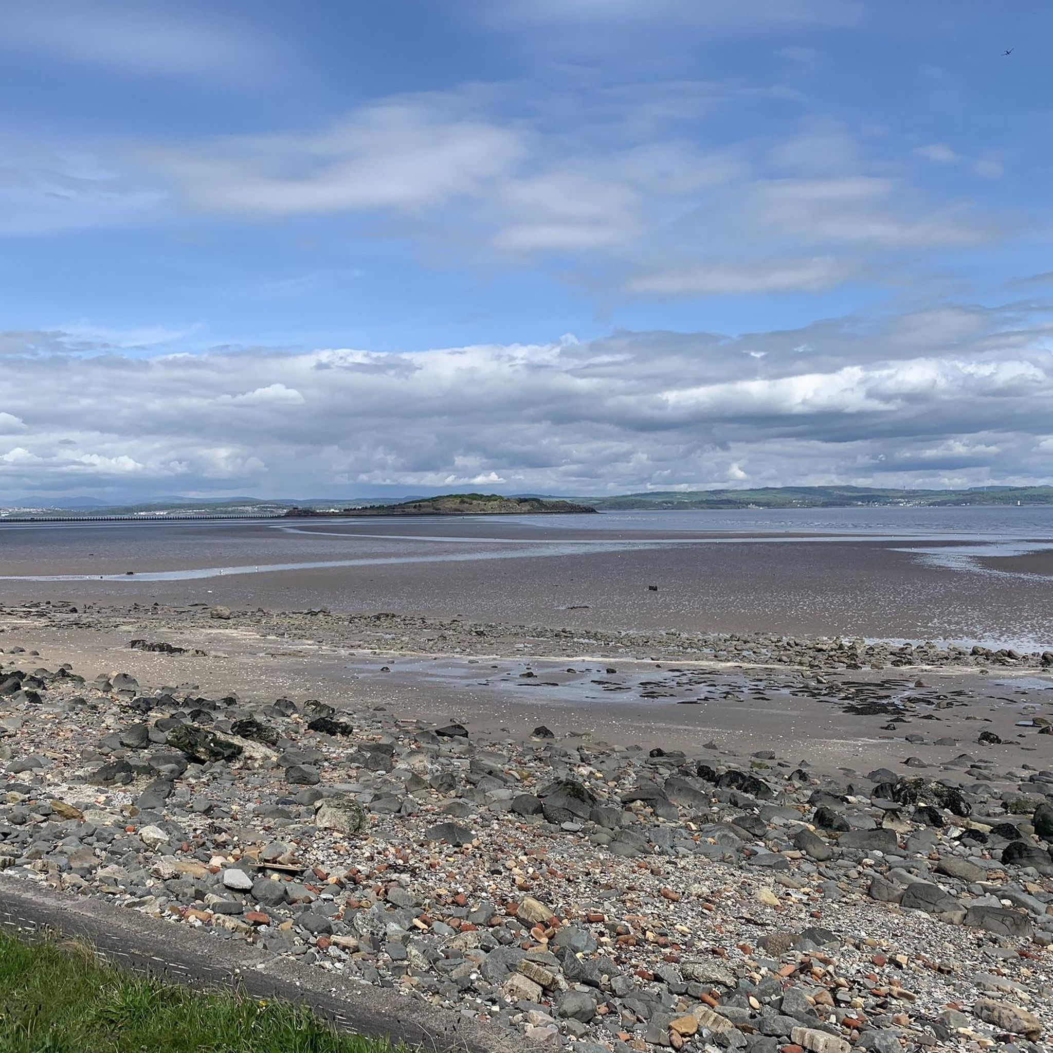
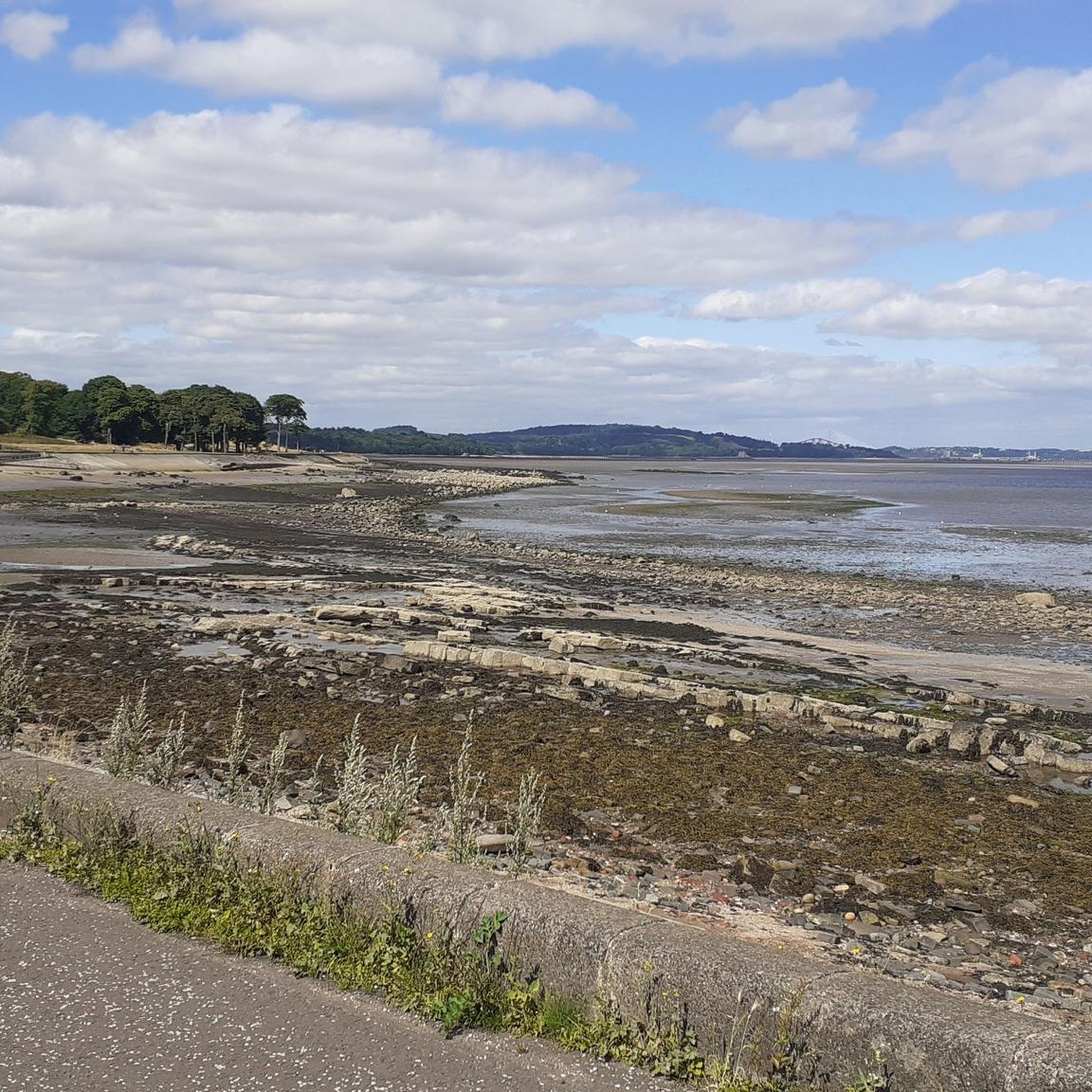
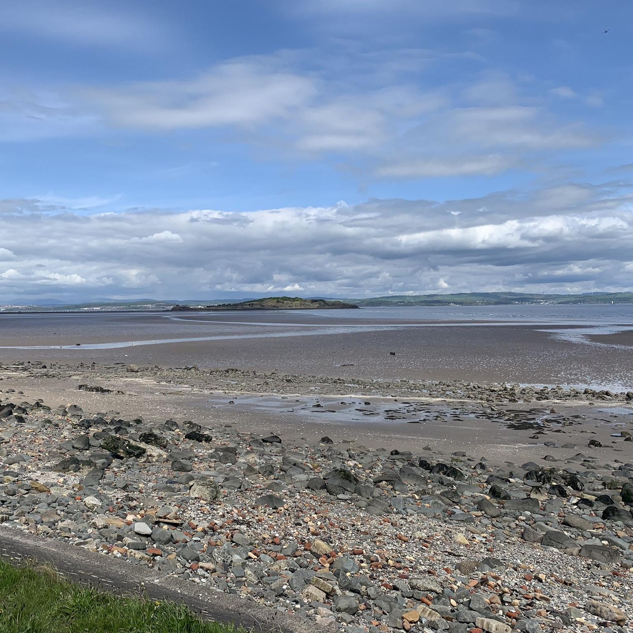
Flat esplanade with good tarmac and nice views across the Firth of Forth
0
0


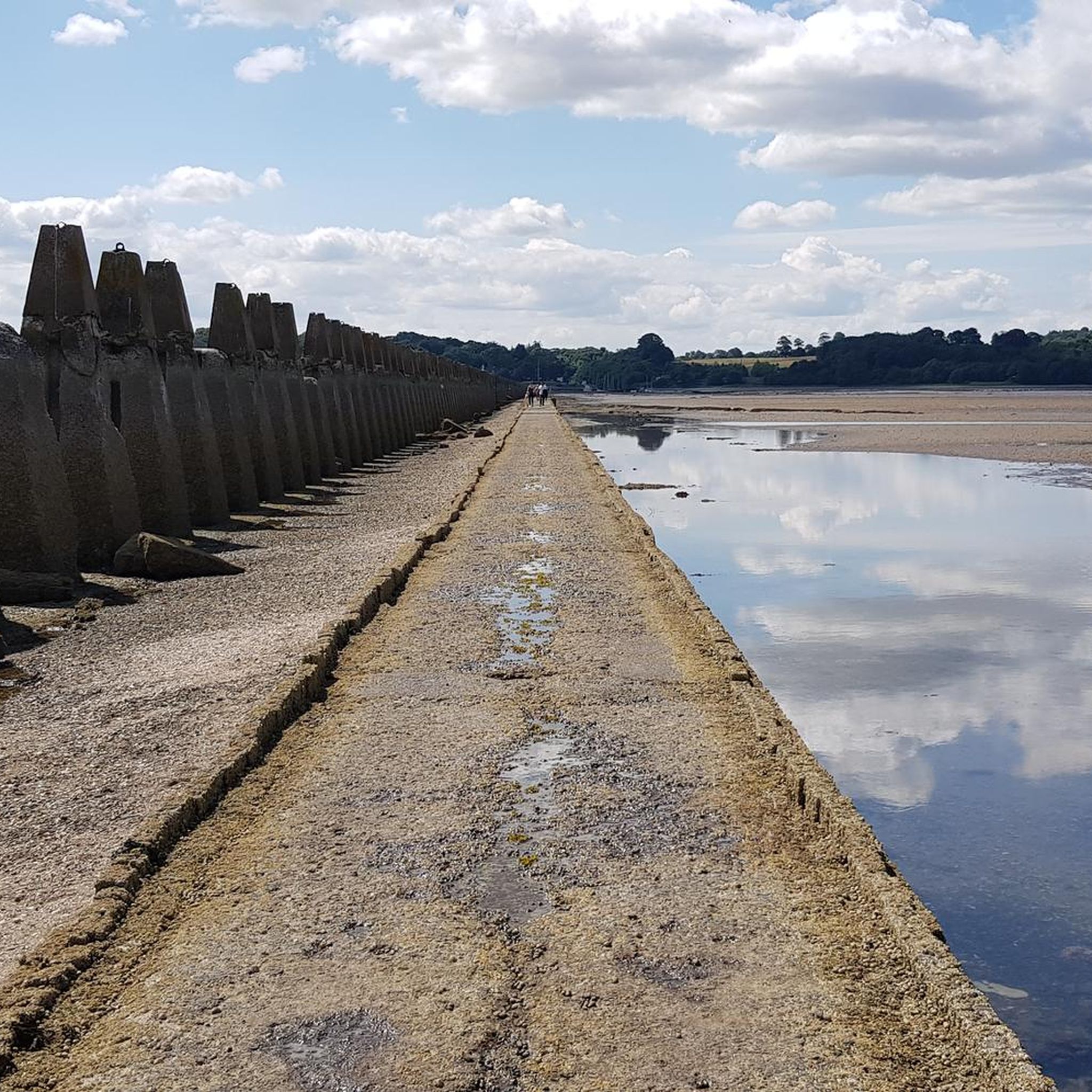
Cramond Island is a deserted island with a few ruins and bunkers from the Second World War. At low tide, the island can be reached over a narrow and low concrete causeway in a four-hour window, two hours before and two hours after low tide. The path is about 1.6 kilometres (one mile) long and passes concrete piers dating from the Second World War, built to protect against torpedoes and ships. The times when the path to the island is open are posted at the start of the path and are also published on the internet: https://queensferrylifeboat.co.uk/cramond-tides At high tide, the water rises so high that you can only leave the island by swimming or waiting up to eight hours for the causeway to be open again. If you do decide to swim, be aware of the current, the low water temperature and the relatively long distance.
6
3

Great to cross the causeway at low tide. Queensferry lifeboats publish save crossing times on their website: https://www.queensferrylifeboat.co.uk/cramond-tides
0
0

Lovely views, but my god it's windy! Plus depending on how busy it is you may have an assault course of dogs to cycle round!
0
0

Cramond Brig provides a crossing and vantage point of the beautiful River Almond. It has some history, back in 1532 being the site where James V, travelling without his entourage was attacked by 5 robbers while crossing, and was rescued by a local named Jock Howieson.
2
0
Frequently Asked Questions
How many road cycling routes are available in West Pilton/West Granton?
There are over 500 road cycling routes available around West Pilton/West Granton, catering to various skill levels. This includes more than 170 easy routes and over 280 moderate options, with some more challenging trails for experienced cyclists.
What kind of terrain can I expect on road cycling routes in West Pilton/West Granton?
Road cycling in West Pilton/West Granton offers a mix of urban landscapes, dedicated cycleways, and coastal paths. You'll find flat sections along the Firth of Forth, as well as routes that integrate with the wider Edinburgh cycle network, which may include some gentle climbs. The area's regeneration efforts are continuously improving the cycling infrastructure.
Are there road cycling routes suitable for beginners or families in West Pilton/West Granton?
Yes, West Pilton/West Granton offers many easy road cycling routes perfect for beginners and families. For instance, the Cramond Brig – Forth Bridge loop from Granton is an easy 16.2-mile path with scenic coastal views. Another accessible option is the Gasholder 1 loop from Granton, which is just over 9 km and relatively flat.
What landmarks or points of interest can I see along road cycling routes in West Pilton/West Granton?
While cycling, you can explore the evolving Granton Harbour and Waterfront, offering views across to Fife. The area is also close to historical sites like the remnants of Granton Castle and its walled garden. For wider Edinburgh attractions, the improving cycle network can connect you to places like Arthur's Seat or Corstorphine Hill Tower, though these are not directly within the immediate area.
Are there any natural features or scenic viewpoints to enjoy while cycling?
Many routes, especially around Granton Harbour and Wardie Bay, provide excellent views over the Firth of Forth, where you might even spot seals. The area's parks, like West Pilton Park and Forthquarter Park, offer greener spaces. You can also find natural monuments like Limestone Waterfall or Cramond Falls nearby.
Is there dedicated cycling infrastructure in West Pilton/West Granton?
Yes, West Pilton/West Granton benefits from significant investment in cycling infrastructure. Key routes include the adopted West Granton Access Cycleway and the recently opened Speirs Bruce Way. There are also plans for a new, safe, bi-directional segregated cycle path along Marine Drive and West Shore Road as part of the Granton Waterfront regeneration, and further improvements through the North Edinburgh Active Travel (NEAT) Connections scheme.
What do other road cyclists say about the routes in West Pilton/West Granton?
The road cycling routes in West Pilton/West Granton are highly rated by the komoot community, with an average score of 4.4 stars from over 300 reviews. Cyclists often praise the evolving infrastructure, coastal views, and the variety of routes that cater to different abilities.
What is the best time of year to go road cycling in West Pilton/West Granton?
The best time for road cycling in West Pilton/West Granton is generally from spring through autumn (April to October) when the weather is milder and daylight hours are longer. While winter cycling is possible, be prepared for colder temperatures, potentially wet conditions, and shorter days.
Where can I park my car when cycling in West Pilton/West Granton?
As the area is undergoing regeneration, parking options are continually evolving. It's advisable to check local parking regulations and available car parks near the starting points of your chosen routes. Some routes, like the Cramond Brig – Elizabeth Yard Climb loop, start from areas with potential parking facilities like Murrayfield Stadium.
Can I combine cycling with exploring local parks or green spaces?
Absolutely. The area is developing its green infrastructure. West Pilton Park is undergoing significant enhancements with improved paths and new wetland features, while Forthquarter Park is already integrated into the local cycling network, providing pleasant green spaces to ride through and explore.
Are there places to stop for refreshments like cafes or pubs along the routes?
Yes, as West Pilton/West Granton is an urban area undergoing regeneration, you'll find various cafes and pubs, particularly along the waterfront and in nearby communities. These offer convenient stops for refreshments during your ride.
Are there more challenging road cycling routes available in the area?
While many routes are easy to moderate, there are options for those seeking a greater challenge. The Cramond Brig – Elizabeth Yard Climb loop from Murrayfield Stadium, for example, is a moderate 19.6-mile route with over 250 meters of elevation gain, offering a more demanding ride.
Most popular routes around West Pilton/West Granton
Most popular attractions around West Pilton/West Granton

Get inspired with the komoot mobile app


Explore more
Browse the best Road cycling routes in other regions.
