The best road cycling routes in Bosque De Riofrío
4.6
(44)
1,744
riders
50
rides
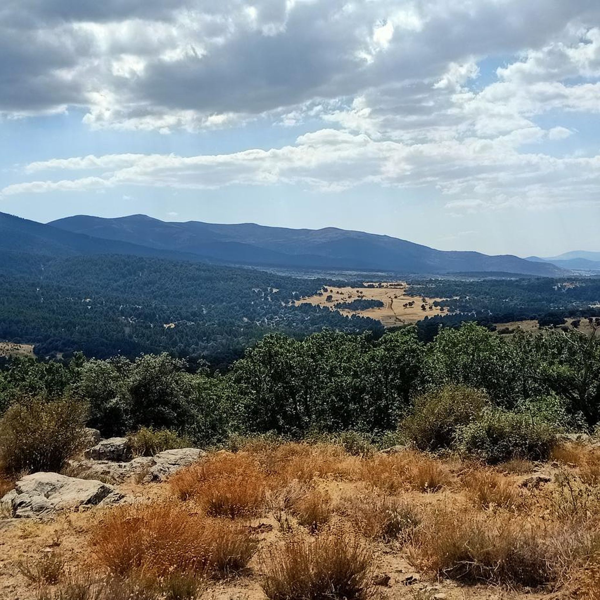
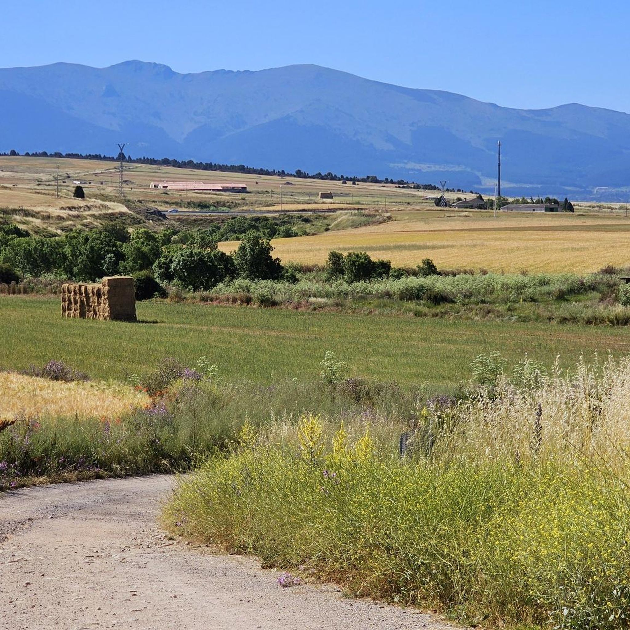
Road cycling routes in Bosque De Riofrío offer varied terrain within a 640-hectare natural space, part of the NATURA 2000 network. The region features diverse ecosystems, including Holm oak, juniper, Pyrenean oak, and ash forests, with the Riofrío River traversing the area. Elevations range from 950 meters to 1,086 meters, providing both climbs and descents on mostly well-paved surfaces. Cyclists can experience shaded woodlands and open vistas adorned with broom, thyme, and rosemary.
Best road cycling routes in Bosque De Riofrío
- The most popular road cycling route is Alto del León and Puerto de Navacerrada Loop, a 59.6 miles (95.9 km) difficult trail that takes 5 hours 8 minutes to complete, featuring significant elevation gain.
- Another top favourite among local road cyclists is Vegas de Matute – Fuentemilanos loop from Navas de Riofrío-La Losa, a moderate 28.5 miles (45.9 km) path that winds through the local landscape.
- Local road cyclists also love the Residential Garden – Fuentemilanos loop from Navas de Riofrío-La Losa, a 14.6 miles (23.5 km) trail leading through varied terrain, often completed in about 1 hour 10 minutes.
- Road cycling in Bosque De Riofrío is defined by dense woodlands, open vistas, and the banks of the Riofrío River. The network offers options for different ability levels, from moderate rides to more challenging ascents.
- The routes in Bosque De Riofrío are highly rated by the komoot community with an average score of 4.5 stars from more than 50 reviews. More than 1,900 road cyclists have used komoot to explore Bosque De Riofrío's varied terrain.
Last updated: May 22, 2026
48
riders
95.9km
05:08
1,890m
1,890m
This difficult 59.6-mile road cycling route through Sierra de Guadarrama National Park features two major mountain passes and reservoir view
3.0
(1)
22
riders
23.7km
01:11
310m
310m
Moderate road ride. Good fitness required. Some segments of this route may be unpaved and difficult to ride.

Sign up for free
5.0
(12)
240
riders
69.5km
03:39
1,200m
1,200m
Hard road ride. Very good fitness required. Mostly well-paved surfaces and easy to ride.
5.0
(1)
241
riders
96.1km
05:15
1,770m
1,770m
Hard road ride. Very good fitness required. Some segments of this route may be unpaved and difficult to ride.
5.0
(1)
87
riders
55.6km
02:38
640m
640m
Moderate road ride. Good fitness required. Mostly well-paved surfaces and easy to ride.
Get access to more routes and recommendations from other explorers.
Sign up for free
Already have an account?
Our route recommendations are based on thousands of hikes, rides, and runs completed by other people on komoot.
Start today with a free account
Your next adventure awaits.
Login or Signup


Tips from the Community

It's a classic climb in the Vuelta a España and in cyclotourism events like the Perico Delgado ride. The switchbacks section is very demanding: The first 4 km are gentle (2-3%). From the Puente de la Cantina (Cantina Bridge), ramps of 6-7% begin. Between km 6 and 8 are the five tightest bends, almost linked together, in a wooded area. The final kilometer has a steep ramp before reaching the summit.
1
0
They are located on the Segovia side of the Navacerrada Pass, on the CL-601 road (formerly the N-601), which connects La Granja de San Ildefonso with the pass. Approximate altitude: between 1,400 m and 1,700 m. There are seven hairpin bends that traverse the foothills of the Sierra de Guadarrama mountain range. Total length of the pass on this side: 13.6 km, with a 669 m elevation gain and an average gradient of 4.9%. The steepest ramps are in the switchbacks, with gradients of 6-8% and occasional sections reaching 9%. Summit at the Navacerrada Pass (1,856 m).
1
0
The name comes from the stone boundary markers erected in the 18th century to demarcate lands acquired by Charles III for hunting. During the Spanish Civil War, it was a strategic area with a Republican detachment stationed there. It formerly housed the Valcotos ski resort, which no longer exists.
1
0

The Siete Revueltas are one of the most iconic sections of the road that ascends to the Navacerrada Pass. This section consists of seven hairpin bends, one after the other, marking the final and toughest part of the climb from the Segovia side.
0
0

There's a fountain as you reach the top on the right. Follow the cobblestone path.
0
1
No water comes out, mind you. Even so, it's a legendary spot in the Navacerrada Pass.
0
0

Mandatory stop on the way down to refill water. (Or uphill, but you have little left and you have to suffer until the end)
0
0
One of the most beautiful and toughest passes in the mountains. Beautiful climb but little shoulder and a lot of traffic on weekends. There are a lot of bikes so it is not a problem because it is respected, but it is good to know. Be patient, and enjoy the wind, that stretch is tough but the reward is closer.
0
0
Frequently Asked Questions
How many road cycling routes are available in Bosque De Riofrío?
Bosque De Riofrío offers a wide selection of road cycling routes, with over 50 distinct tours available. These routes cater to various skill levels, from easy rides to more challenging ascents.
What kind of terrain and surfaces can I expect on road cycling routes in Bosque De Riofrío?
You can expect diverse terrain, ranging from shaded routes winding through dense woodlands to open vistas. The roads are generally well-paved, with minor, narrow, and beautifully surfaced options that offer quieter rides. Elevations vary from 950 meters to 1,086 meters, providing both challenging climbs and exhilarating descents.
Are there road cycling routes suitable for beginners or less experienced cyclists?
Yes, Bosque De Riofrío has routes suitable for all levels. There are 4 easy routes perfect for beginners, and 40 moderate routes that offer a good balance of challenge and enjoyment. For example, the Residential Garden – Fuentemilanos loop from Navas de Riofrío-La Losa is a moderate 23.5 km trail that can be completed in about 1 hour 10 minutes.
What are some challenging road cycling routes in the area?
For experienced cyclists seeking a challenge, there are 9 difficult routes available. A notable option is the Alto del León and Puerto de Navacerrada Loop, a demanding 95.9 km trail with significant elevation gain, typically taking over 5 hours to complete.
Can I find circular road cycling routes in Bosque De Riofrío?
Yes, many of the routes in Bosque De Riofrío are designed as loops, allowing you to start and end at the same point. For instance, the Vegas de Matute – Fuentemilanos loop from Navas de Riofrío-La Losa is a popular moderate 45.9 km circular path.
What natural features and landscapes will I encounter while cycling?
The forest is characterized by four distinct ecosystems: Holm oak, juniper, Pyrenean oak, and ash, with the Riofrío River flowing through. You'll experience diverse scenery, from shaded woodlands to open vistas adorned with broom, thyme, rosemary, and Spanish lavender. The varied terrain also offers panoramic views of the surrounding landscape.
Are there any historical landmarks or attractions to visit along the road cycling routes?
A key attraction within Bosque De Riofrío is the magnificent Palacio Real de Riofrío, a historic hunting lodge. Many cycling routes incorporate a visit to this architectural gem. Additionally, the proximity to Segovia allows cyclists to extend their trips to include iconic landmarks like the Segovia Aqueduct.
Is Bosque De Riofrío suitable for family-friendly road cycling?
While the region offers diverse routes, some are more suitable for families. Look for the easier and moderate routes, which tend to have less elevation gain and shorter distances. The well-paved surfaces generally make for a smoother ride, but always check the specific route details for difficulty and distance to ensure it matches your family's capabilities.
What is the best time of year to go road cycling in Bosque De Riofrío?
The region is appealing for cycling throughout much of the year. Spring and autumn generally offer pleasant temperatures and vibrant scenery. Summer can be warm, but shaded routes through the dense woodlands provide some relief. Always check local weather conditions before heading out.
What do other road cyclists enjoy most about road cycling in Bosque De Riofrío?
The area is highly rated by the komoot community, with an average score of 4.5 stars from over 50 reviews. Cyclists often praise the diverse topography, well-maintained roads, and scenic routes that wind through varied ecosystems. The presence of quiet, beautifully surfaced minor roads is also frequently highlighted as a positive aspect of the cycling experience.
Can I expect to see wildlife while road cycling in Bosque De Riofrío?
Yes, Bosque De Riofrío is rich in biodiversity and offers opportunities for wildlife observation. The forest is home to deer, fallow deer, rabbits, badgers, foxes, genets, and weasels. Birdwatchers can spot over 50 species, including griffon vultures and black vultures, adding an extra dimension to your outdoor experience.
Are there options for accommodation or places to eat near the cycling routes?
While specific establishments are not detailed in the route information, the proximity of Bosque De Riofrío to Segovia and other smaller towns suggests that accommodation, cafes, and pubs would be available nearby. It's advisable to research options in surrounding areas like Segovia or Navas de Riofrío-La Losa for specific amenities.
Most popular routes in Bosque De Riofrío

Get inspired with the komoot mobile app


Explore more
Browse the best Road cycling routes in other regions.
