The best running trails in Sonneneck
4.5
(824)
15,153
runners
621
runs
Jogging in Sonneneck offers diverse running experiences across its varied terrain. The region features a landscape characterized by valleys, rounded hills, and forested areas, with several routes passing by small lakes and waterfalls. Elevation changes are common, ranging from gentle inclines to more challenging ascents. The area provides a mix of natural paths and trails suitable for different running preferences.
Best jogging routes in Sonneneck
- The most popular jogging route is View of the Allgäu Valley – Riedholzer Kugel loop from Hengelesweiher, a 5.7 miles (9.2 km) trail that takes 1 hour 9 minutes to complete. This route offers views of the Allgäu Valley and passes by a rounded hill.
- Another top favourite among local runners is Wooden Bridge on Forest Trail – Speckbach Waterfall loop from Osterhofen, a moderate 5.5 miles (8.8 km) path. This trail leads through forests and features a wooden bridge and a waterfall.
- Local runners also love the Running loop from Rechtis, a 5.2 miles (8.3 km) trail leading through varied terrain, often completed in about 55 minutes.
- Jogging in Sonneneck is defined by its valleys, forested trails, and scenic water features like ponds and waterfalls. The network offers options for different ability levels, from easy runs to more challenging routes with significant elevation gain.
- The routes in Sonneneck are highly rated by the komoot community with an average score of 4.4 stars from over 650 reviews. More than 13,000 runners have used komoot to explore Sonneneck's varied terrain.
Last updated: August 4, 2026
4.0
(1)
68
runners
12.8km
01:25
210m
210m
Moderate run. Good fitness required. Mostly paved surfaces. Suitable for all skill levels.
24
runners
8.38km
00:52
60m
60m
Moderate run. Good fitness required. Mostly paved surfaces. Suitable for all skill levels.

Sign up for free
4.0
(14)
35
runners
9.22km
01:09
350m
350m
Hard run. Very good fitness required. Mostly paved surfaces. Suitable for all skill levels.
11
runners
11.0km
01:21
260m
260m
Moderate run. Good fitness required. Mostly paved surfaces. Suitable for all skill levels.
10
runners
16.7km
02:13
500m
500m
Hard run. Very good fitness required. Sure-footedness, sturdy shoes and alpine experience required.
Get access to more routes and recommendations from other explorers.
Sign up for free
Already have an account?
Our route recommendations are based on thousands of hikes, rides, and runs completed by other people on komoot.
Start today with a free account
Your next adventure awaits.
Login or Signup

Tips from the Community

I have seen some churches in recent years, it is also beautiful in Pleß, Obergünzburg, Heiligkreuz, Sulzberg.
0
0

Beautiful resting place in Buchenberg's town center
0
0
Something else from the Allgäuer Seenland. It was furnished in the so-called Zopfstil or Louise Seize style, a style of emerging Classicism that replaced the Baroque. Thus, in the Buchenberg church, you will not find ceiling paintings or colorful decorations. In contrast, classical style elements dominate, such as on the cornice to the barrel ceiling. The initially single-story west choir was designed with two stories in 1912. On the sides, five glass windows each illuminate the nave. The ceiling of the main nave is decorated with white-gold tinted, elegantly restrained stucco. Above the chancel arch in the main nave is the magnificent coat of arms of the builder, Prince-Abbot Rupert von Neuenstein. It is surrounded by putti and embraced by princely ermine. Above the side altars and above the pulpit, various medallions with relief depictions adorn the space. On the left side, a sculpture of the church patron watches over. It is depicted with a cross and staff as a sign of victory over evil. https://www.allgaeuerseenland.de/vor-ort/poi-detail/kirche-st-magnus-in-buchenberg.
0
0
Given the many stylistic elements, I am overwhelmed by a description. To my taste, it is a bit overloaded, perhaps too many people wanted to immortalize themselves. From Wikipedia, The Kempten prince-abbot Rupert von Neuenstein had the hall church dedicated to St. Magnus built between 1791 and 1793 and elaborately furnished in the classicist Louis Seize style. It consists of a nave, a recessed, three-sided choir to the east, with the sacristy attached to its front, and a late Gothic choir flank tower on the north wall of the choir, which was extended around 1900 to house the tower clock and the bell frame with five church bells[1] and was covered with a pointed roof between the gables. https://de.wikipedia.org/wiki/St._Magnus_(Buchenberg)
0
0

When you are on foot and in wet weather, it can get quite slippery. Sturdy footwear is recommended.
0
0

A very nice destination for a snowshoe hike.
2
0

Very nice tour, but the designated path is blocked off twice with barbed wire.
0
0

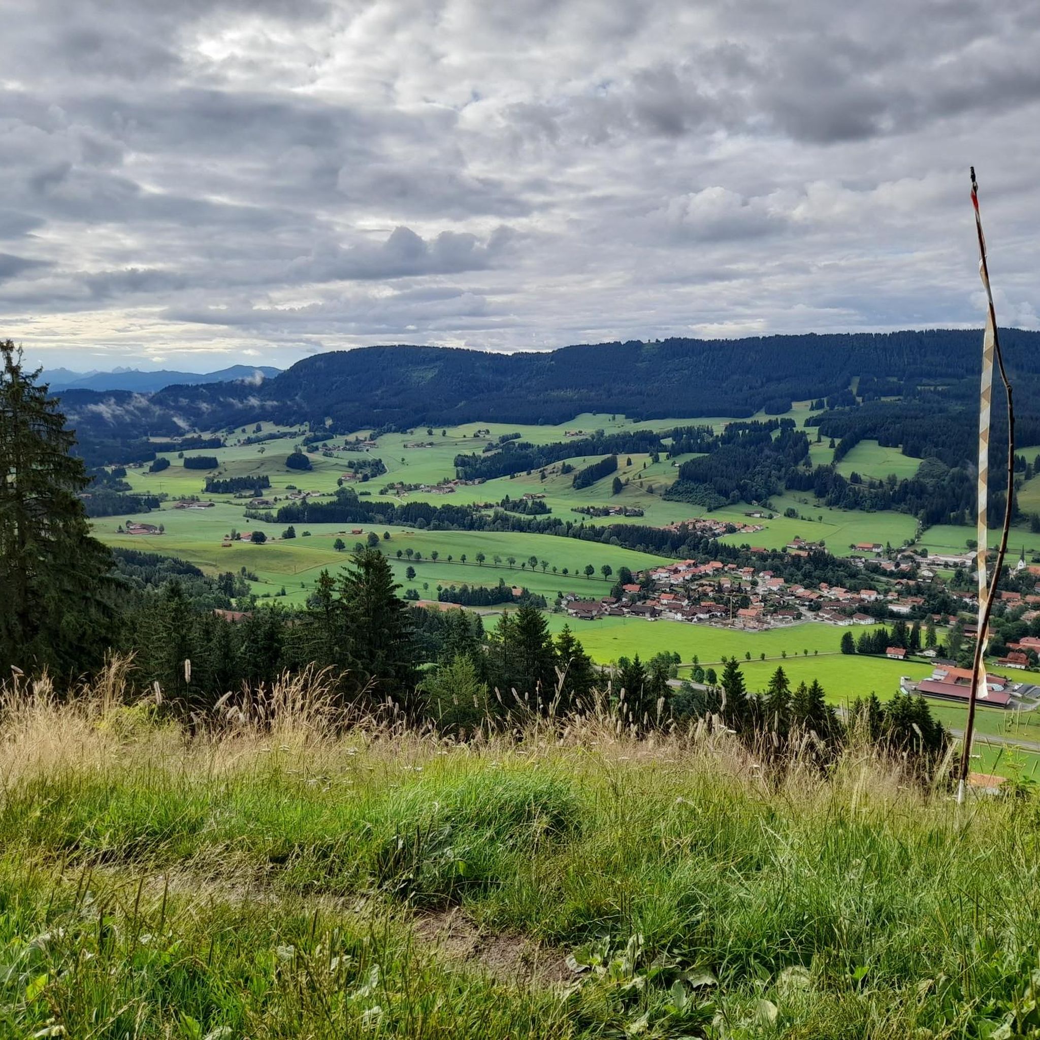
A fantastic view from the Riedholzer Kugel.
0
0
Frequently Asked Questions
How many running routes are available in Sonneneck?
Sonneneck offers a wide variety of running experiences, with over 590 routes available. These range from easy jogs to more challenging trails with significant elevation changes.
What kind of terrain can I expect on Sonneneck's jogging paths?
The region features a diverse landscape characterized by valleys, rounded hills, and forested areas. Many routes pass by small lakes and waterfalls, and you'll encounter varied elevation changes, from gentle inclines to more challenging ascents.
Are there running trails suitable for beginners in Sonneneck?
Yes, Sonneneck has options for all ability levels. There are 69 easy running routes, perfect for beginners or those looking for a more relaxed jog. These trails often feature gentler inclines and well-maintained paths.
Can I find circular running routes in Sonneneck?
Absolutely. Many of Sonneneck's running paths are designed as loops, allowing you to start and finish at the same point. For example, the Breitenmoos loop from Rechtis offers a moderate 5.7-mile experience.
Are there any running routes that feature waterfalls in Sonneneck?
Yes, the region is known for its scenic water features. You can explore the Wooden Bridge on Forest Trail – Speckbach Waterfall loop from Osterhofen, a popular moderate trail that leads through forests and past a beautiful waterfall.
What do other runners enjoy most about jogging in Sonneneck?
The running routes in Sonneneck are highly rated by the komoot community, with an average score of 4.4 stars from over 650 reviews. Runners often praise the varied terrain, scenic views, and the mix of natural paths and trails.
Are there any long-distance running trails in Sonneneck?
While many routes are moderate in length, Sonneneck does offer longer options for those seeking a challenge. The most popular route, View of the Allgäu Valley – Riedholzer Kugel loop from Hengelesweiher, is 5.7 miles (9.2 km) and features significant elevation gain.
What are some scenic viewpoints or attractions I can see along the running routes?
Sonneneck's routes offer several points of interest. You might encounter historical sites like the Alt-Trauchburg Castle Ruins, or natural landmarks such as the Bench at Sonneck Summit Cross, providing great views. There are also specific trails like the Sonneckgrat Trail and the challenging Steep Root Trail.
Are there any challenging running routes with significant elevation gain?
Yes, Sonneneck is known for its varied elevation. Routes like the Raggenhorn Summit Cross loop from Wengen, a 5.5-mile trail, include substantial ascents, making them ideal for runners looking for a more strenuous workout.
How can I find less crowded running trails in Sonneneck?
While popular routes like the Allgäu Valley loop are well-loved, komoot's extensive network of over 590 routes means you can often find quieter paths. Exploring some of the less-trafficked moderate or difficult trails, or running during off-peak hours, can lead to a more solitary experience.
Is Sonneneck a good destination for trail running?
Absolutely. With its forested areas, valleys, and varied elevation, Sonneneck provides an excellent environment for trail running. The region offers a mix of natural paths and trails that cater to different preferences, from smooth forest floors to more rugged, technical sections.
Most popular routes in Sonneneck
Most popular attractions in Sonneneck

Get inspired with the komoot mobile app


Explore more
Browse the best Running Trails & Routes in other regions.
