The best running trails around Općina Đurđenovac
39
runners
3
runs
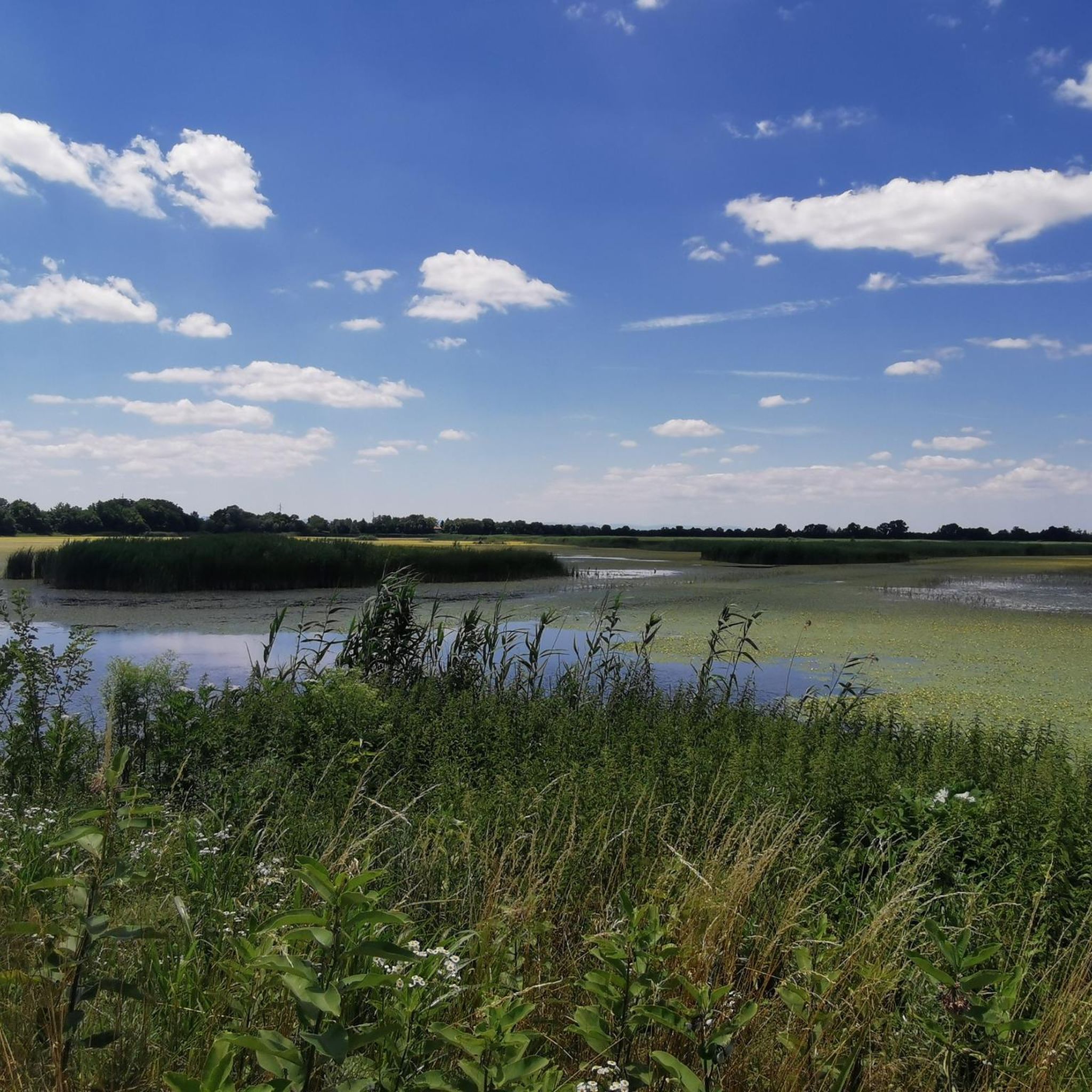
Jogging around Općina Đurđenovac offers a diverse landscape with accessible running trails. The terrain features a mix of mostly paved surfaces and natural paths, providing options for various fitness levels. While not mountainous, the region includes varying elevation gains, from flat stretches to moderate inclines. Natural features like Lake Lapovac near Orahovica contribute to scenic running routes.
Best jogging routes around Općina Đurđenovac
- The most popular jogging route is Running loop from Našice Grad, a 5.6 miles (9.0 km)…
Last updated: October 5, 2026
8
runners
21.5km
02:44
680m
680m
Hard run. Very good fitness required. Sure-footedness, sturdy shoes and alpine experience required.
4
runners
9.01km
00:57
100m
110m
Moderate run. Good fitness required. Mostly paved surfaces. Suitable for all skill levels.

6
runners
12.5km
01:38
440m
440m
Hard run. Very good fitness required. Mostly paved surfaces. Suitable for all skill levels.
3
runners
9.77km
01:02
110m
110m
Moderate run. Good fitness required. Mostly paved surfaces. Suitable for all skill levels.
7
runners
33.8km
04:42
1,240m
1,240m
Hard run. Very good fitness required. Sure-footedness, sturdy shoes and alpine experience required.
2
runners
18.0km
02:32
650m
650m
Hard run. Very good fitness required. Mostly paved surfaces. Suitable for all skill levels.
2
runners
6.92km
00:44
60m
60m
Moderate run. Good fitness required. Mostly paved surfaces. Suitable for all skill levels.
Our route recommendations are based on thousands of hikes, rides, and runs completed by other people on komoot.
Start today with a free account
Your next adventure awaits.
Popular around Općina Đurđenovac
Tips from the Community


Turković Castle in Kutjevo, Croatia is a must-visit. Tucked away in the picturesque region of Slavonia, this hidden gem offers a unique blend of history, architectural beauty and natural surroundings.
10
0

Orahovica Lake is an artificial lake located at the foot of the Papuk mountain, not far from Ružica grad. It is Orahovica's main and most visited destination during summer days. It is 208 meters long, its width varies from 48.8 to 85.2 meters. Its surface area is variable, depending on the water level, and ranges from 1.52 to 1.7 hectares. It contains 65,000 cubic meters of drinking water. The maximum recorded depth is on the north side and is 9 meters. The length of the shore is 570 meters. The shore has been arranged as a promenade. Around the lake are deciduous forests. Above the lake is Ružica grad.
4
0

Be careful last 300m before the peak since there might be downhill mountain bikers riding/jumping next to hiking paths.
1
0

Although there is a large object and transmitter of the OiV at the top, because of the beautiful high pyramid you can see the whole surrounding area and the top is a nice hiking destination.
2
0

Beautiful view of Krndija, Papuk and Slavonia from the top of Kapovac.
0
0
Frequently Asked Questions
How many running routes are available in Općina Đurđenovac?
Komoot features several excellent running routes around Općina Đurđenovac. This guide highlights 6 top-rated trails, but the region offers a broader network for you to explore.
What kind of terrain can I expect on the running trails in Općina Đurđenovac?
The running trails in Općina Đurđenovac feature a diverse landscape with a mix of mostly paved surfaces and natural paths. You'll find varying elevation gains, from flat stretches perfect for leisurely runs to moderate inclines for more challenging workouts. This varied topography provides options for all fitness levels.
Are there any scenic routes with waterside views?
Yes, the region offers beautiful waterside running experiences. A notable option is the Orahovačko jezero loop from Orahovica, which provides picturesque views around Lake Lapovac with minimal elevation gain, making it a very pleasant run.
Are there challenging running routes for experienced runners?
Absolutely. For those seeking a more demanding run, routes like the Ravno Brdo – Male Vincine loop from Gazije offer significant elevation changes over a longer distance, providing a substantial workout. Another challenging option is the Ravno Brdo loop from Gazije.
Are there any family-friendly or easier running paths?
While specific 'easy' routes aren't explicitly categorized, many trails offer moderate difficulty with gentle elevation changes. The Orahovačko jezero loop from Orahovica, with its minimal elevation, is a great choice for a more relaxed run suitable for families or beginners.
What do other runners enjoy most about jogging in Općina Đurđenovac?
Runners frequently appreciate the accessible nature of the trails and the diverse landscape. The presence of green spaces and natural features like Lake Lapovac enhances the experience, offering a refreshing environment for physical activity. Over 40 runners have explored these routes using komoot, highlighting the area's appeal.
Are the running routes in Općina Đurđenovac typically circular?
Many of the popular running routes in the area are indeed circular, offering convenient start and end points. Examples include the Running loop from Našice Grad and the Orahovačko jezero loop from Orahovica, allowing you to return to your starting point without retracing your steps.
What is the best time of year to go jogging in Općina Đurđenovac?
Općina Đurđenovac is suitable for jogging throughout much of the year. Spring and autumn offer pleasant temperatures and vibrant scenery, making them ideal. Summer mornings and evenings are also great to avoid the midday heat. Winter jogging is possible, but check local conditions for snow or ice on paths.
Are there parking facilities available near the running trailheads?
While specific parking details for every trailhead are not provided, the accessibility of the running trails suggests that parking options are generally available in the vicinity of popular starting points, especially in towns like Našice or Orahovica, which serve as common access points for these routes.
Can I bring my dog on the running trails?
Many natural paths and green spaces in Općina Đurđenovac are generally dog-friendly. However, it's always recommended to keep your dog on a leash, especially in more populated areas or near wildlife, and to check for any specific local regulations or signage at the trailhead regarding pets.
Are there any places to eat or drink near the running routes?
The towns and villages surrounding the running routes, such as Našice and Orahovica, offer various options for refreshments. You can find cafes, pubs, and restaurants where you can refuel after your run, especially near the starting points of popular trails like the Running loop from Našice.
What is the typical length of running trails in Općina Đurđenovac?
The running trails in Općina Đurđenovac vary in length to suit different preferences. You'll find routes ranging from moderate distances, such as the 4.3-mile (6.9 km) Orahovačko jezero loop, to longer and more challenging options like the 20.9-mile (33.7 km) Ravno Brdo – Male Vincine loop.
Most popular routes around Općina Đurđenovac

Get inspired with the komoot mobile app


Explore more
Browse the best Running Trails & Routes in other regions.
