The best mountain hikes around gmina Dzierżoniów
4.8
(86)
591
hikers
23
hikes
Mountaineering routes around Gmina Dzierżoniów are set within the diverse landscapes of southwestern Poland, primarily at the foot of the Owl Mountains. The region features a network of trails traversing forests and leading to prominent peaks like those in the Owl Mountains and the Ślęża Massif. These areas are characterized by varied elevations, offering both challenging ascents and rewarding panoramic views. The Kiełczyn Hills also contribute to the region's varied terrain, providing additional opportunities for exploration.
Best mountaineering routes around…
Last updated: November 4, 2026
5.0
(5)
51
hikers
10.7km
03:21
420m
420m
Moderate mountaineering route. Good fitness required. Easily walkable paths.
5.0
(6)
28
hikers
Hard mountaineering route. Good fitness required. Sure-footedness, sturdy shoes and alpine experience required.

15
hikers
7.98km
02:37
340m
340m
Moderate mountaineering route. Good fitness required. Easily walkable paths.
4.8
(5)
22
hikers
Moderate mountaineering route. Good fitness required. Easily walkable paths.
5.0
(2)
13
hikers
6.73km
02:14
320m
320m
Moderate mountaineering route. Good fitness required. Easily walkable paths.
Get access to more routes and recommendations from other explorers.
Already have an account?
Our route recommendations are based on thousands of hikes, rides, and runs completed by other people on komoot.
Start today with a free account
Your next adventure awaits.
Tips from the Community

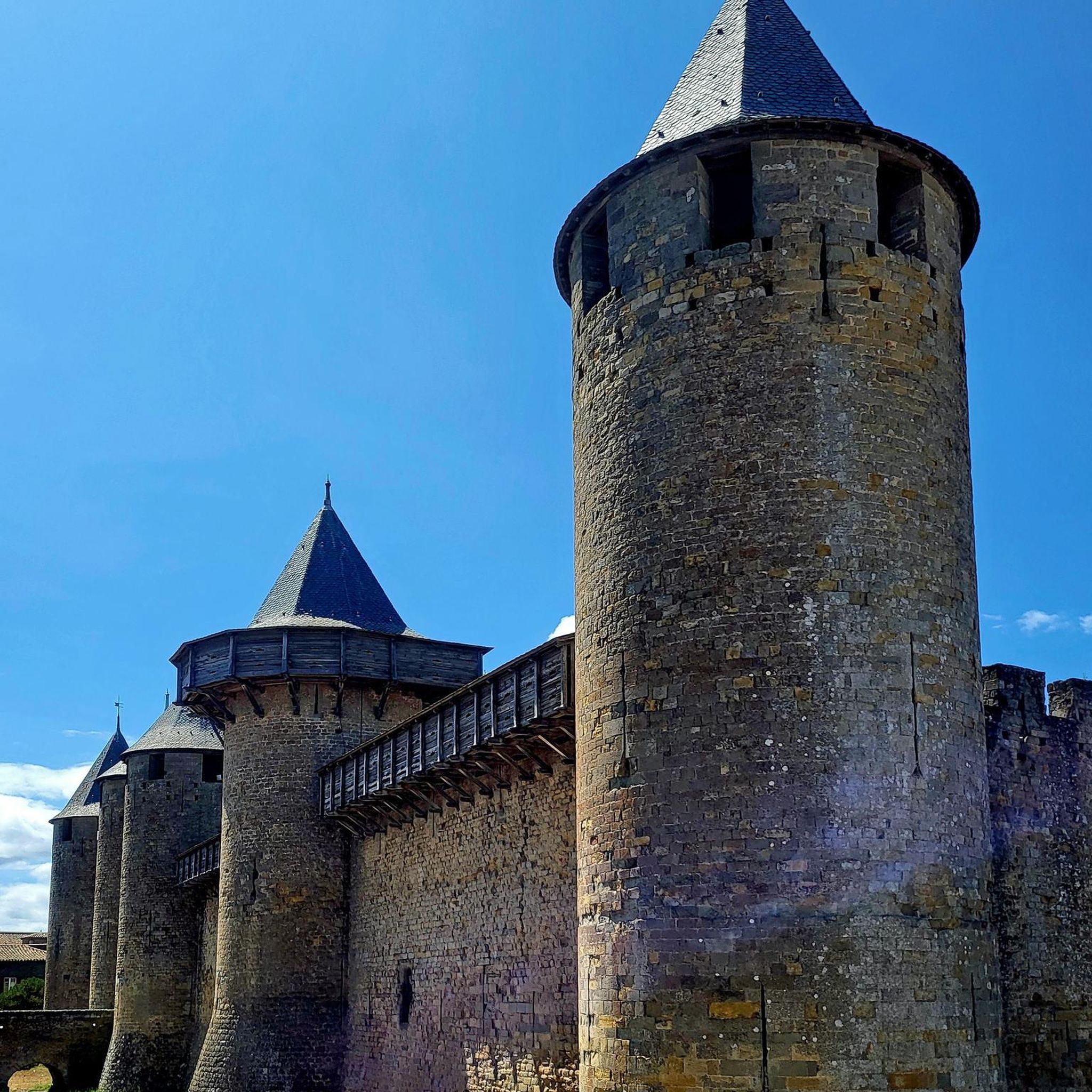
Built on the rock itself, on the site of an ancient place of worship and a medieval castle, it hides many unique secrets within.
0
0
The biggest historical problem of the facility has always been the lack of a natural water source at the very top of the mountain. Over the years, various methods were used to cope (including collecting rainwater or transporting water). It was precisely the permanent problems with the water and sewage infrastructure and the failure to meet modern sanitary requirements that forced the managers to close the accommodation base in February 2014. Today, tourists can only buy a hot meal, snacks, or souvenir stamps here.
0
0
The current building was created on the initiative and with the funds of Georg Haase, a well-known Wrocław entrepreneur and owner of the powerful Haase Brewery. It was designed by the famous Wrocław architect Karl Klimm. Interestingly, a special, extremely atmospheric banquet hall called the "Pustelnia Ślężańska" (German: Zobtenklause) was set up in the new shelter, where tourists could enjoy beer and relax in a unique atmosphere.
0
0
In ancient times, Ślęża was a sacred mountain for many tribes, including the Celts and Slavs. It was a powerful center of sun worship. Interestingly, the surrounding peaks formed a coherent religious system: while the Sun was worshipped on Ślęża, the Moon was venerated on the neighboring Radunia. To this day, stone ritual ramparts surrounding the summit areas are preserved there.
0
0

The path is not difficult and has no exposure, so people with a fear of heights have nothing to fear. On the other hand, it is sometimes technically more difficult and on large stones you have to support yourself with your hands.
0
0
The tower is concrete and has several levels. You climb to each level by ladder. Sometimes there are blockages because you have to wait for someone to come down, but it's not a tragedy. The views from the top are beautiful.
0
0

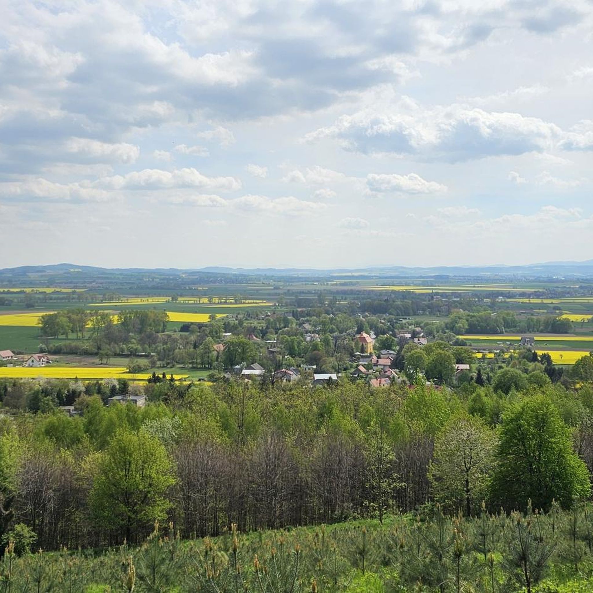
Follow the little trail at the bear statue for 100 m to a viewing tower
0
0

Frequently Asked Questions
How many mountaineering routes are available in gmina Dzierżoniów?
There are over 25 mountaineering routes in gmina Dzierżoniów, catering to various skill levels. You'll find a mix of easy, moderate, and difficult trails to explore.
What kind of terrain can I expect on mountaineering routes in gmina Dzierżoniów?
The terrain in gmina Dzierżoniów features diverse landscapes, primarily at the foot of the Owl Mountains and within the Ślęża Massif. Routes often traverse dense forests and lead to prominent peaks, offering varied elevations and rewarding panoramic views. The Kiełczyn Hills also contribute to the region's varied terrain.
Are there any family-friendly mountaineering routes in gmina Dzierżoniów?
Yes, gmina Dzierżoniów offers a few easier routes suitable for families. While specific family-focused routes aren't detailed, you can find 2 easy routes among the 26 available, which might be suitable for those with children or looking for a less strenuous experience.
What are some notable landmarks or viewpoints I can see along the routes?
Mountaineering routes in gmina Dzierżoniów offer access to several significant landmarks and viewpoints. You can visit the Mount Ślęża summit, which features the historic Church of the Visitation of the Blessed Virgin Mary and the Bismarck Tower. Another highlight is the Viewing tower on the Great Owl, offering expansive vistas. The Tąpadła Pass is also a well-known point of interest.
Are there any circular mountaineering routes in the area?
Yes, many routes in gmina Dzierżoniów are designed as loops. For example, the difficult Goat Saddle Pass – Jugowska Pass loop from Park Krajobrazowy Gór Sowich and the moderate Mount Ślęża Summit loop from Rezerwat Góra Radunia are popular circular options.
What is the best time of year for mountaineering in gmina Dzierżoniów?
The region is generally accessible for mountaineering from spring through autumn. During these seasons, trails are typically clear, and the weather is more favorable for hiking. While winter mountaineering is possible, some routes may require specific equipment and experience due to snow and ice conditions.
What do other mountaineers say about the routes in gmina Dzierżoniów?
The mountaineering routes in gmina Dzierżoniów are highly regarded by the komoot community, with an average rating of 4.8 out of 5 stars from over 70 reviews. Users often praise the immersive forest paths, significant elevation changes, and the rewarding panoramic views from peaks and observation towers.
Are there any routes that lead to the top of Mount Ślęża?
Yes, Mount Ślęża is a prominent feature in the region with dedicated routes to its summit. A popular moderate option is the Mount Ślęża Summit loop from Rezerwat Góra Radunia, which offers expansive views. Another route is the Tąpadła Pass – Mount Ślęża loop from Rezerwat Góra Radunia.
What are the difficulty levels of the mountaineering routes?
The routes in gmina Dzierżoniów cater to a range of abilities. You can find 2 easy routes, 15 moderate routes, and 9 difficult routes. This variety ensures options for both beginners and experienced mountaineers seeking a challenge.
Are there any historical sites or castles near the mountaineering trails?
Beyond the natural beauty, the region offers historical attractions. You can explore the Silver Mountain Fortress, the Ruins of Panków Castle, or the Stoszowice Castle. These sites provide a glimpse into the area's rich past and can be combined with your mountaineering adventures.
What are the main mountain ranges covered by these routes?
The mountaineering routes in gmina Dzierżoniów primarily cover the Owl Mountains and the Ślęża Massif. The Kiełczyn Hills also offer varied terrain for exploration. These ranges provide a diverse landscape of forested slopes and distinct peaks.
Most popular routes around gmina Dzierżoniów
Most popular attractions around gmina Dzierżoniów

Get inspired with the komoot mobile app


Explore more
Browse the best Mountain Hikes & Routes in other regions.
