The best walks and hikes around Cisna
4.7
(1532)
23,751
hikers
204
hikes
Hiking around Cisna, located in the Bieszczady Mountains of Poland, offers a diverse range of landscapes for outdoor enthusiasts. The region is characterized by its extensive network of trails, picturesque mountain meadows known as "połoniny," and dense beech forests. Much of Cisna lies within the Cisna-Wetlina Landscape Park, a protected area featuring varied mountain vegetation and significant wildlife. Hikers can explore numerous peaks, lush forests, and natural water features like the Wetlina River gorge.
Best hiking trails around Cisna
- The most popular hiking route is Sine Wiry Nature Trail, a 4.7 miles (7.6 km) trail that takes 2 hours 9 minutes to complete. This route features the Wetlina River gorge and the Sine Wiry Nature Reserve.
- Another top favourite among local hikers is Smerek and Orłowicz Pass Loop, a moderate 8.9 miles (14.3 km) path. This loop in Bieszczady National Park offers panoramic mountain views.
- Local hikers also love the Smerek Trail from Wetlina via Orłowicz Pass, a 6.4 miles (10.3 km) trail leading through mountain terrain, often completed in about 3 hours 31 minutes.
- Hiking around Cisna is defined by mountain meadows, dense forests, and river gorges. The area offers a comprehensive network of routes suitable for various ability levels.
- The routes in Cisna are highly rated by the komoot community with an average score of 4.7 stars from more than 700 reviews. More than 12,000 hikers have used komoot to explore Cisna's varied terrain.
Last updated: July 21, 2026
4.7
(71)
737
hikers
7.56km
02:09
170m
170m
Hike the 4.7-mile Polanka - Sine Wiry trail in Cisna-Wetlina Landscape Park, featuring the Wetlina River gorge and Sine Wiry Nature Reserve.
4.8
(61)
629
hikers
14.3km
04:39
600m
600m
Hike the moderate 8.9-mile Pętla Smerek - Przełęcz Orłowicza - Wetlina loop in Bieszczady National Park for panoramic mountain views.

Sign up for free
4.9
(41)
662
hikers
10.3km
03:32
550m
550m
Hike the moderate 6.4-mile Wetlina - Smerek yellow trail in Bieszczadzki Park Narodowy for panoramic views from Smerek peak.
4.9
(27)
347
hikers
5.18km
01:53
330m
330m
Hike the moderate 3.2-mile Przełęcz Wyżna to Chatka Puchatka Loop in Bieszczady National Park, offering panoramic views and a mountain hut.
4.9
(14)
238
hikers
30.1km
09:43
1,270m
1,270m
Hike the difficult 18.7-mile Wetlina - Rabia Skała - Wielka Rawka Loop for expansive Bieszczady panoramas and a unique tri-border experience
Get access to more routes and recommendations from other explorers.
Sign up for free
Already have an account?
Our route recommendations are based on thousands of hikes, rides, and runs completed by other people on komoot.
Start today with a free account
Your next adventure awaits.
Login or Signup



Tips from the Community

More information: https://www.twojebieszczady.net/piesze/koronka.php https://dzikie-bieszczady.com/5-najpiekniejszych-szlakow-w-bieszczadach/
1
0
Paportna (1198 m a.s.l.) – a peak in the Western Bieszczady Mountains, located on a side ridge of the border range. This ridge connects to the main one at Riaba Skała, located about 1200 m to the south. Northeast of the main summit is a second one, with a height of 1175 m a.s.l. Steep western and eastern slopes descend to the valleys of the Chomów and Wielki Lutowy streams, respectively; the sources of the Rybnik stream are to the north. The yellow tourist trail Wetlina Stare Sioło – Riaba Skała runs through the summit. information source: https://pl.wikipedia.org/wiki/Paportna
1
0
More information: https://goryaktywnie.pl/rabia-skala https://andrzej-banach.eu/w-gorach/bieszczadzkie-poloniny/rabia-skala/ https://wbieszczady.pl/szlaki-sciezki-bezdroza/bieszczady-maja-szczyt-o-ktorym-malo-kto-wie-zobacz-co-na-ciebie-czeka/ObXdATtphNa3nUtsm1wB https://www.twojebieszczady.net/piesze/koronka.php https://bieszczady.land/rabia-skala-dla-prawdziwych-wedrowcow/#google_vignette
1
0
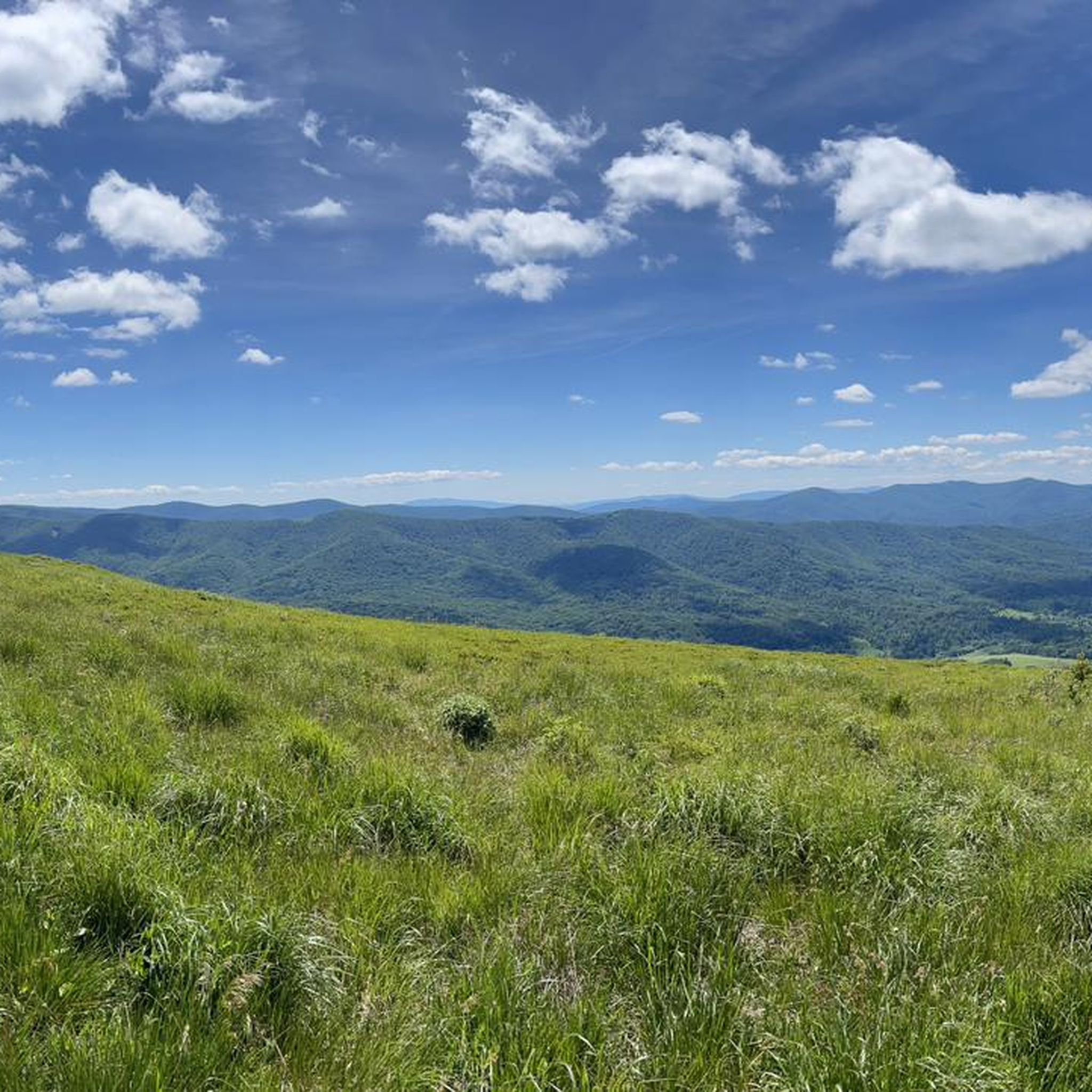
Riaba Skała (1199 m a.s.l.) – a peak in the border range of the Western Bieszczady Mountains, on the Polish-Slovak border. The name comes from the Ukrainian word рябий – motley. In the literature, the most commonly encountered distorted name is Rabia Skała, appearing on 19th-century Austrian maps. An alternative, correct form is Raba Skała. East of the main culmination, there is a lower (1169 m a.s.l.) summit (border marker 1/15). From the highest point, a side ridge of Paportna and Jawornik branches off to the north. From the section of the ridge between the two summits, a very steep, in places precipitous slope descends to the south, above which is a small metal viewing platform. From it, a view (approx. 145° angle) opens up to the south and southeast, onto the Slovak and partly Ukrainian part of the Bieszczady Mountains (up to Pikuj). The shortest route to Riaba Skała leads from the village of Wetlina (2.55 h). The southern slopes of the Riaba Skała ridge lie within the borders of the Slovak National Park "Połoniny", and their upper parts, down to approximately the 930 m contour line, are additionally covered by the Jarabá skala nature reserve. The northern slopes, up to the side arm of Paportna and Jawornik in the west, lie within the borders of the Polish Bieszczady National Park. The northwestern slopes of the higher (western) summit of Riaba Skała, between the main ridge running towards Dziurkowiec and the arm of Paportna and Jawornik, lie within the borders of the Ciśniańsko-Wetliński Landscape Park, and their upper parts are covered by the Dziurkowiec nature reserve. Among the rare plant species in Poland, Spiraea media, Veronicastrum longifolium, and Potentilla carpatica have been found. Information source: https://pl.wikipedia.org/wiki/Riaba_Ska%C5%82a
1
0

A good place to rest and shelter from the rain.
0
0

interesting place, nice hike from Nová Sedlica.
0
0
Frequently Asked Questions
How many hiking trails are available around Cisna?
Cisna offers a comprehensive network of over 180 hiking routes, catering to various ability levels. The area is renowned for its diverse landscapes, including picturesque mountain meadows known as "połoniny," dense beech forests, and natural water features.
What do other hikers enjoy most about the trails in Cisna?
The hiking trails around Cisna are highly rated by the komoot community, with an average score of 4.7 stars from over 750 reviews. Hikers frequently praise the stunning panoramic views from the mountain peaks and ridges, the pristine natural environment, and the rich biodiversity found within the protected areas like the Cisna-Wetlina Landscape Park.
Are there easy hiking trails suitable for beginners or families in Cisna?
Yes, Cisna offers a good selection of easier trails. There are over 50 easy routes available, perfect for beginners or families looking for a more relaxed experience. These trails often lead through lush forests and meadows, providing a gentle introduction to the Bieszczady Mountains' beauty.
Are there any circular hiking routes in Cisna?
Yes, several circular routes allow you to experience the diverse landscapes of Cisna. A notable option is the Smerek and Orłowicz Pass Loop, a moderate 8.9-mile (14.3 km) path in Bieszczady National Park offering panoramic mountain views. Another is the Przełęcz Wyżna to Chatka Puchatka Loop, a shorter, moderate option.
What natural attractions or landmarks can I see along the hiking trails?
Cisna's trails lead to many natural attractions. You can explore the Wetlina River gorge and the Sine Wiry Nature Reserve on the Sine Wiry Nature Trail. Other notable points include the picturesque "połoniny" (mountain meadows), dense beech forests, and various peaks offering sweeping views. The region is also home to diverse wildlife, including bears, wolves, and lynxes.
Are there any waterfalls in the Cisna area?
Yes, the region features the approximately 5-meter Siklawa Ostrowskich waterfall in Stare Sioło, near Wetlina, which is an attractive natural point to visit.
What is the best time of year to go hiking in Cisna?
The Bieszczady Mountains around Cisna are beautiful year-round. Spring and summer offer lush forests and meadows filled with wildflowers, ideal for enjoying the full vibrancy of nature. Autumn brings spectacular colors to the beech forests. While winter hiking is possible, it requires appropriate gear and experience due to snow and potentially challenging conditions.
Are there any unique experiences or attractions near the hiking areas?
Beyond hiking, you can experience the unique Bieszczady Forest Railway, a narrow-gauge railway with its main station in Majdan near Cisna, offering scenic rides. You can also visit the Bieszczady National Park Tourist Shelter "Chatka Puchatka" on Połonina Wetlińska, which is the highest shelter in the Bieszczady Mountains and offers panoramic views. You can find it as a highlight here: Pooh Mountain Hut.
What kind of wildlife can I expect to see while hiking in Cisna?
The Cisna-Wetlina Landscape Park and surrounding areas are rich in biodiversity. Hikers might encounter diverse wildlife, including larger mammals like bears, wolves, lynxes, and wildcats, especially in the more secluded forest areas. Birdwatchers will also find a variety of species.
Are there any mountain passes or viewpoints worth visiting?
Absolutely. The region is known for its stunning viewpoints. The Orłowicz Pass is a significant point offering panoramic views, and you can reach it via routes like the Smerek Trail from Wetlina via Orłowicz Pass. Other notable areas for vistas include Połonina Wetlińska, Połonina Caryńska, and Rawki.
What is the highest point I can reach on a hike near Cisna?
While Cisna itself is in the valley, the surrounding Bieszczady Mountains offer several high peaks. Tarnica Peak is one of the highest in Bieszczady National Park. Within the Cisna-Wetlina Landscape Park, Jarabá skala (Riaba Skała) is the highest point, which you can reach on longer, more challenging routes like the Wetlina - Rabia Skała - Wielka Rawka Loop.
Most popular routes around Cisna
Most popular attractions around Cisna

Get inspired with the komoot mobile app


Explore more
Browse the best Hikes in other regions.
