The best road cycling routes around gmina Solina
4.8
(55)
2,611
riders
35
rides
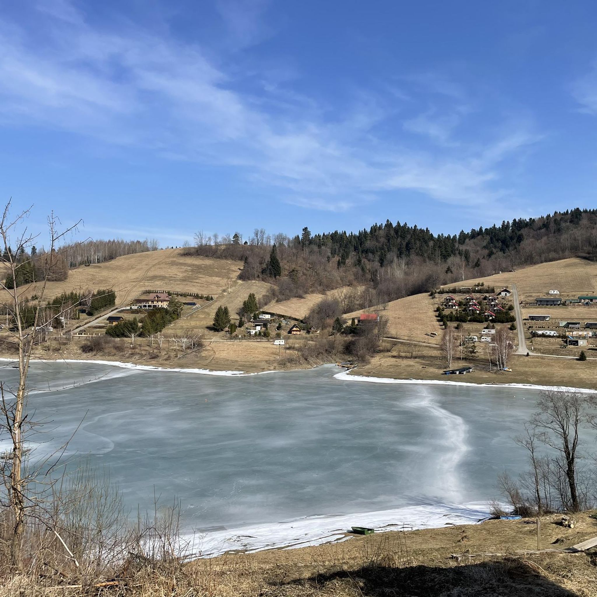
Road cycling around gmina Solina is characterized by its location within the Bieszczady Mountains, featuring two large dam reservoirs, Jezioro Solińskie and Jezioro Myczkowieckie. The terrain includes steep, forested hills, numerous coves, and open panoramic ridges offering views of the lakes and surrounding mountains. Over 80% of the area is within protected landscape areas, providing a diverse environment for road cyclists.
Best road cycling routes around gmina Solina
- The most popular road cycling route is Bridge Below the Solina Dam – Biesart Metal Sculptures loop from Rezerwat Nad Jeziorem Myczkowieckim, a 47.4 miles (76.3 km) trail that takes 3 hours 49 minutes to complete. This difficult route offers views of the Solina Dam and the Myczkowce Lake area.
- Another top favourite among local road cyclists is Wyżna Pass – Base of the People of the Mist loop from Wołkowyja, a difficult 68.0 miles (109.4 km) path. This route includes significant climbs and descents, characteristic of the Bieszczady Mountains.
- Local road cyclists also love the Lipowiec climb from Wołkowyja – View of the mountains in Cisna loop from Myczków, a 43.5 miles (70.1 km) trail leading through forested hills, often completed in about 3 hours 27 minutes.
- Road cycling around gmina Solina is defined by forested hills, scenic lakes, and mountain ridges. The network offers options for different ability levels, with 20 moderate and 11 difficult routes available.
- The routes in gmina Solina are highly rated by the komoot community with an average score of 4.9 stars from over 10 reviews. More than 800 road cyclists have used komoot to explore gmina Solina's varied terrain.
Last updated: July 10, 2026
4.6
(5)
202
riders
Hard road ride. Very good fitness required. Mostly well-paved surfaces and easy to ride.
5.0
(1)
145
riders
110km
05:15
1,550m
1,550m
Hard road ride. Very good fitness required. Mostly well-paved surfaces and easy to ride.

Sign up for free
5.0
(1)
104
riders
70.0km
03:30
1,100m
1,100m
Hard road ride. Very good fitness required. Mostly well-paved surfaces and easy to ride.
4.5
(6)
69
riders
50.6km
02:37
770m
770m
Moderate road ride. Good fitness required. Some segments of this route may be unpaved and difficult to ride.
5.0
(1)
45
riders
Moderate road ride. Good fitness required. Mostly well-paved surfaces and easy to ride.
Get access to more routes and recommendations from other explorers.
Sign up for free
Already have an account?
Our route recommendations are based on thousands of hikes, rides, and runs completed by other people on komoot.
Start today with a free account
Your next adventure awaits.
Login or Signup

Other adventures around gmina Solina

Tips from the Community

Wyżna Pass, located at an altitude of 872 m above sea level in the Western Bieszczady Mountains, is one of the most recognizable places in the region. The pass offers a magnificent panorama of Połonina Wetlińska, Połonina Caryńska and Tarnica, the highest peak of the Western Bieszczady Mountains. For road cyclists, it is an attractive point on the Great Bieszczady Loop route, offering well-maintained asphalt roads. There is a large parking lot, a bus stop and an inn on site, making it a convenient place to rest. It is also worth paying attention to the monument dedicated to Jerzy Harasymowicz, a poet associated with the Bieszczady Mountains.
1
0
The viewpoint in Lutowiska is one of the most picturesque places in the Bieszczady Mountains, offering panoramic views of the highest peaks in the region, such as Tarnica, Halicz and Szeroki Wierch. Located on the Wielka Pętla Bieszczadzki, this point is easily accessible for road cyclists, thanks to good quality asphalt roads. There is free parking, benches and information boards describing the visible mountain ranges. In the summer season, there is also a booth with local delicacies, which makes it an ideal place for a short break during a bike trip.
1
0
A viewpoint over the Solinka River and the surrounding hills. If we go about 150 m further east, there is a path leading to a gazebo and benches visible below.
0
0
Almost 9 km of ascent, with a 240 m elevation gain. The average gradient is 2.8%, but the last kilometer is particularly demanding, with a gradient of 7%. The surface is in good condition.
1
0
The ascent to Lipowiec from Baligród is 4.8 km long and has a 210 m elevation gain. The average gradient is 4.6%, but it accumulates in the last 1.5 km of the ascent, where the gradient reaches 9-10%. As a reward for the effort, we will have a great viewpoint at the top.
1
0
The ascent to Przełęcz Wyżna from Wetlina is longer than from Brzegi Górne and has fewer sides. Over a distance of 5.4 km we overcome 210 m of elevation with an average gradient of 4%. The asphalt is of good quality. On the pass there is a restaurant Zajazd u Górala.
1
0
Wyżna Pass can be reached from Brzegi Górne or Wetlina. Coming from Brzegi, we cover 2.4 km and 130 m of elevation and 5.6% average gradient. The climb gradually becomes steeper and flattens out just before the pass. The quality of the surface is satisfactory.
1
0
View of the San from the bridge just before the dam in Solina.
0
0
Frequently Asked Questions
What kind of terrain can I expect when road cycling in gmina Solina?
Road cycling in gmina Solina offers a diverse and often challenging experience. The region is characterized by its location within the Bieszczady Mountains, featuring steep, forested hills, and panoramic ridges around the Jezioro Solińskie and Jezioro Myczkowieckie. While many routes follow asphalt roads, some sections might include gravel paths or uneven surfaces. Expect significant climbs and descents, which are often rewarded with magnificent vistas of the lakes and surrounding mountains.
Are there road cycling routes suitable for beginners or families in gmina Solina?
While gmina Solina is known for its challenging terrain, it does offer options for various ability levels. There are 20 moderate routes available, which might be more suitable for beginners or families looking for a less strenuous ride. These routes often wind along the bays of Solina Lake, providing scenic views without the most extreme climbs. It's always recommended to check the route profile before setting out.
What are some of the most scenic viewpoints or landmarks I can see along road cycling routes?
Gmina Solina is rich in scenic viewpoints and landmarks. Many routes offer spectacular views of the Solina and Myczkowce Lakes, nestled between forested hills. You can integrate visits to the impressive Jeleni Skok Viewpoint, or explore historic wooden churches and former Orthodox churches scattered throughout the region. The Kamień Leski is another notable natural monument.
Are there any challenging road cycling routes for advanced cyclists?
Absolutely. Gmina Solina is an excellent destination for advanced cyclists seeking a challenge. There are 11 difficult routes available, featuring long and strenuous climbs characteristic of the Bieszczady Mountains. For instance, the Wyżna Pass – Base of the People of the Mist loop from Wołkowyja is a difficult 68.0-mile (109.4 km) path with significant elevation changes, offering rewarding vistas from passes like the one under Markowska.
What do other road cyclists say about the routes in gmina Solina?
The road cycling routes in gmina Solina are highly regarded by the komoot community, holding an average rating of 4.9 stars from over 10 reviews. Cyclists frequently praise the stunning natural beauty, the challenging yet rewarding climbs, and the diverse landscapes that combine lakes, forests, and mountain ridges. Over 800 road cyclists have already used komoot to explore this unique region.
Can I find loop routes for road cycling in gmina Solina?
Yes, many of the road cycling routes in gmina Solina are designed as loops, allowing you to start and end at the same point. An example is the Bridge Below the Solina Dam – Biesart Metal Sculptures loop from Rezerwat Nad Jeziorem Myczkowieckim, which is a 47.4-mile (76.3 km) difficult route offering views of the Solina Dam and Myczkowce Lake area.
What is the best time of year for road biking in gmina Solina?
The best time for road biking in gmina Solina is typically from late spring through early autumn (May to October). During these months, the weather is generally milder and more stable, making for more enjoyable cycling conditions. The lush greenery of spring and the vibrant colors of autumn provide particularly scenic backdrops for your rides.
Are there any specific attractions near the Solina Dam that I can visit during my ride?
The area around the Solina Dam is a hub of activity and attractions. You can cycle past the impressive Solina Dam itself, Poland's largest and highest. Nearby, the Kolej Gondolowa PKL Solina (Gondola Lift) offers a bird's-eye view, leading to Jawor Mountain with its viewing tower. The health resort of Polańczyk, with its Spa Park and brine graduation tower, is also easily accessible and offers stunning views of the lake and mountains.
Where can I find parking for road bike trails near the Solina Dam area?
Parking is generally available in and around the main tourist hubs, such as Solina village and Polańczyk, which are popular starting points for many routes. Given the popularity of the Solina Dam, there are designated parking areas, though they can fill up quickly during peak season. It's advisable to arrive early, especially on weekends, to secure a spot.
Are there any less crowded road cycling routes in gmina Solina?
To experience less crowded routes, consider exploring areas slightly further from the immediate vicinity of the Solina Dam and Polańczyk. Routes that venture deeper into the Bieszczady Mountains, such as the Lipowiec climb from Wołkowyja – View of the mountains in Cisna loop from Myczków, might offer a more tranquil experience while still providing stunning scenery and challenging terrain.
What natural features define the road cycling experience in gmina Solina?
The road cycling experience in gmina Solina is profoundly shaped by its natural features. You'll ride through the picturesque Bieszczady Mountains, encountering two large dam reservoirs, Jezioro Solińskie and Jezioro Myczkowieckie, often referred to as the 'Bieszczady Sea.' The landscape is characterized by steep, forested hills, numerous coves, and open panoramic ridges that provide expansive views. Over 80% of the area lies within protected landscape areas, ensuring a rich and diverse natural environment with extensive forests and crystal-clear mountain rivers.
Most popular routes around gmina Solina
Most popular attractions around gmina Solina

Get inspired with the komoot mobile app


Explore more
Browse the best Road cycling routes in other regions.
