The best walks and hikes around Cabreiros
4.5
(251)
1,766
hikers
44
hikes
Cabreiros hiking trails traverse a region characterized by imposing mountainous terrain and significant natural features. The landscape transitions from dense oak forests to higher elevations with pine trees and granite rock formations. A prominent natural landmark is the Frecha da Mizarela waterfall, the highest in mainland Portugal, with trails often running along its surrounding cliffs. This geological diversity offers varied visual experiences for hikers.
Best hiking trails in Cabreiros
- The most popular hiking route is Frecha da Mizarela Waterfall –…
Last updated: July 28, 2026
4.8
(10)
60
hikers
4.65km
01:45
290m
290m
Easy hike. Great for any fitness level. Easily-accessible paths. Suitable for all skill levels.
4.7
(3)
11
hikers
14.2km
04:12
410m
410m
Moderate hike. Good fitness required. Easily-accessible paths. Suitable for all skill levels.

Sign up for free
5.0
(1)
8
hikers
6.55km
02:09
280m
270m
Moderate hike. Good fitness required. Easily-accessible paths. Suitable for all skill levels.
3
hikers
19.8km
06:21
820m
820m
Hard hike. Very good fitness required. Easily-accessible paths. Suitable for all skill levels.
3
hikers
19.3km
06:15
840m
840m
Hard hike. Very good fitness required. Easily-accessible paths. Suitable for all skill levels.
Get access to more routes and recommendations from other explorers.
Sign up for free
Already have an account?
Our route recommendations are based on thousands of hikes, rides, and runs completed by other people on komoot.
Start today with a free account
Your next adventure awaits.
Login or Signup



Tips from the Community

This trail winds its way along the base of Chãs, crossing dense forests. As it climbs, the oaks give way to pines, until the landscape transforms into an impressive chaos of granite blocks. Here, the scenery is magnificent and, on cold days, the beauty is accompanied by a biting wind. In this high-altitude area, it is common to come across the agile Arouquesa cows, always vigilant in the territory of the Iberian wolf and birds of prey, where nature never sleeps.
2
0
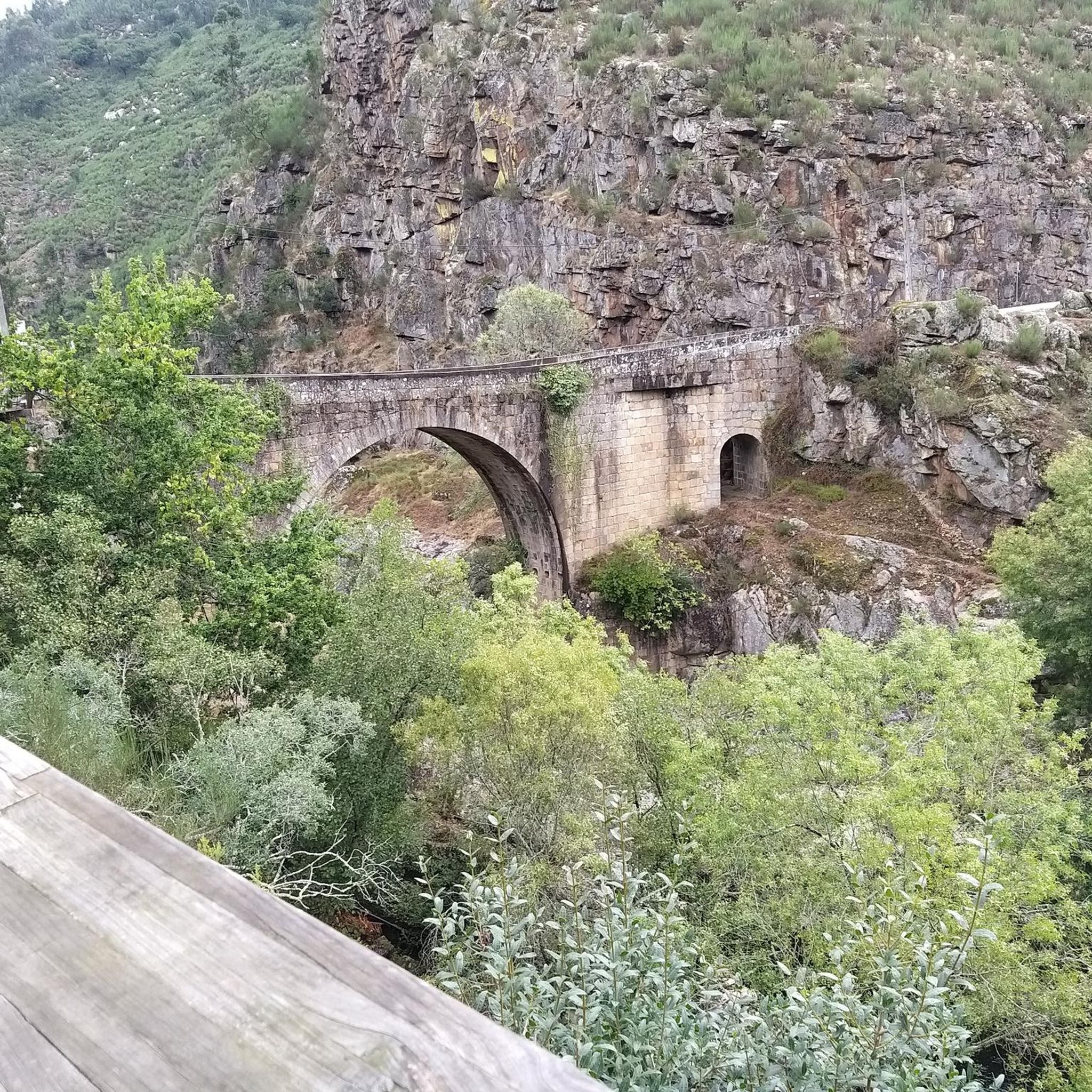
The Roman bridge of Manhouce, built between the 2nd century BC and the 1st century AD, was part of the grand Via Cale, the imperial road that linked Emérita Augusta (today Mérida) to Bracara (today Braga), passing through Viseu. Centuries later, this same route became the famous road of the muleteers, the itinerant merchants who, from the Middle Ages to the 20th century, forged links between peoples, cultures and territories, bringing stories and goods with them.
1
0
Gestosinho is one of those villages where time passes to the rhythm of tradition. Here, life remains faithful to its agricultural roots, cattle graze freely, the land is worked on the mountain terraces and water from the levadas continues to feed the fields. The stone houses, perfectly integrated into the mountain landscape, seem to have been part of the mountain since forever.
1
0
These trails, which stretch along the cliffs of Frecha da Mizarela, offer stunning views of the highest waterfall in mainland Portugal. At every step, the immensity of the mountainous landscape surprises you, making each steep climb a reward in itself.
1
0

Beautiful waterfall with swimming hole
1
0

Very idyllic tiny place. Start for the PR6 hike and access to the PR8. There is a mini shop where you can get a coffee, for example. Parking rather difficult, tip: park at the cemetery in front of the village and follow the signs PR8.
1
0

beautiful, stony descent on the PR 7 into the valley ..... you can also go down by car, but ground clearance is necessary
3
0

Wasserfall Arrow of the Mizarela (75m)
2
2
Frequently Asked Questions
How many hiking trails are available in Cabreiros?
Cabreiros offers a diverse network of over 40 hiking trails, catering to various preferences and skill levels. These routes explore the region's mountainous terrain, dense forests, and unique geological features.
What types of landscapes can I expect to see while hiking in Cabreiros?
Hikers in Cabreiros will experience a varied landscape, transitioning from dense oak forests to higher elevations featuring pine trees and impressive granite rock formations. The region is also characterized by its imposing mountainous terrain and traditional stone houses integrated into the scenery.
Are there hiking trails for all skill levels in Cabreiros?
Yes, Cabreiros provides a range of trails suitable for different abilities. There are 12 easy routes, 21 moderate routes, and 11 more challenging routes, ensuring options for casual walkers and experienced hikers alike.
Where can I see the Frecha da Mizarela waterfall?
The Frecha da Mizarela waterfall, the highest in mainland Portugal, is a prominent natural landmark in Cabreiros. You can experience its grandeur on the Frecha da Mizarela Waterfall – Frecha da Mizarela Trail loop from Albergaria da Serra, an easy 4.6 km route that offers rewarding views of the cascade.
Are there any circular hiking routes in Cabreiros?
Many of the trails in Cabreiros are designed as loops, allowing you to start and end in the same location. Examples include the easy Frecha da Mizarela Waterfall – Frecha da Mizarela Trail loop and the moderate Beautiful trail between villages – Gestosinho loop from Manhouce.
What do other hikers enjoy most about hiking in Cabreiros?
The hiking experience in Cabreiros is highly rated by the komoot community, with an average score of 4.5 stars from over 230 reviews. Hikers frequently praise the diverse terrain, the stunning views of the Frecha da Mizarela waterfall, and the opportunity to explore tranquil villages and agricultural areas.
Are there any challenging hikes in Cabreiros?
For those seeking a more demanding adventure, Cabreiros offers 11 difficult routes. A notable challenging option is the Path Through the Vineyards – Rio de Frades Village loop from Candal, a 19.8 km trail that takes approximately 6 hours 21 minutes to complete and features significant elevation changes.
What nearby attractions can I explore after a hike?
Beyond the trails, you can visit several attractions near Cabreiros. Consider exploring the Paiva Walkways and 516 Arouca Suspension Bridge, or the Arouca Town Center. There are also several historic bridges like the Vau Suspension Bridge.
Are there any picturesque villages to visit along the hiking routes?
Yes, the region features charming villages that serve as excellent starting points or points of interest. Rio de Frades Village, for instance, is a tranquil and picturesque spot mentioned as a starting point for several hikes, offering a blend of cultural heritage and natural beauty.
What is the best time of year to go hiking in Cabreiros?
Cabreiros offers hiking opportunities throughout much of the year. The varied landscapes, from dense forests to mountainous terrain, provide different experiences depending on the season. Spring and autumn generally offer pleasant temperatures and vibrant scenery, while summer can be warm, and winter might bring cooler conditions to higher elevations.
Are there any trails that pass through vineyards or agricultural areas?
Yes, some routes showcase the agricultural beauty of the region. The Path Through the Vineyards – Rio de Frades Village loop from Candal is a prime example, leading hikers through agricultural areas and varied terrain, offering a glimpse into the local rural life.
Can I find shorter, moderate hikes in Cabreiros?
Absolutely. For a moderate experience that isn't overly long, consider the Incas Trail loop from Candal. This route covers 6.5 km and typically takes around 2 hours to complete, offering a balanced challenge and scenic views.
Most popular attractions around Cabreiros

Get inspired with the komoot mobile app


Explore more
Browse the best Hikes in other regions.
