The best road cycling routes around Foz De Arouce
4.6
(101)
2,041
riders
88
rides
Road cycling routes around Foz De Arouce traverse a landscape characterized by river valleys, rolling hills, and traditional schist villages. The region features varied terrain, including climbs towards higher elevations like Alto do Trevim and routes along waterways such as the Ceira River. Road cyclists can expect a mix of open roads and sections passing through forested areas and rural settlements.
Best road cycling routes around Foz De Arouce
- The most popular road cycling route is CIMA PR09: Alto do…
Last updated: October 5, 2026
5.0
(2)
107
riders
53.9km
03:19
1,400m
1,400m
Hard road ride. Very good fitness required. Mostly well-paved surfaces and easy to ride.
170
riders
99.4km
05:28
2,030m
2,030m
Hard road ride. Very good fitness required. Some segments of this route may be unpaved and difficult to ride.

3.9
(21)
125
riders
69.6km
03:17
780m
780m
Moderate road ride. Good fitness required. Mostly well-paved surfaces and easy to ride.
103
riders
83.3km
04:35
1,710m
1,710m
Hard road ride. Very good fitness required. Some segments of this route may be unpaved and difficult to ride.
50
riders
59.3km
02:40
590m
590m
Moderate road ride. Good fitness required. Some segments of this route may be unpaved and difficult to ride.
Get access to more routes and recommendations from other explorers.
Already have an account?
Our route recommendations are based on thousands of hikes, rides, and runs completed by other people on komoot.
Start today with a free account
Your next adventure awaits.


Tips from the Community

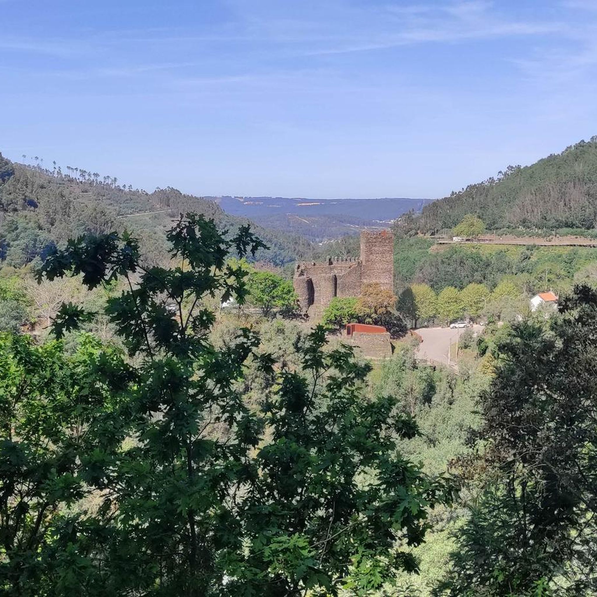
The Ponte Real (or Ponte Velha) over the Ceira River is located in the village of Góis, being one of the historical ex-libris of the region. This medieval-style bridge, later reformed, is an important tourist attraction, crossing the Ceira River, a left-bank tributary of the Mondego River, which originates in the Serra do Açor. Location: Center of the village of Góis, facilitating pedestrian access. Characteristics: Imposing structure with stone arches, typical of crossing constructions from the monarchical period. Surroundings: The Ceira River, near this area, offers river beaches highly sought after during the summer, standing out for the quality of the water and tranquility. History: It is part of the built heritage from the Manueline/medieval period of the region.
1
0

"Terreiro das Bruxas" is a place in the middle of nature for resting after a hike and for picnics; it has restrooms and drinking water.
0
0

There are two beautiful avenues under different trees.
1
0

Candal is part of the so-called "Serra da Lousã", an area characterized by lush nature and breathtaking landscapes. This village is a typical example of the "aldeias de xisto" (schist villages), built entirely with local stone, which integrate harmoniously into the surrounding environment. Candal offers an atmosphere of peace and tranquility, with its traditional houses, waterways and paths surrounded by vegetation.
1
0

Very good cafe, opens early, always fresh home-made pastries, delicious coffee. Prices are pleasing, staff is friendly.
0
0

From the opposite bank you can see the river beach of Palheiros and its beautiful pedestrian/cycling bridge. Quiet and familiar place where you can enjoy the landscape.
2
0
There are tables, toilets, maps of the area. Nice place to relax.
1
0
A very beautiful and useful place. There is a cafe, toilets, showers, a beach, outdoor tables overlooking the river. Great place to relax.
0
0
Frequently Asked Questions
How many road cycling routes are available around Foz De Arouce?
There are over 90 road cycling routes documented around Foz De Arouce on komoot, offering a wide range of options for different skill levels and preferences.
What kind of terrain can I expect on road cycling routes in Foz De Arouce?
The region features varied terrain, including climbs towards higher elevations like Alto do Trevim, routes along waterways such as the Ceira River, and sections passing through forested areas and traditional schist villages. You'll encounter a mix of open roads and rural landscapes.
Are there challenging road bike climbs in the Foz De Arouce area?
Yes, Foz De Arouce offers several challenging climbs. For instance, the CIMA PR09: Alto do Trevim - Lousã route features significant elevation gain towards Alto do Trevim. Another demanding option is the Penela Castle – Castelo de Penela loop from Lousã, which includes substantial ascents over its 86-mile distance.
Are there any easier or beginner-friendly road cycling routes in Foz De Arouce?
While many routes involve climbs, there are 5 routes classified as easy and 57 as moderate. These often follow river valleys or have less severe elevation changes, making them suitable for beginners or those seeking a more relaxed ride. Look for routes with lower elevation gain and shorter distances.
What are some scenic viewpoints or attractions I can see while road cycling?
Many routes pass through or near picturesque locations. You can cycle past historic sites like Talasnal Schist Village or Lousã Castle. Natural attractions include the Senhora da Piedade River Pool and the Tallest Eucalyptus Tree in Europe. The Talasnal Schist Village – Candal Schist Village loop from Lousã specifically connects several scenic villages.
Are there circular road cycling routes available in Foz De Arouce?
Yes, many of the road cycling routes in Foz De Arouce are designed as loops, allowing you to start and end at the same point. Examples include the Loureiro Picnic Park – Palheiros River Beach loop from Lousã and the Royal Bridge over the Ceira River – Candal Schist Village loop from Gândaras.
What is the best time of year for road cycling in Foz De Arouce?
Spring (April to June) and early autumn (September to October) generally offer the most pleasant weather for road cycling in Foz De Arouce, with milder temperatures and less rainfall. Summers can be hot, especially in July and August, while winters are cooler and wetter.
What do other road cyclists enjoy most about the routes in Foz De Arouce?
The road cycling routes in Foz De Arouce are highly rated by the komoot community, with an average score of 4.5 stars from over 90 reviews. Cyclists often praise the varied terrain, the scenic beauty of the river valleys and schist villages, and the challenging climbs that offer rewarding views.
Are there any routes that pass by waterfalls in the Foz De Arouce region?
Yes, the region is home to several natural water features. You can find highlights like the Ribeira de Espinho Waterfalls and a Waterfall and Cave in Serra da Lousã. While specific routes passing directly by them aren't detailed, these natural monuments are within the broader cycling area and can be incorporated into your ride planning.
What is the typical duration for road cycling routes in Foz De Arouce?
Route durations vary significantly based on distance and elevation. For example, a moderate route like the Loureiro Picnic Park – Palheiros River Beach loop from Lousã (43.6 miles) typically takes around 3 hours 20 minutes. More challenging routes, such as the Talasnal Schist Village – Candal Schist Village loop from Lousã (62.3 miles), can take over 5 hours due to significant elevation gain.
Is parking generally available at the start of road cycling routes in Foz De Arouce?
While specific parking information for every trailhead isn't provided, Foz De Arouce and nearby towns like Lousã, which serve as common starting points for many routes, typically offer public parking options. It's advisable to check local parking availability for your chosen starting location.
Most popular routes around Foz De Arouce
Most popular attractions around Foz De Arouce

Get inspired with the komoot mobile app


Explore more
Browse the best Road cycling routes in other regions.
