The best road cycling routes around Alvarelhos
4.4
(37)
2,414
riders
79
rides
Road cycling routes around Alvarelhos, located in the municipality of Trofa, Porto, offer varied terrain suitable for different cycling experiences. The region features an average elevation of 124 meters, with topography ranging from 28 meters to 236 meters, providing a mix of flatter sections and moderate climbs. Cyclists can expect routes that combine coastal and riverine landscapes with inland exploration, including rolling hills and rural roads. This diverse environment allows for both physical activity and cultural engagement, with historical sites…
Last updated: October 5, 2026
5.0
(2)
109
riders
Moderate road ride. Good fitness required. Mostly well-paved surfaces and easy to ride.
5.0
(1)
81
riders
68.8km
03:02
570m
570m
Moderate road ride. Good fitness required. Mostly well-paved surfaces and easy to ride.

4.0
(2)
52
riders
Moderate road ride. Good fitness required. Mostly well-paved surfaces and easy to ride.
34
riders
75.8km
03:53
1,140m
1,140m
Hard road ride. Very good fitness required. Mostly well-paved surfaces and easy to ride.
4.8
(4)
40
riders
44.8km
02:05
470m
470m
Moderate road ride. Good fitness required. Mostly well-paved surfaces and easy to ride.
Get access to more routes and recommendations from other explorers.
Already have an account?
Our route recommendations are based on thousands of hikes, rides, and runs completed by other people on komoot.
Start today with a free account
Your next adventure awaits.

Tips from the Community

The church is an active place of worship, with regular opening hours for visitors and worshippers. Location: Rua da Igreja, 4480-754 Vila do Conde, Portugal. Opening Hours: Daily (Monday to Sunday): 9:30 AM to 12:00 PM and 3:00 PM to 7:30 PM. Masses: For accurate information on Mass times, it is recommended to visit the parish's official website or call directly, as times may vary. Accessibility: The church has wheelchair accessible entrance and parking.
1
0
Architecture and History Construction of the church began in the last years of the 15th century, by order of King Manuel I. The architectural design combines elements of Gothic and Renaissance architecture, in addition to the predominant Manueline style, especially evident in its magnificently sculpted main portal. The interior has beautiful stained glass windows and altars with gilded carvings, which are worth a detailed visit. The church is located on top of a hill where the original Monastery of Santa Clara and the old parish church were situated.
1
0
The Church of St. John the Baptist of Vila do Conde, also known as the Parish Church of Vila do Conde, is one of the city's most important monuments and one of the most significant examples of the Manueline style (late Portuguese Gothic) in the country. It was classified as a National Monument in 1910.
1
0
Nearby Tourist Attractions Ave Riverbank Promenade: A riverside walkway, ideal for relaxing strolls. Monte Padrão Hillfort: Ancient ruins for those interested in history and archaeology.
1
0
Highlights and Architecture Main Church: Built between 1659 and 1679, the monastery church is an imposing example of local religious architecture. Cloisters: The monastery has serene cloisters, one of which still displays a Gothic sculpture of the Virgin and Child in one of the corners. Cloister Fountain: In the center of the cloister stands a slender granite fountain with a polylobed basin, dating from 1649. Style: Over the centuries, the monastery has been rebuilt, combining Baroque and Neoclassical elements.
1
0
Opening Hours and Visits The monastery is open for visits, but guided tours of the cloisters and other areas (besides the church) generally require prior booking by telephone with the Santo Tirso City Hall office. General Hours (Church): Daily (Monday to Sunday): 08:00–12:00 and 15:00–19:00. Accessibility: The entrance and parking are wheelchair accessible.
1
0
The Monastery of São Bento, also known as the Monastery of Santo Tirso, is located on the left bank of the Ave River, in the city of Santo Tirso, Portugal. Founded in 978, it belonged to the Benedictine Order and was one of the most powerful monasteries in Portugal. Currently, it is classified as a National Monument.
1
0
Highlights and Route Landscape: The route crosses rural areas, small population centers, agricultural fields, and forest areas, offering a calm and pleasant environment. Localities: The ecotrail passes through several localities, including Amorim, Terroso, Laundos, Rates, Balazar, Gondifelos, Louro, and Brufe. Intermodality: A great advantage is the direct connection to the Vila Nova de Famalicão train station and the Porto Metro station in Póvoa de Varzim, facilitating access to the beginning and end of the route. Interconnection: The cycle path connects to the Formiga Ecotrail, allowing the ride to be extended.
1
0
Frequently Asked Questions
How many road cycling routes are available around Alvarelhos?
Alvarelhos offers a wide selection of road cycling routes, with over 80 tours available. These routes cater to various preferences, from moderate rides to more challenging ascents.
What are the typical difficulty levels for road cycling routes in Alvarelhos?
The routes around Alvarelhos present a good mix of challenges. You'll find 10 easy routes, 56 moderate routes, and 17 difficult routes, ensuring options for cyclists of all experience levels.
What kind of terrain can I expect on road cycling routes in Alvarelhos?
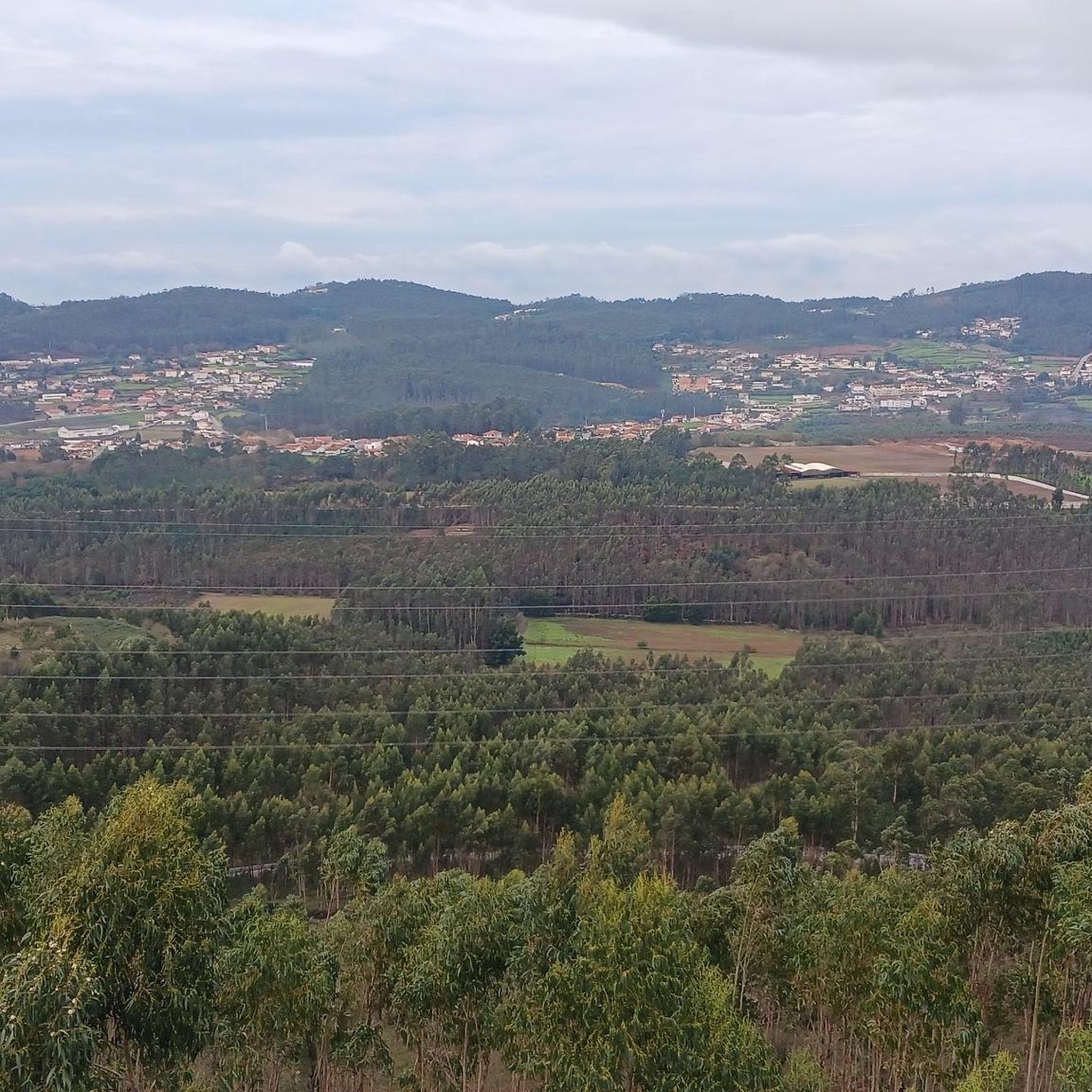
Road cycling in Alvarelhos is characterized by varied terrain. You can expect a mix of flatter sections, rolling hills, and moderate climbs. The region's topography ranges from 28 meters to 236 meters, providing diverse landscapes that combine coastal and riverine scenery with inland exploration.
Are there any family-friendly road cycling routes in Alvarelhos?
While specific 'family-friendly' routes are not explicitly categorized, the presence of 10 easy routes suggests options suitable for less experienced riders or families. These routes typically feature gentler gradients and shorter distances, making them more accessible.
What interesting landmarks or attractions can I see along the road cycling routes?
Many routes offer opportunities to explore local points of interest. You might pass by the historic São Paio Chapel, a 17th-century site with rewarding views, or the scenic Labruge Bridge at the mouth of the Onda River, known for its picturesque setting. The Vila do Conde Town Center and the Lavra Fishing Village also offer cultural stops.
Can you recommend a challenging road cycling route in the area?
For those seeking a challenge, the Ascent – Parish Church loop from ISMAI is a difficult route covering 60.6 km with over 1100 meters of elevation gain, offering a significant test for experienced cyclists.
Are there any loop road cycling routes around Alvarelhos?
Yes, many routes in the area are designed as loops, allowing you to start and finish at the same point. An example is the Always Going Strong – Póvoa Castle loop from Castêlo da Maia, a moderate 52 km route with 389 meters of elevation gain.
What is a popular moderate road cycling route in Alvarelhos?
A popular moderate option is the Famalicão Cycle Path loop from Castêlo da Maia. This route spans 68.8 km with an elevation gain of 570 meters, offering a balanced ride through varied landscapes.
What do other road cyclists say about the routes in Alvarelhos?
The road cycling routes in Alvarelhos are highly regarded by the komoot community, holding an average rating of 4.4 stars from over 30 reviews. Cyclists often praise the diverse terrain, scenic coastal views, and the opportunity to combine physical activity with cultural exploration of historical sites.
What is the best time of year for road cycling in Alvarelhos?
While specific seasonal details for Alvarelhos are not provided, the broader region of Northern Portugal generally offers favorable cycling conditions during spring and autumn. These seasons typically provide milder temperatures and less rainfall, making for more comfortable rides. Summer can be warm, especially inland, while winter might bring more unpredictable weather.
Are there any routes that feature historical sites?
Yes, Alvarelhos's routes often incorporate historical sites. The region is home to the Castro de Alvarelhos, an archaeological site at Santa Eufémia Mountain, which can be part of routes offering both physical activity and cultural engagement. The Difficult Climb – Chapel of Senhor do Calvário loop from Castêlo da Maia is another route that passes by a notable chapel.
What is the typical length of road cycling routes in Alvarelhos?
Route lengths vary significantly, catering to different endurance levels. For instance, the Fulão Megalithic Complex – Saint Michael of Arcos Bridge loop from Guilhabreu is a moderate 49.5 km route, while others can be longer, like the 68.8 km Famalicão Cycle Path loop.
Most popular routes around Alvarelhos
Most popular attractions around Alvarelhos

Get inspired with the komoot mobile app


Explore more
Browse the best Road cycling routes in other regions.
