Pleasant View Ridge Wilderness
Pleasant View Ridge Wilderness
The best walks and hikes in Pleasant View Ridge Wilderness
4.9
(17)
595
hikers
13
hikes
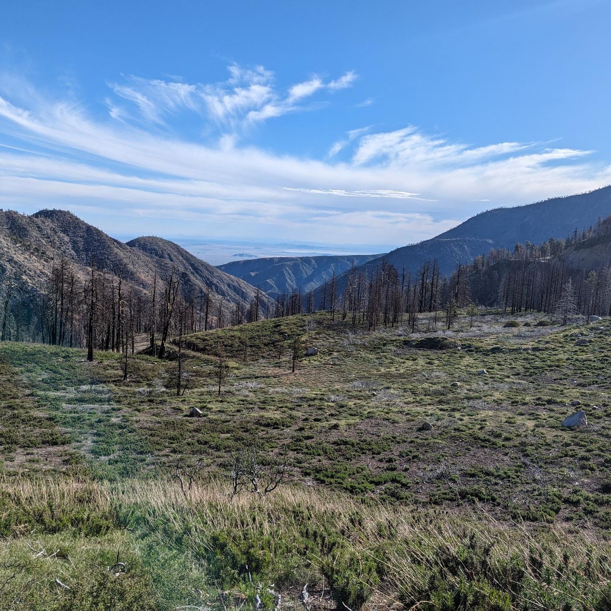
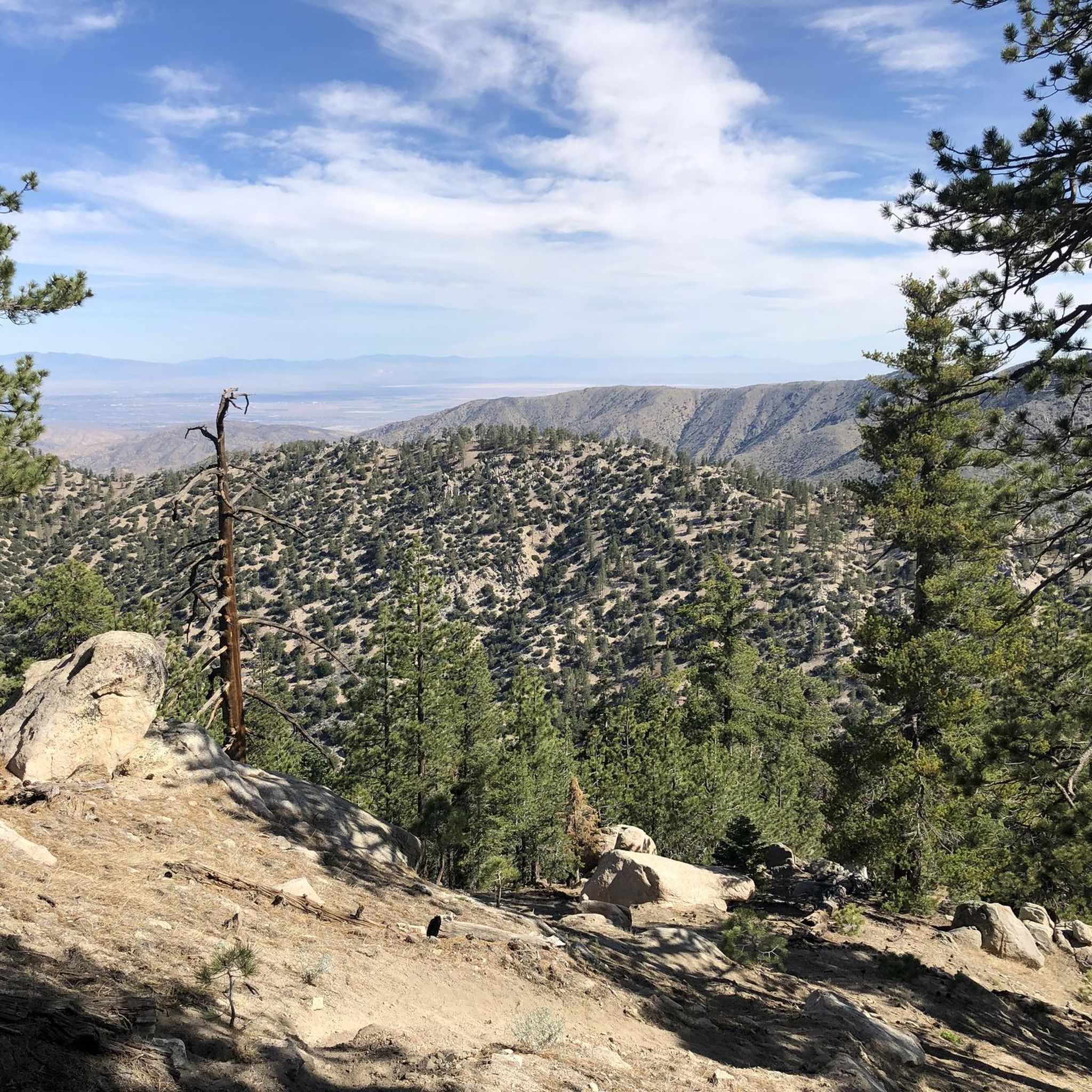
Hiking in Pleasant View Ridge Wilderness, located within the Angeles National Forest and San Gabriel Mountains National Monument, offers rugged terrain and diverse landscapes. The region is characterized by majestic peaks, including Mount Williamson and Mount Islip, and provides a unique transition zone where the San Gabriel Mountains meet the Mojave Desert. This geographical position offers panoramic views of both mountain ranges and the desert basin, with varied vegetation including Jeffrey pines and oak woodlands.
Best hiking trails in Pleasant…
Last updated: November 8, 2026
5.0
(1)
5
hikers
14.4km
04:59
800m
760m
Moderate hike. Good fitness required. Mostly walkable paths. Sure-footedness required.
6
hikers
4.26km
01:24
260m
60m
Easy hike. Easily walkable paths.

1
hikers
9.42km
03:10
440m
510m
Moderate hike. Good fitness required. Easily walkable paths.
4.89km
01:51
510m
0m
Moderate hike. Good fitness required. Easily walkable paths.
5.11km
01:53
480m
30m
Moderate hike. Good fitness required. Easily walkable paths.
Get access to more routes and recommendations from other explorers.
Already have an account?
Our route recommendations are based on thousands of hikes, rides, and runs completed by other people on komoot.
Start today with a free account
Your next adventure awaits.
Popular around Pleasant View Ridge Wilderness
Tips from the Community

At 8,041 feet, Waterman Mountain is the highest point in the San Gabriel Wilderness and marks the northern boundary of the wilderness. There are a couple small ski areas on its northern side and its summit can be accessed either via roads and trails associated with these ski areas or from the PCT. You get nice views from the top of this relatively flat, treed summit and there it frequently snow in the spring and into the early summer. Even though it is a tall peak, you will probably only encounter one or two other hikers, so its a fantastic place to escape the LA crowds and enjoy the fresh mountain air.
0
0

This peak is a converging point between several trails and offers a panoramic view of the area.
0
0

A couple of great viewpoints and a short parallel trail along the PCT that itself also has great views here all along
0
0

Get to the trail head early as the parking fills up fast. Fun hike, we loved it!
1
0


Mount Baden-Powell is a popular peak in the Sheep Mountain Wilderness. At 9,406 feet (2.867 meters) it is the fourth highest peak in the San Gabriel Mountains. It was named after the founder of Scouting. Since it is very close to the Pacific Crest Trail, you should always take the short side trail to the summit. You will find a monument and stunning views over Los Angeles.
9
3
Reaching the summit isn't too hard, at a bit over 2 miles from Islip Saddle along the Angeles Crest Highway.
0
0
Frequently Asked Questions
What kind of terrain can I expect when hiking in Pleasant View Ridge Wilderness?
Pleasant View Ridge Wilderness is characterized by rugged mountain terrain, high-elevation peaks, and diverse landscapes. It serves as a unique transition zone where the San Gabriel Mountains meet the Mojave Desert, offering spectacular panoramic views of both the mountains and the desert basin.
Are there any easy hiking trails suitable for beginners or families in Pleasant View Ridge Wilderness?
Yes, among the 13 routes available, there are 2 easy trails. One option is the Little Jimmy Campground trail, which is approximately 4.2 km long and takes about 1 hour 24 minutes to complete. This trail offers a more gentle introduction to the wilderness.
What are some notable natural features or landmarks to look out for in Pleasant View Ridge Wilderness?
The wilderness boasts majestic peaks like Mount Williamson, Pleasant View Ridge Summit, and Mount Islip, all offering expansive vistas. You can also find picturesque spots like Cooper Canyon Falls, accessible via the Burkhart Trail, and Windy Gap along the Pacific Crest Trail, known for stunning mountain and valley views. For those interested in history, Box Car Ridge features the remains of a 1966 plane crash.
What is the best time of year to hike in Pleasant View Ridge Wilderness?
Spring is particularly beautiful due to vibrant wildflower displays. However, the region's diverse landscapes offer hiking opportunities throughout much of the year. Always check weather conditions, especially for high-elevation trails, and be aware of seasonal considerations like snow or extreme heat.
Are dogs allowed on trails in Pleasant View Ridge Wilderness?
Generally, dogs are permitted on trails within the Angeles National Forest, which includes Pleasant View Ridge Wilderness, but they must be kept on a leash. Always check specific trail regulations before heading out, as rules can vary.
What are the typical trail difficulties in Pleasant View Ridge Wilderness?
The trails in Pleasant View Ridge Wilderness cater to various skill levels. Out of 13 routes, there are 2 easy, 8 moderate, and 3 difficult options. This range ensures that both casual hikers and experienced mountaineers can find suitable challenges.
What do other hikers say about their experience in Pleasant View Ridge Wilderness?
The area is highly rated by the komoot community, with an average score of 4.9 stars from more than 17 reviews. Hikers often praise the expansive mountain vistas, the rugged beauty of the terrain, and the sense of wilderness found on trails like Mount Baden-Powell from Dawson Saddle.
Are there any specific plants or wildlife I should be aware of while hiking?
The wilderness is rich in biodiversity, with over 1,000 plant species, including towering Jeffrey pines and oak woodlands. Wildlife such as deer, mountain lions, bobcats, and various bird species can be observed. Hikers should be aware of 'Poodle Dog bush,' a toxic plant that can cause severe skin reactions upon contact.
Are there any trails that offer access to the Pacific Crest Trail within Pleasant View Ridge Wilderness?
Yes, sections of the Pacific Crest Trail run through the wilderness. For example, the Mount Williamson via Pacific Crest Trail route is a moderate 5.1 km path that utilizes a portion of this iconic long-distance trail.
What kind of views can I expect from the peaks in Pleasant View Ridge Wilderness?
From peaks like Mount Williamson, Pleasant View Ridge Summit, and Mount Islip, you can expect incredible panoramic views. The unique geographical position of the wilderness, where the San Gabriel Mountains meet the Mojave Desert, offers expansive vistas of both mountain ranges and the desert basin.
Are there any long-distance or multi-day hiking opportunities in the area?
While many routes are day hikes, the presence of sections of the Pacific Crest Trail and the High Desert National Recreation Trail (including Burkhart and South Fork trails) suggests opportunities for longer backpacking trips. Adjacent campsites also support multi-day excursions.

Get inspired with the komoot mobile app


Explore more
Browse the best Hikes in other regions.
